List of landscape protection areas in the Dithmarschen district
List of landscape protection areas in the Dithmarschen district in Schleswig-Holstein
| image | number | Name of the area | Area in hectares | map | Coordinates | Parish (noun) | Date of regulation | Reference |
|---|---|---|---|---|---|---|---|---|
| 51-HEI-01 | Old ox path | 2.95 | location | position | Albersdorf , Bunsoh | November 12, 1937 | Regulation text | |
| 51-HEI-02 | Height 75 | 7.43 | location | position | Schrum (Riese practice area) | March 25, 1938 | Regulation text | |
| 51-HEI-03 | Forest near Schrum | 19.42 | location | position | Schrum , Gaushorn (mainly Riese site practice area) | May 24, 1938 | Regulation text | |

|
51-HEI-04 | Steller Castle | 1.72 | location | position | Stelle-Wittenwurth , Weddingstedt | May 24, 1938 | Regulation text |
| 51-HEI-05 | Wood path with oak-lined curtains | 0.68 | location | position | Weddingstedt | May 24, 1938 | Regulation text | |
| 51-HEI-06 | Forest near Schrum with barrows | 17.78 | location | position | Schrum , Gaushorn (mainly Riese site practice area) | May 24, 1938 | Regulation text | |
 |
51-HEI-07 | Welmbütteler Moor | 133.36 | location | position | Welmbüttel , Gaushorn | 19th August 1988 | Regulation text |
| 51-HEI-08 | Wiemerstedter wood | 25.00 | location | position | Wiemerstedt | May 24, 1938 | Regulation text | |
| 51-HEI-09 | Dead arm of Gieselau | 4.62 | location | position | Osterrade , Offenbüttel , Oldenbüttel | May 31, 1938 | Regulation text | |
 |
51-HEI-10 | Mill pond | 11.33 | location | position | Nordhastedt | 15th October 1975 | Regulation text |
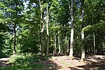 |
51-HEI-11 | Crumpled paper bricks | 12.24 | location | position | Prickling | July 21, 1939 | Regulation text |
| 51-HEI-12 | Gravel pit near Altenkamp | 1.85 | location | position | Hollingstedt | July 25, 1939 | Regulation text | |
 |
51-HEI-13 | Ski jump at Dellbrück | 2.54 | location | position | Sarzbüttel | 2nd August 1956 | Regulation text |
| 51-HEI-14 | Fallofurt | 19.21 | location | position | Albersdorf , Wennbüttel | 1st December 1956 | Regulation text | |
| 51-HEI-15 | Hoper mill | 19.58 | location | position | St. Michaelisdonn | October 29, 1963 | Regulation text | |
| 51-HEI-16 | Klev from Windbergen to St. Michaelisdonn | 115.93 | location | position | Gudendorf , Barlt , St. Michaelisdonn | August 31, 1964 | Regulation text | |
 |
51-HEI-17 | Wodansberg | 6.38 | location | position | Mountains of wind | May 19, 1971 | Regulation text |
 |
51-HEI-18 | Klev from St. Michaelisdonn to Burg | 388.38 | location | position | Things , Kuden , Burg , Buchholz , Eddelak , St. Michaelisdonn | May 19, 1971 | Regulation text |
| 51-HEI-19 | Old dike breach near Preil | 4.52 | location | position | Lehe | 6th December 1976 | Regulation text | |
 |
51-HEI-20 | Elendsmoor near Schafstedt | 8.33 | location | position | Schafstedt | April 5th 1972 | Regulation text |
 |
51-HEI-21 | Ostroher / Süderholmer Moor | 278.77 | location | position | Ostrohe , Heide | June 6, 1972 | Regulation text |
 |
51-HEI-22 | Scenic high moor | 21.57 | location | position | Krumstedt | December 28, 1972 | Regulation text |
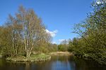 |
51-HEI-23 | Lunden valley with Mötjensee and Steller See | 155.58 | location | position | Lunden , Krempel , Fedderingen , Rehm-Flehde-Bargen , Stelle-Wittenwurth | 6th December 1976 | Regulation text |
| 51-HEI-24 | Dithmarscher Wadden Sea | 6973.43 | location | position | Büsum | 6th December 1976 | Regulation text | |
| 51-HEI-25 | Old dike breach near Großbüttel | 0.40 | location | position | Woehrden , Friedrichsgabekoog | 6th December 1976 | Regulation text | |
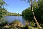 |
51-HEI-26 | Großer Moor / Kätner Moor | 160.97 | location | position | Tellingstedt | April 15, 1980 | Regulation text |
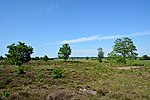 |
51-HEI-27 | Jägersburger Heide | 49.97 | location | position | Elpersbüttel | April 5th 1972 | Regulation text |
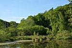 |
51-HEI-28 | Gieselautal | 208.49 | location | position | Albersdorf , Wennbüttel | March 30, 1982 | Regulation text |
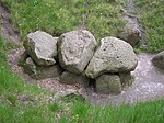 |
51-HEI-29 | Cup stone | 60.77 | location | position | Bunsoh | July 30, 1982 | Regulation text |
| 51-HEI-30 | Steenkroger Moor | 1.81 | location | position | Glüsing , Schalkholz | 5th August 1985 | Regulation text | |
| 51-HEI-31 | Barkenholmer Moor | 90.98 | location | position | Tellingstedt , Barkenholm | 3rd February 1987 | Regulation text | |
| 51-HEI-32 | Forest near Hollingstedt | 31.09 | location | position | Hollingstedt | May 10, 1988 | Regulation text | |
 |
51-HEI-33 | Südermoor near Schwienhusen | 89.01 | location | position | Hollingstedt , Delve | July 20, 1988 | Regulation text |
 |
51-HEI-34 | Hennstedter Moor | 294.23 | location | position | Hennstedt , Kleve | February 27, 1990 | Regulation text |
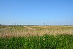
| 51-HEI-35 | Speicheroog Dithmarschen (Nordkoog) | 712.19 | location | position | Warwerort , Friedrichsgabekoog , Wöhrden , Nordermeldorf , Meldorf | November 1, 2006 | Regulation text | |
|
51-HEI-36 | Lunden valley west of the bypass floodwater | 71.11 | location | position | Rehm-Flehde-Bargen | February 16, 2011 | Regulation text |
See also
- List of nature reserves in the Dithmarschen district
- List of natural monuments in the Dithmarschen district
- List of geotopes in the Dithmarschen district
Individual evidence
- ↑ Coordinates were taken from the European Nature Information System (EUNIS) of the European Environment Agency : Nationally designated areas (CDDA) , file CDDA_v12_csv.zip, status October 2014. The map column shows the exact boundaries.
Web links
Commons : Landscape protection areas in the Dithmarschen district - collection of images, videos and audio files