Barlt
| coat of arms | Germany map | |
|---|---|---|

|
Coordinates: 54 ° 1 ' N , 9 ° 4' E |
|
| Basic data | ||
| State : | Schleswig-Holstein | |
| Circle : | Dithmarschen | |
| Office : | Mitteldithmarschen | |
| Height : | 2 m above sea level NHN | |
| Area : | 22.88 km 2 | |
| Residents: | 752 (Dec. 31, 2019) | |
| Population density : | 33 inhabitants per km 2 | |
| Postal code : | 25719 | |
| Area code : | 04857 | |
| License plate : | HEI, MED | |
| Community key : | 01 0 51 006 | |
| LOCODE : | DE BT8 | |
| Office administration address: | Hindenburgstrasse 18 25704 Meldorf |
|
| Website : | ||
| Mayor : | Jark Nedderhof (UWB) | |
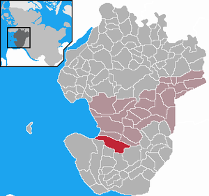
| Location of the municipality of Barlt in the district of Dithmarschen | ||
Barlt is a municipality in the Dithmarschen district in Schleswig-Holstein . The districts of Barlterneuendeich and Barlteraltendeich are located in the municipality.
geography
location
Barlt is located in the Marsch in southern Dithmarschen on the federal highway 5 between Meldorf and Marne . The municipality extends from the North Sea to the Geestrand .
Neighboring communities
Neighboring communities are the communities of Busenwurth , Gudendorf , Sankt Michaelisdonn , Volsemenhusen , Trennewurth and Kronprinzenkoog (all in the Dithmarschen district), starting clockwise in the north .
history
Originally Barlt was part of the parish of Meldorf. In the time of the Dithmarschen peasant republic , the village was comparatively rich, as the building of the Barlter Church in 1428 shows. It was built on the presumably pretended justification that the Hovetkerke (main church) in Meldorf was often not accessible due to the difficult weather and soil conditions - for the Dithmarsch march farmers it was part of everyday life, with frequent wet weather over soggy clay soils and flooded drainage ditches having to achieve their goals.
As a result, the barlers managed to build a church from village funds alone, temporarily paying two pastors and continuing to pay their dues to the Meldorf parish. Church building thus also belongs to a later generation of church buildings, when these no longer led to the founding of regionally extensive parishes , but remained locally limited in their effect and construction.
On April 1, 1934, the parish Barlt was dissolved. Their two farmers Barlt and Barlter Alten- and Neuendeich became independent communities / rural communities.
Incorporations
On July 1, 1964, the previously independent municipality of Barlter Alten- and Neuendeich was incorporated.
coat of arms
Blazon : “Over a blue shield base with a point without a gable, inside a silver wavy bar, divided by red and silver by a rounded bevel. Above a silver winged cross from a Dutch windmill, below a blue cross. "
Attractions
The list of cultural monuments in Barlt includes the cultural monuments entered in the list of monuments of Schleswig-Holstein.
Personalities
Sons and daughters of the church
- Gustav Frenssen (1863–1945), writer
- Toni Rothmund (1877–1956), poet, author and journalist
Associated with Barlt
- Walter Wiborg (* 1904 in Kronprinzenkoog ; † 1969 in Rendsburg ), Low German author, was a country teacher here for several years
Web links
Individual evidence
- ↑ North Statistics Office - Population of the municipalities in Schleswig-Holstein 4th quarter 2019 (XLSX file) (update based on the 2011 census) ( help on this ).
- ↑ State Statistical Office Schleswig-Holstein (Ed.): The population of the communities in Schleswig-Holstein 1867-1970 . State Statistical Office Schleswig-Holstein, Kiel 1972, p. 250 .
- ↑ State Statistical Office Schleswig-Holstein (Ed.): The population of the communities in Schleswig-Holstein 1867-1970 . State Statistical Office Schleswig-Holstein, Kiel 1972, p. 40 .
- ↑ Schleswig-Holstein's municipal coat of arms


