Hollingstedt (Dithmarschen)
| coat of arms | Germany map | |
|---|---|---|

|
Coordinates: 54 ° 17 ' N , 9 ° 14' E |
|
| Basic data | ||
| State : | Schleswig-Holstein | |
| Circle : | Dithmarschen | |
| Office : | Parish land parishes of Eider | |
| Height : | 5 m above sea level NHN | |
| Area : | 9.74 km 2 | |
| Residents: | 303 (Dec. 31, 2019) | |
| Population density : | 31 inhabitants per km 2 | |
| Postal code : | 25788 | |
| Area code : | 04836 | |
| License plate : | HEI, MED | |
| Community key : | 01 0 51 053 | |
| Office administration address: | Kirchspielsschreiber-Schmidt-Straße 1 25779 Hennstedt |
|
| Website : | ||
| Mayor : | Lars Paulsen (WGH) | |
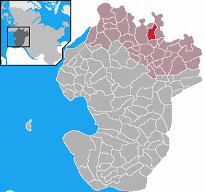
| Location of the community Hollingstedt in the district of Dithmarschen | ||
Hollingstedt is a municipality in the north of the Dithmarschen district in Schleswig-Holstein . Altenkamp, Hollingstedter Mühle, Krusenbusch, Lopshop and Viertel are in the municipality.
geography
location
The community is located on the Geestrand to the Eider-Treene lowland . State road 150, which runs from Delve to Heide, runs through the village .
Neighboring communities
Neighboring communities are the communities of Bergewöhrden (in the district of Dithmarschen), Süderstapel (in the district of Schleswig-Flensburg ), Delve , Glüsing and Hennstedt (all in the district of Dithmarschen), starting clockwise in the north.
history
The name "Hollingstedt" (the spelling has changed several times over the centuries) means something like "Ort am Gehölz", which means the formerly much more extensive farm forest west of the village. Forest used to be a rarity in Dithmarschen , so that the name “Ort am Gehölz” was unmistakable.
On April 1, 1934, the parish of Delve was dissolved. All of their village communities, village communities and farmers became independent communities / rural communities, including Hollingstedt.
politics
Community representation
Since the local elections in 2013, the WGH voter community has all nine seats in the local council.
coat of arms
Blazon : "In gold under a narrow blue wavy bar, a black spade between two green, crossed, leafy oak branches."
For the preparation of the arms, a several hundred years old seal of the former "was used as a basis peasantry Hollingstette" used. The blue wavy bar in the upper third symbolizes the location of the village near the Eider and Wallener Au. The golden color of the coat of arms represents agriculture as the original livelihood of the village. The green oak branches represent the Hollingstedter wood . This former commercial forest is unique for the area in northern Dithmarschen. The spade in the middle of the coat of arms is an indication of the second typical terrain form: the moor . This was managed by peat extraction until the middle of the 20th century. Since this was largely done by hand, the usual tool was the spade.
Economy and Infrastructure
From 1905 to 1937 the place had a rail connection to the Norderdithmarschen district railway .
Culture and sights
Web links
Individual evidence
- ↑ North Statistics Office - Population of the municipalities in Schleswig-Holstein 4th quarter 2019 (XLSX file) (update based on the 2011 census) ( help on this ).
- ↑ State Statistical Office Schleswig-Holstein (Ed.): The population of the communities in Schleswig-Holstein 1867-1970 . State Statistical Office Schleswig-Holstein, Kiel 1972, p. 251 .
- ↑ Final result of the local elections 2013 ( page no longer available , search in web archives ) Info: The link was automatically marked as defective. Please check the link according to the instructions and then remove this notice.
- ↑ Schleswig-Holstein's municipal coat of arms


