Great Wheel
| coat of arms | Germany map | |
|---|---|---|

|
Coordinates: 54 ° 1 ' N , 9 ° 13' E |
|
| Basic data | ||
| State : | Schleswig-Holstein | |
| Circle : | Dithmarschen | |
| Office : | Burg-Sankt Michaelisdonn | |
| Height : | 8 m above sea level NHN | |
| Area : | 10.4 km 2 | |
| Residents: | 454 (Dec. 31, 2019) | |
| Population density : | 44 inhabitants per km 2 | |
| Postal code : | 25712 | |
| Area code : | 04825 | |
| License plate : | HEI, MED | |
| Community key : | 01 0 51 037 | |
| Office administration address: | Holzmarkt 7 25712 Burg |
|
| Website : | ||
| Mayoress : | Friedel Elsner (KWV) | |
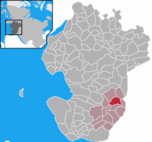
| Location of the community of Großenrade in the district of Dithmarschen | ||
Großenrade is a municipality in the southeast of the Dithmarschen district in Schleswig-Holstein . Großenradermoor is located in the municipality.
geography
location
Großenrade is located in the southeast of Dithmarschen on the Geestrücken .
Neighboring communities
Directly adjacent to big wheels:
| Süderhastedt | Eggstedt | |
| Frestedt |

|
Hochdonn |
| Quickborn | Prickling |
history
The place name Großenrade means something like "large clearing", with the addition of "large" probably being more recent.
On December 1, 1934, the parish district of Süderhastedt was dissolved. All of their villages, village communities and farmers became independent communities / rural communities, including Großenrade.
politics
Community representation
Since the local elections of 2008, has Wählergemeinschaft KWV all nine seats in the municipal council.
Mayoress
At the constituent meeting of the municipal council for the 2018–2023 electoral period on June 13, 2018, Friedel Elsner was repeatedly elected mayor.
coat of arms
Blazon : "A silver ax and a silver clearing hoe crossed diagonally in green over a silver oak stump with four budding leaves."
The overall content of the coat of arms is related to the place name, so the coat of arms is a "speaking" or "speaking" one. The ax , the clearing hoe and the oak stump demonstrate, as it were, that the place, as the name suggests, was created by clearing formerly forested areas, as the basis for fertile farmland and rural economy.
Web links
Individual evidence
- ↑ North Statistics Office - Population of the municipalities in Schleswig-Holstein 4th quarter 2019 (XLSX file) (update based on the 2011 census) ( help on this ).
- ↑ Schleswig-Holstein topography. Vol. 4: Groß Sarau - Holstenniendorf . 1st edition Flying-Kiwi-Verl. Junge, Flensburg 2004, ISBN 978-3-926055-75-0 , p. 23 ( dnb.de [accessed on May 1, 2020]).
- ↑ State Statistical Office Schleswig-Holstein (Ed.): The population of the communities in Schleswig-Holstein 1867-1970 . State Statistical Office Schleswig-Holstein, Kiel 1972, p. 250 .
- ↑ Community representative of the community of Großenrade ( Memento of the original from December 4, 2015 in the Internet Archive ) Info: The archive link was inserted automatically and has not yet been checked. Please check the original and archive link according to the instructions and then remove this notice. (PDF; 28 kB)
- ^ Minutes of the constituent meeting of the Grossenrade community council. (pdf) Retrieved September 21, 2019 .
- ↑ Schleswig-Holstein's municipal coat of arms


