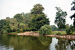
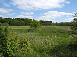
List of landscape protection areas in the Plön district
The list of landscape protection areas in the district of Plön contains the landscape protection areas of the district of Plön in Schleswig-Holstein .
| image | number | Name of the area | Area in hectares | map | Coordinates | Municipality (s) and cities | Date of regulation | Reference |
|---|---|---|---|---|---|---|---|---|
| 57-PLOE-01 | Hagener Au from Probsteierhagen to the confluence with the Baltic Sea and the surrounding area and the Baltic Sea coast between Laboe and Stein | 1154.75 | location | position | Probsteierhagen , Prasdorf , Lutterbek , Stein , Brodersdorf , Laboe | March 30, 1999 | regulation | |
| 57-PLOE-02 | Probsteier salt marshes and surroundings | 1542.57 | location | position | Wendtorf , Lutterbek , Barsbek , Wisch , Krokau , Schönberg | March 30, 1999 | regulation | |
| 57-PLOE-03 | Baltic coast between Stakendorfer Strand and Hohenfelde and the surrounding area | 800.33 | location | position | Stakendorf , Schwartbuck , Hohenfelde | March 30, 1999 | regulation | |
| 57-PLOE-04 | Mühlenau between the Baltic Sea near Hohenfelde and Klinker, municipality of Giekau, and the Baltic Sea coast between Hohenfelde-Malmsteg and Hubertsberg and the surrounding area | 809.77 | location | position | Hohenfelde , Schwartbuck , Köhn , Giekau , Tröndel , Panker | March 30, 1999 | regulation | |
| 57-PLOE-05 | Baltic coast in the area of the communities Behrensdorf and Hohwacht, the Great Inland Lake, the lower reaches of the Kossau and the surrounding area | 1391.14 | location | position | Behrensdorf , Hohwacht , Lütjenburg | March 30, 1999 | regulation | |
| 57-PLOE-06 | Coastal and moraine landscape in the area of the communities Hohwacht and Blekendorf up to the border with the Ostholstein district | 1278.48 | location | position | Hohwacht , Blekendorf | March 30, 1999 | regulation | |
| 57-PLOE-07 | Terminal moraine area with Hessenstein between Lütjenburg and Hohenfelde and the surrounding area | 3753.92 | location | position | Hohenfelde , Tröndel , Panker , Behrensdorf , Giekau , Klamp , Lütjenburg | March 30, 1999 | regulation | |

|
57-PLOE-08 | Selent lake with a lowland between Fargau and Pratjau and the surrounding area | 2745.68 | location | position | Giekau , Lammershagen , Köhn , Fargau-Pratjau , Martensrade , Selent | March 30, 1999 | regulation |
| 57-PLOE-09 | Gödfeldteich, Lammershagener ponds and the wooded terminal moraine landscape east of Lammershagen and the surrounding area | 1954.98 | location | position | Lammershagen , Martensrade , Mucheln , Giekau , Rantzau , Grebin | March 30, 1999 | regulation | |
| 57-PLOE-10 | Middle Kossau valley and surroundings | 2017.29 | location | position | Grebin , Dannau , Rantzau , Giekau , Klamp , Helmstorf , Lütjenburg | March 30, 1999 | regulation | |
| 57-PLOE-11 | Tresdorfer See, Rottensee and the surrounding area | 1224.24 | location | position | Grebin , Lammershagen , Mucheln , Lebrade | March 30, 1999 | regulation | |
| 57-PLOE-12 | Trammer See, Schluensee, forest and bend landscape between Schöhsee and Behler See and the surrounding area | 1429.71 | location | position | Rathjensdorf , Lebrade , Grebin , Plön | March 30, 1999 | regulation | |
| 57-PLOE-13 | Nehmtener forest and the Nehmtener shores of the Großer Plöner See and surroundings | 2025.55 | location | position | Took , Dersau , Plön | March 30, 1999 | regulation | |
| 57-PLOE-14 | Lanker See and the Schwentine to the Kleiner Plöner See and the surrounding area | 2453.84 | location | position | Wittmoldt , Dörnick , Ascheberg , Wahlstorf , Kühren , Schellhorn , Lehmkuhlen , Preetz , Plön | March 30, 1999 | regulation | |
| 57-PLOE-15 | Bornhöveder Seenplatte in the area of Plön and the Alte Schwentine (Kührener Au) to Kührenerbrücke and surroundings | 3048.50 | location | position | Ruhwinkel , Stolpe , Belau , Löptin , Kühren , Kalübbe | March 30, 1999 | regulation | |
| 57-PLOE-16 | Bothkamper See, the Drögen Eider valley and the surrounding area | 941.50 | location | position | Bothkamp , Klein Barkau , Kirchbarkau , Warnau | March 30, 1999 | regulation | |

|
57-PLOE-17 | Dobersdorfer See, Passader See with the upper reaches of the Hagener Au, Kasseteiche and the surrounding area | 2009.61 | location | position | Dobersdorf , Schlesen , Stoltenberg , driving , Passade , Probsteierhagen , Schönkirchen | March 30, 1999 | regulation |
| 57-PLOE-18 | Schwentinetal in the Plön district in the course of the Preetz urban area to the city limits of Kiel | 1390.31 | location | position | Preetz , Raisdorf , Klausdorf , Schönkirchen , Rastorf , Lehmkuhlen | September 8, 1995 | regulation | |
| 57-PLOE-19 | Postsee - Neuwührener Au - Klosterforst Preetz and surroundings | 3428.12 | location | position | Preetz , Kühren , Löptin , Postfeld , Pohnsdorf , Honigsee , Raisdorf | July 13, 2001 | regulation |
Remarks
- ↑ Coordinates were taken from the European Nature Information System (EUNIS) of the European Environment Agency : Nationally designated areas (CDDA) , file CDDA_v12_csv.zip, status October 2014. The map column shows the exact boundaries.
See also
- List of nature reserves in the Plön district
- List of natural monuments in the Plön district
- List of geotopes in the Plön district
Web links
Commons : Landscape protection areas in the Plön district - collection of images, videos and audio files
- http://www.kreis-ploen.de/Kurzmen%C3%BC/Suchresult/Adressen/Landschaftsschutzgebiete-im-Kreis-Pl%C3%B6n.php?object=tx%7C2156.4.&ModID=10&FID=2158.28. 1 & NavID = 2156.25.1 & La = 1 & ort =
- Explanations of the landscape framework plan for planning area III districts of Rendsburg-Eckernförde and Plön, independent cities of Kiel and Neumünster ( Memento from April 2, 2015 in the Internet Archive ) Status: June 2000