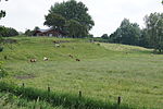
List of geotopes in the Dithmarschen district
This sortable list contains the geotopes of the district of Dithmarschen in Schleswig-Holstein . It contains the official designations for names and numbers as well as their geographical location (as of 2015).
| Geotope number | Object number geotope potential area | Surname | Geotope type | Municipality / city | Coordinates | image | comment |
|---|---|---|---|---|---|---|---|
| You 016 | Inland dunes near Bergewöhrden - Horst (7 individual areas) | Dune , drift sand area | |||||
| You 029 | Inland dunes near Gudendorf | Dune, drift sand area | |||||
| Hy 007 | Riesewohld spring and moorland area | Source , source form | |||||
| Kl 042 | Cliff near Gudendorf with dunes | cliff | |||||
| Kl 043 | Cliff castle i. Dithm. - Kuden - St. Michaelisdonn (4 individual areas) | cliff |

|
||||
| Kl 043 | Cliff castle i. Dithm. - Kuden - St. Michaelisdonn Pleistocene : Kuden vertex ditch | cliff | |||||
| Kl 045 | Kliff near Kleve (3 individual areas) | cliff | Kleve | 54 ° 17 '46.8 " N , 9 ° 7' 4.2" E |

|
||
| Ma 001 | Bog and marshland in the Delver Koog | Marsh / mudflat landscape | Delve | 54 ° 20 ′ 3 " N , 9 ° 14 ′ 52" E |

|
||
| Ma 002 | Marsh landscape near Ketelsbüttel | Marsh / mudflat landscape | Ketelsbüttel | ||||
| Ma 003 | Marshland and moorland near Hemmingstedt | Marsh / mudflat landscape | |||||
| Qp 017 | Eem Warmzeit / Rederstall-Stadial : Rederstall | Exposure | |||||
| Qp 018 | Vistula cold time : Odderade-Interstadial | Exposure | |||||
| Qp 019 | Vistula cold time: Schalkholz-Stadial | Exposure | |||||
| Mon 004 | Moraine from Schrum | moraine | Schrum | ||||
| Mr 002 | White moor | moor | 54 ° 14 ′ 55 " N , 9 ° 2 ′ 4" E |

|
|||
| Ni 006 | Ice crumbling landscape east of Bliesdorf - Albersdorf | Ice collapse landscape | |||||
| Os 023 | Questionable Os Tielener Au at the Schalkholzer basin ( Saale complex ) | Os | |||||
| St 019 | Outside sand Blauort | Beach wall | 54 ° 10 ′ 0 ″ N , 8 ° 43 ′ 15 ″ E |

|
|||
| St 020 | External sand Tertius | Beach wall | 54 ° 8 ′ 0 ″ N , 8 ° 42 ′ 0 ″ E |

|
|||
| St 021 | Trischen Island | Beach wall | Friedrichskoog | 54 ° 3 ′ 34 ″ N , 8 ° 41 ′ 0 ″ E |

|
||
| St 023 | Lunden Spit | Beach wall | |||||
| St 024 | Elpersbütteler Donn | Beach wall | |||||
| St 025 | Spit hook near St. Michaelisdonn (11 individual areas) | Beach wall | |||||
| Ta 019 | Glacial runoff valley from Albersdorf, Gieselautal | Valley shape | |||||
| To 002 | Schalkholz - Pahlhude glacier scraper | Glacier ponds |
See also
- List of nature reserves in the Dithmarschen district
- List of landscape protection areas in the Dithmarschen district
- List of natural monuments in the Dithmarschen district
source
- Geotope list planning area III. (PDF, 303 KB) Geological Service in the State Office for Agriculture, Environment and Rural Areas of the State of Schleswig-Holstein, May 2015, accessed on July 30, 2015 .
Web links
Commons : Geotopes in the Dithmarschen district - collection of images, videos and audio files