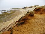
List of geotopes in the district of North Friesland
This sortable list contains the geotopes of the district of North Friesland in Schleswig-Holstein . It contains the official designations for names and numbers as well as their geographical location.
| Geotope number | Object number geotope potential area | Surname | Geotope type | Municipality / city | Coordinates | image | comment |
|---|---|---|---|---|---|---|---|
| You 001 | Dunes of North Sylt with Listland and Elbow | Dune , drift sand area | List on Sylt | 55 ° 2 ′ 54.2 " N , 8 ° 24 ′ 20.1" E | |||
| You 002 | Dunes of Westerland-Hörnum / Sylt | Dune, drift sand area | Hörnum | ||||
| You 003 | Amrum dune area | Dune, drift sand area | Amrum | 54 ° 39 ′ 17.3 " N , 8 ° 19 ′ 29" E | |||
| You 004 | Dunes of St. Peter-Ording | Dune, drift sand area | St. Peter-Ording | ||||
| You 006 | Inland dunes east of Süderlügum | Dune, drift sand area | Süderlügum | 54 ° 52 '19.6 " N , 8 ° 55' 44.3" E |

|
||
| You 007 | Inland dunes near Grellsbüll / Humptrup | Dune, drift sand area | |||||
| You 008 | Inland dunes of Haidburg-Süderberge | Dune, drift sand area | |||||
| You 009 | Inland dunes south of Enge | Dune, drift sand area | Narrow sands | ||||
| You 010 | Inland dunes of the Bargumer Heide | Dune, drift sand area | Bargum | 54 ° 42 ′ 9.6 " N , 9 ° 0 ′ 15" E | |||
| You 011 | Inland dunes between Knorburg and Riesbriek and on the Buschberg near Holzacker | Dunes, drift sand area | |||||
| You 012 | Inland dunes east of Soholm | Dune, drift sand area | Lütjenholm | 54 ° 41 '51.2 " N , 9 ° 3' 41.3" E | |||
| You 013 | Dune remnants of the terps Lundenberg, Herstum, Sterdebüll and Gr. Ellerbüll (10 individual areas) | Dune, drift sand area | Hattstedtermarsch | ||||
| Kl 037 | Elster and Drenthe glacial periods: Red cliff between Westerland and Kampen / Sylt | cliff | 54 ° 57 ′ 9.1 ″ N , 8 ° 19 ′ 45.5 ″ E | ||||
| Kl 038 | White cliff near Braderup / Sylt | cliff | |||||
| Kl 039 | Morsum Kliff / Sylt | cliff | Morsum | 54 ° 52 ′ 30.6 " N , 8 ° 27 ′ 41.5" E |

|
The Morsum Cliff is a National Geotope | |
| Kl 040 | Goting Kliff / Föhr | cliff | Goting | 54 ° 41 '0.7 " N , 8 ° 28' 9.8" E |

|
||
| Kl 041 | Cliff at Steenodde / Amrum | cliff | fog | ||||
| Kl 044 | Erosion cliff Süderstapel-Siebenberge | cliff | |||||
| Mon 001 | Rantzau-Höhe, Ahlefelder Höhe, Heide Berg and Klintumer Berg | moraine | |||||
| Mr 012 | Wild moor near Schwabstedt | moor | Schwabstedt | 54 ° 24 '59.9 " N , 9 ° 15' 4.2" E |

|
||
| Qh 002 | Holocene: Lawn iron stone deposits on the Stollberg (2 individual areas) | Exposure | Bordelum | 54 ° 38 '39.3 " N , 8 ° 56'52.8" E | |||
| Qp 006 | Saale - complex / leak - warm period: leak | Exposure | |||||
| Qp 015 | Eem warm period : Ahrenshöft | Exposure | |||||
| Qp 023 | Weichsel - glacial period: Periglacial polygonal pattern floors near Tinningstedt - Neulandshof | Exposure | |||||
| Qp 024 | Vistula - glacial period: periglacial polygonal pattern floors near Hoxtrup | Exposure | |||||
| Qp 027 | Vistula - glacial period: Pingo - similar structures Schwesing | Exposure | |||||
| Te 002 | Miocene, Pliocene, Quaternary: Morsum - cliff on Sylt | Exposure | Morsum | 54 ° 52 ′ 30.6 " N , 8 ° 27 ′ 41.5" E | |||
| Te 006 | Pliocene: Kaolin sand pits Braderup / Sylt | Exposure | |||||
| Te 006 | Pliocene: Braderup Sylt kaolin sand pits | Exposure | |||||
| St 017 | Front beach Kniepsand and Amrum - Odde / Amrum | Beach wall | |||||
| St 018 | Preliminary beaches of St. Peter Ording - Westerhever (2 individual areas) | Beach wall | |||||
| St 022 | Spit joke word - sand pitcher | Beach wall | |||||
| St 031 | Beach wall system Eiderstedt (Brösum - Haferacker) (2 individual areas) | Beach wall | |||||
| Ta 010 | Ostenau - valley between Bohmstedt and Drelsdorf | Beach wall | |||||
| Ta 023 | Dry valleys on the Glockenberg / Fresendelf (11 individual areas) | Valley shape |
- Source: Geological Service in the State Office for Agriculture, Environment and Rural Areas of Schleswig-Holstein; As of 2015
See also
- List of nature reserves in the district of North Friesland
- List of landscape protection areas in the district of North Friesland
- List of natural monuments in the district of North Friesland
source
- Geotope list planning area I. (PDF, 227 KB) Geological service in the State Office for Agriculture, Environment and Rural Areas of Schleswig-Holstein, May 2015, accessed on July 5, 2015 .
Web links
Commons : Geotopes in the Nordfriesland district - collection of images, videos and audio files