| image |
National geotope |
state |
Coordinates
|
 |
Island of Helgoland |
Schleswig-Holstein |
54 ° 10 ′ 57 ″ N, 7 ° 53 ′ 7 ″ E
|
 |
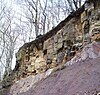
Lieth lime mine near Elmshorn |
Schleswig-Holstein |
53 ° 43 ′ 16 "N, 9 ° 40 ′ 47" E
|
 |
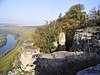
Morsum cliff on Sylt |
Schleswig-Holstein |
54 ° 52 ′ 38 "N, 8 ° 27 ′ 38" E
|
 |
Fossil algae lawn on the Heeseberg near Jerxheim |
Lower Saxony |
52 ° 5 ′ 1 ″ N, 10 ° 51 ′ 25 ″ E
|
 |
Zechstein Karst landscape on the southern Harz ( Rhume spring , unicorn cave ) |
Lower Saxony |
51 ° 35 ′ 23 "N, 10 ° 18 ′ 37" E
|
 |
Wadden Sea coast on the North Sea |
Lower Saxony,
Schleswig-Holstein,
Hamburg |
53 ° 54 ′ 29 ″ N, 8 ° 32 ′ 21 ″ E
|
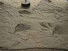 |
Dinosaur tracks in Münchehagen at Steinhuder Meer |
Lower Saxony |
52 ° 26 ′ 33 ″ N, 9 ° 12 ′ 2 ″ E
|
 |
Huvenhoopsmoor near Gnarrenburg |
Lower Saxony |
53 ° 22 '23 "N, 9 ° 6' 8" E
|
 |
Rammelsberg mine in Goslar |
Lower Saxony |
51 ° 53 ′ 25 ″ N, 10 ° 25 ′ 12 ″ E
|
 |
Jasmund chalk coast |
Mecklenburg-Western Pomerania |
54 ° 33 ′ 16 "N, 13 ° 40 ′ 33" E
|
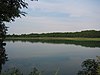 |
Feldberger Lakes |
Mecklenburg-Western Pomerania |
53 ° 20 ′ 11 "N, 13 ° 26 ′ 2" E
|
 |
Neudarß at the northern tip of the Darß
|
Mecklenburg-Western Pomerania |
54 ° 29 ′ 0 ″ N, 12 ° 30 ′ 54 ″ E
|
 |
Muskauer fold arch |
Brandenburg, Saxony |
51 ° 32 ′ 57 "N, 14 ° 34 ′ 54" E
|
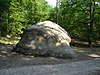 |
Small Markgrafenstein near Fürstenwalde |
Brandenburg |
52 ° 19 ′ 11 ″ N, 14 ° 2 ′ 7 ″ E
|
 |
Harznordrand and the Teufelsmauer
|
Saxony-Anhalt |
51 ° 45 ′ 27 "N, 11 ° 4 ′ 59" E
|
 |
Bodetal in the Harz Mountains |
Saxony-Anhalt |
51 ° 44 ′ 8 "N, 11 ° 0 ′ 35" E
|
 |
Block heaps of the Brocken near Schierke |
Saxony-Anhalt |
Coordinates are missing! Help.
|
 |
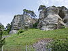
Externsteine in the Teutoburg Forest |
North Rhine-Westphalia |
51 ° 52 ′ 8 "N, 8 ° 55 ′ 3" E
|
 |
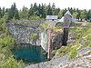
Brick quarry from Hagen-Vorhalle |
North Rhine-Westphalia |
51 ° 22 ′ 56 "N, 7 ° 26 ′ 43" E
|
 |
Siebengebirge near Bonn |
North Rhine-Westphalia |
50 ° 39 '49 "N, 7 ° 14' 44" E
|
 |
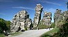
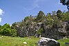
Bruchhauser stones in the Sauerland |
North Rhine-Westphalia |
51 ° 19 ′ 21 ″ N, 8 ° 32 ′ 39 ″ E
|
 |
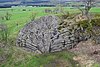
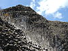
Sea of rocks near Hemer in the Sauerland |
North Rhine-Westphalia |
51 ° 22 ′ 50 ″ N, 7 ° 47 ′ 0 ″ E
|
 |
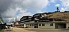
Historical coal mining in the Muttental near Witten |
North Rhine-Westphalia |
Coordinates are missing! Help.
|
 |
Schlade in the Bergisches Land |
North Rhine-Westphalia |
51 ° 0 ′ 13 "N, 7 ° 8 ′ 59" E
|
 |
Hambach lignite mine west of Cologne |
North Rhine-Westphalia |
50 ° 54 ′ 39 "N, 6 ° 30 ′ 10" E
|
 |
Eisenerzgrube Wohlverwahrt in the Weser Mountains |
North Rhine-Westphalia |
52 ° 13 ′ 40 "N, 9 ° 2 ′ 28" E
|
 |
Porta Westfalica breakthrough in the Weser
|
North Rhine-Westphalia |
52 ° 14 ′ 38 "N, 8 ° 55 ′ 11" E
|
 |
Pebble slate folds near Beddelhausen in the Wittgensteiner Land |
North Rhine-Westphalia |
50 ° 59 ′ 54 ″ N, 8 ° 29 ′ 16 ″ E
|
 |
Messel mine near Darmstadt |
Hesse |
49 ° 55 ′ 3 ″ N, 8 ° 45 ′ 24 ″ E
|
 |
Felsenmeer near Lautertal in the Odenwald |
Hesse |
49 ° 43 ′ 26 "N, 8 ° 41 ′ 28" E
|
 |
Lahn marble near Villmar |
Hesse |
50 ° 23 ′ 39 ″ N, 8 ° 11 ′ 3 ″ E
|
 |
Rhön with Wasserkuppe , Schafstein , Steinwand , Teufelstein , Wachtküppel
|
Hesse |
Coordinates are missing! Help.
|
 |
Bohlenwand (Thuringia) near Saalfeld |
Thuringia |
50 ° 37 '54 "N, 11 ° 22' 59" E
|
|
Feldstein near Lengfeld in southern Thuringia |
Thuringia |
50 ° 31 '42 "N, 10 ° 38' 5" E
|
 |
Crystal salt chimneys from Merkers
|
Thuringia |
Coordinates are missing! Help.
|
 |
Long wall near Ilfeld in the southern Harz |
Thuringia |
51 ° 34 ′ 11 "N, 10 ° 47 ′ 12" E
|
 |
Slate mining near Lehesten |
Thuringia |
50 ° 27 '40 "N, 11 ° 25' 54" E
|
 |
Travertine of the Ilm valley near Weimar |
Thuringia |
Coordinates are missing! Help.
|
 |
Scheibenberg in the Ore Mountains |
Saxony |
50 ° 32 '14 "N, 12 ° 55' 26" E
|
 |
Palm fronds on the Hirtstein in the Ore Mountains |
Saxony |
50 ° 32 '9 "N, 13 ° 11' 35" E
|
 |
Basalt chimney from Stolpen in Lusatia |
Saxony |
51 ° 2 ′ 53 "N, 14 ° 5 ′ 3" E
|
 |
Elbe Sandstone Mountains |
Saxony |
50 ° 47 ′ 35 "N, 14 ° 6 ′ 31" E
|
|
Round humps in the Hohburg Mountains in the Leipzig district |
Saxony |
51 ° 24 ′ 22 "N, 12 ° 47 ′ 55" E
|
 |
Altenberger Pinge in the Ore Mountains |
Saxony |
50 ° 45 ′ 56 "N, 13 ° 45 ′ 50" E
|
 |
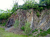
Rochlitzer Porphyrtuff |
Saxony |
51 ° 1 ′ 22 "N, 12 ° 45 ′ 48" E
|
 |
Kirchbruch Beucha |
Saxony |
51 ° 19 '27 "N, 12 ° 33" 59 "E
|
 |
Dauner Maare in the Eifel |
Rhineland-Palatinate |
Coordinates are missing! Help.
|
 |
Middle Rhine Valley |
Rhineland-Palatinate |
Coordinates are missing! Help.
|
 |
Vulkaneifel with Dachsbusch , Eppelsberg , Wingertsbergwand , Meurin Roman mine , Eckfelder Maar
|
Rhineland-Palatinate |
Coordinates are missing! Help.
|
 |
Devil's table in the Palatinate Forest |
Rhineland-Palatinate |
49 ° 11 ′ 42 "N, 7 ° 44 ′ 38" E
|
 |
Druid stone near churches / victory |
Rhineland-Palatinate |
50 ° 47 ′ 42 "N, 7 ° 54 ′ 37" E
|
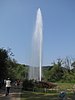 |
Andernach geyser |
Rhineland-Palatinate |
50 ° 26 ′ 54 "N, 7 ° 22 ′ 31" E
|
 |
Saar loop near Mettlach |
Saarland |
49 ° 30 ′ 4 "N, 6 ° 32 ′ 58" E
|
 |
Feldberg and Wutach Gorge
|
Baden-Württemberg |
47 ° 52 ′ 25 "N, 8 ° 0 ′ 14" E ,
47 ° 50 ′ 41 "N, 8 ° 18 ′ 43" E
|
 |
Kaiserstuhl |
Baden-Württemberg |
48 ° 4 ′ 51 ″ N, 7 ° 40 ′ 14 ″ E
|
 |
Randecker Maar |
Baden-Württemberg |
48 ° 34 '27 "N, 9 ° 31' 23" E
|
 |
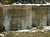
Posidonia slate from Holzmaden |
Baden-Württemberg |
48 ° 38 ′ 8 "N, 9 ° 31 ′ 37" E
|
 |
Upper Danube Valley |
Baden-Württemberg |
48 ° 2 ′ 56 "N, 8 ° 58 ′ 20" E
|
 |
Blaubeurer Alb with the blue pot
|
Baden-Württemberg |
48 ° 24 ′ 57 "N, 9 ° 47 ′ 2" E
|
 |
Volcanic landscape of the Hegau with Höwenegg and Hohentwiel
|
Baden-Württemberg |
47 ° 54 ′ 5 ″ N, 8 ° 44 ′ 30 ″ E
|
 |
Lone Valley on the Swabian Alb |
Baden-Württemberg |
48 ° 34 '53 "N, 10 ° 12' 57" E
|
 |
Isteiner Klotz on the Upper Rhine |
Baden-Württemberg |
47 ° 39 '47 "N, 7 ° 31' 51" E
|
 |
Hessigheim rock gardens in the Neckar valley |
Baden-Württemberg |
49 ° 0 ′ 6 "N, 9 ° 10 ′ 37" E
|
 |
Mössinger landslide on the Swabian Alb |
Baden-Württemberg |
48 ° 22 ′ 40 "N, 9 ° 4 ′ 0" E
|
 |
Bavarian stake |
Bavaria |
49 ° 5 ′ 2 "N, 12 ° 51 ′ 36" E
|
 |
Nördlinger Ries |
Bavaria, Baden-Wuerttemberg |
48 ° 53 ′ 18 ″ N, 10 ° 32 ′ 9 ″ E
|
 |
Altmühltal and Solnhofen limestone limestone
|
Bavaria |
48 ° 54 ′ 0 ″ N, 11 ° 10 ′ 0 ″ E
|
 |
Glacier cut near Fischbach am Inn |
Bavaria |
47 ° 42 '37 "N, 12 ° 9' 5" E
|
 |
Pottenstein in the Franconian Alb |
Bavaria |
49 ° 46 ′ 19 ″ N, 11 ° 24 ′ 29 ″ E
|
 |
High park stone in the Upper Palatinate |
Bavaria |
49 ° 43 ′ 55 "N, 12 ° 4 ′ 12" E
|
 |
Stone Agnes near Berchtesgaden |
Bavaria |
47 ° 41 ′ 12 "N, 12 ° 54 ′ 32" E
|
 |
Osterseen south of Munich |
Bavaria |
47 ° 47 ′ 25 ″ N, 11 ° 18 ′ 15 ″ E
|
 |
Luisenburg rock labyrinth near Wunsiedel in the Fichtel Mountains |
Bavaria |
50 ° 0 ′ 43 "N, 11 ° 59 ′ 32" E
|
 |
Weltenburger Enge near Kelheim |
Bavaria |
48 ° 54 ′ 1 ″ N, 11 ° 49 ′ 49 ″ E
|
 |
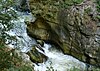
Partnachklamm near Garmisch-Partenkirchen |
Bavaria |
47 ° 28 ′ 9 ″ N, 11 ° 7 ′ 7 ″ E
|
 |
Silberberg near Bodenmais in the Bavarian Forest |
Bavaria |
49 ° 3 '26 "N, 13 ° 7' 27" E
|
 |
Growing rocks from Usterling in Lower Bavaria |
Bavaria |
48 ° 39 '44 "N, 12 ° 38' 56" E
|
 |
Werdenfelser Land |
Bavaria |
47 ° 28 '26 "N, 11 ° 9' 22" E
|


.jpg)

_3.JPG)


_2006-06-28.jpg)


.jpg)


.jpg)


_db.jpg)


