Muttental mining trail
The Muttental mining hiking trail in the Muttental area in Witten is a nine-kilometer circular trail south of the Ruhr . This mining trail was created in 1972. The show points are supervised by the Association for the Promotion of Mining Historic Sites in the Ruhr Area .
Content
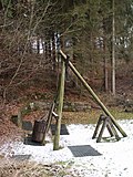
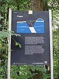
Evidence of centuries of mining in the Ruhr can be found along the hiking trail . These include tunnels , pings , headframes , heaps , loading systems and more. Each relic is explained with an elaborately designed board .
The attractions of the hiking trail include several preserved or restored tunnel openings , a prayer house and the LWL industrial museum, the Zeche Nachtigall . The surrounding forests, meadows and the Muttenbach make the path a natural experience. Part of the route runs through the Hardenstein nature reserve . On the way or in the vicinity of the road are the ruins of the castle Hardenstein which Steinhausen castle and the mining and Feldbahnmuseum Zeche Theresia . Some distance away, near Herbede, there is also the Egbert colliery , the last small mine in the Ruhr area .
Some inns along the hiking trail invite you to rest and stop. The hiking trail is accessible through several parking spaces. With the Hardenstein near the castle ruins, the hiking trail is also accessible from the northern side of the Ruhr.
List of points
| image | location | designation | number | Remarks |
|---|---|---|---|---|
 |
Bommern Muttentalstrasse map |
Visitor gallery Nightingale colliery , Dünkelberg quarry | 1 | Nightingale tunnel also monument no. 139 , Rauen quarry also soil monument no. 8 and natural monument 2.3.20 |

|
Bommern Muttentalstrasse map |
Development of the coal industry | 2 | |

|
Bommern Muttentalstrasse map |
Eastern daily operation Frielinghaus | 3 | |
 |
map | Stollen turtledove | 4th | |
 |
Bommern Muttentalstrasse 35 map |
Miners' prayer house | 5 | also monument no.140 |

|
Herbede Muttentalstrasse map |
Dump of the Hermann colliery | 6th | also ground monument no.18 |
 |
Bommern Muttentalstraße 30/32 map |
Building at the Constanz shaft | 7th | also monument no.150 and monument no.151 and monument no.20 |

|
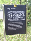
map | Colliery Hermann | 8th | |
 |
Bommern Muttentalstrasse map |
Reel system | 9 | |
 |
Bommern Muttentalstrasse map |
Jupiter colliery loading facility | 10 | also monument no.142 and ground monument no.10 |
 |
Bommern Muttentalstrasse map |
Stettin gallery | 11 | also ground monument no.6 |

|
Herbede Muttentalstrasse map |
Maximus gallery | 12 | also ground monument no.5 |
 |
Bommern Muttentalstrasse map |
Muttentalbahn | 13 | also ground monument no.9 |
 |
Bommern Muttentalstrasse map |
Fortuna tunnel | 14th | also ground monument no.11 |

|
Bommern Muttentalstrasse map |
Juno mine dump | 15th | also ground monument no.4 |
 |
Herbede Muttentalstrasse map |
Renate colliery | 16 | |

|
map | Three tree | 17th | |

|
map | Memorial stone for unfortunate miners | 18th | |

|
map | Geological overview | 19th | |
 |
map | Seam outcrop | 20th | |
| Hollow of the Coal Mountains | 20a | no longer a stop on the mining trail | ||
 |
map | Göpelschacht Moses | 21st | |
| At the "Piärrestall" | 21a | |||

|
Herbede Berghauser Strasse map |
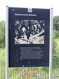
Göpelschacht Wilhelm | 22nd | |
|
|
Herbede Berghauser Strasse map |
Hollow of the Coal Mountains | 22a | |
| Göpelschacht Heinrich | 23 | |||
| Alexander shaft | 23a | |||
 |
Herbede Hardensteiner Weg map |
Western Frielinghaus open-day operation | 24 | also ground monument no.13 |

|
Herbede Hardensteiner Weg map |
Orion colliery | 25th | also ground monument no.14 |
 |
Herbede Hardensteiner Weg map |
Reiger gallery | 26th | also ground monument no.15 |
 |
Herbede Hardensteiner Weg map |
Pingenfeld Carthauser Hole | 27 | also monument no.29 |
 |
Herbede Hardensteiner Weg map |
St. John's Erbstollen | 28 | also monument no.263 |
 |
map | Weir and lock | 28a | |
 |
Herbede Hardensteiner Weg map |
Union adit | 29 | also monument no.143 |
| Ruhr valley / geological outcrop | 29a | |||
 |
Herbede Hardensteiner Weg map |
Post-war tunnel | 30th | also ground monument no.16 |
 |
Herbede on the Martha 1/2/3/5 card |
Martha underground mine | 31 | also monument no.16 |

|
map | Nightingale coal defeat | 32 | also monument no.19 |
 |
map | Nightingale Bridge | 33 | |
 |
Bommern Nachtigallstraße 27/29/31/33 map |
Theresia colliery | 34 | typical examples of company buildings from the early industrialization phase, all types from half-timbered buildings from the 18th century to quarry stone buildings and classicist sandstone buildings from the early 19th century to brick buildings from the late 19th century; also monument no.200 |
 |
map | Braunschweig tunnel south wing | 35 | |
 |
Bommern Auf Steinhausen 28 map |
House Steinhausen | 36 | also architectural monument no.230 and ground monument no.32 |

|
Bommern Muttentalstrasse map |
Meilerplatz | 37 | |
 |
Herbede Muttentalstrasse map |
Margarethe shaft | 38 | also monument no.141 |

|
Herbede Altenhöfen map |
Berghauser Höfe | 39 | |
 |
Herbede Rauendahlstrasse map |
Pinging | 40 | also ground monument no.12 |

|
Herbede Rauendahlstrasse 166 map |
Aurora shaft | 41 | also monument no.15 |
 |
Herbede Kämpenstrasse 97 map |
Shaft frame of the Egbert small mine | 42 | also monument no.3 |
 |
Herbede forest path map |
Weather chimney | 43 | also monument no.4 |
See also
literature
- Gerhard Koetter: Of seams, tunnels and shafts in the Muttental. A hiking guide through the mining history of the Ruhr . 2nd, change Edition. Klartext Verlag , Essen 2007, ISBN 978-3-89861-612-6 .
- Gerhard Koetter: The miners' prayer house in Muttental near Witten . In: VOHM (Hrsg.): Year book of the association for local and local history in the county of Mark . tape 92 . Witten 1994, p. 223-234 .
- Gerhard Koetter: When coal was still the future. Mining history and geology of the Muttental and the Nachtigall colliery . Klartext, Essen 2017
Web links
- Mining circuit Muttental - Stadtmarketing Witten
- Mining hiking trail in Muttental - ruhrgebiet-industriekultur.de
- Report on the mining trail in the Muttental
- Muttental mining trail in the Ruhr-Guide
- Description of this sight on the route of industrial culture
Individual evidence
- ^ Martin Jakel: Monument protection and preservation in Witten . In: City magazine Witten . No. 32 , July 2004, p. 23 ( online [accessed March 22, 2017]).


