Alte Haase mining trail
The Alte Haase mining hiking trail is a two-part circular hiking trail in the Niedersprockhövel area that connects various historical mining sites from the early days of coal production in the Ruhr area . Since the coal seams reached to the surface in the Sprockhöveler area , the oldest evidence of the mining history of the Ruhr area can be found here.
The Alte Haase mining trail (north and south) is combined with four other mining trails to form the “Coal Trace” theme route .
description
The 6.8 km (8.5 km including point 3) (north route) and 9.8 km (south route) long circular hiking trails were created by the Association of Mining Historic Sites Ruhrrevier eV in cooperation with the Heimat- und Geschichtsverein Sprockhövel eV and after the largest colliery in Sprockhövel, the mine Old Haase named. The sign of the circular route north is a stylized Malakow tower , that of the circular route south is a stylized headframe .
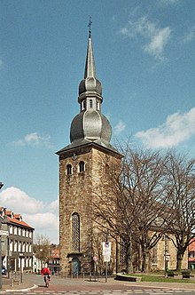
The starting point of the circular route north is the Sprockhöveler Dorfkrug , the former restaurant Stöter-Tillmann , and only a few meters from the Sprockhövel bus station; The starting point of the circular route south is at the former Sprockhövel train station .
Sights of the circular route north
The north circular route leads to 14 sites and objects from mining history, many of which are explained on site with informative display boards.
- Gasthof Stöter-Tilmann (today Zum Dorfkrug ), founded by the manager Gustav Düsterloh and the venue for the annual Sprockhövel Miners' Days .
- Park at the Malakow Tower
- Edeltraud-Stollen union
- Alte Haase colliery with a striking Malakow tower
- Shaft II (1924) of the Alte Haase colliery
- Railway line Wuppertal-Wichlinghausen-Hattingen
- Coal seam slate bank
- Riepelsiepen bridge
- Early shafts and pings from Alte Haase
- Kleinzeche Hoffnungstal / Teufelsburg II
- Stollenzeche Johannessegen , horse-drawn tram on the Paasbach. Transport route to the Wichlinghausen – Hattingen railway line.
- Waskönig farm in the Paasbach valley , the family of one of Alte Haase's main trades lived here for centuries . The first tunnel of the colliery started in the immediate vicinity.
- Dotdbruch farm . The Julie shaft of the Alte Haase colliery was named after the daughter of the Julie Dotdbruch family, the wife of the mine representative Johann Friedrich Große Herzbruch , known as Bröckelmann .
- Museum and Heimatstube of the Heimat- und Geschichtsverein Sprockhövel eV
Sights of the circular route south
The circular route south leads to 22 sites and objects from mining history, many of which are explained on site with informative display boards.
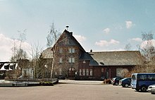
- Sprockhövel train station
- Gasthof Rose , miners 'meeting place and clubhouse of the free trade unions and workers' associations
- Company Nüsser and Gräfer ( TURMAG ), mining equipment supplier
- Gasthof Hilgenstock (today Dorfschänke ), social center of the community and seat of the Knappschaftsunterstützungsverein .
- Mountain pre-school Sprockhövel, training center for the next generation of climbers .
- Raise the weather on the main seam (Alte Haase colliery) to bring in fresh weather .
- United Wildenberg & Vogelbruch colliery
- Vogelbruch farm , location of the Vogelbruch colliery and a barrel of the Alte Haase colliery to the seam water bank .
- Kleinzeche Lange
- Old ravine , horse cart path to transport coal
- Kotten In der Hibbel , home of the Obersteigers Georg Peter Hilgenstock . The Hilgenstock family produced numerous mining officials, mine directors and mining engineers and are still well represented in Sprockhövel today.
- Hof Diefhausen and Diefhauser Bank . The near-surface coal of the Mausegatt seam (called Diefhauser Bank here) has been mined on the farm since 1650 . The Frosch colliery was founded on the property in 1739 by the farm owners.
- Schacht Im Brahm , outer shaft (1953) of the Alte Haase colliery .
- Old coal route
- Molly II small mine
- Desert of the Frosch colliery , one of the oldest mines in Sprockhövel.
- Rudolf Hausherr & Sons, a mining machine factory founded in 1918.
- Hof Homberg and Hof Auf dem Bruch . The two farms were located in the mining area of the Frosch colliery and had to suffer various disadvantages (lowering of the groundwater level, damage to the mountains and use of the roads) from mining. Later shafts were built on the farm premises themselves.
- Sprockhövel colliery, emerged from the Frosch colliery in 1881.
- Air shaft of the Erbstollen of the Frog colliery.
- Bergmannskotten Erlbruch (1888), part-time farming of miner Julius Erlbruch.
- Heimatstube of the Heimat- und Geschichtsverein Sprockhövel eV with an extensive mining history collection
literature
- Friends of Mining Historic Sites Ruhrrevier eV, Sprockhövel Working Group (Hrsg.): The trace of coal - Route 2 . The Alte-Haase-Weg (North) hiking trail through the history of early mining with directions and hiking map. Sprockhövel 1999.
- Friends of Mining Historic Sites Ruhrrevier eV, Sprockhövel Working Group (Hrsg.): The trace of coal - Route 3 . The Alte-Haase-Weg (south) hiking trail through the history of early mining with directions and hiking map. Sprockhövel 1997.
Web links
- Alte-Haase-Weg (north). Retrieved on December 26, 2012 (hiking trail description with map).
- Alte-Haase-Weg (south). Retrieved on December 26, 2012 (hiking trail description with map).
- Internet pages of the association on the hiking trails. Retrieved February 2, 2013 (information with map).
- Description of this sight on the route of industrial culture
Coordinates: 51 ° 22 ′ 20 ″ N , 7 ° 14 ′ 37 ″ E


