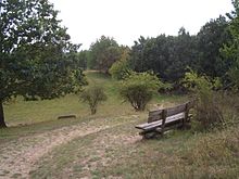
Feldberger Seenlandschaft Nature Park

The Feldberger Seenlandschaft nature park is located in the southeast of Mecklenburg-Western Pomerania in the Mecklenburg Lake District . A large part of the nature park is in the Feldberger Seenlandschaft municipality . In addition, the municipalities of Wokuhl-Dabelow , Grünow , Carpin , Godendorf and parts of the urban areas of Woldegk and Neustrelitz are part of the nature park. The western part of the nature park belongs to the Müritz National Park .
The Feldberger Seenlandschaft nature park is characterized by its large lakes ( Breiter Luzin , Carwitzer See , Schmale Luzin , Große Fürstenseer See and Feldberger Haussee ) and forests with many, even rare animals and plants, but also by its cultural landscape. The specialty of the park are the kettle moors and the oldest beech forest in Germany in the Heilige Hallen nature reserve .
The landscape is shaped by the Ice Age. In the northern part of the nature park there is a ground moraine area , in the south wooded sand areas . The central part with the Feldberg lakes belongs to the terminal moraine of the Pomeranian stage of the Vistula Ice Age . This area has great differences in altitude by north German standards. The highest mountain is the bird cherry (near the village of Schlicht north of the latitude Luzin) with a height of 166.6 m above sea level. NHN. At 58.3 meters, the Breite Luzin is the second deepest lake in Mecklenburg-Western Pomerania.
The state border with Brandenburg runs through the Krüselinsee , the Großer Mechowsee and the southern part of the Carwitzer See .
Many rare animals such as the otter , which the emblem is the park, the black stork , the cry -, lake - and osprey , the Great River mussel and the Tiefenmaräne live here. There are also 1,000 species of wild plants in this nature park.
The park has an area of approx. 340 km², approx. 38% of which is taken up by forests, approx. 11% by lakes and rivers, approx. 45% by agricultural land and approx. 6% by infrastructure and living space.
The Feldberger Seenlandschaft was added to the list of 77 national geotopes awarded in 2006.
Nature reserves
There are 14 nature reserves in the nature park , which cover a total area of 3714 hectares, which corresponds to 10.3 percent of the nature park area:
- Comthureyer Berg (13 ha)
- Conower Werder (54 ha)
- Feldberger Hut (481 ha)
- Hauptmannsberg (44 ha)
- Holy Halls (68 ha)
- Hinrichshagen (1124 ha)
- Hullerbusch and Schmaler Luzin (345 ha)
- Keetzseen (329 ha)
- Krüselinsee and Mechowseen (481 ha)
- Kulow Lakes (199 ha)
- Sandugkensee (67 ha)
- Schlavenkensee (593 ha)
- Sprockfitz (27 ha)
- Zahrensee near Dabelow (17 ha)
See also
literature
- The Feldberger Seengebiet (= values of the German homeland . Volume 57). 1st edition. Verlag Hermann Böhlaus successor, Weimar 1997, ISBN 3-7400-0936-5 .
- Peter Wernicke et al .: Between the Havel and the river. The Feldberger Seenlandschaft and Uckermark Lakes nature parks . Published by the Feldberg-Uckermärkische Seenlandschaft Förderverein. Thomas-Verlag, Leipzig 1998, 97 pages, ISBN 3-86174-050-8
- Klaus Borrmann : Lüttenhäger chief forester. Life and work for the forests of the Feldberg lake landscape 1810 - 2001 . Forest Museum Lütt Holthus , Lüttenhagen 2001, 134 pp.
Web links
- Ordinance establishing the "Feldberger Seenlandschaft" nature park of February 13, 1997
- Nature park page of the State Office for the Environment, Nature Conservation and Geology MV
Individual evidence
- ↑ Klaus Granitzki: Experience the Ice Age - The Feldberger Seenlandschaft. In: Ernst-Rüdiger Look, Ludger Feldmann (Ed.): Fascination Geology. The important geotopes of Germany , E. Schweizerbart'sche Verlagsbuchhandlung, Stuttgart 2006, ISBN 3-510-65219-3 , p. 28f.
Coordinates: 53 ° 20 ′ 11 ″ N , 13 ° 26 ′ 2 ″ E


