Teufelstein (Rhön)
| Devil stone | ||
|---|---|---|
|
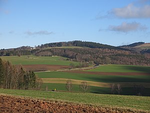
View of the mountain from the southwest |
||
| height | 729.4 m above sea level NHN | |
| location | at stone wall ; District of Fulda , Hessen ( Germany ) | |
| Mountains |
Rhön ( Milseburger Kuppenrhön ) |
|
| Dominance | 1.2 km → Weiherberg | |
| Notch height | 49 m ↓ Grabenhöfchen | |
| Coordinates | 50 ° 31 '7 " N , 9 ° 53' 36" E | |
|
|
||
| rock | Phonolite | |
| particularities | Natural monument | |
The Teufelstein is 729.4 m above sea level. NHN high mountain in the Rhön near Steinwand , a district of Poppenhausen in the eastern Hessian district of Fulda . In terms of its natural surroundings, it is part of the Milseburger Kuppenrhön , whereas the Weiherberg ( 785 m ) to the east is already part of the Wasserkuppenrhön . In the summit area of the Teufelstein there is a rock formation that is designated as a natural monument and gave the mountain its name.
geography
location
The Teufelstein rises in the Hessian Rhön Nature Park . Its summit is - viewed counterclockwise - 3 km southeast of Wolferts , 3.7 km northeast of Poppenhausen , 2.3 km northwest of Abtsroda , 2.9 km southwest of Dietges and 3 km south of the Milseburg (both as the crow flies ). It is only 1.5 km southeast of the Fulda house .
Between the Teufelstein and the Weiherberg lies the Grabenhöfchen pass (height 685 m), which forms the watershed between Fulda and Werra . To the northeast of the mountain, the sources of the Bieber and Wanne streams are only a few hundred meters from the summit as the crow flies.
Natural allocation
The Teufelstein belongs to the natural spatial main unit group Osthessisches Bergland (No. 35), in the main unit Vorder- und Kuppenrhön (with land ridge) (353) and in the subunit Kuppenrhön (353.2) to the natural area Milseburger Kuppenrhön (353.21).
rock
The Teufelstein is a 200 m long phonolite breakthrough with inclusions of mica schist in the local red sandstone . Some of the phonolite blocks lying around it form five to six-sided columns. Their bizarre formations give the mountain its special tourist charm.
Protected areas
The Teufelsstein is located in the Hessian Rhön landscape protection area ( CDDA no. 378477; designated 1967; 410.31 km² in size), in the Hessian Rhön nature park and in the Rhön biosphere reserve . The rock formations have been classified as a natural monument by the district of Fulda.
Infrastructure, traffic and hiking
The Teufelstein is separated from Weiherberg by federal road 458 , which is easy to reach. There is a parking lot on the road at Grabenhöfchen from which a local hiking trail to Poppenhausen and a circular hiking trail start.
See also
Individual evidence
- ↑ a b c Map services of the Federal Agency for Nature Conservation ( information )
- ↑ Naturdenkmalliste , in Naturdenkmale im Landkreis Fulda , from June 7, 2010, accessed on May 1, 2015, on landkreis-fulda.de (PDF; 865.9 KB)
- ↑ Length information using the measure distance function on Google Maps
- ↑ Hiking map of the Rhön Nature Park, 1: 50000 . 10th edition. Fritsch-Verlag, ISBN 3-86116-068-4 .
- ^ A b Rhönklub eV (ed.): Schneider's Rhönführer, official leader of the Rhönklub . 25th edition. Parzeller, Fulda 2005, ISBN 3-7900-0365-4 , p. 285 .
- ↑ Hessische Rhön Landscape Protection Area (map), accessed on May 1, 2015, from protectedplanet.net
Web links
- Description on the website of the Hessian State Office for Nature Conservation, Environment and Geology .


