
Dägeling
| coat of arms | Germany map | |
|---|---|---|

|
Coordinates: 53 ° 53 ' N , 9 ° 32' E |
|
| Basic data | ||
| State : | Schleswig-Holstein | |
| Circle : | Stone castle | |
| Office : | Krempermarsch | |
| Height : | 20 m above sea level NHN | |
| Area : | 7.53 km 2 | |
| Residents: | 1039 (Dec. 31, 2019) | |
| Population density : | 138 inhabitants per km 2 | |
| Postal code : | 25578 | |
| Area code : | 04821 | |
| License plate : | IZ | |
| Community key : | 01 0 61 022 | |
| LOCODE : | DE DDY | |
| Office administration address: | Birkenweg 29 25361 Krempe |
|
| Website : | ||
| Mayor : | Claus Wilke ( CDU ) | |
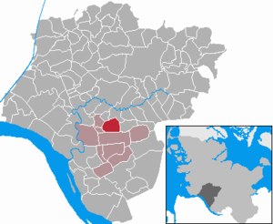
| Location of the municipality of Dägeling in the Steinburg district | ||
  |
||

Dägeling ( Low German : Döling ) is a municipality in the Steinburg district in Schleswig-Holstein . The district of Wellenberg belongs to the municipality.
Geography and traffic
Dägeling is five kilometers south of the district town of Itzehoe on the federal highway 23 between Itzehoe and Elmshorn . Dägeling can be reached with the 6533 or 6531 bus.
history
The place was first mentioned in 1427 as Dodelinghe . It was owned by the Bordesholm Monastery , from which Johann Rantzau bought it in 1526.
From 1890 to 1938 the community belonged to the Lägerdorf district, from 1938 to 1969 to the district or from 1948 to the Neuenbrook district. Since 1969 she has been part of the Krempermarsch office .
In the municipality there is a naturist campsite directly at the Binnendünen Nordoe nature reserve (Lage) .
politics
Community representation
Of the eleven seats in the municipal council, the CDU has six seats since the local elections in 2018, the DWG three and the KWV electoral community two seats.
coat of arms
Blazon : "Above a silver arched foot, covered with a blue wave bar, a silver machine wheel in red, accompanied on each side by a golden ear of wheat."
In the coat of arms it is symbolized by the arched base with a wavy bar. The two ears of wheat are reminiscent of the local agriculture that once comprised 30 farms. The machine wheel stands for the industrial and commercial area built in 1972 and thus refers to the future orientation of the community.
Web links
Individual evidence
- ↑ North Statistics Office - Population of the municipalities in Schleswig-Holstein 4th quarter 2019 (XLSX file) (update based on the 2011 census) ( help on this ).
- ↑ Schleswig-Holstein's municipal coat of arms
Carrion | Abbissinwish | Agethorst | Altenmoor | Auufer | Bahrenfleth | Beidenfleth | Bekdorf | Bekmünde | Besdorf | Blomean Wilderness | Bokelrehm | Bokhorst | Borsfleth | Breitenberg | Breitenburg | Brokdorf | Brokstedt | Büttel | Christinenthal | Dägeling | Dammfleth | Drage | Ecklak | Elskop | Engelbrecht Wilderness | Fitzbek | Glückstadt | Grevenkop | Gribbohm | Hadenfeld | Heiligenstedten | Heiligenstedtenerkamp | Hennstedt | Heart horn | Hingstheide | Hodorf | Hohenaspe | Hohenfelde | Hohenlockstedt | Holstenniendorf | Horst (Holstein) | Huje | Itzehoe | Kaaks | Kaisborstel | Kellinghusen | Lapwing row | Kleve | Kollmar | Kollmoor | Krempdorf | Brim | Kremperheide | Krempermoor | Kronsmoor | Krummendiek | Kudensee | Lägerdorf | Land law | Landscheide | Lockstedt | Lohbarbek | Looft | Mehlbek | Moordiek | Moorhusen | Mühlenbarbek | Münsterdorf | Neuenbrook | Neuendorf b. Elmshorn | Neuendorf-Sachsenbande | Nienbüttel | Nortorf | Nutteln | Oelixdorf | Oeschebüttel | Oldenborstel | Oldendorf | Ottenbüttel | Peissen | Pöschendorf | Poyenberg | Pulse | Quarnstedt | Wheel | Reher | Rethwisch | Rosdorf | Sankt Margarethen | Sarlhusen | Schenefeld | Schlotfeld | Silzen | Summer land | Stördorf | Störkathen | Süderau | Vaale | Vaalermoor | Wacken | Warring wood | Westermoor | Wewelsfleth | Wiedenborstel | Wills | Wilster | Winseldorf | Wittenbergen | Wrist | Wulfsmoor