
Stördorf
| coat of arms | Germany map | |
|---|---|---|

|
Coordinates: 53 ° 55 ' N , 9 ° 26' E |
|
| Basic data | ||
| State : | Schleswig-Holstein | |
| Circle : | Stone castle | |
| Office : | Wilstermarsch | |
| Height : | 1 m above sea level NHN | |
| Area : | 7.41 km 2 | |
| Residents: | 122 (Dec. 31, 2019) | |
| Population density : | 16 inhabitants per km 2 | |
| Postal code : | 25554 | |
| Area code : | 04823 | |
| License plate : | IZ | |
| Community key : | 01 0 61 102 | |
| Office administration address: | Kohlmarkt 25 25554 Wilster |
|
| Website : | ||
| Mayor : | Helmut Sievers (KWVSt) | |
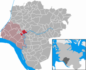
| Location of the municipality of Stördorf in the Steinburg district | ||
  |
||


Stördorf ( Low German : Stöörbody ) is a municipality in the Steinburg district in Schleswig-Holstein . In addition to Stördorf, the municipality also includes the districts of Honigfleth, Kasenort and Kathen.
Geography and traffic
Stördorf is located on the Stör four kilometers east of Wilster . The federal highway 5 runs through the municipality. The landmark of the Wilstermarsch , a post mill, is located in the Honigfleth district . In addition, the Große Feldwetter and the Kampritt Weather run through the municipality.
history
The community has been independent since 1872.
politics
Community representation
Since the local elections in 2008, the KWVSt community of voters has all seven municipal council seats.
coat of arms
Blazon : "divided lowered from green and blue by two narrow four-wave silver wave beams. A silver post mill above, a silver sturgeon below. "
See also
- List of cultural monuments in Stördorf (with Honigfleth )
literature
- HA Becker: The sturgeon Der Stör , Verlag BoD, 1970/2002, pp. 37-38, Stördorf reading sample from Google Books
Web links
- Municipality of Stördorf at the Wilstermarsch office with history & coat of arms section
- Texts and historical postcards about Stördorf at mein-wilster-de
Individual evidence
- ↑ North Statistics Office - Population of the municipalities in Schleswig-Holstein 4th quarter 2019 (XLSX file) (update based on the 2011 census) ( help on this ).
- ↑ Schleswig-Holstein topography. Vol. 9: Schönberg - Tielenhemme . 1st edition Flying-Kiwi-Verl. Junge, Flensburg 2007, ISBN 978-3-926055-91-0 , p. 236 ( dnb.de [accessed on August 6, 2020]).
- ↑ Schleswig-Holstein's municipal coat of arms
Carrion | Abbissinwish | Agethorst | Altenmoor | Auufer | Bahrenfleth | Beidenfleth | Bekdorf | Bekmünde | Besdorf | Blomean Wilderness | Bokelrehm | Bokhorst | Borsfleth | Breitenberg | Breitenburg | Brokdorf | Brokstedt | Büttel | Christinenthal | Dägeling | Dammfleth | Drage | Ecklak | Elskop | Engelbrecht Wilderness | Fitzbek | Glückstadt | Grevenkop | Gribbohm | Hadenfeld | Heiligenstedten | Heiligenstedtenerkamp | Hennstedt | Heart horn | Hingstheide | Hodorf | Hohenaspe | Hohenfelde | Hohenlockstedt | Holstenniendorf | Horst (Holstein) | Huje | Itzehoe | Kaaks | Kaisborstel | Kellinghusen | Lapwing row | Kleve | Kollmar | Kollmoor | Krempdorf | Brim | Kremperheide | Krempermoor | Kronsmoor | Krummendiek | Kudensee | Lägerdorf | Land law | Landscheide | Lockstedt | Lohbarbek | Looft | Mehlbek | Moordiek | Moorhusen | Mühlenbarbek | Münsterdorf | Neuenbrook | Neuendorf b. Elmshorn | Neuendorf-Sachsenbande | Nienbüttel | Nortorf | Nutteln | Oelixdorf | Oeschebüttel | Oldenborstel | Oldendorf | Ottenbüttel | Peissen | Pöschendorf | Poyenberg | Pulse | Quarnstedt | Wheel | Reher | Rethwisch | Rosdorf | Sankt Margarethen | Sarlhusen | Schenefeld | Schlotfeld | Silzen | Summer land | Stördorf | Störkathen | Süderau | Vaale | Vaalermoor | Wacken | Warring wood | Westermoor | Wewelsfleth | Wiedenborstel | Wills | Wilster | Winseldorf | Wittenbergen | Wrist | Wulfsmoor