
Ecklak
| coat of arms | Germany map | |
|---|---|---|

|
Coordinates: 53 ° 57 ' N , 9 ° 16' E |
|
| Basic data | ||
| State : | Schleswig-Holstein | |
| Circle : | Stone castle | |
| Office : | Wilstermarsch | |
| Height : | 1 m above sea level NHN | |
| Area : | 15.6 km 2 | |
| Residents: | 277 (Dec. 31, 2019) | |
| Population density : | 18 inhabitants per km 2 | |
| Postal code : | 25572 | |
| Primaries : | 04823, 04825, 04858 | |
| License plate : | IZ | |
| Community key : | 01 0 61 025 | |
| LOCODE : | DE ELK | |
| Office administration address: | Kohlmarkt 25 25554 Wilster |
|
| Website : | ||
| Mayor : | Jörn Schmedtje (EEC) | |
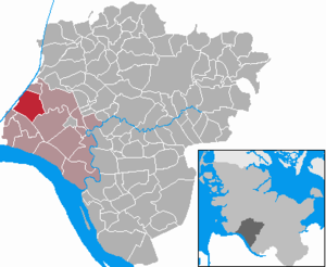
| Location of the municipality Ecklak in the Steinburg district | ||
  |
||

Ecklak ( Low German : Eeklaak ) is a municipality in the Steinburg district in Schleswig-Holstein . The districts of Ackenboe, Austrich, Ecklakerhörn, Keller, Kloster, Seedorf, Wolfsnest and Brokzeile belong to the municipality.
Geography and traffic
Ecklak is located on the periphery of the natural areas Wilstermarsch and Kudenseemoor about ten kilometers northeast of Brunsbüttel and 14 kilometers west of Itzehoe on the Kiel Canal . A few kilometers south of Ecklak run the federal highway 5 and the railway line from Itzehoe to Brunsbüttel . In addition, the Wilsterau flows through the community.
history
The place was first mentioned in a document in 1319.
politics
Community representation
Of the nine seats in the municipal council has the Wählergemeinschaft AEI since the local elections in 2013 four seats, the EEC has three and the voter community KWV two seats.
coat of arms
Blazon : "In green over a blue-silver wave shield base, three silver oak leaves crossing the stems over two golden acorns."
The coat of arms speaks about the name of the municipality, which is derived from acorns (nd. Eek) and shallow waters (mnd. Lake). The green background relates both to the importance of agriculture and to the natural spatial location on the western edge of the Wilstermarsch .
economy
The municipality is predominantly agricultural.
Web links
Individual evidence
- ↑ North Statistics Office - Population of the municipalities in Schleswig-Holstein 4th quarter 2019 (XLSX file) (update based on the 2011 census) ( help on this ).
- ↑ Schleswig-Holstein topography. Vol. 2: Boren - Ellerau . 1st edition Flying-Kiwi-Verl. Junge, Flensburg 2002, ISBN 978-3-926055-68-2 , p. 331 ( dnb.de [accessed June 11, 2020]).
- ↑ Schleswig-Holstein's municipal coat of arms
Carrion | Abbissinwish | Agethorst | Altenmoor | Auufer | Bahrenfleth | Beidenfleth | Bekdorf | Bekmünde | Besdorf | Blomean Wilderness | Bokelrehm | Bokhorst | Borsfleth | Breitenberg | Breitenburg | Brokdorf | Brokstedt | Büttel | Christinenthal | Dägeling | Dammfleth | Drage | Ecklak | Elskop | Engelbrecht Wilderness | Fitzbek | Glückstadt | Grevenkop | Gribbohm | Hadenfeld | Heiligenstedten | Heiligenstedtenerkamp | Hennstedt | Heart horn | Hingstheide | Hodorf | Hohenaspe | Hohenfelde | Hohenlockstedt | Holstenniendorf | Horst (Holstein) | Huje | Itzehoe | Kaaks | Kaisborstel | Kellinghusen | Lapwing row | Kleve | Kollmar | Kollmoor | Krempdorf | Brim | Kremperheide | Krempermoor | Kronsmoor | Krummendiek | Kudensee | Lägerdorf | Land law | Landscheide | Lockstedt | Lohbarbek | Looft | Mehlbek | Moordiek | Moorhusen | Mühlenbarbek | Münsterdorf | Neuenbrook | Neuendorf b. Elmshorn | Neuendorf-Sachsenbande | Nienbüttel | Nortorf | Nutteln | Oelixdorf | Oeschebüttel | Oldenborstel | Oldendorf | Ottenbüttel | Peissen | Pöschendorf | Poyenberg | Pulse | Quarnstedt | Wheel | Reher | Rethwisch | Rosdorf | Sankt Margarethen | Sarlhusen | Schenefeld | Schlotfeld | Silzen | Summer land | Stördorf | Störkathen | Süderau | Vaale | Vaalermoor | Wacken | Warring wood | Westermoor | Wewelsfleth | Wiedenborstel | Wills | Wilster | Winseldorf | Wittenbergen | Wrist | Wulfsmoor