
Summer land
| coat of arms | Germany map | |
|---|---|---|

|
Coordinates: 53 ° 48 ' N , 9 ° 32' E |
|
| Basic data | ||
| State : | Schleswig-Holstein | |
| Circle : | Stone castle | |
| Office : | Horst-Herzhorn | |
| Height : | 2 m above sea level NHN | |
| Area : | 18.75 km 2 | |
| Residents: | 766 (Dec. 31, 2019) | |
| Population density : | 41 inhabitants per km 2 | |
| Postcodes : | 25358, 25379 | |
| Primaries : | 04126, 04128, 04824 | |
| License plate : | IZ | |
| Community key : | 01 0 61 101 | |
| Office administration address: | Elmshorner Strasse 27 25358 Horst (Holstein) |
|
| Website : | ||
| Mayor : | Jürgen Schlueter (KWS) | |
| Location of the community of Sommerland in the Steinburg district | ||
  |
||

Sommerland is a municipality in the Steinburg district in Schleswig-Holstein . The localities of Brunsholt, Dückermühle, Greenland, Camerland and Siethwende are in the municipality.
Geography and traffic
Sommerland is located in the Elbmarsch about 9 km northwest of Elmshorn and 8 km east of Glückstadt . The federal highway 23 runs northeast from Elmshorn to Itzehoe . The march runs through the municipality , but without any passenger trains stopping.
history
The very fertile Elbmarsch was for a long time inaccessible and threatened by floods, but was managed from Horst , which is located higher up on a Geest island. Since the land could only be used in summer, the field name Sommerland was created. Some place names are also of Dutch origin, as the Dutch were involved in building the dike. A large part of the community area was for a long time the Schaumburg exclave in Holstein and was subject to Dutch law until 1470, and in some cases even until the middle of the 17th century.
The community has existed in its current form since 1888. After the Second World War, a camp for displaced people and bombed-out Hamburgers was set up in the municipality , in which up to 255 people lived.
Greenland
The street settlement of Greenland ( Gronlande ) was first mentioned in 1293 together with the parish of Schönmoor, which today belongs to Süderau . From the middle of the 17th century, Greenland together with the summer country ( Zomerlande ) first mentioned in 1312 formed an independent village. Both places were connected by the Marschmoorweg with the County of Pinneberg , to which they belonged.

Streetscape Greenland
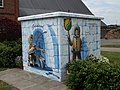
Transformer station


Cameroon
Lesigfeld (1356) and Brunsholt (1357), which are also street settlements, used to belong to the Kamerland settlement, which was first mentioned in 1350. Camerland was an independent village until it merged with Greenland and Sommerland in 1888.
Turn
Siethwende is named after a supplementary ( sitwendige ) dike that was built around 1300 by the Dutch to protect against the water of the neighboring moor. The dike used as a path formed the border between the parish of Süderau and the Königsmoor.
The march train from Hamburg-Altona to Westerland runs through the area of the municipality of Sommerland. In 1845 a train station was built in Siethwende .
After the Second World War , the district of Siethwende in particular took in many refugees. At times their number almost doubled that of the local population.
politics
Community representation
Of the eleven seats in the municipal council has the Wählergemeinschaft KWS since local elections in 2018 six seats, the CDU three and the Greens have two seats.
badges and flags

Blazon : " Slanted left by a narrow black and a silver wavy bar divided into blue and green, at the top of the division a growing golden sun with nine rays adjoining the edge of the shield and the division."
Description of the flag: "On the left diagonal divided by a narrow black and white wavy stripe in blue and green, above the figure of the municipal coat of arms offset from the center to the pole in tincture appropriate for the flag."
partnership
Since 1992 there has been a partnership with Landin in the municipality of Kotzen in the Havelland district ( Brandenburg ).
Cultural monuments
→ List of cultural monuments in Sommerland
economy
The community is strongly characterized by agriculture.
Personalities
- Hans-Jürgen Langholz (* 1935), agricultural scientist and university professor for animal breeding and product science
Web links
Individual evidence
- ↑ North Statistics Office - Population of the municipalities in Schleswig-Holstein 4th quarter 2019 (XLSX file) (update based on the 2011 census) ( help on this ).
- ↑ Schleswig-Holstein topography. Vol. 9: Schönberg - Tielenhemme . 1st edition Flying-Kiwi-Verl. Junge, Flensburg 2007, ISBN 978-3-926055-91-0 , p. 142 ( dnb.de [accessed on August 5, 2020]).
- ↑ Summerland election results
- ↑ Schleswig-Holstein's municipal coat of arms
Carrion | Abbissinwish | Agethorst | Altenmoor | Auufer | Bahrenfleth | Beidenfleth | Bekdorf | Bekmünde | Besdorf | Blomean Wilderness | Bokelrehm | Bokhorst | Borsfleth | Breitenberg | Breitenburg | Brokdorf | Brokstedt | Büttel | Christinenthal | Dägeling | Dammfleth | Drage | Ecklak | Elskop | Engelbrecht Wilderness | Fitzbek | Glückstadt | Grevenkop | Gribbohm | Hadenfeld | Heiligenstedten | Heiligenstedtenerkamp | Hennstedt | Heart horn | Hingstheide | Hodorf | Hohenaspe | Hohenfelde | Hohenlockstedt | Holstenniendorf | Horst (Holstein) | Huje | Itzehoe | Kaaks | Kaisborstel | Kellinghusen | Lapwing row | Kleve | Kollmar | Kollmoor | Krempdorf | Brim | Kremperheide | Krempermoor | Kronsmoor | Krummendiek | Kudensee | Lägerdorf | Land law | Landscheide | Lockstedt | Lohbarbek | Looft | Mehlbek | Moordiek | Moorhusen | Mühlenbarbek | Münsterdorf | Neuenbrook | Neuendorf b. Elmshorn | Neuendorf-Sachsenbande | Nienbüttel | Nortorf | Nutteln | Oelixdorf | Oeschebüttel | Oldenborstel | Oldendorf | Ottenbüttel | Peissen | Pöschendorf | Poyenberg | Pulse | Quarnstedt | Wheel | Reher | Rethwisch | Rosdorf | Sankt Margarethen | Sarlhusen | Schenefeld | Schlotfeld | Silzen | Summer land | Stördorf | Störkathen | Süderau | Vaale | Vaalermoor | Wacken | Warring wood | Westermoor | Wewelsfleth | Wiedenborstel | Wills | Wilster | Winseldorf | Wittenbergen | Wrist | Wulfsmoor