
Hodorf
| coat of arms | Germany map | |
|---|---|---|

|
Coordinates: 53 ° 54 ' N , 9 ° 26' E |
|
| Basic data | ||
| State : | Schleswig-Holstein | |
| Circle : | Stone castle | |
| Office : | Itzehoe country | |
| Height : | 7 m above sea level NHN | |
| Area : | 7.5 km 2 | |
| Residents: | 199 (Dec. 31, 2019) | |
| Population density : | 27 inhabitants per km 2 | |
| Postal code : | 25569 | |
| Area code : | 04821 | |
| License plate : | IZ | |
| Community key : | 01 0 61 039 | |
| Office administration address: | Margarete-Steiff-Weg 3 25524 Itzehoe |
|
| Website : | ||
| Mayor : | Christian Schneider | |
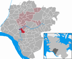
| Location of the municipality of Hodorf in the Steinburg district | ||
  |
||

Hodorf ( Low German : Hodbod ) is a municipality in the Steinburg district in Schleswig-Holstein . Herfahrt, Deicherde, Hörn, Fettenhenne and Brookzeile are in the municipality.
Geography and traffic
Hodorf is located about 6 km southwest of Itzehoe an der Stör, south of a pronounced Störschleife. The monastery weather runs through the south of the municipality .
history
The first documented mention took place in 1148 in the indication of origin de Ho , where Ho means " river loop ", "meadow in a river loop" or " lowland ". It was not until the 17th century that the place name was given the basic word mnd. dorp , nnd. Dorp , hd. Village expanded.
politics
coat of arms
Blazon : "In green under a silver cloud beam with only one large cloud, a golden hall house with gold-black stands."
In the upper half the characteristic river loop of the sturgeon near Hodorf is shown in silver. In the lower half is a golden, black-tinged hall house in post construction, as it was in Hodorf around 200. This "Hodorfer House" is referred to in the professional world as the forerunner of the Lower Saxony House . The green ground indicates that the municipality belongs to the march .
personality
Pastor Hermann Jung was born around 1608 in Brokreihe-Nord, which today belongs to the Hodorf parish.
See also
literature
- Johannes Gravert: The farms between the Elbe , Stör and Krückau with the families of their owners in the last 3 centuries , JJ Augustin , Glückstadt 1929 (unaltered reprint Krempe 1977).
- The farms between the Elbe, Stör and Krückau with the families of their owners , supplementary volume 1, JJ Augustin , Glückstadt 1953.
- The farms between the Elbe, Stör and Krückau with the families of their owners , illustrated book, compiled by Hellmut Augustin, Krempe 1979.
- The farms between the Elbe, Stör and Krückau with the families of their owners , illustrated book II, H. Dietrich Habbe, Krempe 2006.
- HA Becker: The sturgeon Der Stör , Verlag BoD, 1970/2002, pp. 38-39, Hodorf reading sample from Google Books
Web links
- Hodorf municipality at the Itzehoe-Land office
- Johann Friedrich Dörfer: Topography of Holstein in alphabetical order: A repertory on the map of the Duchy of Holstein, the areas of the imperial cities of Hamburg and Lübek, and the Diocese of Lübek , Verlag Röffs, 1807, Hodorf page (154) at digital collections ( MDZ )
- Texts and historical postcards about Holler's ferry between Stördorf and Hodorf in 1908 at mein-wilster-de
Individual evidence
- ↑ North Statistics Office - Population of the municipalities in Schleswig-Holstein 4th quarter 2019 (XLSX file) (update based on the 2011 census) ( help on this ).
- ↑ Schleswig-Holstein topography. Vol. 4: Groß Sarau - Holstenniendorf . 1st edition Flying-Kiwi-Verl. Junge, Flensburg 2004, ISBN 978-3-926055-75-0 , p. 289 ( dnb.de [accessed on May 3, 2020]).
- ↑ Wolfgang Laur : Historisches Ortname Lexikon von Schleswig-Holstein , 2nd edition, p. 333.
- ↑ Schleswig-Holstein's municipal coat of arms
Carrion | Abbissinwish | Agethorst | Altenmoor | Auufer | Bahrenfleth | Beidenfleth | Bekdorf | Bekmünde | Besdorf | Blomean Wilderness | Bokelrehm | Bokhorst | Borsfleth | Breitenberg | Breitenburg | Brokdorf | Brokstedt | Büttel | Christinenthal | Dägeling | Dammfleth | Drage | Ecklak | Elskop | Engelbrecht Wilderness | Fitzbek | Glückstadt | Grevenkop | Gribbohm | Hadenfeld | Heiligenstedten | Heiligenstedtenerkamp | Hennstedt | Heart horn | Hingstheide | Hodorf | Hohenaspe | Hohenfelde | Hohenlockstedt | Holstenniendorf | Horst (Holstein) | Huje | Itzehoe | Kaaks | Kaisborstel | Kellinghusen | Lapwing row | Kleve | Kollmar | Kollmoor | Krempdorf | Brim | Kremperheide | Krempermoor | Kronsmoor | Krummendiek | Kudensee | Lägerdorf | Land law | Landscheide | Lockstedt | Lohbarbek | Looft | Mehlbek | Moordiek | Moorhusen | Mühlenbarbek | Münsterdorf | Neuenbrook | Neuendorf b. Elmshorn | Neuendorf-Sachsenbande | Nienbüttel | Nortorf | Nutteln | Oelixdorf | Oeschebüttel | Oldenborstel | Oldendorf | Ottenbüttel | Peissen | Pöschendorf | Poyenberg | Pulse | Quarnstedt | Wheel | Reher | Rethwisch | Rosdorf | Sankt Margarethen | Sarlhusen | Schenefeld | Schlotfeld | Silzen | Summer land | Stördorf | Störkathen | Süderau | Vaale | Vaalermoor | Wacken | Warring wood | Westermoor | Wewelsfleth | Wiedenborstel | Wills | Wilster | Winseldorf | Wittenbergen | Wrist | Wulfsmoor