
Quarnstedt
| coat of arms | Germany map | |
|---|---|---|

|
Coordinates: 53 ° 57 ' N , 9 ° 47' E |
|
| Basic data | ||
| State : | Schleswig-Holstein | |
| Circle : | Stone castle | |
| Office : | Kellinghusen | |
| Height : | 4 m above sea level NHN | |
| Area : | 10.59 km 2 | |
| Residents: | 458 (Dec. 31, 2019) | |
| Population density : | 43 inhabitants per km 2 | |
| Postal code : | 25563 | |
| Area code : | 04822 | |
| License plate : | IZ | |
| Community key : | 01 0 61 088 | |
| Office administration address: | Am Markt 9 25548 Kellinghusen |
|
| Website : | ||
| Mayor : | Herbert Bad | |
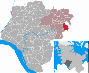
| Location of the community of Quarnstedt in the Steinburg district | ||
  |
||

Quarnstedt ( Low German : Quarnsteed ) is a municipality in the Steinburg district in Schleswig-Holstein .
Geography and traffic
Quarnstedt is about 5 km east of Kellinghusen . The Mühlenbek flows through the community. To the south, the federal highway 206 runs from Itzehoe to Bad Bramstedt , to the west the Hamburg-Altona – Kiel railway line .
history
The community was first mentioned in a document in 1248. The name Quarnstedt is derived from the Low German term “ quern ” or “quarn”, which describes the hand mill. So the place name probably means Mühlenplatz .
politics
Community representation
After the local elections in 2008, the WGQ community of voters had eight and one individual candidate had a seat on the local council. In May 2011, the municipal council resigned after disputes over a planned gas compressor station. Since the new election in October 2011, the WGQ electoral community has all nine seats.
coat of arms
Blazon : "Over a red shield foot, inside a silver prehistoric hand mill (Quern), in silver a green oak branch with two leaves and two fruits."
The oak branch refers to the village oak . This is a natural monument in the Steinburg district and is held in special honor by the population as a landmark of the place. The shield colors red and silver are the colors of the Holstein region .
photos

Village oak
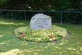
Memorial stone "beautiful village"

Memorial in Quarnstedt

View of the main street


Web links
Individual evidence
- ↑ North Statistics Office - Population of the municipalities in Schleswig-Holstein 4th quarter 2019 (XLSX file) (update based on the 2011 census) ( help on this ).
- ↑ Schleswig-Holstein's municipal coat of arms
Carrion | Abbissinwish | Agethorst | Altenmoor | Auufer | Bahrenfleth | Beidenfleth | Bekdorf | Bekmünde | Besdorf | Blomean Wilderness | Bokelrehm | Bokhorst | Borsfleth | Breitenberg | Breitenburg | Brokdorf | Brokstedt | Büttel | Christinenthal | Dägeling | Dammfleth | Drage | Ecklak | Elskop | Engelbrecht Wilderness | Fitzbek | Glückstadt | Grevenkop | Gribbohm | Hadenfeld | Heiligenstedten | Heiligenstedtenerkamp | Hennstedt | Heart horn | Hingstheide | Hodorf | Hohenaspe | Hohenfelde | Hohenlockstedt | Holstenniendorf | Horst (Holstein) | Huje | Itzehoe | Kaaks | Kaisborstel | Kellinghusen | Lapwing row | Kleve | Kollmar | Kollmoor | Krempdorf | Brim | Kremperheide | Krempermoor | Kronsmoor | Krummendiek | Kudensee | Lägerdorf | Land law | Landscheide | Lockstedt | Lohbarbek | Looft | Mehlbek | Moordiek | Moorhusen | Mühlenbarbek | Münsterdorf | Neuenbrook | Neuendorf b. Elmshorn | Neuendorf-Sachsenbande | Nienbüttel | Nortorf | Nutteln | Oelixdorf | Oeschebüttel | Oldenborstel | Oldendorf | Ottenbüttel | Peissen | Pöschendorf | Poyenberg | Pulse | Quarnstedt | Wheel | Reher | Rethwisch | Rosdorf | Sankt Margarethen | Sarlhusen | Schenefeld | Schlotfeld | Silzen | Summer land | Stördorf | Störkathen | Süderau | Vaale | Vaalermoor | Wacken | Warring wood | Westermoor | Wewelsfleth | Wiedenborstel | Wills | Wilster | Winseldorf | Wittenbergen | Wrist | Wulfsmoor