
Gribbohm
| coat of arms | Germany map | |
|---|---|---|

|
Coordinates: 54 ° 2 ′ N , 9 ° 21 ′ E |
|
| Basic data | ||
| State : | Schleswig-Holstein | |
| Circle : | Stone castle | |
| Office : | Schenefeld | |
| Height : | 10 m above sea level NHN | |
| Area : | 13.23 km 2 | |
| Residents: | 440 (December 31, 2019) | |
| Population density : | 33 inhabitants per km 2 | |
| Postal code : | 25596 | |
| Area code : | 04827 | |
| License plate : | IZ | |
| Community key : | 01 0 61 031 | |
| Office administration address: | Mühlenstrasse 2 25560 Schenefeld |
|
| Website : | ||
| Mayor : | Gerd Saß (FWG) | |
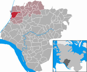
| Location of the municipality of Gribbohm in the Steinburg district | ||
  |
||

Gribbohm ( Low German : Gribboom ) is a municipality in the Steinburg district in Schleswig-Holstein . The outskirts of Bebek and Langenklint belong to the municipality.
Geography and traffic
Gribbohm is located directly west of Wacken . The Kiel Canal , the federal highway 431 and the Marschbahn run through the area of the municipality; the next train stations are in Wilster and Burg (Dithmarschen) . The Forstbach , Nuttelner Bach and the Holstenau flow through the community.
history
The name of the place was mentioned in the files for the first time in 1538 and probably goes back to the "Grießbaum", the pole of a referee with which the fighters in a duel could be separated in a tournament.
politics
Community representation
Of the nine seats in the municipal council, the FWG community of voters has six and the AWG three seats since the local elections in 2018.
coat of arms
Blazon : "In green in front of a bar made of silver and red ten times a left-turned, silver-clad farmer, who is holding a rearing silver horse facing him by the short rein."
The coat of arms is based on a legend about the naming of the community. In the 17th century there is said to have been a border or customs tree in the place where smugglers were supposed to be caught (Low German: griepen). This is how the customs tree was called "Griepbohm". It is now said that once a horse ran away in Nienbüttel that could not be caught in Wacken either. When it ran in the direction of Gribbohm, people are said to have said: "Let the animal lop, he'll take care of the boom!" (Let the animal run, it comes to the (border) tree.) And at the customs tree in Gribbohm could actually grab the animal (“can you griep the animal”). The "Griepboom" was the origin of the place name.
Personalities
- Thomas Carstens (1881–1926), politician, officer, lodge master of the Hamburg Masonic Lodge and large landowner, was born in Gribbohm.
- The Berlin-based action artist John Bock was born in Gribbohm in 1965.
Web links
Individual evidence
- ↑ North Statistics Office - Population of the municipalities in Schleswig-Holstein 4th quarter 2019 (XLSX file) (update based on the 2011 census) ( help on this ).
- ↑ Schleswig-Holstein topography. Vol. 3: Ellerbek - Groß Rönnau . 1st edition Flying-Kiwi-Verl. Junge, Flensburg 2003, ISBN 978-3-926055-73-6 , p. 304 ( dnb.de [accessed April 26, 2020]).
- ↑ Schleswig-Holstein's municipal coat of arms
Carrion | Abbissinwish | Agethorst | Altenmoor | Auufer | Bahrenfleth | Beidenfleth | Bekdorf | Bekmünde | Besdorf | Blomean Wilderness | Bokelrehm | Bokhorst | Borsfleth | Breitenberg | Breitenburg | Brokdorf | Brokstedt | Büttel | Christinenthal | Dägeling | Dammfleth | Drage | Ecklak | Elskop | Engelbrecht Wilderness | Fitzbek | Glückstadt | Grevenkop | Gribbohm | Hadenfeld | Heiligenstedten | Heiligenstedtenerkamp | Hennstedt | Heart horn | Hingstheide | Hodorf | Hohenaspe | Hohenfelde | Hohenlockstedt | Holstenniendorf | Horst (Holstein) | Huje | Itzehoe | Kaaks | Kaisborstel | Kellinghusen | Lapwing row | Kleve | Kollmar | Kollmoor | Krempdorf | Brim | Kremperheide | Krempermoor | Kronsmoor | Krummendiek | Kudensee | Lägerdorf | Land law | Landscheide | Lockstedt | Lohbarbek | Looft | Mehlbek | Moordiek | Moorhusen | Mühlenbarbek | Münsterdorf | Neuenbrook | Neuendorf b. Elmshorn | Neuendorf-Sachsenbande | Nienbüttel | Nortorf | Nutteln | Oelixdorf | Oeschebüttel | Oldenborstel | Oldendorf | Ottenbüttel | Peissen | Pöschendorf | Poyenberg | Pulse | Quarnstedt | Wheel | Reher | Rethwisch | Rosdorf | Sankt Margarethen | Sarlhusen | Schenefeld | Schlotfeld | Silzen | Summer land | Stördorf | Störkathen | Süderau | Vaale | Vaalermoor | Wacken | Warring wood | Westermoor | Wewelsfleth | Wiedenborstel | Wills | Wilster | Winseldorf | Wittenbergen | Wrist | Wulfsmoor