
Silzen
| coat of arms | Germany map | |
|---|---|---|

|
Coordinates: 54 ° 2 ' N , 9 ° 38' E |
|
| Basic data | ||
| State : | Schleswig-Holstein | |
| Circle : | Stone castle | |
| Office : | Itzehoe country | |
| Height : | 22 m above sea level NHN | |
| Area : | 6.69 km 2 | |
| Residents: | 157 (Dec. 31, 2019) | |
| Population density : | 23 inhabitants per km 2 | |
| Postal code : | 25551 | |
| Area code : | 04871 | |
| License plate : | IZ | |
| Community key : | 01 0 61 100 | |
| LOCODE : | DE ILZ | |
| Office administration address: | Margarete-Steiff-Weg 3 25524 Itzehoe |
|
| Website : | ||
| Mayor : | Dirk Mollenhauer (KWV) | |
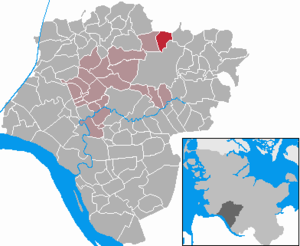
| Location of the community of Silzen in the Steinburg district | ||
  |
||

Silzen is a municipality in the Steinburg district in Schleswig-Holstein .
Geography and traffic
The community is located in the Aukrug Nature Park on the edge of the Schieren Forest between Hohenlockstedt and Hohenwestedt . The federal highway 77 from Schleswig to Itzehoe runs nearby .
history
The community was first mentioned in a document in 1339. The name of the place is probably derived from the noble von Seltzingen family, because it was originally Seltzinghe . The Seltzingen family sold the village in 1441 to Breide zu Rantzau zu Krummendiek , who in turn gave the village to the Itzehoe monastery in 1490 .
politics
Community representation
Since the local elections in 2008, the KWV voter community has had all seven municipal council seats.
coat of arms
Blazon : “Divided by gold and green in a more curved serpentine line. At the top left a red pyramid, at the bottom right a golden outward-pointing linden leaf with a downward-pointing fruit cluster . "
Individual evidence
- ↑ North Statistics Office - Population of the municipalities in Schleswig-Holstein 4th quarter 2019 (XLSX file) (update based on the 2011 census) ( help on this ).
- ↑ Schleswig-Holstein's municipal coat of arms
Web links
Carrion | Abbissinwish | Agethorst | Altenmoor | Auufer | Bahrenfleth | Beidenfleth | Bekdorf | Bekmünde | Besdorf | Blomean Wilderness | Bokelrehm | Bokhorst | Borsfleth | Breitenberg | Breitenburg | Brokdorf | Brokstedt | Büttel | Christinenthal | Dägeling | Dammfleth | Drage | Ecklak | Elskop | Engelbrecht Wilderness | Fitzbek | Glückstadt | Grevenkop | Gribbohm | Hadenfeld | Heiligenstedten | Heiligenstedtenerkamp | Hennstedt | Heart horn | Hingstheide | Hodorf | Hohenaspe | Hohenfelde | Hohenlockstedt | Holstenniendorf | Horst (Holstein) | Huje | Itzehoe | Kaaks | Kaisborstel | Kellinghusen | Lapwing row | Kleve | Kollmar | Kollmoor | Krempdorf | Brim | Kremperheide | Krempermoor | Kronsmoor | Krummendiek | Kudensee | Lägerdorf | Land law | Landscheide | Lockstedt | Lohbarbek | Looft | Mehlbek | Moordiek | Moorhusen | Mühlenbarbek | Münsterdorf | Neuenbrook | Neuendorf b. Elmshorn | Neuendorf-Sachsenbande | Nienbüttel | Nortorf | Nutteln | Oelixdorf | Oeschebüttel | Oldenborstel | Oldendorf | Ottenbüttel | Peissen | Pöschendorf | Poyenberg | Pulse | Quarnstedt | Wheel | Reher | Rethwisch | Rosdorf | Sankt Margarethen | Sarlhusen | Schenefeld | Schlotfeld | Silzen | Summer land | Stördorf | Störkathen | Süderau | Vaale | Vaalermoor | Wacken | Warring wood | Westermoor | Wewelsfleth | Wiedenborstel | Wills | Wilster | Winseldorf | Wittenbergen | Wrist | Wulfsmoor