
Hohenaspe
| coat of arms | Germany map | |
|---|---|---|

|
Coordinates: 53 ° 59 ' N , 9 ° 32' E |
|
| Basic data | ||
| State : | Schleswig-Holstein | |
| Circle : | Stone castle | |
| Office : | Itzehoe country | |
| Height : | 14 m above sea level NHN | |
| Area : | 14.07 km 2 | |
| Residents: | 1946 (Dec. 31, 2019) | |
| Population density : | 138 inhabitants per km 2 | |
| Postal code : | 25582 | |
| Area code : | 04893 | |
| License plate : | IZ | |
| Community key : | 01 0 61 040 | |
| LOCODE : | DE 67R | |
| Office administration address: | Margarete-Steiff-Weg 3 25524 Itzehoe |
|
| Website : | ||
| Mayor : | Hans-Georg Wendrich ( CDU ) | |
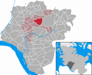
| Location of the community of Hohenaspe in the Steinburg district | ||
  |
||

Hohenaspe ( Low German : Hogenas ) is a municipality in the Steinburg district in Schleswig-Holstein .
The districts of An der Bekau and Burndahl as well as Hohenasperfeld belong to the community.
Geography and traffic
Hohenaspe is 7.5 km north of Itzehoe . Bekau , Rolloher Bek and Mühlenbach flow through the community. The federal highway 23 runs on the western edge.

history
Together with the church, the village of Aspe is first mentioned in 1281. With the free-standing wooden bell tower, the St. Michaelis Church, built on a hill, was and is visible from far away. Because of this prominent location of the church, the place name was probably changed in the course of time in Hohenaspe. Margrave Friedrich Ernst von Brandenburg-Kulmbach is buried in the church itself .
In 1991 Hohenaspe was the district winner in the competition Our village should become more beautiful .
politics
Community representation
Of the thirteen seats, the CDU has had seven since the 2013 local elections and the BWH six.
coat of arms
Blazon : "In gold on a green hill, the red Hohenasper Church, seen from the wooden bell tower, in the left upper corner a green aspen leaf."
The Espenblatt refers to the place name, as "Aspe" is the Low German form of " Espe ". The colors green and gold indicate both the geographic location of the municipality between Marsch and Geest and its agricultural character.
Web links
Individual evidence
- ↑ North Statistics Office - Population of the municipalities in Schleswig-Holstein 4th quarter 2019 (XLSX file) (update based on the 2011 census) ( help on this ).
- ↑ Schleswig-Holstein topography. Vol. 4: Groß Sarau - Holstenniendorf . 1st edition Flying-Kiwi-Verl. Junge, Flensburg 2004, ISBN 978-3-926055-75-0 , p. 304 ( dnb.de [accessed on May 3, 2020]).
- ↑ Schleswig-Holstein's municipal coat of arms
Carrion | Abbissinwish | Agethorst | Altenmoor | Auufer | Bahrenfleth | Beidenfleth | Bekdorf | Bekmünde | Besdorf | Blomean Wilderness | Bokelrehm | Bokhorst | Borsfleth | Breitenberg | Breitenburg | Brokdorf | Brokstedt | Büttel | Christinenthal | Dägeling | Dammfleth | Drage | Ecklak | Elskop | Engelbrecht Wilderness | Fitzbek | Glückstadt | Grevenkop | Gribbohm | Hadenfeld | Heiligenstedten | Heiligenstedtenerkamp | Hennstedt | Heart horn | Hingstheide | Hodorf | Hohenaspe | Hohenfelde | Hohenlockstedt | Holstenniendorf | Horst (Holstein) | Huje | Itzehoe | Kaaks | Kaisborstel | Kellinghusen | Lapwing row | Kleve | Kollmar | Kollmoor | Krempdorf | Brim | Kremperheide | Krempermoor | Kronsmoor | Krummendiek | Kudensee | Lägerdorf | Land law | Landscheide | Lockstedt | Lohbarbek | Looft | Mehlbek | Moordiek | Moorhusen | Mühlenbarbek | Münsterdorf | Neuenbrook | Neuendorf b. Elmshorn | Neuendorf-Sachsenbande | Nienbüttel | Nortorf | Nutteln | Oelixdorf | Oeschebüttel | Oldenborstel | Oldendorf | Ottenbüttel | Peissen | Pöschendorf | Poyenberg | Pulse | Quarnstedt | Wheel | Reher | Rethwisch | Rosdorf | Sankt Margarethen | Sarlhusen | Schenefeld | Schlotfeld | Silzen | Summer land | Stördorf | Störkathen | Süderau | Vaale | Vaalermoor | Wacken | Warring wood | Westermoor | Wewelsfleth | Wiedenborstel | Wills | Wilster | Winseldorf | Wittenbergen | Wrist | Wulfsmoor