
Kronsmoor
| coat of arms | Germany map | |
|---|---|---|

|
Coordinates: 53 ° 54 ' N , 9 ° 36' E |
|
| Basic data | ||
| State : | Schleswig-Holstein | |
| Circle : | Stone castle | |
| Office : | Breitenburg | |
| Height : | 5 m above sea level NHN | |
| Area : | 6.05 km 2 | |
| Residents: | 175 (Dec. 31, 2019) | |
| Population density : | 29 inhabitants per km 2 | |
| Postal code : | 25597 | |
| Area code : | 04828 | |
| License plate : | IZ | |
| Community key : | 01 0 61 058 | |
| Office administration address: | Osterholz 5 25524 Breitenburg |
|
| Website : | ||
| Mayor : | Axel Maas (KWV) | |
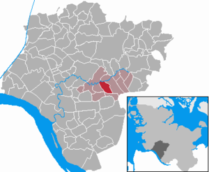
| Location of the municipality of Kronsmoor in the Steinburg district | ||
  |
||

Kronsmoor ( Low German : Kroonsmoor ) is a municipality in the Steinburg district in Schleswig-Holstein (Germany).
Geography and traffic
Kronsmoor is about five kilometers east of Itzehoe an der Stör . Bundesautobahn 23 runs from Hamburg to Itzehoe southwest of Kronsmoor .
politics
Community representation
Of the nine seats in the municipal council has the Wählergemeinschaft KWV since the local elections in 2008 eight seats, one seat from a single applicant maintained.
coat of arms
Blazon : "Above a silver shield base in green with a turned tip without a gable, a naturally tinged black-and-silver crane striding between a golden, leafy birch twig pointing to the edge of the shield under a silver wave head covered with a blue wavy thread."
economy
In addition to a few handicraft businesses and a chalk pit, the municipality is predominantly characterized by agricultural operations.
The Saturn chalk pit , which is no longer being mined but is being discussed for the construction of a pumped storage power plant , is partly located in the municipality.
Web links
Individual evidence
- ↑ North Statistics Office - Population of the municipalities in Schleswig-Holstein 4th quarter 2019 (XLSX file) (update based on the 2011 census) ( help on this ).
- ↑ Schleswig-Holstein's municipal coat of arms
Carrion | Abbissinwish | Agethorst | Altenmoor | Auufer | Bahrenfleth | Beidenfleth | Bekdorf | Bekmünde | Besdorf | Blomean Wilderness | Bokelrehm | Bokhorst | Borsfleth | Breitenberg | Breitenburg | Brokdorf | Brokstedt | Büttel | Christinenthal | Dägeling | Dammfleth | Drage | Ecklak | Elskop | Engelbrecht Wilderness | Fitzbek | Glückstadt | Grevenkop | Gribbohm | Hadenfeld | Heiligenstedten | Heiligenstedtenerkamp | Hennstedt | Heart horn | Hingstheide | Hodorf | Hohenaspe | Hohenfelde | Hohenlockstedt | Holstenniendorf | Horst (Holstein) | Huje | Itzehoe | Kaaks | Kaisborstel | Kellinghusen | Lapwing row | Kleve | Kollmar | Kollmoor | Krempdorf | Brim | Kremperheide | Krempermoor | Kronsmoor | Krummendiek | Kudensee | Lägerdorf | Land law | Landscheide | Lockstedt | Lohbarbek | Looft | Mehlbek | Moordiek | Moorhusen | Mühlenbarbek | Münsterdorf | Neuenbrook | Neuendorf b. Elmshorn | Neuendorf-Sachsenbande | Nienbüttel | Nortorf | Nutteln | Oelixdorf | Oeschebüttel | Oldenborstel | Oldendorf | Ottenbüttel | Peissen | Pöschendorf | Poyenberg | Pulse | Quarnstedt | Wheel | Reher | Rethwisch | Rosdorf | Sankt Margarethen | Sarlhusen | Schenefeld | Schlotfeld | Silzen | Summer land | Stördorf | Störkathen | Süderau | Vaale | Vaalermoor | Wacken | Warring wood | Westermoor | Wewelsfleth | Wiedenborstel | Wills | Wilster | Winseldorf | Wittenbergen | Wrist | Wulfsmoor