
Oeschebüttel
| coat of arms | Germany map | |
|---|---|---|

|
Coordinates: 53 ° 59 ' N , 9 ° 43' E |
|
| Basic data | ||
| State : | Schleswig-Holstein | |
| Circle : | Stone castle | |
| Office : | Kellinghusen | |
| Height : | 38 m above sea level NHN | |
| Area : | 5.48 km 2 | |
| Residents: | 174 (Dec. 31, 2019) | |
| Population density : | 32 inhabitants per km 2 | |
| Postal code : | 25548 | |
| Primaries : | 04822, 04826, 04877 | |
| License plate : | IZ | |
| Community key : | 01 0 61 080 | |
| Office administration address: | Am Markt 9 25548 Kellinghusen |
|
| Website : | ||
| Mayor : | Heiner Rickers (KWV) | |
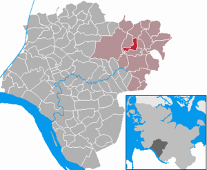
| Location of the community of Oeschebüttel in the Steinburg district | ||
  |
||

Oeschebüttel ( Low German : Oeschebüddel ) is a municipality in the Steinburg district in Schleswig-Holstein . The districts Springhoe, Wrack and Hollenbek belong to the community.
Geography and traffic
Oeschebüttel is located in the Aukrug Nature Park, 5 km northeast of Hohenlockstedt and 5 km north of Kellinghusen in a rural setting. The Mühlenbarbeker Au flows through the municipality. Part of the mill pond belongs to the area of the municipality.
Oeschebüttel is about six kilometers north of the federal highway 206 . The next train stations are in Brokstedt and Wrist on the Altona-Kieler Eisenbahn , each about eight to ten kilometers away.
history
In terms of settlement history, Oeschebüttel is one of the Büttel localities. Oesche- does not mean a personal name, but comes from Esche, so it means Eschenbüttel.
politics
Community representation
Of the seven seats in the municipal council has Wählergemeinschaft KWV since the municipal election in 2008 seven seats.
coat of arms
Blazon : "On a green hill, this is covered with a silver burial chamber formed from a cover plate and three supporting stones, three green oak trees with golden fruits."
Around the village of Oeschebüttel with its three districts Springhoe, Wrack and Hollenbek, a total of 35 barrows and two urn cemeteries were found, which are assigned to the Younger Stone Age and the Bronze Age . The hill grave in the coat of arms stands for this prehistoric settlement of the municipality, the four stones of which are supposed to symbolize the village of Oeschebüttel with its three districts. The oaks indicate the wooded area in which Oeschebüttel is embedded.
photos

A memorial for a murder from 1840.

Web links
Individual evidence
- ↑ North Statistics Office - Population of the municipalities in Schleswig-Holstein 4th quarter 2019 (XLSX file) (update based on the 2011 census) ( help on this ).
- ↑ Schleswig-Holstein topography. Vol. 7: Munkbrarup - Pohnsdorf . 1st edition Flying-Kiwi-Verl. Junge, Flensburg 2006, ISBN 978-3-926055-88-0 , p. 222 ( dnb.de [accessed on July 22, 2020]).
- ↑ Schleswig-Holstein's municipal coat of arms
Carrion | Abbissinwish | Agethorst | Altenmoor | Auufer | Bahrenfleth | Beidenfleth | Bekdorf | Bekmünde | Besdorf | Blomean Wilderness | Bokelrehm | Bokhorst | Borsfleth | Breitenberg | Breitenburg | Brokdorf | Brokstedt | Büttel | Christinenthal | Dägeling | Dammfleth | Drage | Ecklak | Elskop | Engelbrecht Wilderness | Fitzbek | Glückstadt | Grevenkop | Gribbohm | Hadenfeld | Heiligenstedten | Heiligenstedtenerkamp | Hennstedt | Heart horn | Hingstheide | Hodorf | Hohenaspe | Hohenfelde | Hohenlockstedt | Holstenniendorf | Horst (Holstein) | Huje | Itzehoe | Kaaks | Kaisborstel | Kellinghusen | Lapwing row | Kleve | Kollmar | Kollmoor | Krempdorf | Brim | Kremperheide | Krempermoor | Kronsmoor | Krummendiek | Kudensee | Lägerdorf | Land law | Landscheide | Lockstedt | Lohbarbek | Looft | Mehlbek | Moordiek | Moorhusen | Mühlenbarbek | Münsterdorf | Neuenbrook | Neuendorf b. Elmshorn | Neuendorf-Sachsenbande | Nienbüttel | Nortorf | Nutteln | Oelixdorf | Oeschebüttel | Oldenborstel | Oldendorf | Ottenbüttel | Peissen | Pöschendorf | Poyenberg | Pulse | Quarnstedt | Wheel | Reher | Rethwisch | Rosdorf | Sankt Margarethen | Sarlhusen | Schenefeld | Schlotfeld | Silzen | Summer land | Stördorf | Störkathen | Süderau | Vaale | Vaalermoor | Wacken | Warring wood | Westermoor | Wewelsfleth | Wiedenborstel | Wills | Wilster | Winseldorf | Wittenbergen | Wrist | Wulfsmoor