
Moordiek
| coat of arms | Germany map | |
|---|---|---|

|
Coordinates: 53 ° 55 ' N , 9 ° 39' E |
|
| Basic data | ||
| State : | Schleswig-Holstein | |
| Circle : | Stone castle | |
| Office : | Breitenburg | |
| Height : | 2 m above sea level NHN | |
| Area : | 6.3 km 2 | |
| Residents: | 106 (Dec. 31, 2019) | |
| Population density : | 17 inhabitants per km 2 | |
| Postal code : | 25597 | |
| Area code : | 04822 | |
| License plate : | IZ | |
| Community key : | 01 0 61 068 | |
| Office administration address: | Osterholz 5 25524 Breitenburg |
|
| Website : | ||
| Mayor : | Rudolf Wittke (KWV) | |
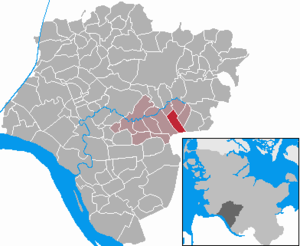
| Location of the municipality of Moordiek in the Steinburg district | ||
  |
||

Moordiek is a municipality in the Steinburg district in Schleswig-Holstein . The federal highway 206 runs from Itzehoe to Bad Bramstedt north of the municipality . Tütigmoor and Breitenberg are in the municipality.
Geography and traffic
Moordiek is about ten kilometers east of Itzehoe on the edge of the Breitenburger Moors . The Hörner Au runs on the border of the municipality.
politics
Community representation
Since the local elections in 2008, the KWV voter community has all seven seats in the local council.
coat of arms
Blazon : "Above a silver corrugated shield base covered with a blue wavy thread, a raised silver hill, inside a red curlew over a green stripe with a point without a gable, on each side a green cattail with black seed stand."
economy
The municipal area is mainly used for agriculture, but also contains large compensation areas due to the state and federal nature conservation law .
Web links
Individual evidence
- ↑ North Statistics Office - Population of the municipalities in Schleswig-Holstein 4th quarter 2019 (XLSX file) (update based on the 2011 census) ( help on this ).
- ↑ Schleswig-Holstein topography. Vol. 6: Kronprinzenkoog - Mühlenrade . 1st edition Flying-Kiwi-Verl. Junge, Flensburg 2006, ISBN 978-3-926055-85-9 , pp. 332 ( dnb.de [accessed July 29, 2020]).
- ↑ Schleswig-Holstein's municipal coat of arms
Carrion | Abbissinwish | Agethorst | Altenmoor | Auufer | Bahrenfleth | Beidenfleth | Bekdorf | Bekmünde | Besdorf | Blomean Wilderness | Bokelrehm | Bokhorst | Borsfleth | Breitenberg | Breitenburg | Brokdorf | Brokstedt | Büttel | Christinenthal | Dägeling | Dammfleth | Drage | Ecklak | Elskop | Engelbrecht Wilderness | Fitzbek | Glückstadt | Grevenkop | Gribbohm | Hadenfeld | Heiligenstedten | Heiligenstedtenerkamp | Hennstedt | Heart horn | Hingstheide | Hodorf | Hohenaspe | Hohenfelde | Hohenlockstedt | Holstenniendorf | Horst (Holstein) | Huje | Itzehoe | Kaaks | Kaisborstel | Kellinghusen | Lapwing row | Kleve | Kollmar | Kollmoor | Krempdorf | Brim | Kremperheide | Krempermoor | Kronsmoor | Krummendiek | Kudensee | Lägerdorf | Land law | Landscheide | Lockstedt | Lohbarbek | Looft | Mehlbek | Moordiek | Moorhusen | Mühlenbarbek | Münsterdorf | Neuenbrook | Neuendorf b. Elmshorn | Neuendorf-Sachsenbande | Nienbüttel | Nortorf | Nutteln | Oelixdorf | Oeschebüttel | Oldenborstel | Oldendorf | Ottenbüttel | Peissen | Pöschendorf | Poyenberg | Pulse | Quarnstedt | Wheel | Reher | Rethwisch | Rosdorf | Sankt Margarethen | Sarlhusen | Schenefeld | Schlotfeld | Silzen | Summer land | Stördorf | Störkathen | Süderau | Vaale | Vaalermoor | Wacken | Warring wood | Westermoor | Wewelsfleth | Wiedenborstel | Wills | Wilster | Winseldorf | Wittenbergen | Wrist | Wulfsmoor