List of natural monuments in the city of Lübeck
The list of natural monuments in the city of Lübeck contains the natural monuments of the independent city of Lübeck in Schleswig-Holstein .
List from 1980
| image | number | number | designation | district | Coordinates | date |
|---|---|---|---|---|---|---|
| 1 | 1 | Silberlinde , Am Koberg in front of the church | Inner city | 53 ° 52 ′ 17 "N, 10 ° 41 ′ 22" E | December 18, 1980 | |
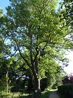
| 2 | 1 | Oak , Hof St.-Annen-Straße 4 (note St.-Annen-Straße 4 , Jenisch'sche Free School - today Carl-Friedrich-von-Rumohr Hotel Management School) | Inner city | 53 ° 51 ′ 48 ″ N, 10 ° 41 ′ 19 ″ E | December 18, 1980 | |
| 3 | 1 | Black walnut , inner courtyard St. Anne's Museum | Inner city | 53 ° 51 ′ 46 "N, 10 ° 41 ′ 22" E | December 18, 1980 | |
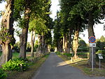
| 4th | 3 | Bald cypresses , ramparts Mühlenteich , north across from the Kaisertor | Inner city | 53 ° 51 ′ 31 ″ N, 10 ° 41 ′ 17 ″ E | December 18, 1980 | |
| 5 | 1 | Schwarzerle , Am Mühlenteich in the garden of the garden and cemetery office (note privatized; today dental practice) | Inner city | 53 ° 51 ′ 36 ″ N, 10 ° 41 ′ 22 ″ E (according to the city, this tree was felled) | December 18, 1980 | |
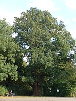
| 6th | 1 | Pedunculate oak , ramparts at the seafaring school , also known as imperial oak | Inner city | 53 ° 51 ′ 29 ″ N, 10 ° 41 ′ 11 ″ E | December 18, 1980 | |
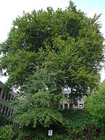
| 7th | 1 | Fan leaf tree , ramparts north of the Kaisertor | Inner city | 53 ° 51 ′ 30 "N, 10 ° 41 ′ 16" E | December 18, 1980 | |
| 8th | 1 | Oak , on the mini golf course, seen from Wallstrasse on the right | Inner city | (According to the city, this tree was felled) | December 18, 1980 | |
| 9 | 1 | Marone , property at the corner of the horse market and Kapitelstraße (formerly Ofenhaus Nutrig) | Inner city | 53 ° 51 ′ 48 ″ N, 10 ° 41 ′ 7 ″ E | December 18, 1980 | |
| 10 | 3 | European beeches , Eschenburgstrasse 39 / 39a | St. Gertrude | 53 ° 53 ′ 10 "N, 10 ° 42 ′ 17" E | December 18, 1980 | |
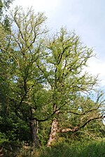
| 11 | 17th | Oak trees , trees on the Jerusalem Mountain, Jerusalemsberg / corner of Konstinstrasse | St. Gertrude | 53 ° 52 ′ 51 ″ N, 10 ° 41 ′ 46 ″ E | December 18, 1980 | |
| 2 | Linden trees , trees on the Jerusalemsberg, Jerusalemsberg / corner of Konstinstrasse | 53 ° 52 ′ 49 "N, 10 ° 41 ′ 44" E | ||||
| 12 | 1 | Red beech , Jerusalemsberg 9, on the rear part behind the main building on the upper edge of the slope | St. Gertrude | 53 ° 52 ′ 54 "N, 10 ° 41 ′ 49" E | December 18, 1980 | |
| 13 | 2 | Plane trees , Jerusalemsberg 7/8 in the front garden to the left of the house | St. Gertrude | 53 ° 52 ′ 52 "N, 10 ° 41 ′ 49" E | December 18, 1980 | |
| 14th | 1 | Silberlinde , Eschenburgpark (near the building) | St. Gertrude | 53 ° 52 ′ 49 "N, 10 ° 41 ′ 41" E | December 18, 1980 | |
| 15th | 1 | Fan leaf tree , Eschenburgpark | St. Gertrude | 53 ° 52 ′ 51 ″ N, 10 ° 41 ′ 41 ″ E | December 18, 1980 | |
| 16 | 1 | real tulip tree , Eschenburgpark | St. Gertrude |
53 ° 52 ′ 47 ″ N, 10 ° 41 ′ 43 ″ E (location coordinates) |
December 18, 1980 | |
| 17th | 1 | Plane tree , at the castle gate | St. Gertrude | |||
| 18th | 8th | Pedunculate oaks , behind the National Insurance building west of Jahnstrasse | St. Gertrude | 53 ° 52 ′ 54 "N, 10 ° 42 ′ 2" E | December 18, 1980 | |
| 19th | 1 | Oak , Travemünder Allee 18, in the back garden of the Martha-Rösing-Heim (2015 veterinary practice) | St. Gertrude | 53 ° 52 ′ 54 ″ N, 10 ° 42 ′ 9 ″ E | December 18, 1980 | |
| 20th | 1 | Wing nut group , at the large city park pond | St. Gertrude | 53 ° 52 ′ 40 "N, 10 ° 42 ′ 13" E | December 18, 1980 | |
| 21st | 1 | Schnurbaum , seen from Parkstrasse at the entrance to the city park | St. Gertrude | December 18, 1980 | ||
| 22nd | 1 | Larch , in the Burgtorfriedhof near the chapel | St. Gertrude | 53 ° 53 ′ 7 "N, 10 ° 42 ′ 15" E | December 18, 1980 | |
| 23 | 2 | Blood beeches , on the south-east side of the Burgtorfriedhof | St. Gertrude | 53 ° 53 ′ 1 ″ N, 10 ° 42 ′ 14 ″ E | December 18, 1980 | |
| 24 | 6th | Plane trees , general Gottesacker / Burgtorfriedhof between Travemünder Allee and Eschenburgstraße | St. Gertrude | 53 ° 53 ′ 3 ″ N, 10 ° 42 ′ 18 ″ E | December 18, 1980 | |
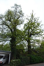
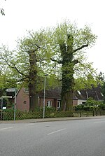
| 25th | 2 | Eichen , Reichweinstr. 2 | St. Gertrude | 53 ° 53 ′ 2 "N, 10 ° 42 ′ 42" E | December 18, 1980 | |
| 1 | Oak , Reichweinstr. 1 | 53 ° 53 ′ 0 ″ N, 10 ° 42 ′ 42 ″ E | ||||
| 1 | Oak , Am Waldsaum 14 | 53 ° 53 ′ 5 "N, 10 ° 42 ′ 45" E | ||||
| 2 | Oaks , in front of the allotment gardens / corner of the forest | 53 ° 53 ′ 5 "N, 10 ° 42 ′ 46" E | ||||
| 8th | Oak trees , port railway , near fairground, Am Waldsaum | 53 ° 53 ′ 7 "N, 10 ° 42 ′ 47" E | ||||
| 1 | A pedunculate oak corner of the parking lot / edge of the forest
Oak trees , port railway , near fairground, Am Waldsaum |
|||||
| 26th | 1 | Red beech , Roeckstrasse 52a | St. Gertrude | December 18, 1980 | ||
| 27 | 1 | Oak , left of the Burgtorbrücke from the direction of Teller | St. Gertrude | 53 ° 52 ′ 30 "N, 10 ° 41 ′ 33" E | December 18, 1980 | |
| 28 | 1 | Silberlinde , Kronsford Allee 17, corner of Brehmerstraße (today the medical center) | St. Jürgen | 53 ° 51 ′ 21 ″ N, 10 ° 41 ′ 22 ″ E | December 18, 1980 | |
| 29 | 1 | European beech , Gärtnergasse / corner garden corridor | St. Jürgen | 53 ° 51 ′ 7 ″ N, 10 ° 42 ′ 15 ″ E | December 18, 1980 | |
| 30th | 2 | Eiben , Drägerwerk , between Heinrich Dräger's grave and the Dräger Forum | St. Lorenz | 53 ° 51 ′ 23 "N, 10 ° 40 ′ 21" E | December 18, 1980 | |
| 31 | 1 | Fan leaf tree , in the complex on Lindenplatz , behind the imperial monument | St. Lorenz | 53 ° 52 ′ 0 ″ N, 10 ° 40 ′ 25 ″ E | December 18, 1980 | |
| 32 | 2 | Larch trees , trees in the Strecknitz court garden | Strecknitz | December 18, 1980 | ||
| 3 | Chestnuts , trees in the Strecknitz court garden | |||||
| 1 | Walnut , trees in the Strecknitz court garden | |||||
| 1 | Linden tree , trees in the Strecknitz court garden | |||||
|
|
6th | Oak trees , trees in the Strecknitz court garden | ||||
| 1 | Ash by the pond | |||||
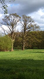
| 2 | Oak trees in the pasture | 53 ° 50 ′ 1 ″ N, 10 ° 42 ′ 50 ″ E | ||||
| 4th | Linden trees | |||||
| 5 | Linden trees | 53 ° 50 ′ 1 ″ N, 10 ° 42 ′ 46 ″ E | ||||
| 33 | 45 | Linden , Allee, Peter-Monnik-Weg, 21 Linden right, 24 Linden left of the manor house | Strecknitz | 53 ° 50 ′ 2 "N, 10 ° 42 ′ 47" E | December 18, 1980 | |
| 34 | 4 (formerly 9) | Linden , on the Chaussee to Herrenbrücke (former Herrenfähre) west of the traffic jam | Israel Village | 53 ° 53 ′ 53 "N, 10 ° 45 ′ 22" E | December 18, 1980 | |
| 35 | 1 | Neue Jahn eiche , Lauerholz , south of Travemünder Allee | Israel Village |
53 ° 53 ′ 12 ″ N, 10 ° 45 ′ 30 ″ E (Note: Finding coordinators - since the Jahnsteine are here) |
December 18, 1980 | |
| 36 | 5 (formerly 6) | Oaks , north of the Schaustellerplatz , in the allotment garden between the Rudolf-Groth-Kinderpark and the Lauerholz landscape protection area | Israel Village | 53 ° 53 ′ 10 ″ N, 10 ° 43 ′ 1 ″ E | December 18, 1980 | |
| 37 | 1 | short-stemmed red beech , lumber on the Fuchsberg | Israel Village | 53 ° 52 ′ 36 "N, 10 ° 44 ′ 10" E | December 18, 1980 | |
| 38 | 2 from formerly 4 | Ulmus laevis group (4 trees), On maids Bach ( Medebek ) behind the settlement Karlshof | Israel Village | 53 ° 53 '48 "N, 10 ° 43' 38" E | December 18, 1980 | |
| 39 | 1 | Yew tree , Lübeck-Israelsdorf, Buchenweg 2a | Israel Village | 53 ° 53 ′ 54 ″ N, 10 ° 44 ′ 16 ″ E | December 18, 1980 | |
| 40 | 2 from formerly 4; the others have probably been felled in the meantime. | Beech , lumber, wood at the fork in the road | Israel Village | 53 ° 54 ′ 13 "N, 10 ° 44 ′ 6" E | December 18, 1980 | |
| 41 | 1 | Beech (handle beech ), Lauerholz, southwest of the star | Israel Village | 53 ° 54 ′ 11 "N, 10 ° 44 ′ 4" E | December 18, 1980 | |
| 42 | 7th | Group of pines in the large Padelugg wood (7 pines), Padelugg wood | Schönbuck |
53 ° 51 ′ 11 "N, 10 ° 36 ′ 22" E (Note: Finding coordinates) |
December 18, 1980 | |
| 43 | 41 | Oak and subsequent linden avenue, 41 oaks , 83 linden trees , road to Padelugge | Schönbuck | 53 ° 51 ′ 16 "N, 10 ° 37 ′ 52" E | December 18, 1980 | |
| 44 | 8th | Oak , right on the road from the Lück brewery to Genin. | Genin | December 18, 1980 | ||
| 45 | 4th | Oaks , in the cemetery east of the church | Genin | 53 ° 50 ′ 27 "N, 10 ° 39 ′ 2" E | December 18, 1980 | |
| 46 | 1 | Linde , Stadtgut Niendorf , in front of the burial site memorial | Niendorf / Moorgarten | 53 ° 50 ′ 8 "N, 10 ° 36 ′ 21" E | December 18, 1980 | |
| 47 | 4th | Group of 4 yew trees , in the park of the Niendorf estate, behind the manor house | Niendorf / Moorgarten | 53 ° 49 ′ 57 ″ N, 10 ° 36 ′ 19 ″ E | December 18, 1980 | |
| 48 | 1 | Oak , In the park of the Niendorf estate, near the apple store | Niendorf / Moorgarten | 53 ° 49 ′ 58 "N, 10 ° 36 ′ 22" E | December 18, 1980 | |
| 49 | 3 | Oaks , on the school property in Niendorf, 1 oak on the street, 2 oaks in front of the building | Niendorf / Moorgarten |
53 ° 49 ′ 56 "N, 10 ° 36 ′ 35" E |
December 18, 1980 | |
| 50 | 1 | Oak , Niendorfer Hauptstrasse 13 | Niendorf / Moorgarten | 53 ° 49 ′ 59 "N, 10 ° 36 ′ 39" E | December 18, 1980 | |
| 51 | 3 | Eichen , Niendorfer Hauptstrasse 11 | Niendorf / Moorgarten | 53 ° 50 ′ 0 ″ N, 10 ° 36 ′ 41 ″ E | December 18, 1980 | |
| 52 | 1 | Oak , Niendorfer Hauptstrasse 15 | Niendorf / Moorgarten | 53 ° 49 ′ 59 ″ N, 10 ° 36 ′ 37 ″ E | December 18, 1980 | |
| 53 | 1 | Oak , in front of the former syringe house in Reecke opposite the schoolhouse | Reecke | 53 ° 49 ′ 57 "N, 10 ° 34 ′ 26" E | December 18, 1980 | |
| 54 | 1 | Dorf Linde , at the fork in the road in Niederbüssau, Dorfplatzdreieck | Niederbüssau | 53 ° 49 ′ 13 "N, 10 ° 38 ′ 7" E | December 18, 1980 | |
| 55 | 1 | Sycamore maple , Niederbüssau | Niederbüssau | 53 ° 49 ′ 11 "N, 10 ° 38 ′ 4" E | December 18, 1980 | |
| 56 | 3 | Group of 3 beeches , Im Vogelsang, north of Krummesse | Curved mass | December 18, 1980 | ||
 see also |
57 | 1 | Edeltanne group and one pine-like jaw , the vagina between Busch Wulfsdorf and Beidendorf | Beidendorf |
53 ° 47 ′ 52 "N, 10 ° 40 ′ 10" E |
December 18, 1980 |

|
58 | 34 | Lindenallee , (34 trees), Fackenburger Allee , in front of the Krempelsdorf manor | Krempelsdorf | 53 ° 52 ′ 47 "N, 10 ° 39 ′ 32" E | December 18, 1980 |

|
59 | 1 | Oak , former Dornbreite Agricultural School | Krempelsdorf | 53 ° 52 ′ 51 ″ N, 10 ° 39 ′ 18 ″ E | December 18, 1980 |
| 60 | 1 | Mountain elm at the lighthouse keeper's house | Travemünde | |||

|
61 | 1 | Linde , at the bend in Marktstrasse in front of the house at Jahrmarktstrasse 8 | Travemünde | 53 ° 57 '24 "N, 10 ° 51' 55" E | December 18, 1980 |

|
62 | 1 | Mövenstein ( Foundling ), in the Baltic Sea on the northern border of the seaside resort | Travemünde | 53 ° 58 ′ 29 ″ N, 10 ° 53 ′ 3 ″ E | December 18, 1980 |
| 63 | 1 | Sweet chestnut , Herderstr. 7-9 | St. Jürgen | 53 ° 51 ′ 17 "N, 10 ° 41 ′ 43" E | 22nd August 1984 | |
| 64 | 1 | Yew tree , Stresemannstr. 22nd | St. Jürgen | 53 ° 51 ′ 21 ″ N, 10 ° 41 ′ 30 ″ E | 22nd August 1984 | |
| 65 | 1 | European beech , III. Fishing shacks | Strecknitz | July 25, 1996 |
Other natural monuments
Not in the 1980 list
| image | number | number | designation | district | Coordinates | date |
|---|---|---|---|---|---|---|
| 1 | Plane tree , seen from Parkstrasse at the entrance to the city park | St. Gertrude | location | found with appropriate identification |
Former natural monuments
In addition to the natural monuments marked as missing in the list from 1980 onwards, other former natural monuments have survived that no longer existed in 1980.
Remarks
- ↑ Hilpert: City ordinance on natural monuments of December 18, 1980 in the version of July 25, 1996. (PDF; 47 kB) July 25, 1996, accessed May 5, 2019 .
- ↑ a b The situation can be guessed from the web link. Unfortunately, the representation is too imprecise, so an exact location description is not given here.
See also
- List of nature reserves in the city of Lübeck
- List of landscape protection areas in the city of Lübeck
- List of geotopes in the city of Lübeck
Web links
Commons : Natural monuments in the city of Lübeck - collection of images, videos and audio files


