List of cultural monuments in Trier-Kernstadt
The list of cultural monuments in Trier-Kernstadt contains all cultural monuments in the core area of the Rhineland-Palatinate city of Trier , consisting of the districts of Mitte / Gartenfeld , North , South and West / Pallien . The basis is the list of monuments of the state of Rhineland-Palatinate (as of January 9, 2018).
Monument zones
| designation | location | Construction year | description | image |
|---|---|---|---|---|
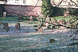
| Monument zone of the old Jewish cemetery | Weidegasse / Gilbertstrasse location |
Mid 17th century | laid out around the middle of the 17th century, expanded in the middle and end of the 19th century, surrounding wall from 1827, occupied until 1920; 547 grave sites recognizable, 446 of them with gravestones or remains of gravestones, the oldest from 1686 |
 more pictures more pictures
|
| Monument zone Augustastraße | Augustastraße 2-8 location |
1902-06 | three double houses and a villa (No. 8), plastered buildings with large gables in the style of picturesque historicism in front gardens with wrought iron lattice fences, 1902-06 |
 more pictures more pictures
|
| Monument zone Bergstrasse | Bergstrasse 16a – 20 location |
1912/13 | seven semi-detached and row villas, 1912/13 (No. 20 as early as 1907); Facades in simple reform architecture, only number 20 echoes of the English country house style |

|
| Monument zone Bollwerkstrasse | Bollwerkstrasse 2, 2a, 3, 4 location |
from 1869/70 | semi-open perimeter block development with three-storey apartment buildings with historicizing facades (No. 4 1869/70, No. 2 / 2a semi-detached house, 1899, No. 3 around 1901) | |
| Monument zone Brotstraße |
Brotstrasse 25–27 location |
Mid 17th century | closed street-defining corner development on Jesuitenstrasse, three-story houses, mid-17th century to 1880s, the core from the 17th and early 18th centuries; No. 25 above a barrel vaulted cellar, probably from the early 18th century, and three-window house, after 1867; No. 26 in the core probably from the 17th century, facade 1854, architect J. Weis, shop front rebuilt around 1900; No. 27 probably from the early 1880s |

|
| Monument zone Bruchhausenstrasse |
Bruchhausenstrasse 2-8, 10-19 location |
1902-14 | 1902–14 the newly laid out street was built with two- to four-story residential and commercial buildings, facades in all the styles of the early 20th century |

|
| Monument zone Christophstraße |
Christophstrasse 8–27, Kochstrasse 13 location |
1892 to 1912 | Representative row houses on Alleenring, closed and completely preserved, 1892 to 1912, No. 5–20 sandstone-integrated clinker buildings, neo-renaissance, No. 21–26 clinker-brick and sandstone-framed plastered buildings, neo-Gothic, neo-renaissance and neo-baroque motifs, no. 27 corner house, Kochstrasse 13 Reichsbank branch, No. 8–12 two- to three-story semi-villa-like row houses at the transition from late historicism to reform architecture |

|
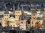
| Monument zone cathedral district | Domfreihof etc. location |
former cathedral immunity within the Dombering wall around the cathedral and Church of Our Lady, the medieval street system preserved, with the former bishop's palace and courtyard rings as well as courtyards of the cathedral canons; bounded by Palaststrasse, Grabenstrasse, Hauptmarkt, Simeonstrasse, Glockenstrasse, Flandernstrasse, Dominikanerstrasse, Windstrasse, An der Schellenmauer, Mustorstrasse, An der Meerkatz, Am Breitenstein |
 more pictures more pictures
|
|
| Monument zone Eberhardstrasse |
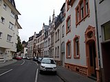
Eberhardstrasse 1–57 (odd numbers), 2–48 (even numbers), Gilbertstrasse 16, 17, 18, Nikolausstrasse 34, Südallee 30, 31, 32, Weidegasse 1, 3, 5, 7, 9 location |
around 1890 to around 1930 | The monument zone shows the development of urban planning within 30 years from classifying historicism with orthogonally running streets to pronounced romantic historicism with the curved street layout to cooperative buildings from the time of the First World War and the 1920s in the Heimat style; also belonging to Eberhardstrasse 15 in expressionistic forms. |
|
| Monument zone Fleischstrasse / Nagelstrasse |
Fleischstrasse 33–37, 40–45, Metzelstrasse 19, Nagelstrasse 2, 3, 28–32 Lage |
second quarter of the 19th century to 1914 | Residential and commercial buildings, predominantly from the second quarter of the 19th century to 1914; the classicist two-storey buildings, the three-and-a-half to four-storey upper-class houses built between 1900-09, the late-historic buildings on Nagelstrasse in the late 19th and early 20th centuries; Fleischstrasse 45 and Nagelstrasse 31: Art Nouveau buildings, Fleischstrasse 42/43 and 37 with Art Nouveau motifs; Fleischstrasse 37, Nagelstrasse 2, Fleischstrasse 34–36: Reinforced concrete constructions and solid and reinforced concrete buildings, the latter reform architecture |
 more pictures more pictures
|
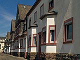
| Monument zone Franz-Georg-Straße / Schinkelstraße / Dr.-Altmann-Straße | Franz-Georg-Strasse 115, 117, Schinkelstrasse 1, 2, 3, Dr.-Altmann-Strasse 1–6, location |
1922 | eleven houses of a group of twelve with three-room apartments for NCOs of the French occupation army; similarly designed mansard hipped roof buildings, neo-baroque motifs, 1922 |
|
| Monument zone Gneisenaucaserne | Gneisenaustraße 30, 31, 33–37, 37a, 38–40, 41/43, Eurener Straße 6/8, Trierweilerweg 13a – c, 13d – f, 49 / 49a / 49b, 51 / 51a / 51b location |
1899/1900 | Most of the formerly 15 buildings have been preserved: six team buildings, the two drill houses, chamber and kitchen buildings, entrance and command building and officers' mess: plastered buildings, new renaissance motifs, team quarters with corner projections, 1899/1900 |
 more pictures more pictures
|
| Monument zone green belt | Friedrich-Ebert-Allee, Nord-Allee, Theodor-Heuss-Allee, Ostallee, Südallee etc. | from 1777 | in the area of the city wall and the leveled trenches on the north, east and west side of the medieval city, the outer border is formed by the avenues laid out from 1777 (Friedrich-Ebert-Allee, Nord-Allee, Theodor-Heuss-Allee, Ostallee, Südallee ), the inner border the streets laid out from 1876 (Franz-Ludwig-Straße, Christophstraße, Balduinstraße, An der Schellenmauer, Weimarer Allee, Kaiserstraße); Green area with tree plantings and curved and straight paths; integrates a piece of the medieval city wall with a half tower and the Baldwin Fountain on the north side , the medieval Red Tower and the Fischerbrünnchen on the south , 1930s |
 more pictures more pictures
|
| Main cemetery monument zone | Herzogenbuscher Straße 8 location |
1808 | Created in 1808, expanded and redesigned several times, parts of the enclosing wall from 1815 preserved; neo-Gothic cemetery chapel with mortuary, 1870, bronze crucifix on the choir side, 1917 by WS Resch, Munich; Heimatstil entrance building with two portal passages and flower shop under a shared hipped roof, 1911; numerous war memorials from the 19th and 20th centuries, including a memorial for the Soviet prisoners of war, a block of red sandstone, 1950 and a memorial for 91 Polish children and 5 Polish strangers, pinned crucifix, soon after 1945; Family graves of the 19th and early 20th centuries, grave crosses and individual grave monuments, 19th century to 1950s; Roman sarcophagi recovered from the grave fields near St. Matthias and St. Maximin; On the Jewish cemetery, which was laid out in 1920, the memorial of the Jewish religious community, 1954 |
 more pictures more pictures
|
| Monument zone in the Olk |
In the Olk 17–28 position |
second half of the 19th century | late historical block perimeter development with representative plastered facades, No. 18, 19 baroque style, No. 21, 27/28 neo-Classicist, No. 23/24 neo-Renaissance, second half of the 19th century | |
| Monument zone Jägerkaserne | Herzogenbuscher Strasse 10, 12, 14, 16, 18, Cläre-Prem-Strasse 1, 3 location |
1913 | seven-part group of buildings, erected in 1913 as barracks for the 7th Jäger-Regiment on Horseback ; two- and three-storey hipped roof buildings in the Baroque style of the homeland |
 more pictures more pictures
|
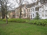
| Monument zone Kaiserstraße 2a – 24 |
Kaiserstrasse 2a – 4a, 6a – 10a, 3–20, 22–24, Wallstrasse 6 location |
from 1879 | representative late historical row houses, No. 24 1879, No. 13 1882, No. 12–3 1888–93, No. 2a – 4a, 9a, 10a 1891–95, No. 6–10 former municipal school, 1891 |
|
| Monument zone Kaiserstraße 39–44 | Kaiserstraße 39–44 location |
from 1893/94 | Part of the original perimeter block development of the street section that was extended to the east in 1893/94; two- and three-storey row houses, new renaissance motifs, No. 39, 40 and 41/42 around 1895, No. 43/44 around 1897 |

|
| Monument zone Karl-Marx-Straße 1–36 |
Karl-Marx-Straße 1–19 and 25–29 (odd numbers), 22–36 (even numbers), Jüdemerstraße 12 Lage |
18th to early 20th century | two rows of houses from the 18th to the early 20th century with two or three-story residential and commercial buildings; baroque mansard roof buildings, classicistic and late historical buildings |
 more pictures more pictures
|
| Monument zone Karl-Marx-Straße 72–76 | Karl-Marx-Straße 72-76 (even numbers) location |
from 1899 | representative perimeter block development at the confluence of Dampfschiffstrasse; Three apartment and commercial buildings on the eaves, no. 72 redesigned in 1899, no. 74 and 76 neo-Gothic and reform architecture, 1902 and 1906/09 |
 more pictures more pictures
|
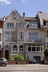
| Katharinenufer monument zone |
Katharinenufer 2-12 location |
1900-14 | three closely lined up short rows of terraced villas with style elements from late historicism to art nouveau to reform architecture, 1900–14, architect C. Kokke except No. 8 (FJ Kuhn) and No. 11 (G. Kasel), with front gardens on the Moselle side and large green spaces in the back ; Highly significant, high-quality testimony to a fully preserved ensemble of upscale living culture of this time |
 more pictures more pictures
|
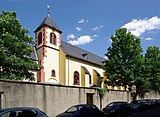
| Monument zone of the Klarissenkloster St. Maria Magdalena | Dietrichstrasse 30 location |
1730-37 | Baroque hall building with nuns' gallery, 1730–37, late Gothic west tower from 1495 with a baroque, romanised bell storey, marked 1731; Monastery: Baroque and Baroque style three-wing complex with mansard roofs, from 1755; Furnishing; barrel-vaulted cellars, including nuns' crypt with wall graves, mostly from the second half of the 18th century |
 more pictures more pictures
|
| Monument zone Kochstrasse / Sichelstrasse |
Kochstrasse 1–12, Sichelstrasse 10–12, 18–26 Lage |
from 1903 | Complete existing three- and four-storey perimeter block development, first construction phase 1903–14 (Kochstrasse 2, 3, 5, 8–12, Sichelstrasse 18–26), late historical and reform style motifs, second construction phase from the 1920s (Kochstrasse 1 , 4, 6/7, Sichelstrasse 10-12), Reformstil |

|
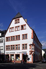
| Monument zone Krahnenstrasse / Johannisstrasse |
Krahnenstrasse 1, 4 / 4a, 6, 30, 33/34, 36–43, Feldstrasse 1, 2, 4, 8, 10, Johannisstrasse 1a, 2, 4–11, 14, 15 location |
Historically grown bourgeois development of the medieval Johannisstraße with different ensembles with Gothic, Baroque, Classicist and late historical houses, supplemented after the middle of the 19th century with three-storey apartment buildings |
|
|
| Kronprinzenstrasse monument zone | Kronprinzenstraße 6-10 and 15a-23, Helenenstraße 7 Lage |
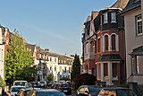
from 1900 | larger part of the Kronprinzenstraße laid out from 1900; on the south side (no. 15a – 23), which was completely built up until 1906, almost exclusively two-storey late-historic block perimeter development, on the north side mainly semi-detached and row villas, 1904–10 |
|
| Monument zone Lindenstrasse 31–34 |
Lindenstrasse 31–34 location |
1886-90 | Row with staggered late historical houses, neo-renaissance motifs, 1886–90 |
 more pictures more pictures
|
| Monument zone Lindenstrasse 41–45 | Lindenstrasse 41–45 location |
1872-79 | Row of five late Classicist houses with front gardens, 1872–79 | |
| Monument zone Maar | Maarstrasse 25–33 and 32, Engelstrasse 39 and Benediktinerstrasse 1–5 location |
first half of the 19th century | Core of the former suburb of Maar; simple two- and three-story houses for day laborers and craftsmen, mostly from the first half of the 19th century |

|
| Monument zone market district | Hauptmarkt 1–23, Dietrichstrasse 1–6, 44–54, Fleischstrasse 1–12, 77–84, Grabenstrasse 1–21, Jakobstrasse 1–13, 31–34, Judengasse 1–7, Simeonstrasse 28–45, Stockplatz 1, 2, 2a, 3, Stockstrasse 4, 5, Sternstrasse 7, Wilhelm-Rautenstrauch-Strasse 7, 9 location |
from the 10th century | includes the area of the medieval settlement on the main market : redevelopment of the main market and the confluent streets and the Stockplatz including the market and parish church of St. Gangolph; Triangular ground plan, laid out in the 10th century by Archbishop Heinrich I , planned changes to the building line from the late 18th to the early 20th century, today's Romanesque development up to the 20th century |
 more pictures more pictures
|
| Monument zone Matthiasstrasse | Matthiasstrasse 67–75 location |
18th and 19th centuries | Group from the time when the former village of St. Matthias was built; four houses from the 18th and 19th centuries, with renovations and extensions in the 20th century; No. 69 mansard roof building and No. 75 with a half-hip roof, probably both from the 18th century, No. 67 a late Classicist three-story plastered building, No. 71/73 set back by four axes and three-story, with expressionist motifs, essentially from 1848 | |
| Monument zone Maximinstrasse |
Maximinstrasse 22–30 location |
second half of the 19th century | Row of two- and three-story, five-axis plastered buildings, some with risalits, some with gates, in corner house No. 22 with facades on three sides, shop, classicist, neo-Renaissance and neo-Gothic motifs, second half of the 19th century (No. 22: 1878 , No. 23: 1876, No. 24: 1883, No. 25: 1892, No. 26: 1876, No. 27: 1862, No. 28: 1864, No. 29: 1862, No. 30: 1869) |

|
| Monument zone Merianstrasse / Martinsufer | Merianstrasse 19–25, Martinsufer 4–7 location |
from 1921 | Group of houses for officers of the French occupation, from 1921; Elongated, curved block (Merianstrasse 20–23), flanked by single-storey individual buildings (No. 19 and 24), Baroque style, as well as Baroque plastered buildings (Martinsufer 4–7) |

|
| Monument zone on Nagelstrasse | Nagelstrasse 19–24 location |
late 19th and early 20th centuries | three-storey late historic row houses and commercial buildings, late 19th and early 20th centuries |
 more pictures more pictures
|
| Monument zone Nells Ländchen | Dasbachstraße 12/14 location |
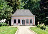
1792 to 1801 | Model estate laid out in the manner of an "ornamental farm" by Nikolaus Nell with the support of the gardener Jakob Gotthard from around 1792 to 1801, especially enlarged and redesigned in the 20th century under Horticultural Director Gottfried Rettig , rose garden from 1958, two bridges over the inflow to the pond, Children's playground with lining wall and stairs; classical entrance gate; so-called mill: small-scale plastered building with Gothic motifs; Ice cellar in the southeast of the lake, tree-lined hill; Former stable building (Dasbachstraße 14): three-part system with Gothic components; Obelisk in memory of Nikolaus Nell, inscribed 1807; Administrators' house (Dasbachstraße 12): late classicist cubic tent roof construction, 1864; Rautenstrauchscher garden pavilion: single-storey baroque hipped roof building, rebuilt in 1968; Copies of the former craftsman figures created by sculptor Heinrich Hamm in 1928 |
 more pictures more pictures
|
| Monument zone Neustraße 18–29 and 77–94 | Neustraße 18–29, 77, 78, 82, 90–94 location |
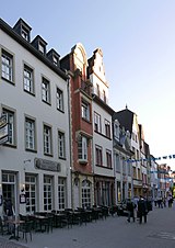
closed development of the middle Neustraße; three-storey gabled houses (No. 21-23; 22 and 23 late Gothic, facade of No. 21 rebuilt after the Second World War adapted) and eaves structures, late 18th century and second quarter of the 19th century until the 1860s |
|
|
| Monument zone Neustraße 42–66 | Neustraße 42–46, 47/48/49, 50–66, Kaiserstraße 31a Lage |
closed development at the southern end of Neustraße; two- to four-storey baroque, classicist and late historical eaves buildings, No. 42 late Gothic |

|
|
| Monument zone Nikolausstrasse | Nikolausstrasse 37-65 location |
1875-96 | for the southern urban expansion of Trier exemplary, closed row of houses with a uniform appearance, 1875–96: predominantly four-axis plastered buildings with still classicist facades, some buildings combined to form mirror-image pairs, the latest from 1896 with two octagonal towers with onion dome and strongly colored clinker facade | |
| Monument zone palace district | Am Palastgarten 1, Konstantinplatz 6/8, Willy-Brandt-Platz 3 location |
from the 4th century | late antique palace auditorium (4th century), electoral palace (17th and 18th centuries), red tower (17th century), surrounding open spaces, some with post-war buildings, palace garden; Center of state power representation from antiquity to the end of the electoral era |

|
| Pallien Monument Zone | Palliener Strasse 3–19 and 34–39 with the bridge over the Sirzenicher Bach, Mühlenweg 1–4, from Bitburger Strasse the Napoleonsbrücke, Bonner Strasse 9–12, 25 Lage |
With the closed row of small houses, inhabited by day laborers who were employed on the farm, in the sand pits and the various mills along the Sirzenicher Bach, the southern part of Palliener Straße gives a vivid picture of the earlier Pallien settlement ; together with the adjoining area of the Martinerhof (see there) and the Mühlenweg a complex of dense historical significance. |
 more pictures more pictures
|
|
| Monument zone Paulusplatz | Paulusplatz 1–6, Kalenfelsstrasse 7 location |
1905-14 | varied, mainly mixed development from 1905-14; neo-Romanesque Pauluskirche, 1907, with parsonage (No. 3), neo-classical former crafts and arts and crafts school (No. 4), three-storey residential buildings, reform style, around 1911/12, architect Josef Steinlein ( no.1 , 6), corner house, around 1870 , Architect Peter Sirker (Kalenfelsstrasse 7), remodeled by Steinlein around 1933 |

|
| Monument zone Petrusstraße | Petrusstrasse 4–17, 21–34 location |
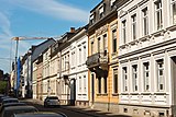
1870s / 80s | closed, built-up street from the 1870s / 80s, despite a large number of builders and architects of a largely uniform appearance; two and three-storey late classicist houses on the eaves throughout, only the most recent, no. 31/32 from 1896, with neo-Gothic motifs |
|
| Monument zone Porta-Nigra-Platz |
Porta-Nigra-Platz 6, 7, Rindestanzstraße 16, Simeonstraße 1, 2 location |
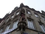
1895-97 | Three and four-story residential and commercial buildings that characterize streets and squares, 1895–97; Simeonstraße 2 Renaissance and Baroque motifs, risalit roof with belvedere-like finish; Simeonstrasse 1 large-volume neo-Gothic corner house “Zum Christophel”; Porta-Nigra-Platz 7 plastered building with open vestibule, Gothic and Renaissance motifs, furnishings; Porta-Nigra-Platz 6 / Rindestanzstraße 16 large-volume corner house with an elaborate neo-renaissance facade (Rindestanzstraße), reconstruction of the north facade around 1909, architect Julius Wirtz: neo-classical box oriel, wooden loggia, gable |
|
| Monument zone rose garden at the Drachenhaus | Stuckradweg location |
1933/34 | 8000 m² rose garden laid out in 1933/34 by horticultural director Gottfried Rettig (with the rose garden in Nells Ländchen (see there), successive task as such since 1956); Terrain with half-height gates (wrought iron grating between sandstone pillars), which is lowered in two steps from street level; on the upper terrace two baroque figures of gods (today copies) in high hornbeam niches, next step accessed from side stairs; Running fountain with accompanying benches, individual hedge gates arranged in a horseshoe shape; Arbours; Stairs to the lower ground floor; adjacent to the north Fichtenallee (Seufzerallee) |
 more pictures more pictures
|
| Saarstrasse monument zone |
Saarstrasse 15–29, Gerberstrasse 30 and 41 location |
1896-1906 | representative row of three-storey historicist residential and commercial buildings, sandstone-framed clinker buildings, 1896–1906 (only corner house no. 27 from 1857) |

|
| Sachsenstrasse monument zone | Sachsenstrasse 6–28, 13–33 location |
1896/97 | two- and three-storey houses with front gardens, partly colored clinker buildings, new renaissance motifs, 1896/97 |

|
| Monument zone of the Magnerichstrasse / Im Hospitalsfeld settlement | Magnerichstrasse 1–11 (odd numbers), 2–10 (even numbers), Im Hospitalsfeld 2/4/6, 8 location |
1926-28 | Group of eight urban apartment blocks, 1926–28; three-storey mansard roof buildings, some in the style of the homeland |
 more pictures more pictures
|
| Monument zone Simeonstrasse | Simeonstrasse 1–27 location |
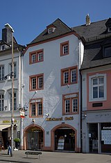
Closed development on the east side of the street including the wide street space that goes back to the Roman Cardo Maximus, Trier main street; Buildings from the high Middle Ages (No. 19) through the Renaissance (No. 7), Baroque (No. 8) and Classicism (No. 4) to the 20th century (No. 10) |
 more pictures more pictures
|
|
| Monument zone Speestrasse / Gilbertstrasse | Speestrasse 1–27, Friedrich-Wilhelm-Strasse 28, Gilbertstrasse 57–73 (odd numbers) location |
1902 to around 1914 | Closed development of high quality, predominantly single and two-family houses in late historical forms, occasionally also Art Nouveau and reform architecture, on the area of the former Jesuit garden, 1902 to around 1914 |
 more pictures more pictures
|
| Monument zone Theodor-Heuss-Allee / Bahnhofstrasse | Theodor-Heuss-Allee 7–22, Bahnhofstrasse 23–26 Location |
last quarter of the 19th century | Two- and three-storey row houses and commercial buildings, restaurants, hotels in the catchment area of the train station, late classicistic or historicizing, last quarter of the 19th century, No. 9 from 1914 |

|
| Zurlauben monument zone |
Zurlaubener Ufer 76–92 location |
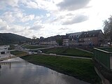
18th century | Core of the former suburb of Zurlauben; closed row of houses with mansard roof buildings, the outward appearance of the 18th century, in the core partly probably older; the two three-story houses nos. 90 and 91 from the late 19th century were redesigned in Baroque style around 1985; In front of the Moselle, small gardens assigned to the houses, some with garden houses; Moselle front covered by high retaining walls due to the construction of the flood protection dam around 1920 |
|
Individual monuments
Streets A to F
Streets G to K
Streets L to P
Streets Q to Z
District
literature
- Patrick Ostermann (arrangement): City of Trier. Old town. (= Cultural monuments in Rhineland-Palatinate. Monument topography Federal Republic of Germany . Volume 17.1 ). Wernersche Verlagsgesellschaft, Worms 2001, ISBN 3-88462-171-8 .
- Ulrike Weber (arrangement): City of Trier. City expansion and districts. (= Cultural monuments in Rhineland-Palatinate. Monument topography Federal Republic of Germany . Volume 17.2 ). Wernersche Verlagsgesellschaft, Worms 2009, ISBN 978-3-88462-275-9 .
- General Directorate for Cultural Heritage Rhineland-Palatinate (publisher): Informational directory of cultural monuments of the district-free city of Trier . Mainz 2018 ( PDF; 4.9 MB [accessed January 18, 2018]).
