List of cultural monuments in the city center (Görlitz), Bi – D
In the list of cultural monuments in the city center (Görlitz), Bi-D , all cultural monuments of the Görlitz city center are recorded that were recorded by the State Office for Monument Preservation of Saxony up to October 2017 (excluding archaeological cultural monuments) and whose street name begins with the corresponding first letter. The notes are to be observed.
This list is a partial list of the list of cultural monuments in Görlitz .
List of cultural monuments in the city center (Görlitz), Bi – D
| image | designation | location | Dating | description | ID |
|---|---|---|---|---|---|
 |
Apartment building in closed development, corner house | Bismarckstraße 1 (main address: Elisabethstraße 37) (map) |
1870s | Raised corner with balustrade and figures, important in terms of building history and urban development |
09280658 |
| Apartment building in closed development, with shop | Bismarckstrasse 2 (map) |
Around 1870 | Significant in terms of building history and urban development |
09285412 |
|
 More pictures |
Apartment building in closed development, plus a butcher shop with original design | Bismarckstrasse 3 (map) |
1876 (tenement house); 1911 (shop) | The builder was the master carpenter Paul Jaeckel, which is important in terms of building history and urban planning. Shop with tiles, including from Villeroy and Boch (probably from 1911). |
09280659 |
 |
Apartment building in closed development, with shop | Bismarckstrasse 4 (map) |
1870s | Architecturally and urbanistically important, probably Paul Mühsam's house (cousin of Erich Mühsam) |
09280660 |
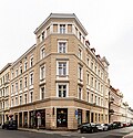 |
Apartment building with original shop fronts in closed development, corner house | Bismarckstraße 5 (main address: Struvestraße 8) (map) |
1868 | Formerly furniture magazine, builders G. Zander & Comp., Of importance in terms of building history and urban planning |
09282285 |
 |
Apartment building with shop in closed development, corner house | Bismarckstraße 6 (main address: Struvestraße 24) (map) |
Around 1890 | Shop window, lettering “Milch-Arlt” and remnants of old tiles, important in terms of building history and urban development. Ground floor disturbed. Corner pulled up to Struvestraße. |
09281643 |
 |
Residential building in closed development | Bismarckstrasse 7 (map) |
1863 | Of importance in urban planning. The facade was redesigned in 1929, blind arches, plaster cornices. |
09289203 |
| Apartment building in closed development | Bismarckstrasse 8 (map) |
Around 1890 | Significant in terms of building history and urban development. Ground floor changed. |
09281687 |
|
| Apartment building in closed development | Bismarckstrasse 9 (map) |
Front building in 1862, rear building in 1867 and 1894 | Building owner, watch dealer Röhrig, portal around 1900, showcases in the entrance area to the passage with iron framed, rear building built as the studio of the Görlitz photographer Robert Scholz, of architectural and urban significance |
09281686 |
|
| Tenement house with shops in closed development, plus villa-like courtyard building | Bismarckstrasse 10 (map) |
1870s | Significant in terms of building history and urban development. Shops with original fronts. |
09281685 |
|
 |
House in closed development, with shop with original front | Bismarckstrasse 11 (map) |
Around 1890 | Of importance in urban planning. Just get stucco around the portal and the shop front. |
09281684 |
 |
Residential building in closed development | Bismarckstrasse 12 (map) |
1860s | Emphasized middle section, of importance in terms of building history and urban planning. Beautiful entrance from the passage around 1910. Cast iron banister from the construction period. Original apartment door only on the top floor. |
09281683 |
 |
Residential building in closed development | Bismarckstrasse 13 (map) |
1862/63 | The builders were master carpenter Karl Heinrich Borgana and master bricklayer Wilhelm Koritzky, which were important in terms of urban planning |
09301891 |
 |
Apartment building in closed development | Bismarckstrasse 13a (map) |
Around 1890 | Upper storeys clinker brick, facade emphasized by central bay window architecture, of importance in terms of building history and the street scene. Courtyard passage with stucco, pilasters, medallions. Cast iron banister, colored leaded glass windows in the stairwell. Open verandas on the left wing. |
09281682 |
 |
Residential house, to the left in closed development | Bismarckstrasse 14 (map) |
1857 | Façade with Art Nouveau elements, important in terms of building history and urban development. Nice etched windows in the stairwell, also on the porch door. Verandas open to the courtyard. |
09281681 |
 |
Residential and office buildings, to the right in closed development | Bismarckstrasse 15a (map) |
Around 1910 | Facade highlighted by a pilaster-like structure, of importance in terms of building and economic history. Outline with colossal pilasters. Old interior (doors) preserved. Colored leaded glass windows in the stairwell. |
09281679 |
 |
House in a corner | Bismarckstrasse 16 (map) |
1852 | Head construction of the street against Schützenstraße, builder Obrist-Leutnand Zechlin, veranda on Schützenstraße in 1893 under post office owner Oswald Geißler, of urban development importance. Smoothed facade. The house still has an old facade structure with a central projectile (still old pilaster capitals). Old plaster grooves on the back and sides. |
09281678 |
 |
Apartment building in closed development, corner house on Schützenstrasse | Bismarckstrasse 17 (map) |
1890s | Historicism façade, of importance in terms of building history, urban development and the street scene. Raised corner with parapet, entrance area stucco structure, staircase window colorfully etched. |
09281186 |
 |
Residential building in closed development | Bismarckstrasse 17a (map) |
1870s | Façade with stylistic elements of the neo-renaissance, important in terms of building history and urban planning |
09281185 |
 |
Apartment building in closed development, with shops with original fronts, lavish Art Nouveau decor, mirror-image with No. 18a | Bismarckstrasse 18 (map) |
1902/03 | Significant in terms of building history and the appearance of the street. Art Nouveau leaded glass windows in the stairwell and in the front door, Art Nouveau stucco and painting in the stairwell, both houses with a balcony each. |
09281184 |
 |
Apartment building with shop in a closed development, facade with lush Art Nouveau decor, identical to No. 18 | Bismarckstrasse 18a (map) |
1902/03 | Façade with lavish Art Nouveau decor, identical to number 18, of importance in terms of building history, architecture and the street scene. Shop front not original, facade rich Art Nouveau jewelry. |
09281183 |
 |
Apartment building in closed development, with original shop front and factory in the courtyard | Bismarckstrasse 19 (map) |
1897/98 | Significant in terms of building history and urban development. Clinker building with stucco. Original shop or restaurant front with a beautiful wrought iron grille in front of it. In the courtyard passage tiles with ornamental drawings and five blue tile pictures with Görlitz motifs. Ceiling of the courtyard passage, wood-paneled, slightly arched in Art Nouveau style, with original Art Nouveau lamp sockets. Stairwell etched windows. Clinker brick courtyard factory with plaster. |
09281182 |
 |
Apartment building in closed development, with a small shop with the original front | Bismarckstrasse 20 (map) |
1880s | Significant in terms of building history and urban development |
09281181 |
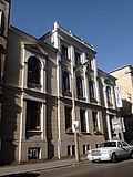 More pictures |
Residential house, to the left in closed development | Bismarckstrasse 21 (map) |
Between 1860 and 1863 | Builder Herrmann Reget Meilly, classicist facade design, of importance in terms of building history and urban development. See number 22. Elevated central projection. |
09281180 |
 |
Tenement house, to the right in a closed development | Bismarckstrasse 22 (map) |
1863 | Original building by master mason Gock, fundamental renovation by retiree Herrmann Reget Meilly, rich historicism facade, of architectural and urban significance. House formerly identical to number 21, preserved unchanged, beautiful etched staircase windows. |
09281179 |
 |
Apartment building in closed development | Bismarckstrasse 23 (map) |
1860s | Significant in terms of building history and urban development |
09281178 |
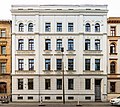 |
Apartment building in closed development | Bismarckstrasse 24 (map) |
1860s | Significant in terms of building history and urban development. Smoothed facade on the third floor, old staircase. |
09281177 |
 |
Apartment building in closed development | Bismarckstrasse 25 (map) |
1860s | From 1878 Dr. Landsberg and then Dr. Mehlhose, facade in the style of the neo-renaissance, of architectural and urban significance, colored leaded glass windows in the stairwell |
09281176 |
 |
Apartment building in closed development, with shop | Bismarckstrasse 26 (map) |
Around 1870 | Significant in terms of building history and urban development. Pilasters in the courtyard. Facade slightly changed. |
09281175 |
| Apartment building in closed development, corner house | Bismarckstraße 27 (Struvestraße 25) (map) |
Around 1870 | Significant in terms of building history and the appearance of the street. Building possibly commercial building. Facade smoothed and changed. Interesting corner design with a balcony on the first floor. Semi-oval stairwell. Stucco in the entrance. |
09281174 |
|
 |
Residential house in closed development, corner house | Bismarckstrasse 28 (map) |
Around 1860 | Builder Police Secretair Bellin, important in terms of building history and the appearance of the street. Corner pulled up. The facade has probably been smoothed out and changed, especially the ground floor on the corner. |
09280906 |
 |
Apartment building in closed development, with shop | Bismarckstrasse 29 (map) |
Around 1870 | Significant in terms of building history and urban development. Changed first floor right. Courtyard building across not uninteresting. |
09280907 |
 |
Apartment building in closed development, with shops with original fronts | Bismarckstrasse 30 (map) |
Around 1870 | Significant in terms of building history and urban development. Raised side elevation. |
09280908 |
 |
Residential house in closed development, with shops with original fronts | Bismarckstrasse 31 (map) |
Around 1870 | Significant in terms of building history and urban development. Raised central projection. |
09280909 |
 |
Apartment building in closed development, with original shop fronts, corner house | Bismarckstrasse 32 (Elisabethstrasse 38) (map) |
1870 | Significant in terms of urban planning and building history.
|
09280910 |
 More pictures |
Peace height; Park in its spatial formation and surface structure, with floor relief, path system, space and structure-forming planting, viewing platform, pergola, shrub and summer flower beds as well as 3 art cast figure groups by the Bautzner sculptor Rudolf Enderlein | Blockhausstrasse (map) |
1858 (park area); 1891 (installation of a bronze monument for Prince Friedrich); from 1952 (pergola); from 1952 (installation of three artificial cast children's figures) | Sculptures by the Bautzner sculptor Rudolf Enderlein , of importance in terms of urban history and garden art. Lookout point in front of the log cabin with a view of the Neisse and the railway viaduct. |
09281321 |
 |
Tenement house, to the right in a closed development | Blockhausstrasse 1 (map) |
Around 1890 | As the last building in front of the railway bridge of importance in terms of urban planning and the street scene, it is a representative building of historicism. Clinker construction. At the bridgehead railway bridge, fire wall designed accordingly in this direction. In the entrance area pilasters and stucco in throat. Remains of etched glass in stairwell windows. Loggias with beautiful wrought iron bars on the first, second and third floors on the right. |
09280876 |
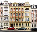 |
Apartment building in closed development | Blockhausstrasse 2 (map) |
Around 1890 | Historic facade, of importance in terms of building history and urban development. Clinker construction. Pilasters and stucco in the entrance area. Etched staircase window. |
09280877 |
 |
Apartment building in closed development, corner house, with front garden and enclosure to Blockhausstraße | Blockhausstrasse 3 (map) |
Around 1890 | Significant in terms of building history and urban development. Corner raised, first and second floor balconies with bars. Nice stucco on the ceiling in the courtyard passage. Pilasters with capitals. |
09280871 |
 |
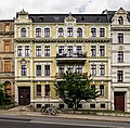
Apartment building in closed development with front garden | Blockhausstrasse 4 (map) |
Around 1890 or earlier | Significant in terms of building history and urban development. Large balconies with iron bars on the first and second floors and arbor on the ground floor. Stencil painting around 1905 in the entrance area. Staircase window with different glass, partly etched. Front garden with an old fence. |
09280872 |
 |
Apartment building in closed development with front garden | Blockhausstrasse 5 (map) |
1887 | Elaborate historic facade, of architectural and urban importance. On the first and second floor balconies with bars. Plaster profiles in the courtyard passage. Etched staircase window. Waist-high wooden paneling in the courtyard passage. |
09280873 |
 |
Apartment building in closed development with front garden | Blockhausstrasse 6 (map) |
Around 1890 | Façade with stylistic elements of the neo-renaissance, important in terms of building history and urban planning. Floor tiles in the stairwell. Window glasses partially etched. On the first and second floor balconies with beautiful wrought iron bars. |
09280874 |
 |
Apartment building in closed development, corner house on Wilhelmsplatz | Blumenstrasse 1 (map) |
1870s | Neo-Renaissance facade, important in terms of building history and the appearance of the street. Stuck in the courtyard passage. |
09281265 |
 |
Apartment building in closed development | Blumenstrasse 2 (map) |
Around 1880 | Significant in terms of building history and urban development. Etched windows in the stairwell. Raised central projection. |
09281089 |
 |
Residential building in closed development | Blumenstrasse 3 (map) |
Around 1880 | Historicism facade, of importance in terms of building history and urban planning. Side elevation. Etched windows in the stairwell. |
09281090 |
 |
Residential building in closed development | Blumenstrasse 4 (map) |
Around 1870 | Palais-like building, facade with classical forms, of architectural and urban significance. Especially gorgeous. Courtyard passage with stucco and pilasters. Etched windows in the stairwell. Cast iron banister. |
09281091 |
 |
Residential house in closed development and courtyard building | Blumenstrasse 5 (map) |
Around 1870 | Elaborate plastered facade, important in terms of building history and urban planning. Courtyard passage with stucco ceiling. Etched windows in the stairwell. Clinker brick courtyard building with wood and wooden veranda. |
09281092 |
 |
Residential building to the left in closed development and rear building | Blumenstrasse 6 (map) |
Around 1870 | In terms of urban development, the rear building has three wings |
09281093 |
 |
Parish hall of the Methodist Church, to the left in open development | Blumenstrasse 7 (map) |
Around 1920 | Significant local history, structure of pilaster strips |
09281094 |
 |
Residential building in closed development | Blumenstrasse 8 (map) |
Around 1920 | Of importance in urban planning. Outline with colossal pilasters. Stucco ornaments in the stairwell. The photo studio Neuse would have been here (see Jakobstrasse 5). |
09281095 |
 |
Residential house, to the left in closed development | Blumenstrasse 9 (map) |
Around 1870 | Significant in terms of building history and urban development. Courtyard passage with pilasters and stucco profiling. Etched windows in the stairwell. |
09281096 |
| Residential house in closed development, corner house and outbuildings | Blumenstrasse 10 (main address: James-von-Moltke-Strasse 44) (map) |
1870s | Significant in terms of building history and urban development. Corner bay window above the ground floor and first floor. Facade slightly smoothed. Stucco in the entrance area and ornamental tiles. Outbuildings: set back small clinker brick building. |
09281124 |
|
 |
House in a corner, with garden fence and front garden | Blumenstrasse 11 (main address: James-von-Moltke-Strasse 7) (map) |
1911 | Reform style of the time around 1910, significant in terms of building history. There is also a memorial plaque for Herbert Balzer with the inscription: “Herbert-Balzer-Straße. Herbert Balzer. Born on December 27th, 1897. Functionary of the KPD in the Görlitz area. Anti-fascist resistance fighter. Murdered by the SS in April 1945. "
Colored leaded glass windows on the veranda, building Blumenstrasse 12 was formerly an annex to this house. |
09281195 |
 |
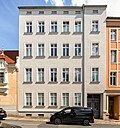
Coach house, to the right in closed development | Blumenstrasse 12 (map) |
Around 1900 | Formerly an annex at Blumenstrasse 11 / James-von-Moltke-Strasse 7, of architectural and social significance. Built on the firewall of Blumenstrasse number 13. |
09281088 |
 |
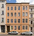
Apartment building in closed development, with left courtyard wing | Blumenstrasse 13 (map) |
Late 19th century | Of importance in urban planning. Facade smoothed to make it distorted, but stucco and pilasters in the courtyard passage. Etched windows in the stairwell. With left courtyard wing, with wooden verandas. Blumenstrasse 12 attached to the fire wall. |
09281087 |
 |
Apartment building in closed development, with right courtyard wing | Blumenstrasse 14 (map) |
Late 19th century | Of importance in urban planning. The façade has been smoothed to make it distorted, but the entrance area is richly decorated with stucco and pilasters. Wooden verandas in the back. Etched windows in the stairwell. |
09281086 |
 |
Apartment building in closed development | Blumenstrasse 15 (map) |
Around 1890 | Of importance in urban planning. In the courtyard passage Stuck (ruinous). Wooden verandas open to the courtyard. Partially etched windows in the stairwell. |
09281085 |
 More pictures |
Apartment building in closed development | Blumenstrasse 16 (map) |
Around 1890 | Representative plastered facade, of importance in terms of building history and urban planning. Without a secret annexe. In the courtyard passage, stucco on the ceiling, medallion, consoles. |
09281084 |
 |
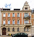
Apartment building in closed development | Blumenstrasse 17 (map) |
Around 1890 | Significant in terms of building history and urban development. Art Deco decorations and floor tiles in the entrance area. The rear of the former car factory, very clear design, with a small inner courtyard (demolished in 1996). |
09281083 |
 |
Apartment building in closed development | Blumenstrasse 18 (map) |
Around 1890 | Representative historic facade, of importance in terms of building history and urban planning. Balconies on the right, large ornamental gables on the right. Etched porch door to the stairwell. A leaded glass window. |
09281082 |
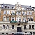 More pictures |
Apartment building in closed development | Blumenstrasse 19, 20 (map) |
Around 1890 | Historicism facade, of architectural and urban significance. One house, one facade. Clinker building with stucco plaster. Large balconies (partly broken) with wrought iron bars. Extraordinary neo-baroque stucco in the courtyard passage, partly figurative. Ceiling pictures. Colored leaded glass windows in the stairwell. Staircase with a beautiful wrought iron grille. The painting in the passage by decorative painter G. Maue, inscribed 1903. |
09281081 |
 |
Apartment building in closed development | Blumenstrasse 21 (map) |
1893 | The client was the master builder Eugen Rother, historicism facade, of importance in terms of building history and urban planning. Clinker building with stucco plaster. Terrazzo floor with ornaments. Staircase with wrought iron grille. |
09281080 |
 |
Apartment building in closed development | Blumenstrasse 22 (map) |
Around 1890 | Neo-Renaissance facade, of architectural and urban significance, stucco in the courtyard passage |
09281079 |
 |
Apartment building in closed development | Blumenstrasse 23 (map) |
Around 1890 | Significant in terms of building history and urban development. Stucco in the courtyard passage. Wooden verandas in the back. Changed stairwell. Etched windows in the stairwell. |
09281078 |
 |
Apartment building in closed development | Blumenstrasse 24 (map) |
Around 1890 | Significant in terms of building history and urban development. Stucco in the entrance area and medallion. |
09281077 |
 |
Apartment building in closed development | Blumenstrasse 25 (map) |
Around 1890 | Façade with stylistic elements of the neo-renaissance, important in terms of building history and urban planning |
09281076 |
 |
Apartment building in closed development | Blumenstrasse 26 (map) |
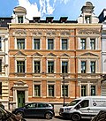
Around 1890 | Significant in terms of building history and urban development. Great ceiling painting in the courtyard passage. Walls with friezes. Etched staircase window. |
09281075 |
 |
Apartment building in closed development | Blumenstrasse 27 (map) |
1891 | Façade with stylistic elements of the neo-renaissance, important in terms of building history and urban planning. Clinker building with plaster (stucco). Entrance area with consoles. |
09281074 |
 |
Apartment building in closed development | Blumenstrasse 28 (map) |
1891 | Façade with stylistic elements of the neo-renaissance, important in terms of building history and urban planning. Ceiling picture in the entrance, some walls painted. Ornamental band in the stairwell. |
09281073 |
 |
Apartment building in closed development | Blumenstrasse 29 (map) |
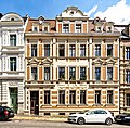
1891 | Historicism facade, of importance in terms of building history and urban planning. Clinker building with stucco. Etched windows in the stairwell. Old floor tiles. |
09281072 |
 |
Apartment building in closed development, corner house | Blumenstrasse 29a (map) |
Around 1890 | Striking building with an elaborate plastered facade and corner tower, of importance in terms of architectural history, urban planning and the appearance of the street. Corner tower. Balconies supported by atlases. Balconies very defaced. Stucco in the entrance. |
09281071 |
 More pictures |
Villa with courtyard wing and villa garden | Blumenstrasse 30 (map) |
1865 | The builder was the particulier Ziemer, courtyard wing and change of the roof in 1899 under the factory owner and councilor Sally Heymann, facade with elements of the Renaissance and the Baroque, important in terms of building history and architecture and gardening. Wrought iron stair gate. The villa has a fire wall to the left and was probably designed to connect other houses. |
09281070 |
 |
Apartment building with buildings open to the left | Blumenstrasse 32 (map) |
Around 1890 | Magnificent historicism facade, of importance in terms of architectural history and urban development. On the open side balconies on the first and second floors. |
09281123 |
 |
Apartment building in closed development | Blumenstrasse 33 (map) |
Around 1890 | Historic facade, of importance in terms of building history and urban development. Pilasters and stucco in the entrance hall. Balconies with wrought iron bars. |
09281122 |
 |
Apartment building in closed development | Blumenstrasse 34 (map) |
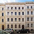
Around 1890 | Historic facade, of importance in terms of building history and urban development |
09281121 |
 |
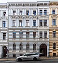
Apartment building in closed development | Blumenstrasse 35 (map) |
Around 1890 | Historicist facade with elements of the neo-renaissance, of architectural and urban significance. Pilasters and stucco in the stairwell, painted in color. Colorful etched staircase windows. |
09281120 |
 |
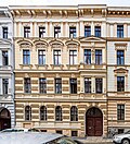
Apartment building in closed development | Blumenstrasse 36 (map) |
Around 1890 | Historicist facade with neo-renaissance style elements, important in terms of building history and urban planning |
09281119 |
 |
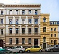
Apartment building in closed development | Blumenstrasse 37 (map) |
Around 1890 | Historicist facade with neo-renaissance style elements, important in terms of building history and urban planning |
09281118 |
 |
Apartment building in closed development | Blumenstrasse 38 (map) |
Around 1890 | Historicist facade with neo-renaissance style elements, important in terms of building history and urban planning. Stucco and pilasters in the entrance. |
09281117 |
 |
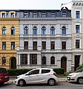
Apartment building in closed development with front garden | Blumenstrasse 39 (map) |
Around 1890 | Here jump out of the street, rich historicism facade, of architectural and urban importance. Stucco and pilasters in the entrance. |
09281116 |
 |
Apartment building in closed development with front garden | Blumenstrasse 40 (map) |
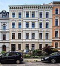
Around 1890 | Historicism facade, of importance in terms of building history and urban planning. On the ground floor porch with balcony. Stucco, pilasters, medallions in the entrance. |
09281115 |
 |
Apartment building in closed development with front garden and fence | Blumenstrasse 41 (map) |
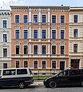
Around 1890 | Historicism facade, of importance in terms of building history and urban planning |
09281114 |
 |
Apartment building in closed development with front garden | Blumenstrasse 42 (map) |
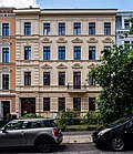
1890s | Significant in terms of building history and urban development. Stucco in the house entrance, etched porch door. |
09281113 |
 |
Apartment building in closed development with front garden and fence | Blumenstrasse 43 (map) |
1890s | Historicism facade, of importance in terms of building history and urban planning. Stucco and ceiling paintings in the courtyard passage. |
09281112 |
 |
Residential house in closed development with front garden | Blumenstrasse 44 (map) |
1880s | Historicism facade, of importance in terms of building history and urban planning. House with porch on the central projectile on the ground floor pilasters in the courtyard passage, beautiful etched windows, cast-iron banisters. |
09281111 |
 |
Apartment building in closed development with front garden and fence | Blumenstrasse 45 (map) |
1890s | Historicism façade, of architectural and urban significance, house entrance with stucco |
09281110 |
 |
Apartment building in closed development, corner house on Sohrstrasse, with front garden and enclosure | Blumenstrasse 46 (map) |
Around 1890 | Smoothed facade, of urban development importance, stucco in the entrance area |
09281109 |
 |
Apartment building in closed development with enclosure and front garden | Blumenstrasse 46a (map) |
Around 1890 | Upper floors clinker, of architectural and urban significance. Colorful etched windows in the stairwell. |
09281107 |
 |
Residential house, to the right in open development, with enclosure and front garden | Blumenstrasse 47 (map) |
Around 1870 | Villa-like, historically important. Right part of the building with bay window changed, courtyard side also changed. |
09281106 |
 |
Residential house, corner property on Blumenstrasse, with commercial courtyard wing and garden on the right | Blumenstrasse 48 (main address: James-von-Moltke-Strasse 8) (map) |
1870s | Of importance in urban planning. Entrance with roofing, on it a balcony with wrought iron grille. Supports changed. Front garden to Blumenstrasse. |
09280823 |
 |
Residential and commercial building in closed development, with several shops with original fronts, corner house | Blumenstrasse 49 (main address: James-von-Moltke-Strasse 43) (map) |
1898 | The builder was master butcher Bruno Göhsing, which was of importance in terms of building history and the appearance of the street. All shops with original fronts. Corner shutters with ornamental tiles, partly figurative, cast iron consoles for shelves, stucco ceiling. Stucco in the courtyard entrance. First, second and third floors on the corner with balconies with wrought iron bars. The house was only at 7 Sommergasse. |
09300672 |
 |
Residential house, to the left in open development | Blumenstrasse 53 (map) |
Around 1870 | Palais-like building with an elaborate plastered facade, important in terms of architectural history and urban development. Stucco ceiling and pilasters in the entrance. |
09281099 |
 |
Residential building in closed development | Blumenstrasse 54 (map) |
Around 1870 | Of importance in urban planning. Facade smoothed, but old facade grid preserved. Pilaster structure and ceiling painting in the courtyard passage. |
09281100 |
 |
Residential house in closed development, with right courtyard wing | Blumenstrasse 55 (map) |
Around 1870 | Façade with stylistic elements of the neo-renaissance, important in terms of building history and urban planning. Pilaster structure and stucco in the entrance. Incised floor tiles. With the right courtyard wing with beautiful ornamental cornices. |
09281101 |
 |
Apartment building in closed development | Blumenstrasse 56 (map) |
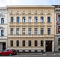
Around 1870 | Historicism facade, of importance in terms of building history and urban planning. Courtyard passage with stucco ornaments. Pilasters carry belt arches. |
09281102 |
 |
Apartment building in closed development | Blumenstrasse 57 (map) |
Around 1870 | Historicism facade, of importance in terms of building history and urban planning. Courtyard passage similar to number 56. |
09281103 |
 More pictures |
Apartment building in closed development, with a chapel in the courtyard | Blumenstrasse 58 (map) |
1870s | Historicism facade, of importance in terms of building history and urban planning. Wooden balconies on the courtyard side. Beautiful etched staircase windows on the front building. |
09281104 |
 |
Apartment building in closed development | Blumenstrasse 59 (map) |
Around 1890 | Neo-Renaissance facade, important in terms of building history and urban planning. Courtyard passage with stucco and pilasters, Art Deco painting. Mosaic floor in the stairwell. |
09281105 |
 |
Apartment building in closed development, corner house on Wilhelmsplatz | Blumenstrasse 60 (map) |
Around 1870 | Façade with stylistic elements of the neo-renaissance, of importance in terms of building history, urban planning and the street scene. Rich painting in the stairwell entrance. Roof landscape totally smoothed. |
09281266 |
 |
Brautwiesenplatz ; Town square, circular traffic area with outer sidewalks, ring-shaped street layout and central plaza as well as remains of the planting (wreath of trees and hedges) | Brautwiesenplatz (map) |
1900 | Circular traffic area with outer sidewalks, ring-shaped street layout and central area as well as remains of the planting (wreath of trees and hedges), of importance in terms of urban planning and urban development.
Description of the garden monument (Ragnhild Kober, September 10, 2008):
|
09280577 |
| Clinker brick transformer house | Brautwiesenplatz (map) |
Around 1930 | Of significance in terms of technology history. Middle section flanked by lower buildings. |
09281218 |
|
| Road tunnel (Brautwiesentunnel) | Brautwiesenplatz to Lutherstrasse (map) |
Late 19th century | Tunnel of the extended Lutherstrasse to Brautwiesenplatz under the railway system, there was a tunnel here as early as 1867 (city map), of importance in terms of both building and railway history |
09282577 |
|
| Apartment building with shops, front building with Am Brautwiesentunnel 2 to Brautwiesenplatz | Brautwiesenplatz 1 (map) |
Around 1895 | Significant in terms of building history and urban development. Demolished balconies. Original shop fronts. |
09281216 |
|
| Apartment building with shops in closed development, head building Cottbuser- / Spremberger Straße to Brautwiesenplatz | Brautwiesenplatz 2 (map) |
Around 1895 | Significant in terms of building history, urban development and the street scene. Original shop fronts, old staircase. Two corner bay windows above the first, second and third floors and the attic. |
09281213 |
|
| Apartment building in closed development, with shop | Brautwiesenstrasse 1 (map) |
Around 1899 | Significant in terms of building history and urban development, shop front later changed, wooden verandas glazed on the courtyard side |
09280763 |
|
| Apartment building in closed development, with shop | Brautwiesenstrasse 2 (map) |
1899 | Significant in terms of building history and urban development. Clinker brick building, shop front changed, but old furnishings with white tiles, blue friezes, iron consoles and the original shop panel (formerly a butcher shop). Staircase remains of etched windows. |
09280762 |
|
| Apartment building in closed development, with shop | Brautwiesenstrasse 3 (map) |
Around 1898 | Significant in terms of building history and urban development. Clinker brick building, original shop front, six balconies with beautiful wrought iron bars on the street facade, remains of etched windows in the stairwell. |
09280761 |
|
| Apartment building in closed development | Brautwiesenstrasse 4 (map) |
Around 1898 | Structurally and in terms of urban development, it is of importance, clinker brick construction, wooden verandas on the courtyard side |
09280760 |
|
| Apartment building in closed development | Brautwiesenstrasse 5 (map) |
1899 | The client was the building contractor Reinhold Paulo, which is important in terms of building history and urban development |
09280759 |
|
| Apartment building in closed development | Brautwiesenstrasse 6 (map) |
1898/99 | The client was the building contractor Reinhold Paulo, of architectural and urban significance, beautiful terrazzo mosaic floor, etched staircase windows |
09280758 |
|
| Apartment building in closed development | Brautwiesenstrasse 7 (map) |
1898/99 | The builder was the bricklayer Wilhelm Rädsch, which is important in terms of building history and urban development |
09280757 |
|
| Apartment building in closed development, with shop | Brautwiesenstrasse 8 (map) |
Around 1898 | Significant in terms of building history and urban development, original shop front |
09280756 |
|
| Apartment building in closed development, with shop | Brautwiesenstrasse 9 (map) |
Around 1898 | Significant in terms of building history and urban development, original shop front |
09280755 |
|
| Apartment building in closed development, with shop | Brautwiesenstrasse 10 (map) |
Around 1898 | Significant in terms of building history and urban development, original shop front |
09280754 |
|
| Apartment building in closed development, with shop | Brautwiesenstrasse 11 (map) |
Around 1898 | Significant in terms of building history and urban development. Original shop front, there are no plaster grooves on the ground floor facade, two medallions in the courtyard passage. |
09280753 |
|
| Apartment building in closed development | Brautwiesenstrasse 12 (map) |
Around 1898 | Significant in terms of building history and urban development. The plaster grooves on the facade are missing on the ground floor. Stucco profiles in the courtyard passage. |
09280752 |
|
| Apartment building in closed development, with shop | Brautwiesenstrasse 13 (map) |
Around 1898 | Significant in terms of building history and urban development, original shop front |
09280751 |
|
| Apartment building in closed development | Brautwiesenstrasse 14 (map) |
Around 1898 | Structurally and in terms of urban development, it is of importance, clinker brick construction |
09280750 |
|
| Apartment house in closed development with shop with original front | Brautwiesenstrasse 15 (map) |
Around 1898 | Significant in terms of building history and urban development |
09280749 |
|
| Apartment building in closed development | Brautwiesenstrasse 16 (map) |
Around 1898 | Significant in terms of building history and urban development |
09280748 |
|
| Apartment building in closed development | Brautwiesenstrasse 17 (map) |
Around 1898 | Significant in terms of building history and urban development |
09280747 |
|
| Apartment building in closed development | Brautwiesenstrasse 18 (map) |
Around 1898 | Significant in terms of building history and urban development |
09280746 |
|
| Apartment building in closed development | Brautwiesenstrasse 19 (map) |
Around 1898 | Significant in terms of building history and urban development |
09280745 |
|
| Tenement house, to the left in closed development | Brautwiesenstrasse 20 (map) |
Around 1898 | Significant in terms of building history and urban development. House in ruins, balconies missing. |
09280744 |
|
| Apartment building in closed development, front building facing Rauschwalder Straße | Brautwiesenstrasse 22 (map) |
Around 1898 | Significant in terms of building history and urban development. Head building is characterized by a raised corner, urban planning effect. |
09280743 |
|
| Apartment building in closed development | Brautwiesenstrasse 23 (map) |
Around 1898 | Significant in terms of building history and urban development. Clinker construction. Original shop front. The left part of the house consists only of the ground floor and first floor because the building is very shallow. This fragment is still necessary because it closes the street. |
09280742 |
|
| Apartment building in closed development with two shops | Brautwiesenstrasse 24 (map) |
Around 1898 | Significant in terms of building history and urban development. Original shop fronts. |
09280741 |
|
| Apartment building in closed development | Brautwiesenstrasse 25 (map) |
Around 1898 | Significant in terms of building history and urban development |
09280740 |
|
| Apartment building in closed development | Brautwiesenstrasse 26 (map) |
Around 1898 | Significant in terms of building history and urban development. Remnants of etched staircase windows. Loading built in after 2000. |
09280739 |
|
| Apartment building in closed development, with shop with original shop front | Brautwiesenstrasse 27 (map) |
Around 1898 | Clinker brick construction, of importance in terms of building history and urban development. Plastered right risalit. Staircase of simple terrazzo floor, etched staircase windows. Remnants of the wall frieze (painted). |
09280738 |
|
| Apartment building in closed development, with shop, on the right with the original front | Brautwiesenstrasse 28 (map) |
Around 1898 | Significant in terms of building history and urban development. Ground floor left disfiguring smoothed. Remnants of etched staircase windows. Without a secret annexe. |
09280737 |
|
| Apartment building in closed development | Brautwiesenstrasse 29 (map) |
Around 1898 | Clinker brick, important in terms of building history and urban development |
09280736 |
|
| Apartment building in closed development, with shops with original fronts and outbuildings | Brautwiesenstrasse 30 (map) |
Marked 1898 | Significant in terms of building history and urban development. Clinker construction. Loggias open to the right and left. Beautiful floor tiles in the stairwell. Nice apartment doors. Large glass verandas in the back. At the back a long angled side building with a wide roof overhang, pent roofs. Covering with large granite slabs in front of it. Probably a commercial building. September 21, 2001 Approval to demolish the rear building and garage, this took place in 2001. |
09280215 |
|
| Apartment building in closed development, with shop | Brautwiesenstrasse 31 (map) |
Around 1895 | Significant in terms of building history and urban development. Clinker brick building with side projections and little gables, original shop front in the middle, shop windows changed to the right and left of it, entrance area and stairwell beautiful floor tiles, stairwell windows colored leaded glazing, beautiful unusual apartment doors, large glass verandas on the courtyard side. |
09280735 |
|
| Apartment building in closed development | Brautwiesenstrasse 32 (map) |
Around 1895 | Structurally and in terms of urban development, it is of importance, clinker brick construction. House empty, ground floor smoothed to distort. |
09280734 |
|
| Apartment building in closed development, with shop with original front | Brautwiesenstrasse 33 (map) |
Around 1895 | Significant in terms of building history and urban development, the original staircase furnishings with floor tiles |
09280733 |
|
| Apartment building in closed development | Brautwiesenstrasse 34 (map) |
Around 1895 | In terms of building history and urban development, the house is in ruins, there are no balconies, the roof is being made |
09280732 |
|
| Apartment building in closed development | Brautwiesenstrasse 35 (map) |
Around 1895 | Architecturally and urbanistically important, balconies removed |
09280731 |
|
| Apartment building in closed development | Brautwiesenstrasse 36 (map) |
Around 1895 | Significant in terms of building history and urban development. Entrance area later repainted ceiling paintings, original wall paintings, beautiful terrazzo mosaic floor, staircase also ceiling and wall paintings, Art Nouveau. |
09280730 |
|
| Apartment building with shops, with Spremberger Straße 1 front building to Brautwiesenplatz | Brautwiesenstrasse 37 (map) |
Around 1895 | Significant in terms of building history and urban development |
09281215 |
|
 More pictures |
Rothenburger Versicherung (RAV); Administration building with fencing and connecting passage with gate passage to house Furtstraße 1 | Brückenstrasse 1 (map) |
1914 | Architect Paul Gerhard Röhr, important in terms of building history and the appearance of the streets. Interior architecture preserved original. Oval stairwell, stucco on the ceiling above. Mosaic floor. |
09281283 |
 More pictures |
Apartment building in closed development with front garden | Brückenstrasse 2 (map) |
Around 1908 | Significant in terms of building history and urban development. Neoclassicism of the 20th century with pilaster strips. Entrance area remnants of wall design. Staircase upper floors leaded glass windows and remnants of stencil painting. |
09281282 |
 More pictures |
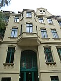
Apartment building in closed development with front garden | Brückenstrasse 3 (map) |
Around 1906 | Significant in terms of building history and urban development. Bay windows on the first and second floors with semicircular balconies, some with bars. Stairwell beautiful colored leaded glass windows. Floor tiles. Verandas facing the courtyard. |
09281281 |
 |
Residential house in closed development, corner house | Brückenstraße 4 (main address: Heynestraße 1) (map) |
Around 1908 | Significant in terms of building history and urban development. Corner with semicircular balconies and bay windows (on Brückenstrasse), verandas on the courtyard side. Stairwell stained glass windows. |
09281278 |
 |
Dry cleaning and laundry administration building | Brückenstrasse 7 (map) |
From 1870 (factory); around 1890 (main buildings with segmental arches) | Origin unclear, important in terms of local history. Clinker brick construction, all rear buildings in ruins. Former buildings belonging to the complex partly demolished or collapsed. |
09281924 |
 |
Factory building of the VEB fire extinguisher plant in Görlitz | Brückenstrasse 9 (map) |
Around 1890 (main buildings with segmental arches) | Founded as a factory for fire fighting equipment, pumps and metal goods, after 1945 VEB fire extinguishing device, production hall made of clinker masonry on the street, of architectural and local significance. Gothic gable with narrow, round windows at the top. Buildings belonging to the factory partly demolished or collapsed since 2000, factory from 1884. |
09281140 |
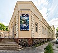 |
Tivoli bowling and athletes' home as well as the “Tivoli” restaurant with enclosure wall and guest garden facing Brückenstraße | Brückenstraße 12, 13 (main address: Dr.-Kahlbaum-Allee 14) (map) |
1850s first buildings; New buildings around 1905 and 1920s | From 1868 it was built in place of the Wilhelmsbad, from 1925 Görlitzer Kegler-Sportheim, of architectural and local significance. Large building with hall, single-storey building with inscription, enclosing wall made of Cyclopean quarry stone masonry. |
09281546 |
| Residential building in closed development | Brunnenstrasse 4 (map) |
After 1800 | Architecturally important, pike dormers |
09280069 |
|
| Residential building in closed development | Brunnenstrasse 8 (map) |
1860s | Significant urban planning, small house |
09280068 |
|
| Residential building in closed development | Brunnenstrasse 9 (map) |
1853 | At times the restaurant Zum Krug, of local importance. Profiled cornices. Original windows and door. |
09282198 |
|
 |
Residential building in closed development | Brunnenstrasse 10 (map) |
1850s | Of importance in terms of urban planning, small house, console frieze |
09280067 |
 More pictures |
Wagon construction ; Factory with the buildings that remained in 2010 | Brunnenstrasse 11 (map) |
From 1870–1956 (part of the factory); 1903 (social building); 1901–1956 (factory building); 1956 (boiler house); 1900 (four administration buildings) | The following buildings clockwise: Administration building by Christoph Lüders on Brunnenstrasse (1853), all subsequent buildings on the southern long side of the area on Conrad-Schiedt-Strasse, all clinker bricks, the buildings at Hilgerstrasse 15, 14, 13 (Fourniererei), north Hilgerstrasse 13, the hall with the railway entrance, the buildings on the northern long side of the area remaining on Christoph-Lüders-Strasse in the western area, the clinker walls remaining as a single-storey enclosure from the demolished buildings along eastern Christoph-Lüders-Strasse, the one around the corner Skeleton building with a glass facade from the 1960s facing Teichstrasse with two framing stair towers, the two-storey long building with an attic along Teichstrasse from the 1960s, the clinker brick building at Conrad-Schiedt-Strasse 2, angled to the west along the main entrance, and the shed roof hall, which closes the emerging horseshoe to the west, economic history, local history importance in terms of building history |
09280066 |
 |
Wagon construction ; Factory II with water tower, old fire station (brick), production hall 236 (clinker) and transfer platform in front of this hall, production hall 256 (clinker) and boiler house (clinker) | Christoph-Lüders-Strasse 24 (map) |
1906 (water tower); 1930 (halls and boiler house); 1959 (halls and boiler house) | Significant in terms of building history, local history and technology history. At the beginning of the 20th century, the Görlitz wagon building had an economic boom due to the high demand for rail vehicles. The increased production demanded a secure water supply, whereupon an in-house water tower was built on the factory premises on Christoph-Lüders-Straße. The circular tower rests on a natural stone base, its shaft is made of red bricks. Pilaster strips, which merge into a round-arched frieze at the upper end of the tower shaft, divide the outer shell into six fields. The three tower floors are lit through differently designed windows: a row of tall rectangular openings with straight lintels, brightly set off in sandstone, are inserted above the base. On the second floor, two arched windows are covered by a large blind arch with oculus, and the third floor has an unadorned, standing rectangular window in the middle of each wall field. A spherical steel tank serves as a water reservoir, the transition zone of which from the brick tower shaft to the pressure ring is clad with a light-colored conical shell made of sheet steel. The container itself is covered by a tiled dome roof with bat dormers and an elaborately designed open roof lantern with a high spire and weather vane (marked 1906). The high design standards of this water tower built for the provision of service water in Plant II of the Görlitz wagon building give the water tower not only technical history but also architectural history.
Water tower (Flur 44, Flst 87): with copper lantern and spike LVII / 6 / 1-35 (possibly with these photos of the wagon construction) |
09285377 |
| Residential building | Christoph-Lüders-Strasse 33 (map) |
Around 1925 | Art Deco ornamentation, important in terms of building history. Everything original also inside. Staircase window with economical colored lead glazing. Floor tiles. |
09280055 |
|
| Property with residential and commercial purpose, several structures built together along the Kummerau with the gables, plus the northern angled building, at the main entrance to the Kummerau plaque above the entrance "Built by Johann Gottlob Petzold in 1863" | Christoph-Lüders-Strasse 36 (map) |
Marked 1863 | Three structures built together along the Kummerau with the gables, the northern angled, Greek barrack a wooden structure built in the basilical scheme, initially built for the 7000 Greek soldiers housed in Moys from 1916 to 1918 and moved here in 1924, architectural and economic historical value, the Greek barrack with a unique one historical value.
Greek barracks: In 1920 the property belonged to the open trading company H. Rudolph & Co. Görlitz, a freight forwarding company. Letter from the Telegraph Construction Office to the building police in Görlitz am Postplatz, March 21, 1924: “On April 1, 1924, the Telegraph Construction Office relocated its construction equipment warehouse from the Ludwig u. Co. At the White Wall to the property of the forwarding agent Rudolph in Christoph-Lüdersstrasse. ... However, since a storage shed, which is intended exclusively for the storage of iron building tools and porcelain double bells, does not yet exist, the telegraph construction office has to build one itself. For this purpose, the Rudolph company provided us with a well-preserved dismantled Greek barracks. " In 1924 the storage shed for the Görlitz telegraph office was built on the site. The Greek barrack comes from the 7000 Greek soldiers interned in Görlitz from 1916 onwards from the so-called Greek camp in Görlitz. At the main entrance to the Kummerau plaque above the entrance "Built by Johann Gottlob Petzold in 1863". Once an address in the ponds, it may have belonged to the brickworks to the east. |
09280058 |
|
 |
Residential building in closed development | Christoph-Lüders-Strasse 39 (map) |
1920s | Significant urban development, original front door |
09289204 |
 |
Apartment building in closed development | Christoph-Lüders-Strasse 40 (map) |
Around 1900 | Significant in terms of building history and urban development. Art Nouveau plaster drawings. |
09280059 |
 |
Apartment building in closed development | Christoph-Lüders-Strasse 41 (map) |
Around 1900 | Significant in terms of building history and urban development |
09280060 |
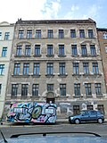 |
Apartment building in closed development | Christoph-Lüders-Strasse 42 (map) |
Around 1900 | Significant in terms of building history and urban development |
09280061 |
 |
Apartment building in closed development | Christoph-Lüders-Strasse 43 (map) |
Around 1912 | Significant in terms of building history and urban development. Plain facade with various cornices and profiles, the latter above the windows. Original windows with vertically grooved skylights. Beautiful original staircase furnishings. |
09280062 |
 |
Apartment building in closed development, four outbuildings and workshop building in the courtyard | Christoph-Lüders-Strasse 44 (map) |
Around 1912 | Significant in terms of building history and urban development. Elaborate design. Facade structure with fluted half-columns, pilaster strips, sparse little ornaments. Plaster grooves on the ground floor. Original windows as in number 43. Two stairwells with colored lead glass windows. Eastern group of buildings in the courtyard consisting of three building parts in clinker brick construction, courtyard building in the north plastered with clinker brick, in the middle a very large gate, right and left a large window, safe car shed, southwest building in the courtyard workshop building, clinker brick. |
09280063 |
 |
Factory, to the left in a closed area | Christoph-Lüders-Strasse 45 (map) |
Before 1900 | Of significance in terms of technology history. Large hall, plaster with clinker brick structure, rear part broken off. |
09280064 |
| Apartment building in the type of closed development | Cottbuser Strasse 5 (map) |
Around 1900 | Significant in terms of building history and urban development. Colored stucco in the throat in the entrance area. Remnants of ceiling and wall paintings. Terrazzo mosaic floor. Art Nouveau stencil painting with floral motifs in the stairwell. |
09280946 |
|
| Apartment building in closed development | Cottbuser Strasse 6 (map) |
Around 1895 | Significant in terms of building history and urban development. Stucco in throat in the entrance area. Terrazzo with a mosaic. |
09280945 |
|
| Apartment building in closed development, corner house on Rauschwalder Straße | Cottbuser Strasse 7 (map) |
1901 | The house of the "Thor-Controle" stood here until 1877, which is of great architectural and urban importance. Previously with a shop. At the corner of Rauschwalder Strasse balconies with bars on the first, second and third floors. Corner gable. Stucco in throat in the entrance area. Staircase window painted with stencils. |
09280963 |
|
| Apartment building in closed development | Cottbuser Strasse 8 (map) |
1901 | Significant in terms of building history and urban development. Beautiful stairwell windows (painted white with a stencil?). |
09280962 |
|
| Apartment building in closed development | Cottbuser Strasse 9 (map) |
Around 1890 | Significant in terms of building history and urban development. Partially etched staircase window. Floor tiles. |
09280961 |
|
| Apartment building in closed development | Cottbuser Strasse 10 (map) |
Around 1890 | Significant in terms of building history and urban development, the lettering "Zentralviehverwaltung GmbH". Partially etched staircase window. |
09280960 |
|
| 9. Community school with gym | Cottbuser Strasse 11, 12, 12a (map) |
1893/94 | Clinker brick building, of importance in terms of architectural history, the history of the town and the appearance of the streets. Gym number 12a, Flst. 91, hallway 54. |
09280959 |
|
| Slaughterhouse with all existing buildings, including new administration building with rear hall extension, the original clinker buildings, including boiler house with chimney, old slaughterhouse, journeyman's house, calf hall, as plastered buildings the porter's house, the police and horse slaughterhouse and the wall to Cottbuser Straße (these extensions by Hugo Frond) | Cottbuser Strasse 21, 22, 23 (map) |
From 1894 (slaughterhouse part); around 1910 (calf hall, boiler house with chimney and slaughterhouse); around 1957 (to no. 23) | See also the administration building at Rauschwalder Straße 73, which is of importance in terms of building history and technology. Probably the old entrance to the stable on Cottbusser Straße. The entrance gate is closed (clinker brick painted). The new administration building: typical construction of the late 1950s in the GDR, slightly baroque architecture with hipped roof, high windows, roof houses. The new gatehouse (gatehouse, number 22) from the 20s / 30s. Granite with partial ceramic cladding. All clinker buildings around 1894. Heating house, with old chimney / old slaughterhouse / journeyman's house / calf hall (somewhat ruinous). Former entrance on Rauschwalder Straße. To the right of this driveway, a little set back from Rauschwalder Strasse. 1910 New building of the Volksbrausebad. In the north-western corner the police slaughterhouse (number 21), to the right of it a little smaller the Kuttelei, to the right of it the horse slaughterhouse. Plastered buildings. From 1878 plans to build the slaughterhouse on the former Opitz property, the first buildings probably planned as plastered buildings, it is questionable whether any of them are still standing. |
09280958 |
|
| Factory building | Cottbuser Strasse 28, 29, 30 (map) |
1920s | Structure with clinker strips, in between plaster parapet areas, important from an architectural point of view |
09282499 |
|
| Apartment building in the type of closed development | Cottbuser Strasse 32 (map) |
Around 1900 | Significant in terms of building history and the appearance of the street |
09281211 |
|
 More pictures |
City Theatre | Demianiplatz 2 (map) |
1848 to 1851 | Late classicist building, expanded by renovations in 1927 and changed in the picture, original building according to plans by the Berlin architect Eduard Titz , executed by master bricklayer Kießling, of importance in terms of the history of the building, the history of the place and the appearance of the square. The classicist building was rebuilt several times, probably in 1872/73, 1878, 1908, 1911, 1925 to 27 and 1939 (details vague). A side wing (north side?) Still shows the old design. The architect Eduard Titz from Berlin designed the first building. Inauguration premiere on October 5, 1851. |
09280669 |
 |
Residential and commercial building in closed development, with shops with original shop fronts | Demianiplatz 8 (map) |
1853 | Architecturally and urbanistically important, shop front around 1910 |
09281352 |
 |
Residential building in closed development | Demianiplatz 9 (map) |
1843 | Formerly the restaurant Zum Echten, the builder was the bar host Frenzel, which was of importance in terms of building history and urban development. Shop on the ground floor, central axes raised and emphasized with triangular gables. |
09281351 |
 More pictures |
Residential and commercial building, corner house | Demianiplatz 10 (map) |
1901/02 | By Hermann and Georg Bargou, a big city building, facade with Art Nouveau elements, of significance in terms of architecture and architecture. Corner balconies and four more balconies. Shops over two floors. Also formerly address Marienplatz 5. According to ALK data only number 10. |
09281350 |
 More pictures |
"Zum Strauss" department store | Demianiplatz 12, 13 (main address: An der Frauenkirche 5, 6, 7) (map) |
1912/13 | Art Nouveau building based on the model of the Wertheim department store in Berlin by Alfred Messel , of importance in terms of architectural and artistic, art history, local history and the appearance of the square |
09283015 |
 |
Residential and commercial building in closed development, rounded corner house | Demianiplatz 14 (main address: An der Frauenkirche 4) (map) |
Before 1914 | Demianiplatz 14, too, is of importance in terms of building history and shaping the street scene. 1st floor fluted columns. Two bay windows, figurative sculptures, surrounding balconies. Architect: Rudolf Bitzan . |
09281387 |
 |
Residential house in closed development, with shop (butcher) with original Art Nouveau tiles | Demianiplatz 15 (map) |
3rd quarter of the 19th century | Significant in terms of building history and urban development |
09281690 |
 |
Residential house in closed development, with shop | Demianiplatz 18 (map) |
1842 | Architecturally significant, first floor disrupted |
09281693 |
 |
Residential and commercial building in closed development, with shops | Demianiplatz 19, 20 (map) |
Marked 1863 | Shops in number 19 originally from around 1900, changed in number 20, facades upgraded in a historicizing way, of importance in terms of building history and urban development |
09281695 |
 More pictures |
Residential building in closed development and rear building, with passage "Theaterpassage" | Demianiplatz 21 (map) |
Around 1860 | Architecturally and in terms of urban development, it is of importance, first floor front building with modified shop front |
09281779 |
 |
Residential building in closed development | Demianiplatz 22 (map) |
1852 | Late classical facade, original shop door, of architectural and urban significance. Ground floor perhaps changed in the 19th century. |
09281780 |
 |
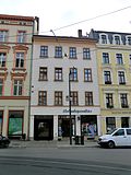
Residential house in closed development with courtyard wing and rear building of the Görlitzer Nachrichten | Demianiplatz 23, 24 (map) |
Around 1870 (residential building); around 1900 (Görlitzer Nachrichten) | Classical structure of the facade, important in terms of building history and local history |
09281781 |
 |
Residential building in closed development and the Görlitzer Nachrichten printing house in the courtyard | Demianiplatz 25 (map) |
Around 1850 (house); 1914 (printer) | Structurally and locally of importance. Simple facade, courtyard entrance. Ground floor shop fronts slightly changed. Printing: red clinker brick, partially plastered, with relief busts printer, rich stucco. |
09302583 |
 |
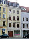
Residential building with shops in closed development and workshop building in the courtyard | Demianiplatz 26 (map) |
Marked 1878 | Architecturally important. Neo-Renaissance facade, backyard building questionable (left side wing, clinker brick, 19th century, right side wing from the 1920s, 20th century, very simple factory building). Was (after its construction ???) the central warehouse of the consumer association founded in 1887. |
09281783 |
 |
Residential house with shop in a closed development and workshop building in the courtyard | Demianiplatz 27 (map) |
Around 1870 | Structurally and urbanistically important, plaster divisions |
09281784 |
 |
Residential and commercial building and printing workshop building in the courtyard | Demianiplatz 28 (map) |
After 1850 (residential and office buildings); 1894 (workshop) | In front, once restoration to Zum Rebstock, later to Zum Mönchshof, from 1894 “Neuer Görlitzer Anzeiger”, Art Deco façade, of architectural and local significance. Notable door. |
09281785 |
| House in closed development, with shops with original fronts | Demianiplatz 29, 30 (map) |
1887 | Significant in terms of building history and architecture. The original staircase, windows and apartment doors have been preserved. |
09281786 |
|
| House in closed development, with shop with original front | Demianiplatz 31 (map) |
1853 | In terms of urban planning and building history, the window is almost flush with the wall surface |
09281787 |
|
 |
Residential house in closed development, with shop | Demianiplatz 32 (map) |
1868 | Builder Victualienhandel Springer, of architectural importance |
09281788 |
| Residential house in closed development, with courtyard wing | Demianiplatz 33 (map) |
Around 1850 | Of importance in urban planning. Portal. Stairwell with doors and ceiling paintings. Courtyard wing with wooden loggias. Stucco in the courtyard passage. Original doors and windows. |
09281789 |
|
 |
Residential house in closed development and courtyard building, corner house with original shop fronts | Demianiplatz 34, 35 (Luisenstraße 1) (map) |
1881 (tenement house); 1900 (outbuilding) | Builder butcher Moritz Fehler, significant in terms of building history and space. Neo-Renaissance facade (including caryatids, reliefs, branded keystones). First floor hardly changed. Courtyard building, clinker brick 1900 or 1906. |
09281790 |
 |
Apartment house with shops in closed development, corner house | Demianiplatz 38 (main address: Luisenstraße 21) (map) |
1841 (part on Demianiplatz); 1868 (part of Luisenstrasse) | A facade on Demianiplatz 38, of importance in terms of building history and the appearance of the street. Beveled corner. Shops with the original front. |
09280322 |
| Residential building in closed development with a coat of arms above the entrance | Demianiplatz 39 (map) |
Around 1860 | Structurally and locally of importance. Theaterklause restaurant, rich ornamentation. |
09280348 |
|
| House in closed development, with shops with original fronts | Demianiplatz 40 (map) |
Around 1860 | Significant in terms of building history and urban development |
09280347 |
|
 |
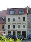
Apartment building in closed development, with shops with original fronts | Demianiplatz 41 (map) |
Around 1860 | Façade with plaster ornamentation, of architectural and artistic importance |
09280346 |
 |
Residential building in closed development | Demianiplatz 44 (map) |
1860s | Significant in terms of building history and urban development. Filigree ornamentation. |
09280089 |
 |
Residential building in closed development | Demianiplatz 45 (map) |
2nd quarter of the 19th century | Significant in terms of building history and urban development |
09282258 |
 |
Residential building in closed development | Demianiplatz 46 (map) |
After 1800 | Significant in terms of building history and urban development |
09282284 |
 |
Residential building in closed development | Demianiplatz 47 (map) |
2nd quarter of the 19th century | Significant in terms of building history and urban development |
09282286 |
 |
Seilerei Th. Reiss, Nachf. Köllner u. Goltz house in closed development | Demianiplatz 48 (map) |
After 1800 | With writing “Alte Seilerei”, of significance in terms of building history and urban planning. Bay window above the front door with triangular gable, rope factory founded in 1836. Third floor later added. |
09280090 |
 |
House in closed development, with shop with original front | Demianiplatz 49 (map) |
After 1800 | Significant in terms of building history and urban development. Middle bay above the first and second floors, with a small shop with the original front. |
09302592 |
 |
Apartment building in closed development | Demianiplatz 50 (map) |
1890s | With kink, important in terms of urban planning. Modern stores. Original door and window. Plaster divisions. |
09280091 |
| Residential house in closed development, with shop | Demianiplatz 51 (map) |
Around 1840 | Significant in terms of building history and urban development. House simple. Shop on the first floor around 1920, see number 52. |
09280092 |
|
| Residential house in closed development, with shop | Demianiplatz 52 (map) |
After 1800 | Significant in terms of building history and urban development. House simple, compare number 51. Center raised. Shop with original front. |
09280093 |
|
| Residential building in closed development | Demianiplatz 53 (map) |
Core after 1800, later disfigured | Of importance in urban planning |
09280094 |
|
 |
Gasthof "Zur Sonne" with relaxation, with all the buildings surrounding the courtyard, including the inner buildings and the archway: guest house, outbuilding with stables, coach house and stable building, southern half-timbered outbuilding with shed and two northern outbuildings | Demianiplatz 54 (map) |
Around 1850 (inn); around 1800 (Remisen building) | Also called Zur Goldenen Sonne, 1618 To the 3 Crabs, of architectural and local significance. Large complex surrounded by buildings on four sides. Large guest house, outbuilding with stable and granite spiral staircase, in the courtyard a coach house and stable building, south of the newer half-timbered building with shed. Also included the north outer wing. Large arch over the courtyard entrance. The coach house in the courtyard with three elevator hatches. Broken roof with pigeon exit hatches. |
09280088 |
 More pictures |
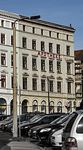
Residential and commercial building in closed development, corner house | Demianiplatz 55 (map) |
Around 1870 | Significant in terms of building history and urban development, design similar to number 56 |
09280087 |
 |
Residential and commercial building in closed development, corner house to Grünen Graben | Demianiplatz 56 (map) |
Around 1870 | Corner house to the Grünen Graben, birthplace of the satirist Werner Finck, of architectural and urban significance. Large representative building. Corner bay windows on the first and second floors, console frieze, arched ground floor windows. Cast iron stair gate, design also compare number 55. |
09280086 |
 |
Residential and commercial building in closed development, corner house | Dr.-Friedrichs-Straße 1 (main address: Berliner Straße 61) (map) |
1860s | Significant in terms of building history and urban development. Facade slightly over-shaped, ground floor changed, window on bay window on first floor changed. Partly original shop fittings (stairs and showcases) from the 30s and 40s. |
09280703 |
 |
Discount Society; Bank building, corner building | Dr.-Friedrichs-Straße 2, 2b (main address: Berliner Straße 62) (map) |
Before 1923 | Built as a Sparkasse and Stadtbank, later also “Deutsche Bank”, architect Alfred Hentschel, of importance in terms of building history, urban planning and the street scene. The municipal hospital had been on the municipal property since 1843/44, and was demolished in 1910. The city built it with Sparkasse and Stadtbank. Sparingly decorated structure with a kind of colossal order. Doors changed. Reliefs in plaster. Lead glass windows in the stairwell, here ribbon windows. |
09281807 |
| Residential house in closed development, with shop | Dr.-Friedrichs-Strasse 3 (map) |
Around 1870 | Façade with elements of the neo-renaissance style, of architectural and urban significance, ground floor preserved |
09280671 |
|
| Closed residential building and courtyard building (Volkshaus) | Dr.-Friedrichs-Strasse 4, 6 (map) |
1924 to 1926 (residential building); 1920s (club house) | The Volkshaus (number 6) elaborate architecture in the Art Deco style, also preserved inside, of architectural historical importance. Did the Volkshaus only have an address at Luisenstrasse 8? There is no Volkshaus there in the building files. |
09281806 |
|
| Residential house in closed development, with shop | Dr.-Friedrichs-Strasse 5 (map) |
Around 1870 | Façade with stylistic elements of the neo-renaissance, important in terms of building history and urban planning. Neo renaissance. Roof landscape disturbed. |
09280672 |
|
| Residential building in closed development | Dr.-Friedrichs-Strasse 7 (map) |
Around 1870 | Slender neo-renaissance facade, of architectural and urban importance, unsuitable roof extension |
09280673 |
|
| Apartment building with shop in closed development and northeastern courtyard building | Dr.-Friedrichs-Strasse 8 (map) |
1920s | Architect presumably Alfred Hentschel, important in terms of building history and urban development. First floor broken into by shops. Original window preserved. Art Deco appeal. North-western outbuilding in the courtyard in the same design as the front building. |
09281805 |
|
| Apartment building in closed development, with shop | Dr.-Friedrichs-Strasse 9 (map) |
1894 | Rich late-historical facade, of architectural and urban importance. Rich facade, very nice courtyard passage. |
09280674 |
|
| Apartment building in closed development | Dr.-Friedrichs-Strasse 10 (map) |
1890s | Elaborate historicism facade, of importance in terms of building history and urban planning. Neo-Gothic / Art Nouveau. Ground floor completely and partially changed in the entrance area. Door received. |
09281804 |
|
| Apartment building in closed development, with shop | Dr.-Friedrichs-Strasse 11 (map) |
Around 1895 | Representative historic facade, courtyard entrance with remnants of the ceiling painting, of architectural and urban importance. Richly designed facade, original shop window design. Nice passage through the courtyard. |
09280675 |
|
| Apartment building in closed development | Dr.-Friedrichs-Strasse 12 (map) |
Around 1870 | Of importance in urban planning. Facade changed (20s / 30s), worth preserving? Original windows and doors, later changed again. |
09281803 |
|
| Apartment building in closed development, with shop | Dr.-Friedrichs-Strasse 13 (map) |
Around 1895 | Architecturally high-quality facade of the late 19th century, of architectural significance. Ground floor changed in the 20s / 30s. |
09280676 |
|
| Apartment building with shop in closed development, corner house | Dr.-Friedrichs-Strasse 14 (Luisenstrasse 12) (map) |
Around 1870 | Significant in terms of building history and urban development. Most of the ground floor has been changed. Original rest in the corner shop. |
09281802 |
|
 |
Apartment building in closed development | Dr.-Friedrichs-Strasse 15 (map) |
Around 1895 | Of importance in urban planning |
09280677 |
| Traditional column of the Infantry Regiment IR 19 and for the "Warrior Honor of Inf. Rgt. V. Courbiere" | Dr.-Kahlbaum-Allee, near the Ständehaus (map) |
1938 | Pillar made of clinker brick with a square cross-section, on it a shell made of iron, on the side oak leaves, of local historical importance. Founded in the 19th century, the Infantry Regiment IR 19, the Görlitz Home Regiment, existed until 1914. Then it became the IR 8. After the reintroduction of compulsory military service in 1935, it was converted into IR 30. The column was opened in 1938 as a symbol of this history and as a warrior honor ( Signature on plan from 1938). Design by Heinz Grunwald, Uferstrasse 26. |
09281002 |
|
 More pictures |
Park of Peace; Park, also bordered by Brückenstraße and Louis-Braille-Straße, with a Jakob-Böhme monument, pool and memorial stone | Dr.-Kahlbaum-Allee (map) |
1905 (park area); 1898 (Jacob-Böhme-Monument); 1950s (inscription: Park of Peace) | Former villa park of the manufacturer Ernst Geißler, redesigned in 1905 to the public "Otto Müller Park" after the silk screen manufacturer Otto Müller, who bought the property in 1905 and donated it to the city, after the buildings were demolished in 1906, green area according to plans by the gardening director Emil Schneider, 1957 Renamed "Park of Peace", artistically, artistically and botanically of importance. |
09282981 |
| avenue | Dr.-Kahlbaum-Allee (map) |
Around 1850 | Laid out as a promenade, a four-row tree-lined avenue through the cattle pasture from the portico to the Obermühlberge, here the log house in 1857, remnants of the old trees, essentially two rows of linden trees on the west side of the northern section, a row of different deciduous trees on the east side of the southern section, southernmost section Today is not called Dr.-Kahlbaum-Allee, but is part of the Obermühlberge, urban history and landscape design significance. |
09282983 |
|
| Park with promenade, Schiller monument, viewing platforms, path system, stairs, fence and sidewalk (Obermühlberge; park with Schiller monument; municipal facilities; promenade; Neisse slopes) | Dr.-Kahlbaum-Allee (between Blockhausstraße and Neisse); Blockhausstrasse (map) |
1829-1836 (Promenade); from 1850 (park area); 1859 (Schiller Monument) | Bounded by Blockhausstrasse, Dr.-Kahlbaum-Allee, Neisseufer and railway line, with plateau and Neisse slopes, on the Promenade plateau as the southern end of the promenade from the portico to the Obermühlberge as a four-row linden avenue with an old river pebble bed, Schiller monument with a bust of Johann Heinrich Dannecker , two Viewing platforms and a viewing point with iron fence parapets, eastern sidewalk on Blockhausstraße with basalt paving, on the plateau from 1857 the blockhouse as an inn (see Blockhausstraße 9 - Object 09280875), Neisse slopes and banks with path system, stairs and old trees, seamless transition to the south the area of vineyards and Weinlache, also municipal facilities, of importance in terms of urban history, landscape design and gardening. |
09302369 |
|
 More pictures |
Tivoli bowling and athletes' home as well as the “Tivoli” restaurant with enclosure wall and guest garden facing Brückenstraße | Dr.-Kahlbaum-Allee 14 (Brückenstraße 12, 13) (map) |
1850s first buildings; New buildings around 1905 and 1920s | From 1868 it was built in place of the Wilhelmsbad, from 1925 Görlitzer Kegler-Sportheim, of architectural and local significance. Large building with hall, single-storey building with inscription, enclosing wall made of Cyclopean quarry stone masonry. |
09281546 |
| Administration building of the fire extinguishing equipment plant in the rear part of the property | Dr.-Kahlbaum-Allee 15 (map) |
Around 1880 | Preserved only two parts of the building in the rear part of the property, according to the 1909 address book Görlitzer Wollwäschei und Karbonisieranstalt Schmitt und Hoffmann, wool and piece dyeing O. Gruhne, cloth factory Peltzer und Lutze GmbH, in GDR times the administration building of the fire extinguishing equipment factory, of local historical importance |
09289202 |
|
| Factory owner's villa of the Obermühle | Dr.-Kahlbaum-Allee 16 (map) |
Around 1890 | Light-colored facing bricks with plaster structures, architecturally high-quality building, of local historical importance |
09281019 |
|
| Kahlbaumsche Nervenklinik (totality) | Dr.-Kahlbaum-Allee 17 (Querstraße 12; James-von-Moltke-Straße 25) (map) |
1854-1930 | All of the Kahlbaum mental health clinic with the following individual monuments: Karl Ludwig Kahlbaum's house , office and reception building (1), a house with James-von-Moltke-Strasse 25 (see Obj. 09281322). Schweizerhaus (3). House with a tower (4). Farm building (5). Society house (6). Kurhaus for light cases and Reimer's residential building (7) with a water basin behind. Medical pedagogy with bowling alley, workshop and gymnasium (8), plus the long, single-storey verandas with closed rear wall, which form an angle with each other and with house 8 a courtyard, reclining halls (garages on the back no individual monuments). Sick cells for moderately severe cases, men (9), facing east with an open wooden porch, plus the open wooden pavilion to the east. Sick cells for moderate cases men (10). Tobacco cells, dining room and sick cells for severe cases men (11). Kesselhaus (12, Querstraße 12). Small outbuilding to the east of house 13 and an open building, probably a shelter, to the west of house 13. A wooden pavilion open on one side with cracks on the gable southwest of house 3. An open wooden pavilion east of house 9. An open wooden pavilion near the Dr.-Kahlbaum- Avenue. Chapel as a stone garden house with arched openings, stone stairs leading up and basement on Kahlbaumallee. A small gate house next to House 1. A reception house on Querstraße, north of House 5. A long, single-storey building with a closed rear wall parallel to Moltkestraße, possibly a lounge area with garages. An open iron pavilion southwest of House 6 (see individual monuments at the same address, Obj. 09281320) as well as the institutional garden in its spatial formation and area structure with floor relief, path system, structure and space-forming planting, water basin, seating area and retaining walls (garden monument) and the following parts: garages (2) and workshops (13); Of importance in terms of building history, medical history, site history and garden design |
09302549 |
|
| House Karl Ludwig bald tree , administrative and reception building (1), a house with James von Moltke-Straße 25 Swiss house (3). House with a tower (4). Farm building (5). Society house (6). Kurhaus for light cases and Reimer's residential building (7) with a water basin behind. Medical pedagogy with bowling alley, workshop and gymnasium (8), plus the long, single-storey verandas with closed rear wall, which form an angle with each other and with house 8 a courtyard, reclining halls (garages on the back no individual monuments). Sick cells for moderately severe cases, men (9), facing east with an open wooden porch, plus the open wooden pavilion to the east. Sick cells for moderate cases men (10). Tobacco cells, dining room and sick cells for severe cases men (11). Kesselhaus (12, Querstraße 12). Small outbuilding to the east of house 13 and an open building, probably a shelter, to the west of house 13. A wooden pavilion open on one side with cracks on the gable southwest of house 3. An open wooden pavilion east of house 9. An open wooden pavilion near the Dr.-Kahlbaum- Avenue. Chapel as a stone garden house with arched openings, stone stairs leading up and basement on Kahlbaumallee. A small gate house next to House 1. A reception house on Querstraße, north of House 5. A long, single-storey building with a closed rear wall parallel to Moltkestraße, possibly a lounge area with garages. An open iron pavilion southwest of house 6 and the institution garden (garden monument, see also general document Obj. 09302549) | Dr.-Kahlbaum-Allee 17 (map) |
1854 (Kurhaus, 7); 1854–1884 (Medical Education, House 8); 1854–1897 (three sick cells, house 9–11); 1885–1887 (Gesellschaftshaus, 6); after 1854 (small reception building on Querstraße) | Individual features of the aggregate Kahlbaumsche Nervenklinik; Of importance in terms of building history, medical history, site history and garden design.
Brief description: Clinic founded in 1854 by doctor Hermann Andreas Reimer, taken over by Karl Ludwig Kahlbaum in 1867. The entirety of the entire clinic premises, see map for scope, with the following individual monuments: The entire park-like area including the path system, the paved streets, stairs and smaller and larger walls (CIX / 60/1 to 3, 6, 9 to 11, 14 to 18, CIX / 61/37). |
09281320 |
|
 |
Free villa | Dr.-Kahlbaum-Allee 21 (map) |
1887 | The client was the builder of the free swimming pool to the north of it, clinker brick with plastered surfaces, of importance in terms of both building history and local history. Verandas at the back. |
09281067 |
 More pictures |
Outdoor pool ; Cold water sanatorium; Hydropathic and bathing establishment with several pools for swimming and for tubs and steam baths | Dr.-Kahlbaum-Allee 22 (map) |
1885-1887 | Founded by Medical Councilor Walter Freise (1856–1918), of importance in terms of building history, social history and local history. Old baths of different classes, very nice old swimming pool with a great open roof structure, considerable ceiling construction, all clinker brick, partly colored glaze. Original steam bath with underfloor heating. Old laundry roll, old boiler house, old laundry. To consider everything as a technical monument. Building clinker with plaster. |
09281068 |
| Villa with enclosure and garden | Dr.-Kahlbaum-Allee 27 (map) |
1880 | The client was the factory owner Leopold Heymann, which is of great architectural importance. Ground floor arbor with later grilles, on the first floor balcony with old grilles. Cast iron stair gate. Enclosure in stone plinth and iron stakes. |
09281069 |
|
| enclosure | Dr.-Kahlbaum-Allee 30 (map) |
Around 1908 | From Lossow and Kühne , historically and historically significant. Formerly Katz Villa, villa destroyed. |
09280995 |
|
 More pictures |
Ständehaus as a three-wing complex and garden with old trees | Dr.-Kahlbaum-Allee 31 (map) |
1853/54 | Architect Carl Ferdinand Busse , of architectural and local importance. Large quarry stone masonry left visible. Main building with central projectile and porch with balcony. Battlements. Gothic windows. Courtyard-side stair tower. Round stairwell in the main building. Seat of the estates of the Prussian Upper Lusatia. Former Remisentrakt, now a new building for assisted living. |
09280997 |
| Apartment building in closed development | Dresdener Strasse 2 (map) |
Around 1885 | Significant in terms of building history and urban development. Original windows and doors. |
09283016 |
|
 |
Apartment building in closed development | Dresdener Strasse 3 (map) |
1860s | Early construction of the area, structure with cornices, important in terms of building history and urban planning. Original windows and door. |
09282196 |
 |
Apartment building in closed development | Dresdener Strasse 4 (map) |
Around 1895 | Significant in terms of building history and urban development. Original windows and door. |
09281249 |
 |
Apartment building in closed development, with shop | Dresdener Strasse 5 (map) |
Around 1880 | Significant in terms of building history and urban development. Original windows and door. |
09281248 |
 |
Apartment building in closed development | Dresdener Strasse 6 (map) |
Around 1895 | Significant in terms of building history and urban development. Partly yellow clinker with plaster. Six balconies with wrought iron bars. Original windows and door. |
09281247 |
 |
Apartment house of the type in closed development and rear building | Dresdener Strasse 8 (map) |
1876 (rear building); 1884 (rear building); 1888 (tenement house) | Significant in terms of building history and urban development. The four-storey building has ground and three upper floors, a jamb and a slightly high gable roof. The house has seven window axes. On the far left there is a passage through the courtyard from which the stairwell is also accessible. This passage through the courtyard and the fire walls on the right and left show that the city intended to build a closed development that would close the gaps, which has not yet materialized. The design language of the elements is extremely eclectic. The forms, especially of the window roofs, are partly invented in free fiction, partly borrowed from the Renaissance, the Baroque or Classicism. As with the exterior, there is also a demand for representation inside the house. |
09281246 |
| Secret Annex | Dresdener Strasse 10 (map) |
2nd half of the 19th century | Front building does not exist, historically significant |
09282195 |
|
| Apartment house of the type in closed development | Dresdener Strasse 11 (map) |
1885/1895 | Significant in terms of building history and urban development |
09282081 |
|
| Apartment building in closed development | Dresdener Strasse 12 (map) |
Around 1870 | Significant in terms of building history and urban development. Nice original windows. |
09282080 |
|
| Apartment building in closed development and rear building | Dresdener Strasse 13 (map) |
1885/1895 | Significant in terms of building history and urban development. New store. Portrait busts in medallions. Clinker courtyard wing. Original door. |
09282079 |
|
| Apartment building in closed development and two outbuildings | Dresdener Strasse 14 (map) |
3rd quarter of the 19th century | Structurally and in terms of urban development, it is of importance, jetty floor |
09282078 |
|
| Apartment building in closed development | Dresdener Strasse 15 (map) |
Around 1870 | Significant in terms of building history and urban development. Original windows and door. Art Deco painting with wax paints. |
09282077 |
|
| Apartment building in closed development, with shops with original front, corner house | Dresdener Straße 16 (main address: Krölstraße 15) (map) |
Around 1890 | Clinker brick facade on the second and third floors, of importance in terms of building history and the street scene, corner bay windows above the first and second floors |
09281245 |
|
| Apartment building with shops in closed development, corner house on Krölstrasse | Dresdener Strasse 17 (map) |
Around 1880 | Elaborate design with caryatids, important in terms of building history and urban planning. Original equipment, entrance area stucco in the throat. Original windows and doors. Entrance door painted with stencils. |
09281430 |
|
 |
Apartment building with shop in closed development, rear building across the corner with No. 18a and shed on the right with a wooden structure | Dresdener Strasse 18 (map) |
1890s | Significant in terms of building history and urban development. Ground floor left: shop with original front and original interior design. Original door and window. |
09281431 |
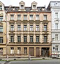 |
Apartment building with shop in closed development and rear building across the corner with No. 18 | Dresdener Strasse 18a (map) |
Around 1885 | Significant in terms of building history and urban development. Ground floor right: shop with original front, original interior design, original windows and door. |
09303581 |
| Apartment building in closed development | Dresdener Strasse 19 (map) |
Around 1880 | Significant in terms of building history and urban development. Filigree stucco. Soap and detergent factory in rear buildings 18 and 18a demolished in 2012. |
09281433 |
|
| Apartment building in closed development | Dresdener Strasse 20 (map) |
1881 | Structurally and in terms of urban development, it is of importance, jetty floor |
09281434 |
|
| Residential house, of the type in closed development | Dresdener Strasse 27 (map) |
Around 1890 | Significant in terms of building history and urban development, structure of the pilaster strips, facade somewhat smoothed |
09289205 |
|
| Apartment building in closed development, with a small shop with the original front | Dresdener Strasse 28 (map) |
Around 1890 | Significant in terms of building history and urban development. Eclecticism. Central gable. |
09281436 |
|
| Apartment building with shop in closed development, corner house | Dresdener Strasse 29 (main address: Salomonstrasse 37) (map) |
Around 1880 | Significant in terms of building history and urban development. Beveled corner, original windows, otherwise smoothed facade. |
09285607 |
Deletions from the list of monuments
| image | designation | location | Dating | description | ID |
|---|---|---|---|---|---|
| Neisse slope; Park on the Neisse slope with its spatial structure and area structure, with remnants of the path system, structure and space-creating planting and viewing platform to the Neisse with a solitary tree and enclosure | Blockhausstraße, slopes east of the blockhouse and north of the viaduct (map) |
1872 (ground relief) | Of importance in terms of local history and garden design; integrated into monument with ID 09302369 after 2014 |
09282990 |
|
| Waggonbau Görlitz | Christoph-Lüders-Strasse 1 (map) |
1920s (reinforced concrete skeleton construction); before 1900 (factory building) | Significant in terms of building history, local history and technology history; tore off |
09280057 |
|
| Apartment building with shop in closed development, corner house | Cottbuser Strasse 24 (map) |
Around 1880 | Shop with original front and remarkable doors from the 1920s, of architectural and urban significance (main address: Rauschwalder Straße 64); Removed from the list of monuments after 2014 |
09280957 |
|
 |
Residential house with shop in closed development, corner house on Bautzener Strasse | Demianiplatz 42 (map) |
Around 1860 | Of importance in terms of building history and urban planning; Removed from the list of monuments after 2014 |
09280345 |
| Lindenallee (four rows, linden trees) from the log house to Dr.-Kahlbaum-Allee | Dr.-Kahlbaum-Allee (map) |
Around 1850 | Urban planning of importance; integrated into monument with ID 09302369 after 2014 |
09282988 |
Remarks
- This list is not suitable for deriving binding statements on the monument status of an object. As far as a legally binding determination of the listed property of an object is desired, the owner can apply to the responsible lower monument protection authority for a notice.
- The official list of cultural monuments is never closed. It is permanently changed through clarifications, new additions or deletions. A transfer of such changes to this list is not guaranteed at the moment.
- The monument quality of an object does not depend on its entry in this or the official list. Objects that are not listed can also be monuments.
- Basically, the property of a monument extends to the substance and appearance as a whole, including the interior. Deviating applies if only parts are expressly protected (e.g. the facade).
Detailed memorial texts
-
^ History: 1844-1847 construction of the railway viaduct over the Neisse; 1855 Construction of the log house, originally for military surveillance of the bridgehead on the viaduct, but developed into a popular restaurant for excursions among the Görlitzers, the end of the promenade; 1858 horticultural expansion of the facilities on the hillside of the Obermühlberg and in front of the log house; 1871 renamed "Friedenshöhe" to commemorate the end of the Franco-German war in 1870/1871, design as a public area, planting of peace oaks; 1891 Installation of a bronze memorial for the general Prince Friedrich Karl of Prussia by the Berlin sculptor Franz Ochs (1852-1903), melted down in 1942; until 1940 it was repeatedly redesigned and improved, 1940-1950 used as allotment gardens; 1952 Draft for the redesign of the Friedenshöhe (part of the facility south-east of the log house) by Görlitz garden director Henry Kraft (1899-1979), carried out as part of the national structure, installation of three groups of artificial stone figures by the Bautzner sculptor Rudolf Enderlein (1908–1985): Girl with a hangover , Boy with cat, boy with dachshund; 1965 Revision and addition of the garden by Henry Kraft in line with the design from 1952; 2003 repair
- Structural assets:
- Entrances: Main entrance from Goethestrasse, direct transition to the adjacent vineyard complex to the south (object 09282977)
- Path system: landscaped curved paths with a water-bound cover,
- Garden furnishings: three roughly life-size garden sculptures (groups of children's figures), artificial casting, sculptor Rudolf Enderlein (1908–1985): girl with hangover, boy with cat, boy with dachshund
- Horticultural buildings: viewing platform with a view of the Neisse valley and the railway viaduct, pergola with supports made of hewn sandstone and wooden support, planted with real wine (Vitis vinifera)
- Vegetation: younger trees
- Individual trees: Trumpet tree (Catalpa) at the entrance from Goethestrasse, shrub beds in the northern area
- Other protected assets:
- Ground relief: steeply sloping slope to the east to the Neisse
- Viewing relationship: viewing platform with a view of the Neißetal and the viaduct
- Structural assets:
- ↑ Old KB: Waggonbau Görlitz factory with different parts of the building: Christoph Lüders's residential and commercial building on Brunnenstrasse (1849), 105 administration building (1905), 106 and 107 administration building (1900), 108 boiler house (1956), 109 and 110 assembly carpentry shop ( 1901), 111 and 112 assembly carpentry, 113 non-ferrous metal stores (1924), 114 non-ferrous metal stores (1894), 115 to 120 woodworking (1900), 121 administration building (1923), 122 plywood production / veneering (1929), 123 and 125 kitchen and canteen buildings as well Porter's office, offices (1903), 124 passage (1900), 126 plastic workshop / paint store (1900), 130 assembly hall (1954), 131 final paint scheme (1952), 132 office building (1900), 133 spray hall (1951), extension 1909, 138 office building (1943), 148 warehouse (1929), 149 tool shed (1967), 153 assembly hall (1956), 154 assembly hall (1947), see also Christoph-Lüders-Straße 1 and 24 and Hilgerstraße 4, 5, 6, 7 and 13, 14.15, of importance in terms of building history, local history and technology history. Clinker buildings with shed roofs, behind a large hall (clinker brick), large iron gate. To the left of this plastered building, with adjoining clinker buildings, extends far into the depths of the property. Specially equipped board room. The buildings at Christoph-Lüders-Straße 128, 120, 148, 149, 150, halls 130/131/132/133 and 154 will be demolished by 2010. All other buildings are under protection (as of 2015).
-
↑ Jakob Böhme , philosopher, 1575-1624, monument: bronze / sandstone, artist Johannes Pfuhl , 1846-1914. Figurative representation on a base, cast in Lauchhammer in 1898. Description of the garden monument (Ragnhild Kober, September 10, 2008):
- History: up to the middle of the 19th century, the cloth manufacturer Ernst Geißler bought the garden parcels on the site, demolished a summer cottage there and built a villa, a summer house and horse stables, and created a park around a pond that was open to the citizens of the city , 1904 sale of the area to a real estate company, in 1905 the screen silk manufacturer Otto Müller acquires the area in order to donate it to the city, demolition of the building and in 1906 redesign according to plans by gardening director Ernst Schneider, taking into account existing elements, in which "Otto-Müller -Park "the so-called" Gute Stube "(regular architectural system with trellises, seating, marble figures and flower beds), renamed" Park des Friedens "on the World Day of Peace on September 1, 1957, 1972 erection of the Jakob Böhme monument in the area of the former, Already abandoned "good room", filling of the pond
- Access: curved path system
- Soil relief: landscaped soil modeling (former pond was filled in due to insufficient water supply), flat area in the central east area with Jacob Böhme monument (formerly the so-called "room" here with ornamental plants)
- Woods: largely preserved valuable woody stock with solitary trees and groups of trees, solitary tree (ginkgo probably of the "St. Cloud" variety) in the northwest of the monument square, two pyramid oaks on the monument square, a beech in the north area
- Water elements: circular water basin with artificial stone surround in the wooded area south of the monument site (not in use), former pond (filled in)
- Jakob-Böhme monument: octagonal base (granite), on it an octagonal water basin (granite), now planted with Lonicera pileata, in the middle of the bowl a pedestal with bronze ornaments (lilies) on all four sides (formerly gargoyles) and with the 1 ½ times life-size bronze figure of Jakob Böhme (shoemaker, later philosopher), on the back a plaque leans against the shoemaker's stool with the inscription: "Love and humility - our sword.", On the front of the bowl a bronze shield with a five-leaf clover and the inscription " JAKOB / BOEHME / 1575 - 1624 ”, on the reverse a bronze shield with the inscription“ Designed & modeled by Johannes Pfuhl in Berlin. / Cast in Lauchhammer 1898. “, Unveiling of the monument on October 31, 1898, until 1972 the location of the monument was near the town hall at today's town bridge, formerly Reichenberger Bridge (three sandstone steps led to the fountain at this location) had to give way to the expansion of the border crossing
- Entrance stone: at the north-west entrance a triangular granite block, almost as high as a man, with the inscription: "PARK / DES / FRIEDENS"
- Note: severe impairments and changes in the peripheral areas due to civil engineering and road construction measures, addition of a football field with a high grid in the south-east area, addition of a transformer house on the east border
-
↑ Description of the garden monument (Ragnhild Kober, December 19, 2008):
- History: At the beginning of the 18th century tree avenues were planted in front of the city gates (in the south of the city the Webertor was called “Die Pforte”), 1829-1933 the “Promenade” (four-row tree-lined avenue leading through the pasture and private gardens from the end) today's Curiestraße to Tivoli and on to the Obermühlberge to the log cabin) (Sources: Wittenburg, Plan der Stadt Görlitz 1967, www.goerlitz.de). According to Jecht, a four-fold row of trees laid out from 1829 to 1836 - Kube. C. Fr. Schrickel donated the trees from 1762 to 1835.
- From the western end, the so-called "Promenade" to Dr.-Kahlbaum-Allee number 16 (curve of the street): two-row tree-lined avenue with old and young trees of different species, between the rows of trees at the western end of the parking lot, otherwise lawn tape, paving channel and on the side facing the Neisse Footpath with a water-bound path cover, on the north side the street
- Dr. Kahlbaumallee number 16 (curve of the street) to Querstraße: two-row tree-lined avenue with old trees and young trees of different species, between the rows of trees a strip of lawn and an axial narrow footpath with a water-bound path surface, on the east side a parallel side street with a bitumen surface and another row of trees (old trees of different species ), on the west side the street
- Cross street to Brückenstraße: two-row plane tree avenue (young trees), an old tree (Norway maple) at the north end on the east side, in the middle a continuous strip of lawn, on the east side parallel a side street, on the west side the street
- Brückenstraße to Louis-Braille-Straße: at the south end on the east side row of trees (three linden trees, older trees), on the east side a row of trees on the lawn of the Park of Peace (linden trees, younger trees), street with sidewalks on both sides
- Louis-Braille-Straße up to the street Am Stadtpark: no rows of trees, street with sidewalks
- At the city park to the beginning of Dr.-Kahlbaum Allee, corner of Schützenweg: on the west side two rows of trees (linden, older trees) with staggered trees, between the rows a footpath with a water-bound ceiling
-
↑ Description of the Promenade garden monument (Silke Epple, September 10, 2008):
- Access: Entrances from the north from Dr.-Kahlbaum-Allee to the promenade, from the west from Blockhausstrasse, from the south from the garden of the blockhouse
- Path system: scenic, curved paths with a water-bound ceiling have partially disappeared, the southern end of Dr.-Kahlbaum-Allee leads to the log cabin as a promenade, direct transition to the Neisse slopes
- Horticultural buildings: viewing platform east of the promenade with a view of the viaduct and the Neisse,
- Equipment: Schiller monument at the northern corner of the complex (corner of Dr.-Kahlbaum-Allee / Blockhausstraße)
- old trees, avenues: gappy avenue of oppositely arranged winter linden trees (Tilia cordata) along the promenade. Created by CW von Schrickel. Until 2003, the avenue was on the list of monuments under “Promenade”.
- Woods: four-row avenue of trees with largely preserved uncut linden trees, the two middle rows are further apart, the two outer rows are closer to each other
- Path system: Promenade with three paths (one medium wide path and one outer narrow path each), water-bound path surface (old) with a paved channel on the northwest side
- Access: Entrances from Dr.-Kahlbaum-Allee, from the path at the foot of the slope parallel to the Neisse
- Path system: landscaped, curved paths formerly with a water-bound ceiling, some have disappeared or are difficult to read, direct transition to the park at the Schiller monument
- Horticultural buildings: viewing platform with central Norway maple (Acer platanoides) directly on Dr.-Kahlbaum-Allee (view of the Neisse overgrown), viewpoint east of the viewing platform as an extension of a path leading down to the Neisse (overgrown view of the Neisse)
- old trees
- Soil relief: steeply sloping terrain to the southeast towards the Neisse
- Visual relationship: former visual relationships to the Neisse, which used to exist from various points on the hillside paths, overgrown throughout
-
↑ Description of the garden monument (Silke Epple, October 14, 2008):
- Historical plan in: Bresler, Dr. Johannes (Hrsg.): German sanatoriums and care institutions for the mentally ill in words and pictures. Halle 1910. p. 570.
- Garden parts: there were patient gardens directly on the buildings, south of houses 6 and 7 in the form of a park design, in the eastern area there was formerly the nursery
- Structural assets:
- Buildings: see above
- Access / access: Main access with a double-leaf decorative grille gate at the southwest corner of the site from Dr.-Kahlbaum-Allee, access from the north from Querstraße
- Path system: driveway paved with granite paving from the main driveway on Dr.-Kahlbaum-Allee to the northern driveway, paths with water-bound ceiling and narrow granite borders, some still exist, some can still be read, walking paths in the area of the former nursery
- Horticulture:
- Elaborately designed wooden pavilion (individual monument) on a square floor plan southwest of House 3 (see above)
- Elaborately designed, large wooden pavilion (individual monument) on a square floor plan on Dr.-Kahlbaum-Allee
- Garden house (individual monument) made of stone on an octagonal floor plan (apparently used as a chapel) on Dr.-Kahlbaum-Allee (see above), with stairs (recorded on historical map)
- Wooden pavilion (individual monument) east of house 9 (recorded on historical map)
- iron pavilion (single monument) southwest of house 6
- Seating with a retaining wall made of quarry stone as a semicircular bulge on the path east of the garden house (recorded on the historical map)
- Quarry stone retaining walls and granite stairs southwest of House 6,
- Water element: concrete fountain south of house 7
- Vegetation: old trees in the entire area, especially in the area south of houses 6 and 7, the park-like structure is still clearly visible here
- Groups of trees: Group of four, formerly six, Norway maples (Acer platanoides) north of house 10
- Individual trees: Magnolia (Magnolia spec.) East of house 5, huge red beech (Fagus sylvatica), weeping ash (Fraxinus excelsior 'Pendula') on the wooden pavilion southwest of house 3
- Hedges and shrubs: planting of yew trees (Taxus baccata) and ornamental shrubs along the southern section of the driveway
- Remarks: The historical design of the outdoor facilities, as it is shown on the plan from 1910, is still clearly legible in some areas, but changes have been made in many cases or, e.g. B. Path relationships smoothed.
-
↑ The following large buildings as individual monuments:
- Karl Ludwig Kahlbaum's residential building, office and reception building (1), a house with James-von-Moltke-Straße 25, CIX / 60/31 and 37, CIX / 62/1 to 3 and 9, CXI / 58/36. According to the building police files, the house was built in 1866 by Messrs. Derschau and Techniker Flößel. It is referred to as the Kahlbaum family home, but it is unclear when Kahlbaum bought and moved into it. As a reminder, it should be said that Ludwig Kahlbaum came to Görlitz in 1866 and bought the clinic from Reimers in 1867. The building has two wings that meet at an angle, with a ground floor, an upper floor and a jamb floor. In the outer corner, i.e. directly at the intersection of the then promenade and today's Dr.-Kahlbaum-Allee and the then Sommergasse and today's James-von-Moltke-Straße, the facade is decoratively raised with a multi-level attic. The same motif can be found at the ends of the two wings, and a copy of the uppermost parapet element is placed on the long sides of the wings in the middle. The house has a high representative standard, which is expressed, among other things, in several cornices, window roofs, a console frieze on the eaves and plaster grooves on the ground floor. From the rear, the house looks simple. Details such as the double-winged entrance door with a skylight have been preserved in the original. The exterior of the semi-detached house (also address James-von-Moltke-Straße 25) has been preserved unchanged. Monument value: high.
- Schweizerhaus (3), CIX / 62/17 to 20 and 23, CXI / 58/32, 33. The house was probably built from 1872 onwards. The architect is a Mr. H. Brick. It rises on three floors with a jagged floor and a flat saddle roof - therefore a Swiss house - above a rectangular floor plan with a recess. The structure of the facade with three cornices, straight window roofs and plastered plaster mirrors in relief between the roof and window has been preserved. The jump and a triangular roof over the balcony exit have also been preserved on the southern gable. One door has a beautiful glass etching with tendrils and vases. The exterior of the house has been preserved unchanged. Monument value: high.
- House with tower, multi-section, closed sick cells for difficult cases women and residential building (4), on Querstraße, CIX / 60/36, CIX / 62/21 to 22 and 24 to 25. The house was built from 1880 to 1882. It rises with two wings that join at right angles with a mezzanine floor and a lower floor. The structure is strongly dissolved. In the wing, parallel to the cross street, a higher structure is stuck through in the middle, the gable of which forms a kind of central projection with an oriel on the ground floor, and a four-story, slender tower with a square base dominates the corner on the outside. Next to the tower is the entrance with a flight of stairs. The cornices are preserved. State of preservation: The original plaster structure has not been preserved. The current one probably dates from around 1910 and is therefore already a monument in itself. Monument value: high.
- Utility building for kitchens and storage buildings (5), near Querstraße, CIX / 62/26, 28 and 29, CXI / 58/35, 36. The house was built from 1887 to 1889 by the Görlitz contractor P. Dudel based on designs by RO Schendler. It rises above a large area with the ground floor and first floor. On the north side, the corners are drawn in and closed by single-storey quarter-circle buildings. On the south side, a single-storey small building is set in the middle, whereby the remaining corners are closed by quarter-circle buildings. A flat connecting passage to House 6 starts in the middle of the building. The construction is very simple. State of preservation: Smoothed in the exterior, there are hardly any plaster structures. Monument value: low.
- Social building with activity rooms, including a music room, library, ballroom and winter garden (6), built from 1885 to 1887, CIX / 62/30 to 33, CXI / 58/30 and 31 (hall) and 34. The house was built from 1885 to 1887 built according to designs by the Görlitz contractor P. Dudel. It rises partly on one, partly on two floors above a rectangular floor plan and contains various activity rooms, including the hall on the west side. The facades are lavishly designed with cornices, pilaster strips, straight and triangular window coverings and plastered mirrors. Conservation status: good. Monument value: high.
- Kurhaus for light cases and Reimer's residential building (7) with a fountain behind. CIX / 62/34 to 37, CIX / 61/1, Fountain CIX / 60/12, CXI / 58/27 to 29. The house was built as the first and most important building of the Reimers'schen Anstalt in 1854, the function as “Kurhaus for light cases” was only given to the building later. The fountain with a large round ring was added in 1855 and a new staircase on the west gable in 1858. The design for the building comes from master builder Grube from the provincial trade school in Görlitz. It is a three-storey building with a central corridor. The exterior is heavily smoothed; the three-storey wooden verandas on the back facing the park are an original detail. State of preservation: The building has been raised and the exterior is heavily smoothed. The last original detail is the three-storey wooden verandah at the back of the park. Conservation status: bad. Monument value: poor in terms of the original substance. Here, however, the historical value must be observed.
- Medical pedagogy with bowling alley, workshop and gymnasium (8), plus the long, single-storey verandahs with closed back wall that form an angle with each other and house 8 with a courtyard, either reclining halls or bowling alleys. There are garages on the back, this is not a single monument. CIX / 61/2 to 4 and 10/11, CIX / 61/5 to 9. The house was built and remodeled between 1854 and 1884. It rises with two stories above a horseshoe-shaped floor plan (or has only two two-story wings at an angle). Single-storey buildings complement the floor plan to form a rectangle. The facades are sophisticated with multiple cornices, corner pilasters and a bay window. The long, single-storey verandas with a closed rear wall, which formed an angle with each other and a courtyard with House 8, were either lounge halls or the bowling alley recorded in the building files. State of preservation: The facades are original. The two representative triangular gables and some cornices in the upper area are missing. The entrance area was designed much more representative. Monument value: medium to high.
- Sick cells for moderately severe cases, men (9), wooden porch open to the east, plus the wooden pavilion open to the east. CIX / 61/12 to 14. The house was built between 1854 and 1884. It is quite long with a classic architectural structure with cornices and window coverings and windows and an open wooden porch to the east. This wooden porch is quite high and thus corresponds to the massive wing behind it. The arches are sawn out in a Moorish style in small arches. The open wooden pavilion consists only of a wooden structure with a flat tent roof and four supports. State of preservation: Good, the facades are original. Monument value: medium to high.
- Sick cells for moderate cases men (10). CIX / 61/21 to 23, CXI / 58/24 (stucco) and 26 (spiral staircase). The house was probably built in the 1854-1866 phase. It is two-story with a rectangular floor plan and has a classic architectural structure with cornices, window roofing and window frames as well as plastered mirrors between the window and roofing. The front door is original. State of preservation: Good, the facades are original. Monument value: medium to high.
- Tob cell, dining room and sick cells for severe cases men (11), near Querstraße. CIX / 61/15 to 19. The house was built from 1895 to 1897 by P. Dudel. It consists of two wings, with the one that kinks to the south, in contrast to the otherwise two-story building with a jamb floor, for the most part is single-story. The building has a classic architectural structure with cornices, window frames and roofing as well as between plastered mirrors and partly arched windows. State of preservation: Good, the facades are original. Monument value: medium to high. House burned on June 16, 2015.
- Boiler house to supply the institution with water gas (12), Querstraße 12. CIX / 61/24 to 26, 31, 36. The house was probably built around 1890 in clinker. It consists of a residential wing for the staff of the facility, a connecting wing at right angles and the actual boiler house. The residential building faces the cross street with the gable of the flat gable roof and is not unambitious in terms of design: lighter and darker clinker brick alternate in layers, there are cornices and the sills rest on consoles. On the left long side, cornices are cranked around wall projections. State of preservation: Good, the buildings have been preserved in their original state. Monument value: medium to high.
- Small adjoining building made of clinker east of house 13. CIX / 61/33 to 35. The house was probably built around 1890 in clinker. It rises with two floors above a small floor plan. A cornice with clinker bricks placed across the corner separates the first and second floors. State of preservation: Good, the building has been preserved in its original state. Monument value: medium to high.
- Reception house, massive, on the cross street north of house 5. CIX / 62/27.
- Open warehouse west of house 13. CIX / 61/28 and 29. This is a shelter that is open on all sides with a flat gable roof
- The following small buildings as further individual monuments:
- A wooden pavilion open on one side with cracks and carvings on the gable southwest of house 3, CIX / 62/14 to 16
- A wooden pavilion open on all sides near Dr.-Kahlbaum-Allee, CIX / 60/4 and 5
- Chapel as a stone pavilion closed on all sides with arched openings, stone stairs leading up and basement directly on Dr.-Kahlbaum-Allee, from 1854, CIX / 60/7, 8 and 30
- A small gate house next to house 1, monument value questionable, CIX / 62/7 and 8
- A long, ground-level building with a closed rear wall parallel to James-von-Moltke-Straße, possibly a lounge area, with garages, CIX / 62/11 to 13
- An open iron pavilion southwest of House 6, CIX / 60/13
- No individual features, but components of the entity:
- Utility buildings and workshops (13) CIX / 61/27 and 30 and 32. The house was also built in the 19th century. It is a three-storey, unadorned plastered building with a flat gable roof.
- Garages (2), CIX / 62/4 to 6 and 10
- Building shopping source, CIX / 61/20
-
↑ Description of the garden (ancillary facility, Ragnhild Kober, December 19, 2008):
- Trees: Solitary trees (an oak in the southwest of the estate, a weeping willow in the west corner of the property, a beech in the northwest of the estate), old trees in the north area (beech, linden, norway maple) and row of trees on the west border (four Norway maple, ash) dense and tall, yew trees in the west corner of the property, a stump (linden tree) on the southeast border
- Access: under the porch with balcony, the main entrance to the building as a driveway with large stone paving made of granite, courtyard with small stone paving made of granite and two stairs with five granite steps each and cheeks made of plastered masonry with cover stones made of granite, basalt paving at the entrance in the south
- Note: garden severely impaired by parking spaces in the south-west area and a bitumen-covered driveway around the Ständehaus, currently used as an old people's and nursing home "Am Stadtpark", new ward building built in 1999/2000, newly laid out in the south-west corner Paths and vegetation areas, on the map of the city and the urban district of Goerlitz in 1891, the routing in the garden is recorded (source: Müller: Plan of the city and the urban district of Goerlitz 1891, SLUB map forum, object document 70400124)
swell
- List of listed monuments of the State Office for the Preservation of Monuments in Saxony, as of April 15, 2014
- List of monuments of the state of Saxony , accessed on October 31, 2017
Web links
Individual evidence
- ↑ Jaroslav Zeman: With Rudolf Bitzan through the Euroregion Neisse. Stráž pod Ralskem - Zittau Municipal Museums, 2013
- ↑ Görlitz district geoportal. In: Gis-lkgr.de. District Office Görlitz, accessed on October 31, 2017 .
- ↑ Görlitz district geoportal. In: Gis-lkgr.de. District Office Görlitz, accessed on October 31, 2017 .