List of cultural monuments in Nesse-Apfelstädt
The list of cultural monuments in Nesse-Apfelstädt is as of July 14, 2016 and, in accordance with the law on the maintenance and protection of cultural monuments in the state of Thuringia (ThüDSchG) in the current version of February 24, 2016 or the first law on Amendment to the ThüDSchG of November 23, 2005, the cultural monuments of the municipality of Nesse-Apfelstädt in the Thuringian district of Gotha , of which it is the easternmost municipality.
The list therefore includes the cultural monuments of the districts of Apfelstädt , Gamstädt , Kleinrettbach , Ingersleben , Kornhochheim and Neudietendorf .
Note: The list may be subject to changes that do not appear here. In individual cases, the current list can be viewed at the lower monument protection authority of the district office or at the building authority of the respective municipality.
Definitions
The protection of immovable cultural monuments already arises from the existence of the legal requirements of § 2 of the Thuringian Monument Protection Act and does not depend on the entry in the list of monuments of the state or the municipalities. This means that objects that are not included in a list of monuments can definitely be monuments.
Cultural monuments
According to § 2 of the Thuringian Monument Protection Act, cultural monuments are all things, aggregates or parts of things that are of public interest for historical, artistic, technical, scientific, folklore or urban planning reasons as well as for reasons of historical village image maintenance. Monument ensembles and ground monuments are also counted among the cultural monuments.
Monument ensemble
A monument ensemble can be:
- Overall structural systems: Overall structural systems are, in particular, groups of buildings, uniformly designed quarters and settlements and historical town centers including the plants, open spaces and water areas associated with them.
- Characteristic street, square or townscape: A characteristic street, square or townscape is given in particular if the appearance of the facility is indicative of a specific era or development or of a characteristic construction method with different styles.
- Characteristic local floor plans: A characteristic local floor plan is given if the appearance of the facility is characteristic of a certain epoch or development, in particular with regard to local and settlement forms, street layouts, plot structures and fortifications.
- Historic parks and gardens: Historic parks and gardens are works of horticultural art, the location of which, as well as the architectural and plant design, bear witness to the function of the complex as a living space and self-portrayal of earlier forms of society and the culture it supported. This also includes animal and botanical gardens, provided they have their own overall historical and architectural design.
- historical production sites and plants.
Not all parts of a monument ensemble have to be cultural monuments in order to be considered cultural monuments.
Ground monument
Movable or immovable objects that were or are hidden in the ground or under water and that provide information about animal or plant life (paleontological monuments) or that represent evidence, remains or traces of human culture (archaeological monuments) are soil monuments.
Historical background
Nesse-Apfelstädt is a municipality in the Thuringian district of Gotha.
history
The oldest places in the community that can be documented are Apfelstädt, which was first mentioned in 704 and Kleinrettbach (775-802).
The rural community of Nesse-Apfelstädt was created on December 1, 2009 through the merger of the communities of Apfelstädt, Gamstädt, Ingersleben and Neudietendorf. Previously, the districts of the municipality were already amalgamated in the administrative association Nesse-Apfelstädt-Gemeinde , this was dissolved at the same time as the municipality was established. Until 1994, when the administrative association was founded, Kleinrettbach was a district of Gamstädt and Kornhochheim was a district of Neudietendorf. The community is named after the two rivers Nesse and Apfelstädt . However, the Nesse is only a border river of the municipality and does not flow through it.
The seat of the community is Neudietendorf.
Monument ensembles
Overall structural systems
The following monument ensembles are listed as "characteristic street, square and townscape" according to § 2 Paragraph (2) No. 2 and Paragraph (4) ThürDSchG:
| image | address | designation | description | Remarks | Corridor / parcel location coord. Web link |
|---|---|---|---|---|---|
| Kirchstrasse 13 | Evangelical Brethren Community Neudietendorf | Church hall | For more information, see the Wikipedia page | 2-334 location |
|
| Zinzendorfplatz | Zinzendorfhaus | 2-336 location |
|||
| Kirchstrasse 13 | Church of the Moravian Brethren | The “ Church of God ” of the Brethren was laid out in 1743 with the settlement of the Bohemian and Moravian families of the Brethren, the oldest surviving grave is from 1743 and commemorates the parishioner Elisabeth Keller . In its simplicity, the churchyard should be a testimony to the Christian community, so every grave is of the same type and has a simple lying stone with the dates of life and a Bible verse. In fact, the burial regulations are followed to this day: all graves in the cemetery are designed in a simple and similar manner, they are arranged in close rows in the lawn at ground level. The graves are laid out in chronological order, brother and sister graves are also separated, there are no family graves. In addition, all of the graves are preserved and no burials are excavated, so two extensions were necessary in 1765 and 1827 to enlarge the complex. The reserve areas have meanwhile been limited by hedges and new paths, tree plantings offer shade and protection from rain, today the cemetery has around 2100 grave sites and is still used as a Christian cemetery. | 2-334 / 1 layer |
Characteristic street scene
| image | designation | Remarks | Corridor / parcel location coord. Web link |
|---|---|---|---|
| Bahnhofstrasse | For more information, see the Wikipedia page of Neudietendorf | 2-310 location |
|
| Zinzendorfplatz | 2-349 location |
||
| Zinzendorfstrasse | 2-329 / 2, 2-329 / 5, 2-388 / 3, 2-329 / 1 layer |
Individual features § 2 Paragraph (1) No. ThürDSchG
Sacred buildings
| image | address | Monument designation | comment | Corridor / parcel location coord. Web link |
|---|---|---|---|---|
| Gamstädt, Straße der DSF 3 | Church with furnishings and churchyard | 1-77 / 4 Location Sankt-Michael-Kirche (Gamstädt) at Wikipedia |
||
| Kleinrettbach, Kirchgasse | Saint Severi Church | 4-104-106 Location St. Severi at Wikipedia |
||
| Ingersleben, Karl-Marx-Strasse 34 | Church of Saint Mary with fittings, 12th century with extensions in the 18th and 20th centuries | 2-280 Location The page about the church at Wikipedia |
||
| Neudietendorf, Drei-Gleichen-Strasse 33 | Saint John's Church | 1-117 / 2 Location St. Johannis (Dietendorf) at Wikipedia |
||
| Kornhochheim, Dorfplatz 1 | Church of St. Nicholas with furnishings and churchyard | 1-99 Location Sankt-Nikolaus-Kirche (Kornhochheim) at Wikipedia |
||
| Apfelstädt, Kirchgasse 1 | Sankt Walpurgis church with furnishings |
Location Sankt-Walpurgis-Kirche (Apfelstädt) at Wikipedia
|
Castle and parks, cemeteries
| image | address | Monument designation | comment | location |
|---|
Secular buildings (by streets)
Apple Town
| image | address | Monument designation | comment | Corridor / parcel location coord. Web link |
|---|---|---|---|---|
| Hainstrasse 19 | Marienturm | The Romanesque tower has been part of a school building since the end of the 19th century. The Marienkirche, probably from 1396, was a branch church, was later used as a malt and kiln house and then demolished except for the tower. In 1992 the tower was renovated. In the following years an exhibition on the rural way of life was also set up there. | 1-84 / 3 position |
|
| Hauptstrasse 5 | Residential building | 1-153 / 2 position |
||
| Hauptstrasse 9 | House with door and street front | 1-151 location |
||
| Hauptstrasse 12 | Stone in facade | In the gate entrance | 1-166 / 1 layer |
|
| Hauptstrasse 14 | Residential building | 1-167 location |
||
| Hauptstrasse 19 | Residential building | 1-135 / 1 layer |
||
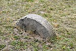
| Hauptstrasse 31 | Waidstein | The Waidmühlstein is now (2016) almost completely buried in front of house no.37, presumably to protect it from loss or damage at house no.31, as this is a rubble plot. | 1-128 location |
|
| Hauptstrasse 37 | Half-timbered house | 1-125 location |
||
| Hauptstrasse 38 | Open staircase | 1-16 / 2 position |
||
| Hauptstrasse 54 | Residential building | 1-30 position |
||
|
|
Kastanienweg | Rest of the village wall | This “old village loam wall” was reconstructed in 1997 as part of a job creation measure with the financial support of the Gotha Employment Office by the “Horticulture, Landscape Management, Environment and Forests Thuringia eV: Erfurt” funding agency. | |
| Kirchgasse 3 | Tower of the Walpurgis Church | 1-1 Location of the tower at Wikipedia |
||
| Kirchgasse 4 | Rectory with outbuildings | The picture only shows the outbuildings | 1-1 / 1 position |
|
| Mühlgasse 4 | former mill with equipment and outbuildings | 1-118 / 4 Location mills in Apfelstädt in Wikipedia |
||
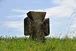
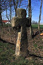
| Riedweg / Gutenbergweg | Latin cross | The medieval stone cross at the western end of the village in the direction of Wandersleben. The information board on the stone cross reports that it was erected between 1400 and 1450 to commemorate a person who was killed or killed at this point. Since 1657 it has been traceable in land maps ("am Creuchte"). A local legend says that the apple townspeople killed and buried a Danish colonel here. Hence the name "Schwedenkreuz". Another popular oral tradition tells of an injured carter. The location and orientation of the cross indicate the course of the old trade route coming from Erfurt, which headed from here directly to the Freudenthal Fuhrmannsgasthof . | 1-165 / 10 Location stone crosses in Apfelstädt at Wikipedia |
|
| Sülzenbrücker Strasse / K 22 | Maltese Cross, "Seitz Cross" | The stone cross on the bike path in the direction of Sülzenbrücken dates from the 19th century. It was built on March 23, 1898 by Erfurt pensioner Seitz in memory of his 18-year-old son, who had an accident here on June 27, 1897 “while on a corso ride by local and foreign cyclists” and died one day later in Erfurt. The stone cross was about twice as high until it was damaged in 1970 and had to be erected several times over the years. Its shape is unique in Thuringia, as the information board reports. The “Erfurt Stone Cross” in Kleinrettbach , however, has a similar shape, with less pronounced tapering towards the center of the cross . However, the local cross is much smaller (today) with a visible height of around 60 cm. Seitz combined the erection of the cross with a foundation for the benefit of needy residents in Apfelstädt. |
Location stone crosses in Apfelstädt at Wikipedia
|
Gamstädt
| image | address | Monument designation | comment | Corridor / parcel location coord. Web link |
|---|---|---|---|---|
| 38 Broad Street | Residential building | 1-38 / 1 layer |
||
| Long Street 12 | Courtyard | 1-6 / 5 position |
||
| Long Street 22 | Residential building | 1-15 position |
||
| Long Street 23 | Residential building | 1-16 location |
Ingersleben
| image | address | Monument designation | comment | Corridor / parcel location coord. Web link |
|---|---|---|---|---|
| Ernst-Haeckel-Platz 1 | Guest house with hall | “Zur Schenke” inn, around 1630/40, hall from 1912 | 2-341 location |
|
| Ernst-Haeckel-Platz 4 | Residential building | around 1700 | 2-367 location |
|
| Ernst-Haeckel-Platz 6 | Rectory | Rectory from 1720, outbuilding from 1810. In 2003, the municipality applied for the property to be removed from the list of monuments. |
2-366 location |
|
| Karl-Marx-Strasse 40 | Former Manor | Manor house around 1600, horse stable 1800, today local history museum | 2-282 / 3 position |
|
|
|
Max-Laumann-Strasse 1 | Residential building | "Freisassenhaus". A dendrochronological investigation carried out around 2014 revealed a year of construction of 1568. This makes the Freisassenhaus the oldest farmhouse in Ingersleben and the fourth oldest in Thuringia. | 2-266 location |
|
|
Mühlgasse | bridge | Bridge over the Mühlgraben from 1812 | with 2-351 / 2 position |
| Marienthal | bridge | Bridge over the Apfelstädt from 1752 | at 2-394 / 3 location Marienthalbrücke at Wikipedia |
|
| Schulstrasse 9 | school | "Old School" community center from 1879 | 2-154 / 1 layer |
|
| Südstrasse 4 | gym | Built from 1928-1929, refurbished 1998-2000 and 2016 | 2-188 location |
|
| Holzbergstrasse (?), Molsdorfer Weg | Atonement Cross | 1686 | 2-440 location |
Kleinrettbach
| image | address | Monument designation | comment | Corridor / parcel location coord. Web link |
|---|---|---|---|---|
| Corner 18 | Residential building | 4-65 location |
Kornhochheim
| image | address | Monument designation | comment | Corridor / parcel location coord. Web link |
|---|---|---|---|---|
| Village square 11 | Residential building | location | ||
| Village square 12 | Courtyard | 1-78 location |
||
| Village square 17 | Courtyard | 1-73 location |
||
| Village square | Well house | "David's Born" | 1-82 location |
|
| Northern location | Village wall with entrance gates | 1-45 position |
||
| "At the horse enclosure" corridor | bridge | Bridge over the Weidbach , stabilized in 2015. | 1-45 position |
Neudietendorf
| image | address | Monument designation | comment | Corridor / parcel location coord. Web link |
|---|---|---|---|---|
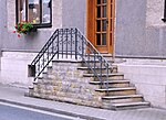
| Bahnhofstrasse 2 | Residential building | Residential house with typical external staircase | 2-313 / 1 layer |
|
| Bahnhofstrasse 14 | Residential building | Residential house with typical external staircase | 2-305 location |
|
| Bahnhofstrasse 15 / Kirchstrasse 3 | Former Sealing wax factory | The former sealing wax factory with the slate-clad crane elevator. It was built by Nicolaus Jacob Lilliendahl (1738-1805) as a factory with a manor house in 1778. The paints were produced using the original technology until 1985. The house was used as a residential building until 1996, and repairs have been carried out gradually since 1990. The Protestant kindergarten "Die Arche" has been in the building since December 15, 1998. A painting of Noah's Ark is also attached to the house wall. | 2-304 / 3 position |
|
| Bergstrasse 9 | Residential house Kruger Villa | 3-556 location |
||
| Drei-Gleichen-Strasse 19 | Residential building | 1-109 / 1 layer |
||
| Three Equals Street 34 | Residential building | Until the second half of the 17th century, the property was the seat of the nobles of Wittern . In the middle of the 18th century the main building was rebuilt after a fire with the baroque mansard roof, using the medieval cellar vault and the Gothic sandstone door. From the second half of the 18th century until 1978 the building was the "church school", the village school of Neudietendorf. Johann Michael Aghte lived and worked here as a teacher, cantor and plant breeder. Aghte was the stepfather of Carl Bechstein (1826–1900), who spent his youth in this house and who later became famous as a piano maker. Aghte's daughter Auguste became the wife of August Köhler (1821-1879) in 1849 , who also went to school here and later became known as a kindergarten teacher and successor to Froebel . In the middle of the 19th century the western classroom extension (left in the picture) was built and in the middle of the 20th century the attic was converted into a teacher's apartment. From 1999 to 2001 the building was completely renovated by the municipality of Neudietendorf, with the installation of a new staircase and five residential units. | 1-118 location |
|
| Zinzendorfstrasse 16 | Former manor house | In 1734 Imperial Count Gustav Adolf von Gotter acquired the neglected feudal estate "Alte Hof", which was opposite Dietendorf on the then left bank of the Apple Town. | 2-344 / 2 position |
|
| Zinzendorfstrasse 22 | Residential building | Residential and commercial building of a florist | 2-391 / 1 layer |
Objects not listed
"Objects not listed" are not part of the official list of monuments.
Various objects are not listed. The reasons can be:
- the property owners have requested that the property be removed from the list
- the object no longer exists
- the property was not up for listing
Monument ensemble
| image | address | Monument designation | comment | Corridor / parcel location coord. |
|---|
Individual monuments
| image | address | Monument designation | comment | Corridor / parcel location coord. |
|---|---|---|---|---|
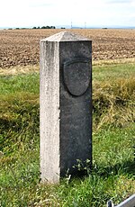
| Gamstädt, B7 | Prussian eagle | Grenzadler: On the eastern district border, which once represented the boundary of the duchy of Saxe-Coburg and Gotha to the Kingdom of Prussia and today between the district of Gotha and the city of Erfurt, one notices on the southern side of the street the main road B7 in the curve a Grenzadler , a about 1.50 m high sandstone, once with a Prussian eagle . Opposite it on the other side of the street is the "Zollhaus", which previously served as a customs post and now houses a commercial enterprise. It functioned as a border and post station together with a no longer existing building that stood on the south side of the street, as can be seen from old maps. | North. End of 2-169 Lage Gamstädt at Wikipedia |
|
| Gamstädt, Landstrasse 85 | Weimar court | former, historical restaurant | 1-55 / 3 location Gamstädt at Wikipedia |
|
| Kleinrettbach, Matternweg | Grabsleben stone cross | 3-879 / 672 Location Kleinrettbach at Wikipedia |
||
| Kleinrettbach, Green Aue | Erfurt stone cross | 6-6 Location Kleinrettbach at Wikipedia |
||
| Ingersleben, Karl-Marx-Strasse 1 | Obermühle or Zitzmann-Mühle | The only still working watermill on the Apfelstädt | 4-3 / 8 Lage Ingersleben at Wikipedia |
|
| Ingersleben, Mühlgasse 11a | Under mill | The mill was built in 1441 and extensively renovated as a residential ensemble from 2002 to 2005. The half-timbered building has a reconstructed mill wheel that drives a generator to generate electricity. The original generator, which operated until 1945 and supplied the manor with electricity, was dismantled by the Soviet occupying forces and brought to the USSR. The lower mill was the former manor mill from 1441, opposite it on the other side of the mill ditch was the manor house, the castle-like "villa" that was demolished after the war in a park that was also deforested. | 2-349 / 3 Lage Ingersleben at Wikipedia |
|
| Kornhochheim, village square | Glut | The "Schwemme", the former village pond, dominates the south side of the village square. In the 20th century this water basin served primarily as a fire fighting pond; it was laid out in its existing form as an in-situ concrete pool before the First World War. In the centuries before it still had the real character of a village pond, at that time you could drive in the wooden horse-drawn carriages in dry summers to prevent the wheels from falling apart. The name “Schwemme” certainly indicates that horses, ducks and geese could also have a refreshing bath here. | 1-95 Location Kornhochheim at Wikipedia |
Individual evidence
- ↑ StBA: Area changes from January 2nd to December 31st, 2009
- ↑ a b Information board on the object
- ↑ Prof. Dr. P. Rehfeldt: Architectural and Art Monuments of Thuringia , Booklet VIII., 1891, p. 6
Literature and Sources
- Municipal administration of the municipality of Nesse-Apfelstädt (as of July 2016)


