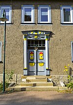
List of cultural monuments in the administrative community of Nesseaue
The list of cultural monuments in the administrative community of Nesseaue (district of Gotha) is as of August 21, 2006 and, in accordance with the law on the maintenance and protection of cultural monuments in the state of Thuringia (ThüDSchG) in the current version of February 24, 2016 or the first law amending the ThüDSchG of November 23, 2005, the cultural monuments of the administrative community Nesseaue in the Thuringian district of Gotha .
The list includes the cultural monuments of the municipalities of Bienstädt , Eschenbergen , Friemar , Molschleben , Nottleben , horse life , Tröchtelborn , Tüttleben and Zimmersupra .
Definitions
The protection of immovable cultural monuments already arises from the existence of the legal requirements of § 2 of the Thuringian Monument Protection Act and does not depend on the entry in the list of monuments of the state or the municipalities. This means that objects that are not included in a list of monuments can definitely be monuments.
Cultural monuments
According to § 2 of the Thuringian Monument Protection Act, cultural monuments are all things, aggregates or parts of things that are of public interest for historical, artistic, technical, scientific, folklore or urban planning reasons as well as for reasons of historical village image maintenance. Monument ensembles and ground monuments are also counted among the cultural monuments.
Monument ensemble
A monument ensemble can be:
- Overall structural systems: Overall structural systems are, in particular, groups of buildings, uniformly designed quarters and settlements and historical town centers including the plants, open spaces and water areas associated with them.
- Characteristic street, square or townscape: A characteristic street, square or townscape is given in particular if the appearance of the facility is indicative of a specific era or development or of a characteristic construction method with different styles.
- Characteristic local floor plans: A characteristic local floor plan is given if the appearance of the facility is characteristic of a certain epoch or development, in particular with regard to local and settlement forms, street layouts, plot structures and fortifications.
- Historic parks and gardens: Historic parks and gardens are works of horticultural art, the location of which, as well as the architectural and plant design, bear witness to the function of the complex as a living space and self-portrayal of earlier forms of society and the culture it supported. This also includes animal and botanical gardens, provided they have their own overall historical and architectural design.
- historical production sites and plants.
Not all parts of a monument ensemble have to be cultural monuments in order to be considered cultural monuments.
Ground monument
Movable or immovable objects that were or are hidden in the ground or under water and that provide information about animal or plant life (paleontological monuments) or that represent evidence, remains or traces of human culture (archaeological monuments) are soil monuments.
Note
The list of monuments of VG Nesseaue does not make the distinctions described.
Historical background
The administrative community was founded on April 9, 1992. It is located in the northeast of the district of Gotha and borders in the north on the administrative community Fahner Höhe , in the west on the administrative community Middle Nessetal , in the southwest on the city of Gotha and in the south on the communities Drei Gleichen and Nesse-Apfelstädt . The Nesse , a right tributary of the Hörsel , meanders through the area , into which it flows in the east of Eisenach .
Individual features § 2 Paragraph (1) No. ThürDSchG
Sacred buildings
| image | address | Monument designation | comment | Corridor / parcel location coord. Web link |
|---|---|---|---|---|
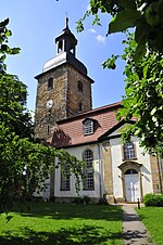
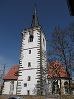
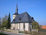
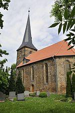
| Bienstädt, Kirchplatz 72 | Ev. Parish church "Friedenskirche" with artistic furnishings, churchyard and remains of the enclosure | The dilapidated pre-Reformation St. John's Church was rebuilt between 1811 (laying of the foundation stone) and 1814 (inauguration). During the reconstruction it was given the auspicious name Friedenskirche . The parish renewed the nave, only the tower of the late Gothic predecessor church remained. Multiple looting and war burdens in the turmoil of the Napoleonic wars delayed construction progress considerably. | 1/145 Location Friedenskirche Bienstädt at Wikipedia |
|
| Eschenbergen, Kirchstrasse 7 | Ev. Parish Church “St. Margareten ” with artistic furnishings, churchyard and enclosure | The construction of the Lutheran church “St. Margareten ”in the place then called Eschenberga took place in 1584. This is also attested by a relief stone in the church wall. In 1841 a new church tower was built. A curiosity is the fact that a woad millstone was used as the foundation stone for the northwest corner of the tower. | 1-166 / 168/170 Location Eschenbergen at Wikipedia |
|
| Friemar, Kirchstrasse 1a | Ev. Parish Church “St. Viti “ with artistic furnishings, churchyard and enclosure | In the center of the village is the St. Viti Church, built in 1780 after a great fire, the jewel of which is the organ built in 1830 by the Tabarz organ builder Johann Valentin Knauf . | 1-1 Lage Friemar at Wikipedia |
|
| Molschleben, school area 11 | Ev. Parish Church “St. Peter and Paul ”with artistic furnishings, churchyard and enclosure | One of the local attractions is the Protestant church of St. Peter and Paul. Today's church stands in the same place as its predecessor from the 8th or 9th century, which was demolished at the end of the 15th century due to dilapidation. The current late Gothic church was built in several construction phases. | 1-76 Location St. Peter and Paul at Wikipedia |
|
| Nottleben, Hauptstrasse 100 | Ev. Parish Church “St. Peter and Paul ”with artistic furnishings, churchyard and enclosure | The Peter and Paul Church was essentially built between 1427 and 1493, a reconstruction took place in 1521. The tower is five-story, structured by cornices, has a circumferential gallery parapet with gargoyles at the corners and a slender, slated spire. The nave has a three-sided choir closure and keel-arched portals on the north and south sides. During the GDR era, the church, the symbol of Nottleben, fell into disrepair. (For details see web link) | 4-968 / 856 Lage Nottleben at Wikipedia |
|
| Horse life, Kirchstrasse 58 | Ev. Branch church "St. Wigbert ”with artistic furnishings, churchyard and enclosure | The listed church of St. Wigbert is named after the patron saint of the place. The current building - the predecessor was much smaller - was made in late Gothic style from 1483, starting with the defense tower built in three years. |
1-86 Lage Nottleben at Wikipedia |
|
| Tröchtelborn, Kirchberg | Ev. Branch church "St. Bonifatius ” with artistic furnishings, churchyard and enclosure | The St. Bonifatius Church - a hall church with a wooden barrel and choir closed on three sides - dates from 1603 to 1605. The nave of the Romanesque predecessor building from the 11th century stood on the opposite side of the defense tower. Today's church was built in a transitional period, the builders chose the (still) popular late Gothic style with filigree tracery windows. |
4-166 / 1 Location of St. Boniface on Wikipedia |
|
| Tüttleben, Kirchgasse 12 | Ev. Parish Church “St. Viti “ with artistic furnishings, churchyard and enclosure | The St. Viti Church is the most famous attraction of the place. There was probably a previous church, as is so often the case in this area. A plaque is set into the tower - its text, written in Latin, reads in the translation: In the year of the Incarnation of the Lord Jesus Christ in 1463 on the 22nd day of March this tower was founded. | 2-262 Location St. Viti at Wikipedia |
|
| Zimmersupra, Street of Peace 66 | Ev. Parish Church “St. Jacobus ” with artistic furnishings, churchyard and enclosure | The St. Jacobus Church is the main church in Zimmersupra in the Gotha district. It belongs to the Protestant church district of Erfurt, Bindersleben community. | 4-693 Location St. Jacobus at Wikipedia |
Secular buildings (by location)
Bienstädt
| image | address | Monument designation | comment | Corridor / parcel location web link |
|---|---|---|---|---|
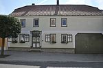
| Church Square 73 | former rectory | After the parish of Bienstädt was abolished in 2012, the former rectory with its parish hall is still a meeting place for Christian doctrine, senior citizens and for church services in the cold season. The current rectory stands behind the church. | 1-144 location |
|
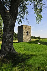
| Bienstädter Warte | Bienstädter Warte | The Bienstädter Warte has been part of the outer fortification system of the city of Erfurt since the late Middle Ages, in 1411 it was one of 16 urban wards . The ruin, which is now protected as an architectural monument, was also named Uffhusener Warte after a former village location in its neighborhood . The tower has a square floor plan with a side length of 4.65 m, the control room once towered 18 meters above the ground, today the remaining height is around 6 m. After a fire in 1733, in which over 50 houses were destroyed, the farmers were allowed to remove usable building material from the control room, which at that time had already fallen into disrepair. | 7-1 / 7 Location Bienstädt at Wikipedia |
Eschenbergen
| image | address | Monument designation | comment | Corridor / parcel location coord. Web link |
|---|---|---|---|---|
|
|
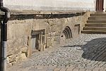
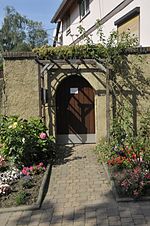
Hauptstrasse 41 | Courtyard gate |
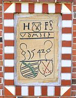
Lower picture: Relief stone from 1610 (?) |
1-98 Location Eschenbergen at Wikipedia |
| Kirchstrasse 5 (formerly Kirchgasse 5) | former rectory | 1-171 / 2 position |
||
|
|
Mönchstrasse 3 (formerly Mönchsgasse 3) | Gate drive and courtyard gate | Relief stone above the gate from 1795 | 1-13 / 1 position |
Friemar
| image | address | Monument designation | comment | Corridor / parcel location coord. Web link |
|---|---|---|---|---|
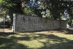
| Gothaer Strasse | Village wall | location | ||
|
|
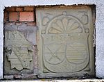
Schenkstrasse 2 (formerly Kirchstrasse 2) | Community gifts | General view detail Two coat of arms stones in the wall |
1-241 location |
|
|
Pfarrstrasse 3 | Rectory with enclosure | 1-270 location |
|
| School place 1 | Handle pump | Cast iron handle pump from 1880-1890 with four-pass motif | 1-275 / 3 position |
Molschleben
| image | address | Monument designation | comment | Corridor / parcel location coord. Web link |
|---|---|---|---|---|
| School place | Cemetery wall including gun bastion from the 16th century | 1-78 location |
||
| Dorfplatz 1 | Courtyard with seating niche portal | 1-47 location |
||
| Gothaer Strasse 3 | Courtyard with woad | The building was built as a woad factory in 1793 by a Herr von Piutti. The only remaining system in the Central European woad growing area. The relatively large drying floors, which are still called "Waiddarre" today, were located in the attic of the residential and farm buildings. The ventilation flaps in front of the mansard windows are still clearly visible today. (In September 2016 there was a scaffolding in front of the facade) |
2-155 / 3 position woad at Wikipedia |
|
| Gierstädter Strasse 2 (formerly Hauptstrasse 191) | Inscription stone from 1542 | The “Neuenthor” once stood here. | 2-54 / 2 Location The story of Neuenthor at Wikipedia |
|
| Church square 6 | Rectory | 1-73 location |
||
|
|
Gift place 8 | Community gifts with plaque | The plaque commemorates a fire caused by negligent arson in 1764, which killed 122 houses within two hours. | 2-94 location |
| Bath plan 5 | Stone cross | Remnants of a stone cross in the shape of a Maltese, reddish red sandstone with a pointed surface, dating 1500-1650 | 2-140 position |
Emergency life
| image | address | Monument designation | comment | Corridor / parcel location coord. Web links |
|---|---|---|---|---|
| No secular building memorial included in the list. | ||||
Horse life
| image | address | Monument designation | comment | Corridor / parcel location coord. Web links |
|---|---|---|---|---|
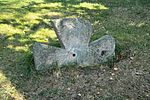
| At Anger 93a | Waidmühlstein | The only surviving woad mill ( small woad mill ) in Central Europe. It is owned by the community. In historical times it was operated by draft animals that pulled the vertical millstone in a circle over the grist lying in the mill pan. It is one of at least three pasture mills in the town. | 1-28 Location horse life at Wikipedia |
|
|
|
Kirchstrasse 60 (formerly Kirchgasse 60) | Gate drive and seating niche courtyard portal | 1-100 / 4 position |
|
|
|
Long Street 27 | Gate drive and seating niche courtyard portal | 1-141 location |
Tröchtelborn
| image | address | Monument designation | comment | Corridor / parcel location coord. Web links |
|---|---|---|---|---|
| Bornberg 13/14 | Courtyard | 4-43 / 1 layer |
||
| Bornberg 18 | Courtyard gate | 4-29 / 1 layer |
||
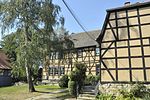
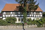
| Kirchgasse 74 | Rectory | The half-timbered rectory with an idyllic garden is not far from the church. From 1610 to 1621 it was the residence and official residence of Michael Altenburg , pastor and composer of the early Baroque. The Altenburg living room, a plank parlor, serves as a winter church and for meetings and celebrations. | 4-173 / 1 layer |
Tüttleben
| image | address | Monument designation | comment | Corridor / parcel location coord. Web links |
|---|---|---|---|---|
| No secular building memorial included in the list. | ||||
Room supra
| image | address | Monument designation | comment | Corridor / parcel location coord. Web links |
|---|---|---|---|---|
| Brühlstrasse 48 | Courtyard | 4-377 location |
||
| Dreifussstrasse 54 | Courtyard | 4-494 / 385; 4-636 / 386 position |
||
| Dreifussstrasse 55 | Courtyard | 4-387 location |
||
| Erfurter Strasse 87 | Residential building | 4-672 location |
||
| Road of Peace 69/70 | front door | 4-678 location |
Objects not listed
Various objects are not listed. The reasons can be:
- the property owners have requested that the property be removed from the list
- the object no longer exists
- the property was not up for listing
Individual monuments
| image | address | Monument designation | comment | Corridor / parcel location coord. |
|---|---|---|---|---|
| Bienstädt, Obertor 1 | Community gift inn-country hotel | First mentioned in 1733 | 1-112 location |
|
| Friemar, school square | Waidmühle | 1-275 / 3 position |
Individual evidence
- List of monuments of the administrative community Nesseaue
Literature and Sources
- Administrative community Nesseaue (status: 23 August 2006)


