
Horse life
| coat of arms | Germany map | |
|---|---|---|

|
Coordinates: 50 ° 58 ' N , 10 ° 49' E |
|
| Basic data | ||
| State : | Thuringia | |
| County : | Gotha | |
| Management Community : | Nesseaue | |
| Height : | 290 m above sea level NHN | |
| Area : | 6.61 km 2 | |
| Residents: | 398 (Dec. 31, 2019) | |
| Population density : | 60 inhabitants per km 2 | |
| Postal code : | 99869 | |
| Area code : | 036258 | |
| License plate : | GTH | |
| Community key : | 16 0 67 055 | |
| Address of the municipal administration: |
Dr.-Külz-Str. 4 99869 Friemar |
|
| Website : | ||
| Mayoress : | Sandra Kamm | |
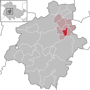
| Location of the community of Pferdeleben in the district of Gotha | ||
  |
||

Horse life is a municipality in the administrative community Nesseaue in the Thuringian district of Gotha .
geography
The place is located in the flat valley of the Nesse between Friemar in the west and Nottleben in the east. The county road K 4 connects the municipality with the approximately 2 km south extending B 7 (Erfurt - Gotha). The lowest point of the district is 281 m high and NN in the immediate vicinity of Friemar at the Riethquelle, which leads its water into the Nesse after a few meters. The highest point is 325 m above sea level. NN in the east of Tröchtelborn . The center of the village by the church is 290 m above sea level. NN. Apart from the Nesse, the local situation only has a trickle as flowing water that comes from the Gehrenfeld , a corridor in the northeast of the municipality.
history
Like the other places in the region that end in "living", the name Pferddingsleben refers to a settlement from around 300 AD. At the beginning of the 9th century, horse life is first mentioned as Pertikeslebo in a list of the goods lent by Archbishop Lullus († 786) of Mainz to the monastery of Hersfeld von Free . The place belonged as an exclave to the upper county of Gleichen , which was under the sovereignty of the Duchy of Saxony-Gotha-Altenburg .
Horse life developed as a cluster village , which was protected by a wall with three gates and a surrounding ditch. Agriculture, especially woad cultivation, made the village prosperous. A representative church could also afford it. There are still beautiful courtyard gates and original half-timbered buildings in the village.


Population development
Development of the population (December 31) :
|
|
|
|
|
- Data source: Thuringian State Office for Statistics
coat of arms
In the municipality's coat of arms, approved in 1997, the symbols for the last Waidmühle (Waidmühlstein) preserved at its location in Central Europe, the first mention in the Hersfeld Monastery inventory (Hersfeld Cross) and the grape as an attribute of St. Wigbert can be seen.
Attractions
St. Wigbert village church
The listed church of St. Wigbert is named after the patron saint of the place. The current building - the predecessor was much smaller - was made in late Gothic style from 1483, starting with the defense tower built in three years . It lies to the south in front of the nave, is 42 meters high and has slit-shaped windows, gargoyles, a walkway and a Seiger bell on the spire for the chime of time. The rich interior of the church is partly from the time it was built when it was Catholic. In the 18th century, three galleries were built one on top of the other. Each of their painted cassettes has a different pattern. The ceiling decoration was designed similarly. The winged altar from 1514 shows a coronation of Mary. A pulpit wall that harmonizes well with its surroundings is a foundation from a later period. The baptismal font was already in the previous church. In the meantime - because of its unsuitable location - it had found use as a horse trough on a farm, but returned to the church in 1953. The walled churchyard was abandoned as a cemetery at the beginning of the 20th century. After the fall of the Wall, the church was extensively restored, in which the German Foundation for Monument Protection made a significant financial contribution.
Waidmühle
The only surviving woad mill ( small woad mill ) in Central Europe is located in horse life . It is owned by the community. In historical times it was operated by draft animals that pulled the vertical millstone in a circle over the grist lying in the mill pan. It is one of at least three pasture mills in the town. A second (the large Waidmühle ) was moved to the site of today's ega in Erfurt after 1896 . There was a third mill at Tümpels house , its whereabouts are unclear. The stone pillars of the Waidmühlen, in whose fork the millstone support beam was stored, often served as a footbridge over streams, to secure gate entrances, fence posts, wall end stones, etc. after the mill had stopped operating. Ä. A millstone can be found as the lowest stone in the northwest corner of the church in Eschenbergen . All mills were on the northern edge of the village at the time, on the large and small Angergarten (today the area of Angerstrasse ), i.e. on public lawns near a watercourse, the Mollbach . The Mollbach rises in the NSG Alacher See and (today) flows into the Nesse on the north-western outskirts of Nottleben . Ernst Reinhardt, the last horse farmer from horse life, delivered his production of about 2 tons of bale woad to the woad dealer in Erfurt, city council friend. The Waidmühle gradually deteriorated and was only rediscovered as a tourist monument in the 1950s, reconstructed and designed as a cultural monument. In 1974 there was another reconstruction, the last renovation and redesign of the facility took place on the occasion of the 1st International Woad Conference in spring 1992. (See also: Woad cultivation in Thuringia )
Personalities
- Ernst Koch (1819–1894), born in horse life, chamber singer and music teacher
literature
- Ines and Frank Baumert: Ortsfamilienbuch der Ortschaft Pferdeleben in Thuringia from 1609 to 1795. Berlin: Pro Business 2008, ISBN 978-3-86805-065-3
Individual evidence
- ^ Population of the municipalities from the Thuringian State Office for Statistics ( help on this ).
- ↑ Information board on the monument, author: Eberhard Brandt
Web links
Bad Tabarz | Bienstädt | Dachwig | Döllstädt | Three of a kind | Emleben | Eschenbergen | Friedrichroda | Friemar | Georgenthal | Gierstädt | Gotha | Großfahner | Manor | Earpiece | Luisenthal | Molschleben | Nesse-Apfelstädt | Nessetal | Emergency life | Ohrdruf | Horse life | Schwabhausen | Sonneborn | Tambach-Dietharz | Tonna | Tröchtelborn | Tüttleben | Waltershausen | Room supra