List of cultural monuments in Nessetal
The list of cultural monuments in the rural community of Nessetal is as of January 2014 and contains, in accordance with the law on the maintenance and protection of cultural monuments in the state of Thuringia (ThüDSchG) in the current version of February 24, 2016 or the first law amending the ThüDSchG of November 23, 2005 the cultural monuments of the rural community Nessetal in the Thuringian district of Gotha .
The list includes the cultural monuments of the districts Ballstädt , Brüheim , Bufleben , Hausen , Pfullendorf , Friedrichswerth , Goldbach , Haina , Hochheim , Remstädt , Wangenheim , Warza and Westhausen .
Nessetal is a fulfilling community for the community of Sonneborn . The cultural monuments of Sonneborn are listed in the following article:
Note: The list may be subject to changes that do not appear here. In individual cases, the current list can be viewed at the lower monument protection authority of the district office or at the building authority of the respective municipality.
Definitions
The protection of immovable cultural monuments already arises from the existence of the legal requirements of § 2 of the Thuringian Monument Protection Act and does not depend on the entry in the list of monuments of the state or the municipalities. This means that objects that are not included in a list of monuments can definitely be monuments.
Cultural monuments
According to § 2 of the Thuringian Monument Protection Act, cultural monuments are all things, aggregates or parts of things that are of public interest for historical, artistic, technical, scientific, folklore or urban planning reasons as well as for reasons of historical village image maintenance. Monument ensembles and ground monuments are also counted among the cultural monuments.
Monument ensemble
A monument ensemble can be:
- Overall structural systems: Overall structural systems are, in particular, groups of buildings, uniformly designed quarters and settlements and historical town centers including the plants, open spaces and water areas associated with them.
- Characteristic street, square or townscape: A characteristic street, square or townscape is given in particular if the appearance of the facility is indicative of a specific era or development or of a characteristic construction method with different styles.
- Characteristic local floor plans: A characteristic local floor plan is given if the appearance of the facility is characteristic of a certain epoch or development, in particular with regard to local and settlement forms, street layouts, plot structures and fortifications.
- Historic parks and gardens: Historic parks and gardens are works of horticultural art, the location of which, as well as the architectural and plant design, bear witness to the function of the complex as a living space and self-portrayal of earlier forms of society and the culture it supported. This also includes animal and botanical gardens, provided they have their own overall historical and architectural design.
- historical production sites and plants.
Not all parts of a monument ensemble have to be cultural monuments in order to be considered cultural monuments.
Ground monument
Movable or immovable objects that were or are hidden in the ground or under water and that provide information about animal or plant life (paleontological monuments) or that represent evidence, remains or traces of human culture (archaeological monuments) are soil monuments.
Note
The list of monuments of the municipality of Nessetal does not make the distinctions described consistently.
Historical background
The rural community of Nessetal was created on January 1, 2019 from the merger of the member communities of the Mittleres Nessetal administrative community with the exception of the Sonneborn community.
The name of the rural parish refers to the river Nesse .
Individual features § 2 Paragraph (1) No. ThürDSchG
Sacred buildings
| image | address | Monument designation | comment | Corridor / parcel location coord. Web link |
|---|---|---|---|---|
 More pictures More pictures
|
Ballstädt, Rittergasse 5 | Church of St. Petri | The church with its fortified tower emerged from a chapel in 1497. This is shown by a plaque attached to the south wall of the church: On March 3, 1497 church renewed . In 1696 the church was renewed. At the same time it received a new organ, which was renewed again in 1836. In 1855 the church received a clock tower. | 1-1 Location Ballstädt at Wikipedia |
 More pictures More pictures
|
Brüheim, Schlossgasse | Church of St. Vitus with furnishings and churchyard and enclosure | The village church of St. Vitus is next to the Edelhof. The parish church tower was built around 1726, the nave about 100 years later. The church has a baptismal font from the 13th century. | 1-141 / 2; 1–142, 1–143 Lage Brüheim at Wikipedia |
 More pictures More pictures
|
Bufleben, Kirchstrasse | Church of St. Cyriakus with furnishings, churchyard with historical gravestones and enclosure | 1–104 Lage Bufleben at Wikipedia |
|
 More pictures More pictures
|
Bufleben-Hausen, Kirchstrasse 35/36 | Church of St. Nikolai with furnishings and churchyard and enclosure | 1-1 Location Hausen at Wikipedia |
|
 More pictures More pictures
|
Bufleben-Pfullendorf, Hauptstrasse 4 | Church of St. Boniface with furnishings | 1-1 Location Pfullendorf at Wikipedia |
|
 More pictures More pictures
|
Friedrichswerth, Haackstrasse 39 a | Gustav-Adolf-Church with furnishings, churchyard and enclosure | 1–99 Lage Friedrichswerth at Wikipedia |
|
 More pictures More pictures
|
Goldbach, Kirchplatz 1 | Church of St. Peter with furnishings, churchyard and enclosure | The nave of the late Gothic church has two naves. The construction began in 1518 and was changed in 1752. | 1–128 location Goldbach at Wikipedia |
 |
Haina, Kirchhofstrasse 1 | Church of St. John with furnishings, churchyard and enclosure | The 350th anniversary was celebrated in 2015 | 1-1 Location Haina at Wikipedia |
 |
Hochheim, Kirchstrasse 93 | Church of St. Nicholas with furnishings, churchyard with historical tombstones and fencing | In 2015, the St. Nicholas Church was inaugurated again after a two-year renovation period. | 1–78 Location Hochheim at Wikipedia |
 More pictures More pictures
|
Remstädt, Hauptstrasse 21 a | Church of St. Luke with furnishings | 1–129 / 1 Lage Remstädt at Wikipedia |
|
 More pictures More pictures
|
Wangenheim, Kirchberg 1 | Church of St. Trinitatis with furnishings, churchyard and enclosure | 1–75 Location Wangenheim at Wikipedia |
|
 More pictures More pictures
|
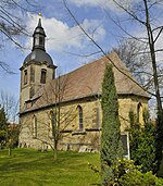
Warza, Kirchstrasse | Church of St. John with equipment, churchyard with histor. Gravestones and enclosure | 1–90, 1–91 Location St. Johannes (Warza) at Wikipedia |
|
 |
Westhausen, Hochheimer Strasse 41 | Church of St. Vitus with furnishings and churchyard | 1–50 Location Westhausen (Nessetal) at Wikipedia |
Secular buildings (by location)
Ballstädt
| image | address | Monument designation | comment | Corridor / parcel location web link |
|---|---|---|---|---|
 |
Donkey climb | Post mill | It was built in 1834 and moved from Hoheneggelsen to its current location in 1933 . | 3–977 / 2 layer |
 |
Hauptstrasse 3 | House facade | 1–146 position |
|
 |
Hauptstrasse 7 (at Miehlener Platz) | Residential building | 1–158 / 6 position |
|
 |
Mühlenweg 6 | Untermühle, residential building (partial demolition 2007) | A preserved wall of the former mill now forms the eastern boundary of the property of a newer building whose owner does not want a photo to be published. | 3–1114 / 6 position |
 |
Rittergasse 3 | House | 1-35 position |
|
 |
Rittergasse 4 | Rectory | 1–2 / 2 layer |
|
 |
Outdoor area | Archaeological monument: fortification | ||
 |
Outdoor area | Archaeological monument: Germanic fire burial ground | Today the cemetery is a cultivated field. Location: north of the Hungerbornsweg in the north of Ballstädt, west of the Mittelmühle and the state road. | 2-511 / 2 layer |
Bruheim
| image | address | Monument designation | comment | Corridor / parcel location web link |
|---|---|---|---|---|
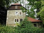 |
Schlossgasse 1 | Medieval residential tower ("Käseburg") | The former moated castle Käseburg (Steinhof) was a smaller fortification built in the Middle Ages, originally in the form of a tower hill castle. | 1–144 / 1 layer |
 |
Schlossgasse 3 | Former manor complex (existing: residential house and courtyard pavement, demolished: stable and barn building) | 1–147 / 3 layer |
|
 |
Schlossgasse 4 | Edelhof | Once a seat of the von Wangenheim family, today an apartment building | 1–157 position |
 |
Unterdorf 20 | Rectory | 1-96 position |
|
 |
At the station 1 | Complete system at Sonneborn-Brüheim station | The station is now a privately owned residential building. | 2-91, 2-93 position |
Bufleben
| image | address | Monument designation | comment | Corridor / parcel location web link |
|---|---|---|---|---|
 |
Kirchstrasse 12 | Rectory and barn | 1–107 Lage Bufleben at Wikipedia |
|
 |
L 1043 (Kindleben-Bufleben) (K 4) | Wayside shrine "The Cross" | 2-81 position |
|
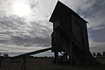 |
Tonnaer Strasse | Post mill | 3–57 / 1 layer |
|
 |
Cattle trail | Archaeological monument: burial mound | 3–48 / 1 layer |
|
 |
Backhausgasse (3) | Archaeological monument: fortification | The bakery still exists today (photo) and was part of the earlier fortifications and part of a monastery that used to exist here. (Information from landowner, house no.4) | 1–69 / 2 layer |
Bufleben-Hausen
| image | address | Monument designation | comment | Corridor / parcel location web link |
|---|---|---|---|---|
 |
Flürchenstrasse 1 | Courtyard gate | 1-50 Location |
|
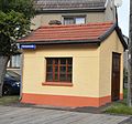 |
Before Flürchenstrasse 39 ("Lindenplatz") | Scales house | 1–58 / 2 layer |
|
 |
Kirchstrasse 37 | former rectory | 1–59 / 1 layer |
|
 |
Kirchstrasse 37 | former school | (in the courtyard now fire station) | 1–59 / 3 position |
Bufleben-Pfullendorf
| image | address | Monument designation | comment | Corridor / parcel location web link |
|---|---|---|---|---|
| No secular buildings in the list of monuments | ||||
Friedrichswerth
| image | address | Monument designation | comment | Corridor / parcel location web link |
|---|---|---|---|---|
 |
Haackstrasse 1 (formerly Anger 1) | Castle , garden, park, moat, wall | 1-112, 1-113, 1-114 position |
|
 |
Haackstrasse 120 (formerly Allee 120) | "Villa Meyer" | Former Residential and administrative building of the family of Dr. hc Eduard Meyer (1850–1931), founder of Friedrichswerther animal and plant breeding (1885–31 March 1935) | 1–103 / 11 position |
 |
At train station 95 | Railway station: complete system with outbuildings | The station building is now (2016) privately owned and is being expanded into a company headquarters. | 5–12 / 7 position |
 |
Haackstrasse 11 | Farmhouse | 1–126 position |
|
 |
Haackstrasse 39 | Parish homestead | 1-95 position |
|
 |
Haackstrasse 54 | Birth house including memorial room of Prof. Dr. H. Haack | Haack was an important cartographer. | 1–77 / 2 layer |
 |
Waisenhausstrasse 112 | former orphanage with wall and outbuildings | Today it houses the mayor's office and rooms for meetings and celebrations. On the first floor there is a local history museum and an apartment. The second floor is still in need of renovation; Exhibitions and benefit concerts are intended to help finance the work. | 1–101 / 1 layer |
Goldbach
| image | address | Monument designation | comment | Corridor / parcel location web link |
|---|---|---|---|---|
 |
Backhausgasse 4 | water pump | 1–123 / 6 position |
|
 |
Backhausgasse 18 | Residential building | 1–145 / 2 layer |
|
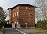 |
Bahnhofstrasse 27 | former station building | 3–536 / 1 layer |
|
 |
Hauptstrasse 17 | Former servants' house and stable of the Scharfenstein estate | 2-263 / 3, 2-264 / 3 Location |
|
 |
Hauptstrasse 25 | water pump | Object does not exist (Nov. 2016) | 1–28 position |
 |
Bahnhofstrasse 29 | Rectory and barn | 1–17 / 3 position |
|
 |
Karl-Marx-Strasse 6 | water pump | 2–229 position |
|
 |
Riedstrasse 19 | water pump | 2-357 position |
|
 |
Community Street 13 | Residential building with gatehouse and cross barn | 1–153 position |
|
 |
Wangenheim-Goldbach-Hochheim intersection | Wegestein top right: "Weg nach Hochheim 1/2 St." Bottom right picture: "Way to Wangenheim 3/4 hour" |
 
|
3–479 / 3 layer |
Haina
| image | address | Monument designation | comment | Corridor / parcel location web link |
|---|---|---|---|---|
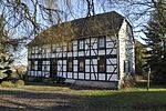 |
Hauptstrasse 19 | Rectory with outbuildings, baptismal font in the garden | 1-43 position |
|
 |
Outside area ("At the castle") | Archaeological monument: castle complex | 2–275 Lage Haina at Wikipedia |
|
 |
Outdoor area | Archaeological monument: "Das Schlösschen" ramparts | 3 - (approx. 50 parcels) location |
|
 |
western outskirts of the village | Archaeological monument: fortification | Field path between Kirchhofstrasse and Behringer Strasse. In the picture: Remnants of the wall at the cemetery | 1–87 / 1, 1–88 / 1, 1–89 / 1, 1–90 / 1 layer |
 |
Location | Archaeological monument: fortified manor | Area around church and churchyard | 1-1, 1–2 / 2, 1–2 / 3, 1–11 / 1, 1–11 / 2, 1–11 / 3, 1–13 / 19, 1–17, 1–18, 1– 80, 1-83, 1-84, 1-106, 1-128 / 1, 1-130 / 5, 1-130 / 6 |
Hochheim
| image | address | Monument designation | comment | Corridor / parcel location web link |
|---|---|---|---|---|
 |
Kirchstrasse | Tombstone | The stone is on the roadside in front of the church. | 1–88 / 1 layer |
 |
Kirchstrasse 59 | Residential building | 1-35 position |
|
 |
Kirchstrasse 92 | Rectory (demolished) and former school | The rectory stood where there is now a car parking lot. The school is to the west of it. | 1-86 position |
| The Wachhög is the eastern area of the Hautelsberg in the wind farm, north of the village | Burial mound remnant | The topographic point 340.7 is located on the burial mound. | location | |
| Eberstädter Weg, cross street, corner of Viehgasse | Village fortification | The fortification was created on the west side of the village and began at the village stream Backsgraben, which secured the south flank of the village. | location |
Remstädt
| image | address | Monument designation | comment | Corridor / parcel location web link |
|---|---|---|---|---|
 |
At the good 1 | Former manor house (monument protection application for the manor complex is available, now only the manor house is a cultural monument) | 1–71 / 10 position |
|
 |
Warzaer Strasse / cemetery | Cemetery chapel | 1–162 / 1 layer |
|
 |
Hauptstrasse 19 | Homestead | 1-57 position |
|
 |
Hauptstrasse 21 | Parish homestead | 1-52 position |
|
 |
Hauptstrasse 38 | Gate to the church | 1–128 / 1 layer |
Wangenheim
| image | address | Monument designation | comment | Corridor / parcel location web link |
|---|---|---|---|---|
 |
Hauptstrasse 30 | water pump | A few years ago the pump was knocked over and largely disposed of. A few parts are kept in the house. | 1-72 / 32 position |
 |
Hauptstrasse 63 | House | 1-203 / 3 position |
|
 |
Kirchberg 2 | Rectory | 1-69 location |
Warza
| image | address | Monument designation | comment | Corridor / parcel location web link |
|---|---|---|---|---|
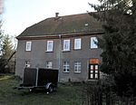 |
Pfarrgasse 5 | Residential building (rectory) | 1-98 location |
Westhausen
| image | address | Monument designation | comment | Corridor / parcel location web link |
|---|---|---|---|---|
 |
Hauptstrasse 37 | Residential building | 1-90 location |
|
 |
Hauptstrasse 39 | Residential building | 1-91 location |
|
 |
Hauptstrasse 50 | Residential house with courtyard gate | "Partially" broken off, there is still a half-timbered building in danger of collapse to the east of the rubble site. | 1-125 location |
 |
Hochheimer Strasse 55 | Courtyard | 1-58 location |
Former cultural monuments
| image | address | Monument designation | comment | Corridor / parcel location web link |
|---|---|---|---|---|
 |
Goldbach, Backhausgasse 11 | Residential building | Demolished in 2011, meanwhile (2016) new residential building (not listed) | 1–115 position |
| Goldbach, Karl-Marx-Strasse 4 | barn | Broken down in 1998, today the schoolyard | 2–228 position |
|
 |
Community Street 6 | House and barn | House demolished in 1994, Az. 316/94, meanwhile (2016) new building | 2–275 / 7 position |
Literature and Sources
- Municipality of Nessetal (as of February 2014)
- Hermann Kaufmann: Prehistoric burial mounds in the area of the Gotha and Langensalza districts. In: Alt-Thüringen 6th vol. 1962–63 digitized