List of streets in Oberhausen-Neue Mitte
The list of streets in the Neue Mitte Oberhausen describes the street system in the Oberhausen district of Neue Mitte with the corresponding historical references.
overview
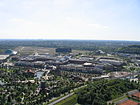
In the sense of this article, the New Center includes the actual New Center, the Centro shopping center built in 1994–1996 on a former Gutehoffnungshütte site and the surrounding area, as well as the “Am Technologiezentrum” and “Max-Planck-Ring” industrial areas, the Kaisergarten as well as the Grafenbusch settlement and forest .
Starting in the north, the district is bounded clockwise as follows: Duisburg – Quakenbrück to Sterkrade , Konrad-Adenauer-Allee to Osterfeld-Heide , Rhine-Herne Canal to Osterfeld-Mitte , Osterfelder Strasse and Duisburg-Wedau – Bottrop South to Borbeck , Ripshorster Straße to the Essen district of Frintrop , the Duisburg – Dortmund line to Bermensfeld , the Knappenviertel and Marienviertel, and the Oberhausen – Arnhem line to Lirich-Süd , Lirich and Buschhausen .
There are 28 designated traffic areas in the Neue Mitte, including two squares. Six of these streets are only partially in the district:
Duisburger Straße continues via Lirich-Süd to Alstaden and Duisburg - Meiderich , Essener Straße via Bermensfeld to Essen-Frintrop and Mülheimer Straße via Marienviertel, the city center and Unterstyrum on to to Mülheim - Oberstyrum . Osterfelder Strasse leads via Vonderort to Osterfeld-Mitte. Lindnerstrasse will be continued in Buschhausen.
The federal autobahn 42 leads through the Neue Mitte, with the Oberhausen-Zentrum junction at an exit in the northwestern part of the Neue Mitte. The federal autobahn 516 begins directly to the north with the “Oberhausen-Eisenheim” exit. To the northeast of the Neue Mitte is the “Oberhausen-Osterfeld / Neue Mitte” exit of the A42. The two federal highways B223 and B 231 run in the New Center and also cross here. The Mülheimer Strasse - Konrad-Adenauer-Allee road belongs to the B223, and the Essener Strasse to the B 231.
The following streets have the status of a state or district road:
- Landesstraße 450: (starts at the B 231) - Osterfelder Straße - further in Vonderort
- Landesstraße 452: (continuation of the B 231) - junction B 223 - Duisburger Straße - continue in Lirich-Süd
- Kreisstraße 3: (coming from Buschhausen) - Lindnerstraße - end of the B 223
Overview of streets and squares
The following table gives an overview of the existing streets, paths and squares in the district as well as some related information.
- Name : current name of the street or square.
- Length / dimensions in meters:
- The length information contained in the overview are rounded overview values that were determined in Google Earth using the local scale. They are used for comparison purposes and, if official values are known, are exchanged and marked separately.
For squares, the dimensions are given in the form a × b. - The addition in the district indicates that the length is that of the street section within the Neue Mitte, provided that the street continues into neighboring districts.
- The addition without spur streets indicates the length of the "main street" for branched streets.
- The addition (all street sections together) indicates that the street is so winding that there is no “main street”. Instead, the length of all road sections is added together.
- Derivation : origin or reference of the name
- Notes : additional information
- Image : Photo of the street or an adjacent object
| Surname | Length / dimensions (in meters) |
Derivation | Date of designation | Remarks | image |
|---|---|---|---|---|---|
| Old roller | 650 | Nickname of the former sheet metal mill located here | Around 1830 a small sheet metal rolling mill was built here by Gutehoffnungshütte , which was called "Walzwerk Oberhausen". Until it was demolished in the 1990s, however, it was popularly known as the "Alte Walz", which is why the street on its site was given this name.
The Alte Walz street leads from Essener Straße as an extension of Im Lipperfeld past the König-Pilsener-Arena to the bus stop “Neue Mitte Oberhausen” on the Platz der Guten Hoffnung, behind which it continues as Centroallee. |
||
| At the Grafenbusch | 1160 without access roads: 650 |
Grafenbusch settlement | From 1910 to 1922 the Gutehoffnungshütte built a settlement in the former forests of the Emscherbusch, which was named "Grafenbusch settlement" after the nearby forest. The street Am Grafenbusch, which forms a side street to Konrad-Adenauer-Allee, leads through the settlement to the Oberhausen Gasometer , a former 116 meter high gas tank, which is now the symbol of the city of Oberhausen. | ||
| At the Kaisergarten | 900 | Kaisergarten, Volkspark at Oberhausen Castle | 1936 | In 1896, the city of Oberhausen acquired the green areas around Oberhausen Castle from Count von Westerholt and developed the park into a local recreation facility, which was inaugurated on the 100th birthday of Kaiser Wilhelm I in 1897 and named after him "Kaisergarten". The street Am Kaisergarten leads as a cul-de-sac to Konrad-Adenauer-Allee on the southern edge of the park. Until 1936 it was called Hammerstrasse . | |
| Amsterdam street | 220 | Amsterdam , capital of the Netherlands | The name of the Amsterdamer Straße refers to the first manager of the center, Hans Matthijsse, as well as the neighborly connection to Holland. Amsterdamer Straße leads from Centroallee to Brammenring. | ||
| Arena Street | 550 | Koenig-Pilsener-Arena | Arenastraße is located west of the König-Pilsener-Arena and leads to the parking lots. |

|
|
| Slab ring | 2600 | Slab , block made of cast steel | The Brammenring is an industrial park east of Osterfelder Straße. | ||
| Brussels Street | 100 | Brussels , capital of Belgium and headquarters of the European Union | The name is intended to indicate the Western European, international character of the Centros and the New Center. Brusseler Strasse connects Centroallee and Essener Strasse. | ||
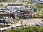
| Centroallee | 1100 | Centro , shopping center and heart of the New Center | The Centroallee surrounds the centerpiece in a semicircle, it begins at the Platz der Guten Hoffnung as a continuation of the Alte Walz and leads to the Luise-Albertz-Platz. |

|
|
| Duisburger Strasse | 800 in the district |
Duisburg , neighboring city | 1892 | Duisburger Straße is the continuation of Essener Straße behind Mülheimer Straße in a westerly direction, it leads via Lirich-Süd and Alstaden to Duisburg and therefore bears this name. Until 1892 it was called Meiderich-Steeler Provinzialstraße . | |
| Essener Strasse | 1500 in the district |
Essen , neighboring city | 1892 | As a continuation of Duisburger Strasse, Essener Strasse runs eastwards past Mülheimer Strasse, past the Centro and through Bermensfeld to Essen, which is why it is named after the neighboring town of Oberhausen. Until 1892 it was part of the Meiderich-Steeler Provinzialstraße . |

|
| Europaallee | 170 | Europe | The name "Europaallee" is intended to indicate the international, European character of the Centros and the New Center. Europaallee connects Centroallee and Brammenring. | ||
| Heinz-Schleusser-Strasse | 180 | Heinz Schleusser , 1936–2000, Oberhausen politician of the SPD , Finance Minister of North Rhine-Westphalia | Heinz-Schleusser-Strasse is located directly on the Heinz-Schleusser Marina and therefore bears this name. It is a dead end to Zum Aquarium. | ||
| In the Lipperfeld | 1300 | "Lipperfeld", part of the Lipper Heide | Before industrialization, the Lipper Heide was located here, the central area of which was called the "Lipperfeld". The street Im Lipperfeld leads south from Essener Straße and then back in an arc back to it, opening up the “industrial area at the technology center” that is located here today. | ||
| Konrad-Adenauer-Allee | 1400 | Konrad Adenauer , 1876–1967, first Federal Chancellor of Germany | April 7, 1993 | Konrad-Adenauer-Allee is the continuation of Mülheimer Strasse behind Duisburger / Essener Strasse. It leads northwards from the Neue Mitte past Oberhausen Castle to the 516 federal motorway in the direction of Sterkrade. The federal road 223 runs on it . Until 1993 it was called Sterkrader Straße , before that until 1892 Düsseldorf-Münstersche Provinzialstraße . |

|
| Lindnerstrasse | 1200 | Gustav Adolf Lindner , 1828–1887, Czech teacher | 1963 | The Lindnerstraße comes from Buschhausen and runs past the Niederrhein stadium, parallel to the Emscher, to Konrad-Adenauer-Allee, behind which it ends. Until 1963 it was called Grafenbuschstraße on this section . | |
| Luise-Albertz-Platz | 55x45 | Luise Albertz , 1901–1979, politician of the SPD and Lord Mayor of Oberhausen | Luise-Albertz-Platz closes off the eastern section of the promenade at the cinema center and the Coca-Cola oasis. It is named after the long-time mayor of Oberhausen (1946–1948, again 1956–1975), Luise Albertz. |

|
|
| Marie-Juchacz-Weg | 90 | Marie Juchacz , 1879–1956, German politician and women's rights activist, founder of the Arbeiterwohlfahrt | September 11, 2019 | Marie-Juchacz-Weg is a small cul-de-sac to Essener Strasse, where the headquarters of the Oberhausen Workers' Welfare Association is located. | |
| Max Planck Ring | 1960 (all road sections together) |
Max Planck , 1858–1947, physicist and Nobel Prize winner | The Max-Planck-Ring opens up the industrial area of the same name between Duisburger and Mülheimer Straße. | ||
| Middlesbroughstrasse | 90 | Middlesbrough , twin town of Oberhausen | The Middlesbroughstraße leads as a cul-de-sac to Centroallee to the shopping center parking garages. | ||
| Mülheimer Strasse | 650 in the district |
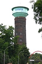
Mülheim an der Ruhr , neighboring town | 1892 | Mülheimer Strasse, as an extension of Konrad-Adenauer-Allee, leads southwards behind Duisburger / Essener Strasse through the Marienviertel, the city center and Styrum to Mülheim, which is why it bears this name. The Oberhausen Water Tower and the Oberhausen Technology Center (TZU) are located here. Until 1892 the street was called Düsseldorf-Münstersche Provinzialstraße . |

|
| Music way | 140 | Here is the Metronom Theater . | The Musikweg branches off from Centroallee at the Metronome Theater and ends at the railway embankment. |

|
|
| Osterfelder Strasse | 1200 in the district |
Osterfeld , neighboring district | 1936 | Osterfelder Strasse leads from Essener Strasse northeast through Vondern to Osterfeld, which is why it bears this name. Until 1936 it was called Emscherstraße . | |
| Good Hope Square | 50x30 | Good Hope Hut | The blast furnaces, steelworks and rolling mills of the Gutehoffnungshütte, after which the space between the bus stop “Neue Mitte Oberhausen” and the promenade is named, were located on the site of the Center. |

|
|
| promenade | 450 | designed as a promenade | The promenade is the promenade between the gastronomy area of the center and the open water at the amusement park. It leads from the place of good hope to the Luise-Albertz-Platz. | ||
| Sheffield Street | 140 | Sheffield , birthplace of Centro investor Eddie Healey | Sheffieldstrasse is a small cul-de-sac to Centroallee that leads to the shopping center parking garages. | ||
| Wilhelm Bettinger Way | 50 | Wilhelm Bettinger, 1903–1982, Oberhausen resistance fighter | Wilhelm Bettinger was a resistance fighter from Oberhausen who was imprisoned from 1933 to 1939. In the post-war period he made it his business to educate young people about the time of National Socialism and led many school classes through the exhibitions in Oberhausen Castle .
The path named after him leads from Konrad-Adenauer-Allee to the Kaisergarten, past Oberhausen Castle. |
||
| To the aquarium | 600 | Sea Life Center Oberhausen | The aquarium leads past the Aquapark Oberhausen to the Heinz Schleusser Marina and the Sea Life aquarium located there. |

|
|
| To the ironworks | 450 | former ironworks "Oberhausen II" | To the ironworks in the industrial area at the technology center leads away from the street Im Lipperfeld and back to it. The ironworks "Oberhausen II" was located here from 1907 to 1980. |
See also
Individual evidence
- ↑ Unless otherwise stated, the source used is: Alfred & Ulrich Lindemann: 500 Kilometer Oberhausener Strassegeschichte , 1997
- ↑ OpenStreetMap. Retrieved January 19, 2016 .
- ^ Official Journal for the City of Oberhausen. (PDF; 1.7 MB) Official Journal 19/2019. City of Oberhausen, October 15, 2019, accessed on July 26, 2020 .

