List of listed objects in Wölbling
The list of listed objects in Wölbling contains the 12 listed , immovable objects of the municipality of Wölbling in the Lower Austrian district of Sankt Pölten-Land .
Monuments
| photo | monument | Location | description | Metadata |
|---|---|---|---|---|

|
Wayside shrine, Barbarakreuz ObjektID : 91901 |
Location KG: Ambach |
The wayside shrine, known as the Barbara cross, has three niches one above the other. At the top there is a picture of Mary , in the middle a cross and at the bottom an image of St. Barbara. The memorial was renovated in 1947, 1982 and 1999. The veneration of St. Barbara , the patron saint of miners , has a long tradition in the area around Ambach, as a lignite mine, the Hermannschacht , was operated in the vicinity until the 1960s . |
ObjectID : 91901 Status: § 2a Status of the BDA list: 2020-02-29 Name: wayside shrine, Barbarakreuz GstNr .: 717 Barbarakreuz (Ambach) |

|
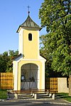
Local chapel Hausheim ObjektID : 91900 |
Location KG: Hausheim |
Origin not recorded: on January 5th, 1766 the community of Hausheim vowed the "preservation of the chapel with turrets and prayer bells" |
ObjectID : 91900 Status: § 2a Status of the BDA list: 2020-02-29 Name: Ortskapelle Hausheim GstNr .: 58 |

|
Landersdorf Castle ObjectID : 73562 |
Landersdorf 15 KG location : Landersdorf |
First documented mention: May 8, 1155 as a noble estate, came to the Archdiocese of Salzburg in 1674 (until 1802), then incorporated into the Walpersdorf rule. |
ObjectID : 73562 Status: § 2a Status of the BDA list: 2020-02-29 Name: Schloss Landersdorf GstNr .: .11 Schloss Landersdorf |

|
Corridor / path chapel ObjectID : 73563 |
KG location : Landersdorf |
The St. The chapel in Landersdorf, consecrated to Johannes Nepomuk, is a prayer chapel with outdoor benches. |
ObjectID : 73563 Status: § 2a Status of the BDA list: 2020-02-29 Name: Flur- / Wegkapelle GstNr .: 660/5 Kapelle Landersdorf |

|
Catholic parish church hll. Peter and Paul and defensive wall with towers ObjectID : 55230 |
Upper market location KG: Oberwölbling |
Built around 1500 at the upper end of the market square: late Gothic three-aisled staggered church with baroque changes. The west tower in front is essentially medieval, the upper floor and spire were built in 1846 |
ObjectID : 55230 Status: § 2a Status of the BDA list: 2020-02-29 Name: Catholic parish church hll. Peter and Paul and defensive wall with towers GstNr .: 35/3 Parish Church Oberwölbling |

|
Town Hall / Municipal Office ObjectID : 73544 |
Oberer Markt 1 location KG: Oberwölbling |
Two-storey corner house, the core from the 2nd half of the 16th century, facade and renovations from the 20th century. |
ObjectID : 73544 Status: § 2a Status of the BDA list: 2020-02-29 Name: City Hall / Municipal Office GstNr .: 46/5 |

|
Vicarage ObjectID : 73546 |
Waldbadstrasse 6 KG location : Oberwölbling |
Built in 1756 by Pastor Johann Georg Scheibnpogn about 300 meters west of the church. |
ObjectID : 73546 Status: § 2a Status of the BDA list: 2020-02-29 Name: Pfarrhof GstNr .: 5 |

|
Wayside shrine Herrgott auf der Wies ObjectID : 73548 |
KG location : Oberwölbling |
The statue dates from 1899, the veneration of the scourged Savior goes back to the passion cult in the 18th century of the Bavarian "Wieskirche" (name!) |
ObjectID : 73548 Status: § 2a Status of the BDA list: 2020-02-29 Name: wayside shrine Herrgott auf der Wies GstNr .: 788/4 |

|
Pillory ObjectID : 73545 |
KG location : Oberwölbling |
Erected in 1584 by Baron von Jörger as a sign of high jurisdiction, the best preserved pillory in the St. Pölten district |
ObjectID : 73545 Status: § 2a Status of the BDA list: 2020-02-29 Name: Pranger GstNr .: 1257/1 |

|
Wayside shrine, Flötzersteig (Kaiblinger) ObjectID : 91903 |
KG location : Oberwölbling |
The Marterl am Flötzersteig is located on a dirt road that the former Danube rafts used on their way home up the Danube. The circumstances of its origin are not known. It has niches with pictures. In the mid-1990s, it was renovated by the local Mader family. |
ObjectID : 91903 Status: § 2a Status of the BDA list: 2020-02-29 Name: Bildstock, Flötzersteig (Kaiblinger) GstNr .: 1259 |
|
|
Fortified hillside settlement Singerkreuz ObjectID : 97094 |
Dachsgraben location KG: Ratzersdorf |
Settlement in prehistoric times, approx. 2300/2200–1600 BC Chr .: fortified settlement completely surrounded by a wall, multiple ditch-wall system on the north side |
ObjectID : 97094 Status : Notification Status of the BDA list: 2020-02-29 Name: Fortified hillside settlement Singerkreuz GstNr .: 5; 8/1; 8/2; 8/3; 8/4; 8/5; 15th |

|
Catholic branch church hl. Vitus and former cemetery ObjectID : 73560 |
Unterwölbling location KG: Unterwölbling |
The three-aisled late Gothic hall church, built between 1511 and 1522, was originally a fortified church, the fortifications are no longer recognizable. 1650 incorporated into the parish of Oberwölbling. |
ObjectID : 73560 Status: § 2a Status of the BDA list: 2020-02-29 Name: Kath. Filialkirche hl. Vitus and former cemetery GstNr .: 69/3 Filialkirche Unterwölbling |
literature
- Bundesdenkmalamt (Ed.): The art monuments of Austria - Lower Austria south of the Danube, in two parts. Part 1: M – Z. Verlag Berger, Horn 2003 ISBN 3-85028-365-8
Web links
Commons : Listed objects in Wölbling - collection of pictures, videos and audio files
Individual evidence
- ↑ a b Lower Austria - immovable and archaeological monuments under monument protection. (PDF), ( CSV ). Federal Monuments Office , as of February 14, 2020.
- ↑ a b Marterl and wayside shrines in the northern parish area. Retrieved August 22, 2020 .
- ↑ § 2a Monument Protection Act in the legal information system of the Republic of Austria .