List of listed objects in Wilhelmsburg (Lower Austria)
The list of listed objects in Wilhelmsburg contains the 20 listed , immovable objects of the municipality of Wilhelmsburg in the Lower Austrian district of Sankt Pölten-Land .
Monuments
| photo | monument | Location | description | Metadata |
|---|---|---|---|---|

|
Outlet chamber Traisendüker (AK 79), discharge chamber, 3 canal bridges (Grünbauer 1, 2, Windhaag), entry tower 80 Object ID: 129626 since 2012 |
Location see description KG: Kreisbach GstNr .: 38/1; 49/3; 159/1; 152/1; 174, 186; 264/3; 207/1, 208/4; 266 |
The Traisen culvert, a culvert of the Second Vienna High Spring Water Pipeline , crosses under the Traisen in Wilhelmsburg with a horizontal distance of around 1170 m from the inlet chamber EK 78 to the outlet chamber AK 79 ( location ).
In addition to the Traisendüker, the Federal Monuments Office also protects the canal bridge ( location ) with the same entry , ?? ( Location ), ?? ( ) And the entry tower 80 ( location ). |
ObjectID : 129626 Status : Notification Status of the BDA list: 2020-02-29 Name: Traisendüker discharge chamber (AK 79), discharge chamber, 3 canal bridges (Grünbauer 1, 2, Windhaag), entry tower 80, entry tower 80, II HQL, Wilhelmsburg |

|
Engelbauer aqueduct ObjectID : 129627 since 2012 |
KG location : Kreisbach |
The second Viennese spring water pipeline is a 183 km long drinking water supply pipeline for the city of Vienna . It was built at the instigation of Karl Lueger and, after a ten-year construction period, opened on December 2, 1910 as the 2nd Kaiser-Franz-Josef Spring Pipeline . |
ObjektID : 129627 Status : Notification Status of the BDA list: 2020-02-29 Name: Engelbaueraquädukt GstNr .: 49/3; 153/1; 159/1 Engelbauer aqueduct |

|
Gutshof / Meierhof (stately) ObjectID : 73595 |
Kreisbacher Strasse 22 KG location : Kreisbach |
The three-winged, two-storey former estate is larger than the castle today and was built around 1600. The windows are partially equipped with sgraffito frames, the service wings with pointed cap barrel vaults . |
ObjectID : 73595 Status: § 2a Status of the BDA list: 2020-02-29 Name: Gutshof / Meierhof (manorial) GstNr .: 1536 Schloss Kreisbach |

|
Castle Chapel St. Anna ObjectID : 73596 |
Kreisbacher Strasse 27 KG location : Kreisbach |
The on St. Anna chapel was created in 1681 through the renovation of a ballroom at Kreisbach Castle. The two-bay interior measures 10 × 8 meters in plan and is 6 meters high. The stucco decor on the vaults and walls date from around 1720. |
ObjectID : 73596 Status: § 2a Status of the BDA list: 2020-02-29 Name: Schlosskapelle hl. Anna GstNr .: 118/2 Schloss Kreisbach |

|
Kreisbach Castle ObjectID : 73600 |
Kreisbacher Strasse 27 KG location : Kreisbach |
From the medieval building, first mentioned in the 12th century and largely redesigned in the 16th century, only the east wing, consisting of two tracts, has been preserved, in which the castle chapel is also located. A large part of the building was demolished in the middle of the 19th century for tax reasons. The 14 meter high gate tower that leads into the former inner courtyard is an eye-catcher. Only small remnants are left of the curtain wall, a moat and two towers that used to surround the complex. |
ObjectID : 73600 Status: § 2a Status of the BDA list: 2020-02-29 Name: Schloss Kreisbach GstNr .: 118/2; 119/2; 119/1 Kreisbach Castle |

|
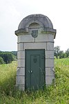
Entry tower 77 ObjectID : 129623 since 2012 |
Location KG: Pömmern |
The entrance tower 77 serves as access to an underground part of the Vienna High Spring Pipeline, which was built by 1910 . |
ObjectID : 129623 Status : Notification Status of the BDA list: 2020-02-29 Name: Entrance tower 77 GstNr .: 196 Entrance tower 77, II HQL, Wilhelmsburg |
|
|
Pommern aqueduct ObjectID : 129624 since 2012 |
Location KG: Pömmern |
The second Viennese spring water pipeline is a 183 km long drinking water supply pipeline for the city of Vienna . It was built at the instigation of Karl Lueger and, after a ten-year construction period, opened on December 2, 1910 as the 2nd Kaiser-Franz-Josef Spring Pipeline . |
ObjektID : 129624 Status : Notification Status of the BDA list: 2020-02-29 Name: Pömmernaquedukt GstNr .: 196; 197; 198; 199; 144; 178 Pommern aqueduct |

|
Hadinga Aqueduct ObjectID : 129620 since 2012 |
KG location : Wielandsberg |
The Hadinga aqueduct of the second Viennese spring water pipeline connects the communities of Weinburg and Wilhelmsburg. |
ObjectID : 129620 Status : Notification Status of the BDA list: 2020-02-29 Name: Hadingaquedukt GstNr .: 474; 177/1; 177/2 Hadinga aqueduct |

|
Wolkersberg aqueduct ObjectID : 129621 since 2012 |
KG location : Wielandsberg |
The Wolkersberg aqueduct of the second Viennese spring water pipeline connects the cadastral communities of Wielandsberg and Wolkersberg . |
ObjectID : 129621 Status : Notification Status of the BDA list: 2020-02-29 Name: Wolkersbergaquedukt GstNr .: 123/1 Wolkersbergaquedukt |

|
Inlet chamber Traisendüker (EK 78) ObjektID : 129625 since 2012 |
KG location : Wilhelmsburg |
The Traisen culvert, a culvert of the Second Vienna High Spring Water Pipeline , crosses under the Traisen in Wilhelmsburg from the inlet chamber EK 78 to the outlet chamber AK 79 with a horizontal distance of around 1170 m . |
ObjectID : 129625 Status : Notification Status of the BDA list: 2020-02-29 Name: Inlet chamber Traisendüker (EK 78) GstNr .: 71/1 |

|
Plague Cross / Plague Column ObjectID : 73589 |
at Bahnhofstrasse 1, KG location : Wilhelmsburg |
The plague column with a multi-tiered base dates from 1678. |
ObjectID : 73589 Status: § 2a Status of the BDA list: 2020-02-29 Name: Pestkreuz / Plague column GstNr .: 589/36 Plague column Wilhelmsburg (Lower Austria) |

|
Figure shrine St. Jude Squidward ObjectID : 73590 |
Hauptplatz location KG: Wilhelmsburg |
The statue of St. Judas Thaddäus dates from 1717. It stands on a broad base in the main square. |
ObjectID : 73590 Status: § 2a Status of the BDA list: 2020-02-29 Name: Figurine picture stick hl. Judas Thaddäus GstNr .: 660/2 Judas Thaddäus Wilhelmsburg (Lower Austria) |

|
Catholic parish church hl. Stephan ObjectID : 56316 |
Hauptplatz 5 KG location : Wilhelmsburg |
The Roman Catholic Parish Church of St. Stephanus on the northern part of the main square is a Gothic stacked church from the 14th and 15th centuries with a Romanesque core. A low gable tower rises on its west side. |
ObjectID : 56316 Status: § 2a Status of the BDA list: 2020-02-29 Name: Catholic parish church hl. Stephan GstNr .: .137 Parish Church hl. Stephan, Wilhelmsburg |

|
Marienkapelle, Ducal Chapel ObjectID : 73570 |
Hauptplatz 5 KG location : Wilhelmsburg |
Today's Protestant ducal chapel is a remarkable example of a Gothic double chapel. It is connected to the rectory by a wing and has served as an evangelical place of worship since 1969. |
ObjectID : 73570 Status: § 2a Status of the BDA list: 2020-02-29 Name: Marienkapelle, Herzogskapelle GstNr .: .120 Marienkapelle Wilhelmsburg (Lower Austria) |

|
Parsonage Object ID: 73571 |
Hauptplatz 5 KG location : Wilhelmsburg |
The parsonage north of the parish church is separated from it by a walled garden - the former cemetery. The two-storey building with a hipped roof is medieval in essence and was changed in the baroque era. |
ObjectID : 73571 Status: § 2a Status of the BDA list: 2020-02-29 Name: Pfarrhof GstNr .: .120 Pfarrhof Wilhelmsburg (Lower Austria) |

|
Bürgerhaus ObjektID : 34037 |
Hauptplatz 10 KG location : Wilhelmsburg |
The two-storey town house with a hipped roof is medieval in essence and has been changed in Baroque style. |
ObjectID : 34037 Status : Notification Status of the BDA list: 2020-02-29 Name: Bürgerhaus GstNr .: .100 Bürgerhaus Hauptplatz 10, Wilhelmsburg |

|
Bürgerhaus ObjektID : 47757 |
Hauptplatz 11 KG location : Wilhelmsburg |
This gabled town house with a high storey is also essentially medieval. It was rebuilt in the 16th and 17th centuries. |
ObjectID : 47757 Status : Notification Status of the BDA list: 2020-02-29 Name: Bürgerhaus GstNr .: .99 Bürgerhaus Hauptplatz 11, Wilhelmsburg |

|
Town Hall / Municipal Office ObjectID : 56315 |
Hauptplatz 13 KG location : Wilhelmsburg |
The gable-facing town hall with its simple facade dates from the 1st half of the 17th century. The relief with the city coat of arms is marked 1632. |
ObjectID : 56315 Status: § 2a Status of the BDA list: 2020-02-29 Name: City Hall / Municipal Office GstNr .: .97 City Hall Wilhelmsburg (Lower Austria) |

|
Remains of the curtain wall ObjectID : 34038 |
Penknergasse 19 KG location : Wilhelmsburg |
The city fortifications were originally built in 1310 and were raised and reinforced twice from the second half of the 16th century. From 1856 the gates and towers were razed. Remnants of the curtain wall have been preserved in the northwest of the city. |
ObjectID : 34038 Status : Notification Status of the BDA list: 2020-02-29 Name: Remnants of the ring wall GstNr .: 470/1; 553/2 |

|
Wolkersberg aqueduct ObjectID : 129622 since 2012 |
KG location : Wolkersberg |
The Wolkersberg aqueduct of the second Viennese spring water pipeline connects the cadastral communities of Wielandsberg and Wolkersberg. |
ObjektID : 129622 Status : Notification Status of the BDA list: 2020-02-29 Name: Wolkersbergaquädukt GstNr .: 20; 23 Wolkersberg aqueduct |
Former monuments
| photo | monument | Location | description | Metadata |
|---|---|---|---|---|

|
Residential building, Peinstadlhaus ObjektID : 12256 until 2014 |
Färbergasse 28 KG location : Wilhelmsburg |
The so-called Peinstadlhaus is a three-wing, single-storey building from the early 18th century. The east wing has a high, multiple curved gable. |
ObjectID : 12256 Status : Notification Status of the BDA list: 2014-06-27 Name: Residential house, Peinstadlhaus GstNr .: 533/4 |
literature
- Bundesdenkmalamt (Ed.): The art monuments of Austria - Lower Austria south of the Danube, in two parts. Part 1: M – Z. Verlag Berger, Horn 2003 ISBN 3-85028-365-8
Web links
Commons : Listed objects in Wilhelmsburg - collection of images, videos and audio files
Individual evidence
- ↑ a b Lower Austria - immovable and archaeological monuments under monument protection. (PDF), ( CSV ). Federal Monuments Office , as of February 14, 2020.
- ↑ additionally according to Lower Austria Atlas
- ↑ a b Entry about Kreisbach on Burgen-Austria
- ^ Lower Austria - immovable and archaeological monuments under monument protection. ( Memento from September 23, 2015 in the Internet Archive ) . Federal Monuments Office , as of June 27, 2014 (PDF).
- ↑ § 2a Monument Protection Act in the legal information system of the Republic of Austria .