List of listed objects in Pyhra
The list of listed objects in Pyhra contains the 27 listed , immovable objects of the municipality of Pyhra in the Lower Austrian district of Sankt Pölten-Land .
Monuments
| photo | monument | Location | description | Metadata |
|---|---|---|---|---|

|
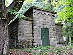
Inlet chamber Perschlingdüker (EK 85) ObjektID : 129638 since 2012 |
KG location : Auern |
The second Viennese spring water pipeline is a 183 km long drinking water supply pipeline for the city of Vienna . It was built at the instigation of Karl Lueger and, after a ten-year construction period, opened on December 2, 1910 as the 2nd Kaiser-Franz-Josef Spring Pipeline . |
ObjectID : 129638 Status : Notification Status of the BDA list: 2020-02-29 Name: Inlet chamber Perschlingdüker (EK 85) GstNr .: 231/2 Perschlingdüker |
|
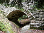
Geißelhofer Canal Bridge ObjectID : 129637 since 2012 |
KG location : Auern |
The Geißelhofer canal bridge connects the cadastral communities of Heuberg (see there) and Auern. |
ObjectID : 129637 Status : Notification Status of the BDA list: 2020-02-29 Name: Geißelhofer Canal Bridge GstNr .: 231/1 Geißelhofer Canal Bridge |
|
Outlet chamber Perschlingdüker (AK 86) ObjektID : 129639 since 2012 |
Location KG: Heuberg |
The Perschlingdüker discharge chamber is part of the Second Vienna High Spring Pipeline. |
ObjectID : 129639 Status : Notification Status of the BDA list: 2020-02-29 Name: discharge chamber Perschlingdüker (AK 86) GstNr .: 216 Perschlingdüker |

|
Geißelhofer Canal Bridge ObjectID : 129636 since 2012 |
Location KG: Heuberg |
The Geißelhofer canal bridge connects the cadastral communities of Auern (see there) and Heuberg. |
ObjectID : 129636 Status : Notification Status of the BDA list: 2020-02-29 Name: Geißelhofer Canal Bridge GstNr .: 167/2 Geißelhofer Canal Bridge |

|
Former agricultural college ObjectID : 29670 |
Dr. C. Kupelwieser-Straße 20 KG location : Heuberg |
A complex of two irregularly designed two- to three-story buildings under a hipped roof and with a trickle plaster facade and natural stone plinth. Donated by the landlord of Kirnberg Karl Kupelwieser and built in 1913. |
ObjectID : 29670 Status : Notification Status of the BDA list: 2020-02-29 Name: Former agricultural college GstNr .: 16/4 |

|
Reintalaquädukt Object ID: 129640 since 2012 |
Location KG: beneficial organism |
The Reintala aqueduct in the Kirnberger Walde near here is part of the second Viennese spring water pipeline. |
ObjektID : 129640 Status : Notification Status of the BDA list: 2020-02-29 Name: Reintalaquädukt GstNr .: 280/12; 280/8; 280/6 Reintalaquädukt |

|
2 canal bridges (beneficial insects 1, 2), entry tower 87 ObjectID : 129641 since 2012 |
For location see description of KG: beneficial insect |
In addition to other structures of the second Viennese high spring water pipeline in the municipality, the canal bridges beneficial 1 ( location ) and beneficialling 2 ( location ) as well as entry tower 87 ( location ) are protected. |
ObjektID : 129641 Status : Notification Status of the BDA list: 2020-02-29 Name: 2 canal bridges (beneficials 1, 2), entry tower 87 GstNr .: 244; 236/1; 243; 242; 241 |
|
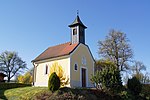
Local chapel ObjectID : 29652 |
KG location : Perersdorf |
Built at the end of the 19th century, is slightly elevated in the center of the village. |
ObjectID : 29652 Status: § 2a Status of the BDA list: 2020-02-29 Name: Ortskapelle GstNr .: .8 / 3 |

|
Church ruin hl. Cäcilia ObjectID : 29690 |
KG location : Perersdorf |
Between the villages of Böheimkirchen and Pyhra are the ruins of a church built in the 14th century and baroque in the 18th century, which was destroyed by French troops in 1805 during the Napoleonic War . It was under the patronage of St. Cecilia . |
ObjectID : 29690 Status : Notification Status of the BDA list: 2020-02-29 Name: Church ruins hl. Cäcilia GstNr .: .17 / 1 Church ruins St. Cäcilia |

|
Canal bridge boiler ObjectID : 129633 since 2012 |
Location KG: Probstwald |
The canal bridge Kessel of the second Viennese spring water pipeline connects the cadastral communities of Probstwald and Schauching . |
ObjectID : 129633 Status : Notification Status of the BDA list: 2020-02-29 Name: Canal bridge Kessel GstNr .: 6 Canal bridge Kessel, II HQL, Pyhra |

|
Probstwald canal bridge, entry tower 84 ObjectID : 129632 since 2012 |
Location see description KG: Probstwald |
The Probstwald canal bridge ( Lage ) and the entrance tower 84 ( Lage ) are protected along with other structures of the Second Vienna Spring Water Pipeline in the municipality . |
ObjektID : 129632 Status : Notification Status of the BDA list: 2020-02-29 Name: Canal bridge Probstwald, Einsteigurm 84 GstNr .: 6 Canal bridge Probstwald, II HQL, Pyhra |

|
Harlander Aqueduct ObjectID : 129631 since 2012 |
Location KG: Probstwald |
The Harland aqueduct of the second Viennese spring water pipeline connects the cadastral communities of Probstwald and Zuleithen . |
ObjectID : 129631 Status : Notification Status of the BDA list: 2020-02-29 Name: Harlander Aqueduct GstNr .: 5 Harlander Aqueduct, II HQL, Pyhra |

|
Secondary school ObjectID : 29681 |
Am Eichberg 1 location KG: Pyhra |
Two-storey building on a broad base, erected 1911–12. |
ObjectID : 29681 Status: § 2a Status of the BDA list: 2020-02-29 Name: Hauptschule GstNr .: .80 |
|
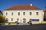
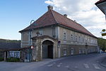
Town hall / municipal office, former model school ObjectID : 29683 |
Hauptstrasse 13 Location KG: Pyhra |
Two-storey building under a hipped roof, the core of the second half of the 18th century, redesigned around 1980. |
ObjectID : 29683 Status: § 2a Status of the BDA list: 2020-02-29 Name: City Hall / Municipal Office, former Musterschule GstNr .: .8 |
|
Parsonage Object ID: 29675 |
Hauptstrasse 17 KG location : Pyhra |
Broad, two-storey building from around 1800/01, flanked on both sides by a wicker garden portal. |
ObjectID : 29675 Status: § 2a Status of the BDA list: 2020-02-29 Name: Pfarrhof GstNr .: .9 Pfarrhof Pyhra |
|
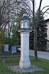
Wayside shrine, plague column ObjectID : 29685 |
Kreuzfeldgasse 1 KG location : Pyhra |
Pillar shrine with a niche top, marked 1733 on the shaft. |
ObjectID : 29685 Status: § 2a Status of the BDA list: 2020-02-29 Name: wayside shrine, plague column GstNr .: 716/7 |

|
Catholic parish church hl. Margareta and former cemetery wall ObjectID : 29677 |
Location KG: Pyhra |
Erected as a pillar basilica in the late 13th century, it was converted into a staggered church around 1450. The church stands on a hill in the center of the village, partially surrounded by the former cemetery wall. Three-aisled nave, three staggered, unequal choirs, massive tower with pointed arched medieval sound windows. Inside there is a remarkable collection of Renaissance tombs of the Protestant patron saint Greiß. |
ObjectID : 29677 Status: § 2a Status of the BDA list: 2020-02-29 Name: Catholic parish church hl. Margareta and former cemetery wall GstNr .: .10 Parish Church Pyhra |

|
Pillory ObjectID: 29679 |
Location KG: Pyhra |
Massive, heavily chamfered pillar southeast of the church. Probably from the 16th century, partially renewed. |
ObjectID: 29679 Status: § 2a Status of the BDA list: 2020-02-29 Name: Pranger GstNr .: 748/1 |

|
Canal bridge boiler ObjectID : 129634 since 2012 |
KG location : Schauching |
The canal bridge Kessel of the second Viennese high spring water pipeline connects the cadastral communities Probstwald (see there) and Schauching. |
ObjectID : 129634 Status : Notification Status of the BDA list: 2020-02-29 Name: Canal bridge Kessel GstNr .: 247/2 Canal bridge Kessel, II HQL, Pyhra |

|
Canal bridge Reichebner ObjektID : 129635 since 2012 |
KG location : Schauching |
The Reichebner canal bridge is part of Vienna's second high spring water pipeline. |
ObjektID : 129635 Status : Notification Status of the BDA list: 2020-02-29 Name: Kanalbrücke Reichebner GstNr .: 327/1 Kanalbrücke Reichebner, II HQL, Pyhra |

|
Wayside shrine ObjectID: 29689 |
KG location : Schauching |
The three-sided niche shrine from the first half of the 18th century houses a statue of the Madonna, which is likely to date from the same period. |
ObjectID: 29689 Status: § 2a Status of the BDA list: 2020-02-29 Name: Bildstock GstNr .: 361/1 |

|
Cemetery cross ObjectID : 29662 |
Cemetery location KG: Forest |
Crucifix from 1906 in the cemetery. |
ObjectID : 29662 Status: § 2a Status of the BDA list: 2020-02-29 Name: Friedhofskreuz GstNr .: 1027/2 |

|
Parsonage Object ID: 29653 |
Perschlingtalstrasse 50 KG location : Forest |
Two-storey building from 1838. |
ObjectID : 29653 Status: § 2a Status of the BDA list: 2020-02-29 Name: Pfarrhof GstNr .: .91 Pfarrhof Wald |

|
Forest Castle ObjectID : 29691 |
Schlossweg 1 location KG: forest |
In the second half of the 16th and first half of the 17th centuries, a medieval castle was built. Three-storey, four-wing complex, dominated by the medieval keep in the southeast. |
ObjectID : 29691 Status : Notification Status of the BDA list: 2020-02-29 Name: Schloss Wald GstNr .: .72 Schloss Wald |

|
Catholic Parish Church of the Assumption of Mary ObjectID : 29696 |
Location KG: forest |
Neo-Gothic building with semicircular closing south choir and neoclassical facade design. Uniform neo-Gothic fittings and furnishings. |
ObjektID : 29696 Status: § 2a Status of the BDA list: 2020-02-29 Name: Catholic Parish Church of the Assumption of Mary GstNr .: .100 Parish Church of the Assumption of Mary, Wald, Pyhra |

|
Figure shrine St. Johannes Nepomuk ObjectID : 29661 |
Location KG: forest |
This statue of St. Johannes Nepomuk comes from the second half of the 18th century. |
ObjectID : 29661 Status: § 2a Status of the BDA list: 2020-02-29 Name: Figurine picture stick hl. Johannes Nepomuk GstNr .: 1226/3 Statue of John of Nepomuk, Wald, Pyhra |

|
Harlander Aqueduct ObjectID : 129630 since 2012 |
Location KG: Zuleithen |
The Harland aqueduct of the second Viennese spring water pipeline connects the cadastral communities of Probstwald (see there) and Zuleithen. |
ObjectID : 129630 Status : Notification Status of the BDA list: 2020-02-29 Name: Harlander Aqueduct GstNr .: 125; 120/1; 120/2; 218 Harlander Aqueduct, II HQL, Pyhra |
literature
- Bundesdenkmalamt (Ed.): The art monuments of Austria - Lower Austria south of the Danube, in two parts. Part 1: M – Z. Verlag Berger, Horn 2003 ISBN 3-85028-365-8
Web links
Commons : Listed Objects in Pyhra - Collection of images, videos and audio files
Individual evidence
- ↑ a b Lower Austria - immovable and archaeological monuments under monument protection. (PDF), ( CSV ). Federal Monuments Office , as of February 14, 2020.
- ↑ § 2a Monument Protection Act in the legal information system of the Republic of Austria .