List of bridges in Hamburg / A
A.
| photo | Name, brief description | use | (First) construction | District, location |
|---|---|---|---|---|
|
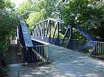
Achterdiekbrücke (Hein-Wulff Bridge) crosses the Gose Elbe between the Neuengammer Hinterdeich and the Kirchwerder Hausdeich near the village of Achterdiek. It is a steel truss bridge of the Vierländer Eisenbahn, in 1977 it was converted for car traffic and renamed Hein-Wulff-Brücke . |
Street | 1911 |
Neuengamme , Kirchwerder ( 53 ° 25 ′ 42 ″ N, 10 ° 12 ′ 18 ″ E ) |
|
Achterweidenbrücke led in the course of the street Achterweide over the Müggenburger Canal (harbor bridge) |
Street |
Veddel ( 53 ° 31 ′ 2 ″ N, 10 ° 2 ′ 27 ″ E ) |
||
|
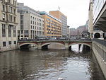
Adolphsbrücke (A037) leads over the Alsterfleet |
Street | 1843 |
Hamburg-Altstadt , Neustadt ( 53 ° 33 ′ 2 ″ N, 9 ° 59 ′ 23 ″ E ) |

|
Alfredstrasse Bridge Stone bridge; runs via the Lübeck Railway and the S-Bahn between the Landwehr and Berliner Tor stations . The bridge is a listed building. |
Street | 1901 |
Borgfelde ( 53 ° 33 ′ 31 ″ N, 10 ° 1 ′ 54 ″ E ) |
|
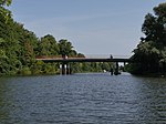
Allermöher church bridge leads between Allermöher Deich and Reitbrooker Vorderdeich over the Dove Elbe . |
Street | 1980 |
Reitbrook , Allermöhe ( 53 ° 28 ′ 54 ″ N, 10 ° 7 ′ 43 ″ E ) |

|
Alster Bridge leads in the course of the street Trillup over the Oberalster |
Street |
Lemsahl-Mellingstedt ( 53 ° 41 ′ 0 ″ N, 10 ° 6 ′ 59 ″ E ) |
|

|
Alsterdorfer Bridge This bridge runs along the Alsterdorfer Damm over the Skagerrak Canal . |
Street | 1914 |
Alsterdorf ( 53 ° 36 ′ 37 ″ N, 10 ° 0 ′ 12 ″ E ) |
|
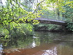
Alsterparkbrücke leads from the Alsterwanderweg over the Alster to the Alsterpark |
Footpath |
Ohlsdorf , Fuhlsbüttel ( 53 ° 37 ′ 43 ″ N, 10 ° 1 ′ 40 ″ E ) |
|

|
Old Harburg Elbe Bridge (A123) oldest Süderelbbrücke . The bridge is a listed building. |
Footpath | September 30, 1899 |
Wilhelmsburg , Harburg ( 53 ° 28 ′ 24 ″ N, 9 ° 59 ′ 42 ″ E ) |

|
Old Holstenstrasse railway bridge Railway bridge on the Hamburg-Berlin route over Alte Holstenstrasse, steel beam bridge |
railroad | 1935 |
Bergedorf ( 53 ° 29 ′ 26 ″ N, 10 ° 12 ′ 29 ″ E ) |

|
Altenwallbrücke (A141) leads over the Mönkedammfleet between Graskeller and Mönkedamm |
Street | 1842/1844 |
Hamburg old town ( 53 ° 32 ′ 57 ″ N, 9 ° 59 ′ 16 ″ E ) |

|
Altmannbrücke (A163) bridges the tracks south of the main station and connects Steinstraße with Kurt-Schumacher-Allee. |
Street |
St. Georg , Hammerbrook ( 53 ° 33 ′ 1 ″ N, 10 ° 0 ′ 28 ″ E ) |
|

|
Altona jetty Access bridge to the pontoon system; In 1995 the pier was relocated from the Altonaer Holzhafen to the fish auction hall, the bridge originates from the former pier Roßhöft. |
Access | 1907 |
Altona old town ( 53 ° 32 ′ 40 ″ N, 9 ° 57 ′ 7 ″ E ) |
|
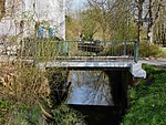
At the Pollhofsbrücke (A411) this bridge leads over the Brookwetterung . |
Street |
Bergedorf ( 53 ° 28 ′ 45 ″ N, 10 ° 13 ′ 47 ″ E ) |
|

|
Andreas Meyer Bridge leads over the Moorfleeter Canal . The namesake Andreas Meyer (1837–1901) was a senior engineer in Hamburg's structural engineering. |
Street | 1963/1965 |
Billbrook ( 53 ° 31 ′ 30 ″ N, 10 ° 4 ′ 8 ″ E ) |

|
Argentina Bridge (A621) leads along the Reiherdamm over the Reiherstieg ; previously the second Reiherstieg swing bridge stood here from 1907 . |
Street |
Kleiner Grasbrook , Steinwerder ( 53 ° 31 ′ 41 ″ N, 9 ° 58 ′ 36 ″ E ) |
|

|
Arndtstrasse Bridge leads along the Arndtstraße over the Uhlenhorster Canal |
Street | 1911 |
Uhlenhorst ( 53 ° 34 ′ 25 ″ N, 10 ° 1 ′ 7 ″ E ) |

|
Assmann Canal Bridge leads at the end of the Vogelhüttendeich over the Assmann Canal ; Concrete slab construction. |
Street | 1924 |
Wilhelmsburg ( 53 ° 30 ′ 56 ″ N, 9 ° 59 ′ 52 ″ E ) |
Individual evidence
- ^ Sven Bardua: Bridge metropolis Hamburg. Architecture - Technology - History up to 1945. Dölling and Galitz Verlag, Hamburg 2009, ISBN 978-3-937904-88-7 , p. 156.
- ^ A b Horst Beckershaus: The Hamburg bridges. Their names - where they come from and what they mean. Convent Verlag, Hamburg 2007, ISBN 978-3-86633-007-8 .
- ^ Sven Bardua: Bridge metropolis Hamburg. Architecture - Technology - History up to 1945. Dölling and Galitz Verlag, Hamburg 2009, ISBN 978-3-937904-88-7 , pp. 6, 31, 52 f.
- ^ Sven Bardua: Bridge metropolis Hamburg. Architecture - Technology - History up to 1945. Dölling and Galitz Verlag, Hamburg 2009, ISBN 978-3-937904-88-7 , pp. 40, 64.
- ^ Sven Bardua: Bridge metropolis Hamburg. Architecture - Technology - History up to 1945. Dölling and Galitz Verlag, Hamburg 2009, ISBN 978-3-937904-88-7 , p. 101 ff.
- ^ Sven Bardua: Bridge metropolis Hamburg. Architecture - Technology - History up to 1945. Dölling and Galitz Verlag, Hamburg 2009, ISBN 978-3-937904-88-7 , p. 159.
- ^ Sven Bardua: Bridge metropolis Hamburg. Architecture - Technology - History up to 1945. Dölling and Galitz Verlag, Hamburg 2009, ISBN 978-3-937904-88-7 , p. 119.
- ^ Sven Bardua: Bridge metropolis Hamburg. Architecture - Technology - History up to 1945. Dölling and Galitz Verlag, Hamburg 2009, ISBN 978-3-937904-88-7 , p. 175.