Gose Elbe
| Gose Elbe | ||
|
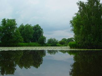
Gose Elbe near Reitbrook |
||
| Data | ||
| Water code | DE : 59548 | |
| location | Vier- und Marschlande , Hamburg | |
| River system | Elbe | |
| origin |
Lapwing as Gose-Elbe-Graben 53 ° 24 ′ 31 ″ N , 10 ° 14 ′ 11 ″ E |
|
| muzzle | at the nature reserve Die Reit in der Dove Elbe Coordinates: 53 ° 28 '52 " N , 10 ° 6' 11" E 53 ° 28 '52 " N , 10 ° 6' 11" E
|
|
| length | 15 km | |
| Catchment area | 68.8 km² | |
The Gose Elbe is a 15 kilometer long oxbow arm of the Elbe in the Hamburg Vier- und Marschlanden . The Gose Elbe is not to be confused with the "Gamm (el) elbe", which connected the Gose with the Dove Elbe .
The Gose Elbe was separated from the main river of the Lower Elbe by a dike between the islands of Kirchwerder and Neuengamme around 1390 . Directly behind the dike at the Krauel settlement there are several bracks that are still connected to each other and to the Elbe through water-bearing layers of soil in the old course of the river. They emerged as washouts after a dike breach and were first mentioned in 1594 as Kraueler Brack . Under the name of the largest of the water bodies, the Lapwing , the area has been a nature reserve since 1985.
The Gose-Elbe-Graben begins at the Kiebitzbrack and runs in wide meanders in a westerly direction and from the bridge of the Neuengammer Heerweg is called Gose Elbe . The very winding river course with a wide bank edge continues in a north-westerly direction between Kirchwerder and Neuengamme in the Vierlanden , as well as afterwards between Ochsenwerder and Reitbrook in the marshland .
From the Heinrich-Stubbe-Weg bridge , the Gose Elbe can be ridden with rowing boats and canoes. At the north-western tip of Reitbrook it flows around the nature reserve Die Reit . Behind the riding lock , which is no longer used to regulate the water level, the Gose Elbe is navigable for a short distance with motor boats before it flows into the Dove Elbe , which is broadened like a lake after about 500 meters (as a regatta route) .
The current of the Gose Elbe is extremely weak, due to the almost non-existent gradient and the many turns. Its water quality is good and it is rich in fish .
Name meaning and spelling
The name component "Gose" goes back to the Low German "goes, gose" for "dry" - here in the sense of a small amount of water.
At the confluence of the Gose Elbe and the Dove Elbe, there is a sign on which it is referred to as “Goose Elbe”. The different spellings stem from the fact that in Low German or in the Low German dialects, unlike in High German, no standardized spelling has developed.

The river name is also often written Gose-Elbe , as the adjectival use of “goos” is not immediately recognizable in High German. It is debatable even whether you can decline the river name, or must, if it so above is not actually the flow of Goshen same ... should be called. (To clarify, imagine that the river is called the Black Elbe .)
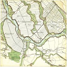
In a map made by Gustav Adolf von Varendorff in 1796, the watercourse starting from the Kiebitzbrack to the northwest is shown parallel to the " Dowe Elbe " with the same name, on another map by the same author this name is entered until the confluence of the two courses into the "Billwärder Elbe" (today's sealed Billwerder Bay).
Fish fauna
According to fishing law, the Gose Elbe is leased to the Angelsport-Verband Hamburg eV and may be fished by its members from the confluence with the Dove Elbe to the Alte Twiete bridge . It is one of the so-called Hamburg association waters, in which members of the fishing clubs affiliated to AV Hamburg can practice the sport of fishing. It should be noted that for nature conservation reasons, the introduction of attractants and feed materials is strictly prohibited. The following fish species are found in the water: carp , tench , roach , rudd , aland , bream , pike, pikeperch , asp , perch and eel . As a result of the hot summer of 2014, fish died in the Gose Elbe.
literature
- Hans Kellinghusen: The Hamburg marshland. In: Lichtwark . Special Edition No. 9, July 1954, pp. 11-13. Ed. Lichtwark Committee, Bergedorf. ZDB ID 1123396-5 . (See now: Verlag HB-Werbung, Hamburg-Bergedorf. ISSN 1862-3549 ).
Individual evidence
- ↑ Wolfgang Laur : The names of places and waters of the Free and Hanseatic City of Hamburg , Neumünster 2012, p. 112 f.
- ↑ The Kiebitzbrack at the Hamburg Authority for Urban Development and the Environment ( Memento of the original from September 13, 2010 in the Internet Archive ) Info: The archive link was inserted automatically and has not yet been checked. Please check the original and archive link according to the instructions and then remove this notice.
- ↑ Map of the Lapwing Brace at the above-mentioned authority (PDF; 182 kB)
-
^ Fritz Witt: Contributions to the knowledge of the river names of Northwest Germany. Kiel 1912, p. 137 (Kiel, Phil. Diss. Of Oct. 21, 1912);
Wolfgang Laur : The names of places and waters of the Free and Hanseatic City of Hamburg , Neumünster 2012, p. 117 f. - ↑ Homepage of the AV Hamburg eV ( Memento of the original from August 20, 2016 in the Internet Archive ) Info: The archive link was inserted automatically and has not yet been checked. Please check the original and archive link according to the instructions and then remove this notice.
- ↑ Other association waters are Dove Elbe , Eichbaumsee , Alte Süderelbe , Hohendeicher See (Oortkatensee), Strom-Elbe 1-3, Hummelsee , parts of the Oste and Elbe Lateral Canal
- ↑ Dead fish are also floating in the Gose-Elbe, Bergedorfer Zeitung, August 18, 2014


