List of bridges in Hamburg / B
B.
| photo | Name, brief description | use | (First) construction | District, location |
|---|---|---|---|---|
|
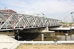
Baaken Bridge since 2011: Magdeburg Bridge; the Versmannstrasse leads over the Magdeburg harbor ; (Harbor bridge) |
Street |
HafenCity ( 53 ° 32 ′ 28 ″ N, 10 ° 0 ′ 3 ″ E ) |
|
|
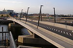
Baakenhafenbrücke across the Baakenhafen |
Street |
HafenCity ( 53 ° 32 ′ 22 ″ N, 10 ° 0 ′ 29 ″ E ) |
|

|
Baakenpark Bridge connects Versmannstraße via Baakenhafen with Baakenpark |
Footpath |
HafenCity ( 53 ° 32 ′ 20 ″ N, 10 ° 0 ′ 49 ″ E ) |
|

|
Bachstrasse Bridge runs along Bachstrasse / Barmbeker Strasse ( Bundesstrasse 5 ) over the Osterbek Canal |
Street |
Winterhude , Uhlenhorst , Barmbek-Süd ( 53 ° 34 ′ 55 ″ N, 10 ° 1 ′ 10 ″ E ) |
|

|
Baker's Bridge leads over the Alster in the course of the Saseler Damm |
Street |
Poppenbüttel ( 53 ° 39 ′ 22 ″ N, 10 ° 5 ′ 14 ″ E ) |
|
|
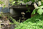
Bahnhofstrasse Bridge Leads the Rahlstedter Bahnhofstraße and the Rahlstedter Uferweg near the Rahlstedter Liliencornteich over the Wandse , reinforced concrete construction |
Street | 1977/1979 |
Rahlstedt ( 53 ° 35 ′ 58 ″ N, 10 ° 9 ′ 10 ″ E ) |

|
Barmbeker Ring Bridge (B764) leads as an extension of Dennerstraße over Fuhlsbüttler Straße and joins Lauensteinstraße; Reinforced concrete structure |
Street | 1970/1971 |
Barmbek-Nord ( 53 ° 35 ′ 55 ″ N, 10 ° 2 ′ 29 ″ E ) |

|
Barmbeker road bridge runs in the course of Barmbeker Straße; Reinforced concrete structure. |
Street |
Winterhude ( 53 ° 35 ′ 16 ″ N, 10 ° 1 ′ 0 ″ E ) |
|

|
Beesenlandbrücke Crosses the southern entrance of the Peutekanal . The bridge is a listed building. The railway operation has meanwhile ceased, the footpath over the bridge is closed due to dilapidation. |
Railway / bike path |
Veddel ( 53 ° 31 ′ 21 ″ N, 10 ° 1 ′ 38 ″ E ) |
|

|
Bekassinenau Bridge This road bridge runs along the street Bekassinenau over the underground line 1 . The Hamburg artist Ernst Hanssen designed the lettering on the railing and the surrounding artistic ironwork . |
Street |
Farmsen-Berne ( 53 ° 37 ′ 19 ″ N, 10 ° 8 ′ 3 ″ E ) |
|

|
Bellevue Bridge crosses the Goldbek Canal in the course of the Bellevue street |
Street |
Winterhude ( 53 ° 34 ′ 57 ″ N, 10 ° 0 ′ 10 ″ E ) |
|
|
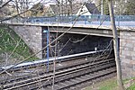
Bernese Bridge (B846) crosses the underground line 1 as an extension of the Fasanenweg. The Hamburg artist Ernst Hanssen designed the lettering on the railing and the surrounding artistic ironwork . |
Street |
Rahlstedt , Farmsen-Berne ( 53 ° 37 ′ 43 ″ N, 10 ° 8 ′ 31 ″ E ) |
|

|
Billbrook Canal Bridge leads over the Billbrook Canal in the course of the Moorfleeter Straße |
Street |
Billbrook ( 53 ° 31 ′ 51 ″ N, 10 ° 5 ′ 42 ″ E ) |
|

|
Billhorner Bridge as an extension of the New Elbe Bridge, the B 75 crosses the Billhafen Canal and the Entenwerder Haken |
Street |
Rothenburgsort ( 53 ° 32 ′ 4 ″ N, 10 ° 1 ′ 42 ″ E ) |
|

|
Billwerder Kirchenstegbrücke leads from Billwerder Billdeich with the Billwerder Kirchensteg over the Bille into the Boberger Niederung |
Footpath |
Billwerder ( 53 ° 30 ′ 55 ″ N, 10 ° 7 ′ 42 ″ E ) |
|

|
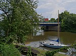
Binnenhafenbrücke (B852) connects the Baumall with the Rödingsmarkt and crosses the inland port at the mouth of the Alster |
Street |
Hamburg-Altstadt , Neustadt ( 53 ° 32 ′ 41 ″ N, 9 ° 59 ′ 0 ″ E ) |
|
|
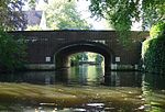
The blue bridge leads over the Bille with the Horner ramp . One of originally three (red, blue and green), today six Billebrücken (brown, yellow and black bridge), which are painted in different colors for orientation. It is debatable whether the choice of color should make it easier for river boats or workers to find their way around. |
Street |
Horn , Billbrook ( 53 ° 32 ′ 23 ″ N, 10 ° 5 ′ 1 ″ E ) |
|

|
Bleichenbrücke (B395) leads between the Neuer Wall and the Große Bleichen across the Bleichenfleet; already built as a wooden bridge in 1718; Architect Johann Hermann Maack . The bridge is a listed building. |
Street | 1844/1845 |
Neustadt ( 53 ° 33 ′ 6 ″ N, 9 ° 59 ′ 19 ″ E ) |
|
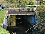
Flower road bridge leads over the towpath canal |
Streets | 1919 |
Winterhude ( 53 ° 35 ′ 4 ″ N, 9 ° 59 ′ 59 ″ E ) |
|
Boberger Furtweg Bridge leads with the Boberger Furtweg over the Bille . |
Street |
Lohbrügge , Billwerder ( 53 ° 30 ′ 26 ″ N, 10 ° 9 ′ 44 ″ E ) |
|

|
Buoy dam bridge crosses the Bille between the Billwerder Billdeich and the Bojewiese. |
Street |
Lohbrügge , Billwerder ( 53 ° 30 ′ 9 ″ N, 10 ° 10 ′ 16 ″ E ) |
|

|
Bujewiesenbrücke cross the Bille in the course of the street Auf der Bojewiese |
Street |
Lohbrügge , Bergedorf , Billwerder ( 53 ° 29 ′ 48 ″ N, 10 ° 10 ′ 40 ″ E ) |
|

|
Bombay Bridge crosses the northern New York ring |
Footpath |
Winterhude ( 53 ° 36 ′ 14 ″ N, 10 ° 1 ′ 5 ″ E ) |
|

|
Stock Exchange Bridge (B448) former bridge, spanned the Reichenstraßenfleet, which was filled in in 1877; today only street name |
Street | 1844 |
Hamburg old town ( 53 ° 32 ′ 55 ″ N, 9 ° 59 ′ 33 ″ E ) |

|
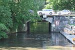
Borsigbrücke leads along the Borsigstrasse over the Tiefstack Canal . The bridge is a listed building. |
Street |
Billbrook , Rothenburgsort ( 53 ° 32 ′ 2 ″ N, 10 ° 4 ′ 19 ″ E ) |
|
|
Borsteler Bridge crosses the Tarpenbek with the Eppendorfer Landstrasse . The bridge is a listed building. |
Street |
Eppendorf ( 53 ° 35 ′ 50 ″ N, 9 ° 59 ′ 20 ″ E ) |
|

|
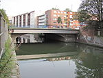
Braband Bridge runs along the Brabandstrasse over the Braband Canal . The bridge is a listed building. |
Street |
Alsterdorf ( 53 ° 36 ′ 47 ″ N, 10 ° 0 ′ 38 ″ E ) |
|
|
Bramfeld Bridge leads with the Bramfelder Straße over the Osterbek Canal |
Street |
Barmbek-Süd , Barmbek-Nord ( 53 ° 35 ′ 1 ″ N, 10 ° 2 ′ 49 ″ E ) |
|
|
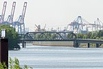
Brandenburg Bridge (B783) leads from Niederfelder Ufer over the Veddel Canal |
Street |
Kleiner Grasbrook ( 53 ° 31 ′ 27 ″ N, 9 ° 59 ′ 27 ″ E ) |
|

|
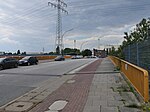
Brown Bridge (B563) leads with the street of the same name over the Bille. The bridge railings of originally three, now six Billebrücken (red, brown, blue, green, yellow and black bridges) are painted in different colors for orientation. It is debatable whether the choice of color should make orientation easier for river boats or workers. |
Street |
Hamm , Rothenburgsort ( 53 ° 32 ′ 45 ″ N, 10 ° 3 ′ 39 ″ E ) |
|
|
Bredow Bridge (B581) leads with the Bredowstraße over the Tidekanal |
Street |
Billbrook ( 53 ° 31 ′ 41 ″ N, 10 ° 4 ′ 40 ″ E ) |
|

|
Brennerhof Bridge (B834) leads with the street Brennerhof over the federal highway 1 |
Street |
Moorfleet ( 53 ° 30 ′ 26 ″ N, 10 ° 4 ′ 57 ″ E ) |
|

|
Brooksbrücke (B853) leads over the Zollkanal between the streets Bei den Mühren and Brook. The bridge is a listed building. |
Street |
Hamburg-Altstadt , HafenCity ( 53 ° 32 ′ 40 ″ N, 9 ° 59 ′ 23 ″ E ) |
|

|
Brooktorkaibrücke leads with the Brooktorkai road over the connecting canal between Brooktorhafen and Brooksfleet. The bridge is a listed building. |
Street |
HafenCity ( 53 ° 32 ′ 40 ″ N, 9 ° 59 ′ 56 ″ E ) |
|

|
June 17th Bridge (B998) connects Wilhelmsburg and Harburg over the Süderelbe and lies between the old Harburg Elbbrücke and the Europabrücke ; it was built under the name Süderelbbrücke and got its name after the uprising of June 17, 1953 |
Street | 1935-1937 |
Wilhelmsburg , Harburg ( 53 ° 28 ′ 25 ″ N, 9 ° 59 ′ 44 ″ E ) |

|
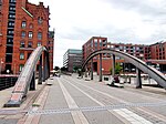
Bullerdeichbrücke leads with the street Bullerdeich over the flood basin |
Street |
Hammerbrook ( 53 ° 32 ′ 37 ″ N, 10 ° 2 ′ 0 ″ E ) |
|
|
Busan Bridge (B897) leads across Magdeburg harbor from Osakakai / Störtebekerufer to Elbtorpromenade; originally Magdeburg Bridge, from 1871 to 1931 Meyerstraßenbrücke , renovated and renamed in 2011 as part of the redesign and connection of the Elbtorquartier. |
Footpath | 1931 |
HafenCity ( 53 ° 32 ′ 35 ″ N, 9 ° 59 ′ 58 ″ E ) |

|
Busbrook Bridge runs south of the Berne underground station over the tracks of the U 1, between Berner Heerweg and Kriegkamp |
Street |
Farmsen-Berne ( 53 ° 37 ′ 35 ″ N, 10 ° 8 ′ 20 ″ E ) |
|
|
Buxtehude Bridge leads with the Buxtehuder Straße over the Seevekanal |
Street |
Harburg ( 53 ° 27 ′ 30 ″ N, 9 ° 59 ′ 18 ″ E ) |
Individual evidence
- ^ A b Sven Bardua: Bridge metropolis Hamburg. Architecture - Technology - History up to 1945. Dölling and Galitz Verlag, Hamburg 2009, ISBN 978-3-937904-88-7 , p. 154.
- ↑ Horst Beckershaus: The Hamburg bridges their names - where they come from and what they mean. Convent Verlag, Hamburg 2007, ISBN 978-3-86633-007-8 , p. 18.
- ↑ a b c Horst Beckershaus: The Hamburg bridges. Their names - where they come from and what they mean. Convent Verlag, Hamburg 2007, ISBN 978-3-86633-007-8 .
- ↑ HafenCity: Inauguration of the Busan Bridge , accessed on October 22, 2016.
