Marylebone
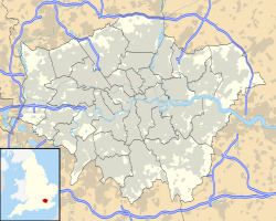
Location of Marylebone in Greater London |
Marylebone ([ ˈmɑrlɨbən ], St. Marylebone , Mary-le-bone ) is a neighborhood in London in the City of Westminster north of Oxford Street or the district of Mayfair and south of Regent's Park . Marylebone is bounded to the west by Edgware Road or the Paddington district , and to the east by Portland Place and the Fitzrovia district.
The name is derived from a St Mary’s Church (now: St Marylebone Parish Church ), which stands on the banks of the small stream Tybourne . The area was therefore called St Mary at the bourne , which later became Marylebone. The fact that the name is derived from Marie la bonne is just a popular misinterpretation.
The Metropolitan Borough of St Marylebone was a Metropolitan Borough of the County of London from 1899 to 1965 , then it was united with the Metropolitan Borough of Paddington and the Metropolitan Borough of Westminster to form the City of Westminster .
traffic
Subway stations
- Baker Street
- Bond Street
- Edgware Road
- Great Portland Street
- Marble Arch
- Marylebone
- Oxford Circus
- Regent's Park
railroad
Attractions
- Madame Tussauds wax museum and planetarium
- Marble Arch
- University of Westminster
- Royal Academy of Music
- Harley Street
- Regent's Park
- Wallace Collection Art Museum
- Hyde Park borders Marylebone to the southwest
- Lord's Cricket Ground is northwest of Marylebone
Personalities
Sons and daughters of the place
- Elisabetta de Gambarini (1730–1765), composer, musician and painter
- EM Forster (1879-1970), author
- Reginald Drax (1880-1967), Admiral
- Reginald Farrer (1880–1920), writer, painter and plant collector
- Leonard Montefiore (1889–1961), philanthropist
- Howard Lang (1911-1989), actor
- Alec Guinness (1914-2000), actor
- Tony Benn (1925-2014), politician (Labor Party)
- Marcus Kimball, Baron Kimball (1928–2014), politician (Conservative Party)
- Rosalind Rowe (1933-2015), table tennis player
- Cat Stevens (* 1948), singer (Yusuf Islam)
- Keeley Hawes (born 1976), actress
Personalities who have worked in this district
- Sherlock Holmes (fictional character) as a detective in the 19th and 20th centuries. century
- HG Wells (1866-1946), science fiction writer
- Yoko Ono (* 1933), artist
- Brian Epstein (1934–1967), manager of The Beatles
- John Lennon (1940–1980), member of The Beatles
- Ringo Starr (* 1940), member of The Beatles
- Paul McCartney (* 1942), member of The Beatles
- Jacqueline du Pré (1945–1987), cellist
- David Chipperfield (* 1953), architect
- Madonna (* 1958), singer
- Noel Gallagher (* 1967), musician
- Guy Ritchie (* 1968), director
literature
- St Marylebone . In: Encyclopædia Britannica . 11th edition. tape 24 : Sainte-Claire Deville - Shuttle . London 1911, p. 30 (English, full text [ Wikisource ]).
Web links
- Road map of Marylebone
- Description and history of St Marylebone from the 1868 Gazetteer
- The Marylebone Association
Coordinates: 51 ° 31 ′ N , 0 ° 10 ′ W


