
Mecklenbeck
Mecklenbeck is a residential area ( district ) in the south of the western district of the city of Münster in Westphalia . It lies between the districts of Albachten in the west and the inner city area in the east, as well as Sentrup in the north and Amelsbüren in the south. Located directly between the A1 and A43 motorways , Mecklenbeck has 9,490 inhabitants (as of the end of 2017) on an area of almost 6.24 km².
history
Mecklenbeck developed from an old peasantry that settled left and right of the Meckelbach (the namesake of the village) along the country road to Dülmen (today's Mecklenbecker Straße). The Meckelbach flows into the Münstersche Aa shortly before the Aasee . Already in the year 889 there is a documentary mention of a farm belonging to the cathedral chapter in the area of today's Mecklenbeck. The old half-timbered store of "Haus Kump", a building from the 16th century and the oldest store building in Münster, still bears witness to this early settlement.
Around 1800, the peasantry began to grow slightly, and in the coming decades it was given a more village-like center with a chapel, school and inns. The chapel, which was newly built in 1845, was enlarged soon afterwards, but did not become a parish church until 1951. Before that, Mecklenbeck was part of the church of St. Lamberti in Münster.
Most of Mecklenbeck has belonged to the city of Münster since the second incorporation in 1903, when it was incorporated as part of the municipality of Lamberti . The part south of the railway line was not incorporated into Münster until 1975 as part of the municipality of Amelsbüren . After the Second World War , a large barrack camp for refugees and ethnic German repatriates was built in Mecklenbeck. Smaller new housing estates have been built since the 1920s. The district now consisted of several spatially separated residential areas, while some of the old farms were demolished and all farms stopped farming by the beginning of the 21st century. With the project Neue Mitte Mecklenbeck , attempts have been made since the mid-1990s to give the district a central town center. For this purpose, a new residential area with numerous shops, kindergartens and a community center was created in the area around the St. Anna Church, which was newly built in 1972, and the other historical buildings located there, to which one of the old farms was converted.
statistics
Structural data of the population in Mecklenbeck on December 31, 2016:
- Youth quota: 28.5% (Münster average: 27.2%)
- Elderly rate: 28.9% (Münster average 26.0%)
- Proportion of foreigners: 6.9% (Münster average 10.1%)
Churches
- Catholic St. Anna Church, Dingbängerweg. Inauguration 1972, architect: Harald Deilmann .
- Evangelical Martin Luther Church, Mecklenbecker Strasse. Inauguration in 1967, architect: Karl-Heinz Schwabenbauer .
schools
- Peter-Wust-Schule, municipal elementary school, on Dingbängerweg
- Loevelinglohschule, municipal cath. Elementary school on Wiedaustrasse
- Peace School , Episcopal Comprehensive School, on Echelmeyerstraße
traffic
Public transport
Mecklenbeck is connected to the city center with three bus lines from Stadtwerke Münster . On Weseler Strasse, the district's main access road, the buses run every 10 minutes during the day, using a bus lane towards the city. Every 20 minutes there is a bus to the neighboring district of Albachten , where there is a train station. The Roxel district is approached every hour . In the evening, Mecklenbeck can be reached from the center by two night bus routes.
The station, which has been closed since June 1991, was rebuilt around 400 m further east as a stop for the Baumberbahn . The construction preparations required for this began in 2016. The new stop was put into operation when the timetable changed in December 2018. This means that Mecklenbeck not only has a faster connection to Münster's main train station, but also to the Münster-Roxel stop and the Coesfeld district.
Private transport
As everywhere in Münster, the bicycle also plays an important role in Mecklenbeck. The two streets leading into the city center have reached their capacity limits during rush hour, but expansion is not possible. The nearest motorway junctions are the northern beginning of the A 43 , from where the A 1 can also be reached at the Münster motorway junction, the Senden junction of the A 43 (Münster - Recklinghausen - Wuppertal) and the Münster-Hiltrup junction of the A 1.
Sports
Mecklenbeck is home to two football and sports clubs, the DJK Wacker Mecklenbeck 1956 eV and 1. FC Mecklenbeck, both of which run their sports programs together on one of the most modern sports facilities in Münster and the surrounding area (110,360 m² of usable space). There is also the skate park with its football pitch and volleyball field.
Since November 2019 there has been a shooting range for air rifles on the sports grounds of Wacker Mecklenbeck, which was built by the local rifle brotherhood St. Lamberti Mecklenbeck. Practice evenings and competitions take place here regularly.
Pictures from Mecklenbeck
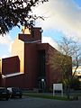
Saint Anne's Church on Dingbängerweg
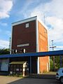
Mecklenbeck station (closed in 1982)
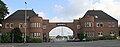
Operation building of the substation


literature
- Karlheinz Pötter (Ed.): Mecklenbeck - From the peasantry to the district. 1st edition. Regensberg Verlag, Münster 1979 (2nd edition 1980).
- Karlheinz Pötter u. a .: With Mecklenbeck into the 3rd millennium. Self-published, 1998, ISBN 3-9806275-0-0 .
Web links
- Rifle Brotherhood St. Lamberti-Mecklenbeck eV
- District of Mecklenbeck eV: District portal of Mecklenbeck
- Mecklenbecker Geschichts- und Heimatkreis eV: On the history of Mecklenbeck
- Mecklenbeck in the Westphalia Culture Atlas
Individual evidence
- ↑ http://www.stadt-muenster.de/fileadmin//user_upload/stadt-muenster/61_stadtentwicklung/pdf/karten/Statistische_Gebietsgliederung_Schematische_Darstellungen_Bevoelkerung.pdf
- ↑ Small-scale regional breakdown of all city districts 2010 ( Memento of the original from June 5, 2012 in the Internet Archive ) Info: The archive link has been inserted automatically and has not yet been checked. Please check the original and archive link according to the instructions and then remove this notice. (PDF; 299 kB), p. 2.
- ↑ Youth quota in Münster (CSV document)
- ↑ Elderly quota in Münster (CSV document)
- ↑ Migration in Münster (CSV document)
Coordinates: 51 ° 56 ' N , 7 ° 35' E