Mexicali
| Mexicali | ||
|---|---|---|
|
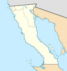
Coordinates: 32 ° 39 ′ N , 115 ° 29 ′ W Mexicali on the map of Baja California
|
||
| Basic data | ||
| Country | Mexico | |
| State | Baja California | |
| Municipio | Mexicali | |
| City foundation | 1903 | |
| Residents | 730,800 (2014) | |
| - in the metropolitan area | 1,063,000 | |
| City insignia | ||
| Detailed data | ||
| height | 8 m | |
| Time zone | UTC −8 | |
| City Presidency | Gustavo Sánchez Vázquez | |
| Website | ||
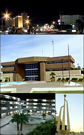
| above: Mexicali at night; Center: Universidad Autónoma de Baja California (UABC); bottom left: UABC's engineering faculty; below right: Monument in the city center | ||
Mexicali ( Spanish : [ mexiˈkali ] ) is the capital and second largest city of the state of Baja California in Mexico after Tijuana and had 689,775 inhabitants as of the 2010 census. The name of the city is an artificial word made up of Méxi co and Cali fornia (compare Calexico ). It is located in the northern part of the state, on the border with the US state of California, not far from the city of San Diego . The city is the administrative seat of the Municipio Mexicali and the seat of the Diocese of Mexicali .
description
The city lives mainly from the processing of the cotton grown in the surrounding area . Numerous US and international companies offer additional job opportunities, such as B. Kenworth LKW, Sony , Pepsi Cola Company (with Frito-Lay / Sabritas; making potato chips and other snacks), which have settled in Mexicali. The advantages for these companies are the cheap Mexican labor and the close proximity to the US border and thus to the San Diego metropolitan area. The distances to San Francisco and Los Angeles are not great either.
Similar to the Mexican city of Tijuana , Mexicali is a springboard for many Mexicans who want to enter the USA illegally in search of the “ American Dream ”. This is facilitated by the fact that the city is right on the border. Many of the newcomers fail when crossing the border illegally and are stranded permanently in the city.
Mexicali has an international airport that is served by Aeroméxico and Volaris .
Mexicali is the sister city of Calexico on the US side, which also has a name that combines California and Mexico.
On April 4, 2010, the city was hit by a 7.2 magnitude earthquake in Baja California.
population
Population development of the city
| year | population |
|---|---|
| 1990 | 438.377 |
| 1995 | 505.016 |
| 2000 | 549.873 |
| 2005 | 653.046 |
| 2010 | 689.775 |
| 2014 | 730.800 |
Population development in the metropolitan area
| year | population |
|---|---|
| 1950 | 66,000 |
| 1960 | 175,000 |
| 1970 | 266,000 |
| 1980 | 343,000 |
| 1990 | 606,000 |
| 2000 | 770,000 |
| 2010 | 938,000 |
| 2017 | 1,063,000 |
climate
| Mexicali | ||||||||||||||||||||||||||||||||||||||||||||||||
|---|---|---|---|---|---|---|---|---|---|---|---|---|---|---|---|---|---|---|---|---|---|---|---|---|---|---|---|---|---|---|---|---|---|---|---|---|---|---|---|---|---|---|---|---|---|---|---|---|
| Climate diagram | ||||||||||||||||||||||||||||||||||||||||||||||||
| ||||||||||||||||||||||||||||||||||||||||||||||||
|
Average monthly temperatures and rainfall for Mexicali
Source: CONAGUA
|
|||||||||||||||||||||||||||||||||||||||||||||||||||||||||||||||||||||||||||||||||||||||||||||||||||||||||
Famous residents
- Enriqueta Basilio (1948–2019), athlete and member of parliament
- Carlos Girón (1954-2020), diver
- Gabriel Trujillo Muñoz (* 1958), writer
- José Fortunato Álvarez Valdéz (1967–2018), Catholic clergyman and bishop of Gómez Palacio.
- Lupita Jones (* 1968), Miss Universe 1991
Web links
- City administration site
- Universidad Autónoma de Baja California
- Instituto Tecnológico de Mexicali
- CETYS Universidad
Individual evidence
- ^ Catálogo de Localidades
- ↑ Mexico: States and Cities - Population Statistics in Maps and Tables. Retrieved July 26, 2018 .
- ↑ World Urbanization Prospects - Population Division - United Nations. Retrieved July 23, 2018 .

