Mittaghorn (Lauterbrunnen)
| Midday horn | ||
|---|---|---|
|
In front the Mittaghorn, in the background the Bietschhorn |
||
| height | 3892 m above sea level M. | |
| location | Canton border Bern / Wallis , Switzerland | |
| Mountains | Bernese Alps | |
| Dominance | 1.78 km → Äbeni Flue | |
| Notch height | 194 m ↓ Äbeni-Flue-Joch | |
| Coordinates | 637 920 / 149774 | |
|
|
||
| First ascent | Charles Montadon, A. Ringier and Adolf Rubin on August 19, 1878 over the southeast ridge | |
| Normal way | Via Äbeni Flue Firn , Anujoch and Südgrat ( difficulty WS ) | |
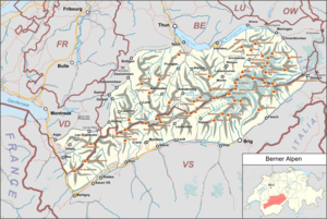
The Mittaghorn is 3892 m above sea level. M. high mountain in the Bernese Alps on the border between the Swiss cantons of Bern and Valais with a sub-peak to the west. The main peak, which protrudes only a little over the ridge, is covered with ice and firn , to the west, north and south-east the Horn sends pronounced ridges. The southeast ridge is called Anungrat and leads down to the Lötschenlücke , a pass at an altitude of 3,164 meters where the Hollandiahütte (also called Lötschenhütte ) is located. This refuge is an important base for climbing the Mittaghorn. The mountain was first conquered from the Lötschental via the Lötschenlücke and the southeast ridge by Charles Montadon, A. Ringier and Adolf Rubin on August 19, 1878.
Surroundings
The Mittaghorn lies on the eastern extension of the Petersgrat, which leads up from the Lötschenpass . The mountain is surrounded on all sides by glaciers, extensive glacier areas are located in the south with the Anun Glacier and in the east with the Great Aletschfirn . Neighboring mountains are in the northeast, separated by the Äbeni-Flue-Joch at an altitude of 3699 meters, the Äbeni Flue (3962 m) and, beyond the Gletscherjoch (3766 m), the 3983-meter-high Gletscherhorn . In the southwest, separated by the Mittagjoch (3648 m), lies the Grosshorn with an altitude of 3754 meters. To the north, the Horn falls over small but steep glaciers ( Breitlouwenengletscher , Vordra Schmadrigletscher ) down into the upper Lauterbrunnen valley . The closest villages are Blatten, about 14 kilometers as the crow flies, in the south-west of the Lötschental, and Stechelberg, 6 km to the north, in the upper Lauterbrunnertal.
Development
The normal route, which was also the route of the first climber, leads from the Hollandia hut (at the Lötschenlücke at 3240 meters above sea level) in a northerly direction over the Äbeni-Flue-Firn into the upper glacier basin. Then you turn southwest towards the Anujoch . From the yoke the ascent leads over the last narrow south ridge to the summit. The Hollandia hut at the Lötschenlücke from the Swiss Alpine Club at 3214 meters above sea level serves as a base for an ascent of the Mittaghorn . The difficulty is indicated in the literature with WS in the SAC mountain and high-altitude tour scale. Other routes difficulties ZS are possible from the south or the west ridge of Mittagjoch from the difficulty L .
On the other hand, a very serious ice climbing in combined terrain with inclines of up to 80 ° and difficulty AS leads through the north face (first climbed on July 2nd, 1977 by Pietro Zifiropulo and Hannes Stähli). The walking time here is from the Schmadrihütte base ( Academic Alpine Club Bern ) (2262 m, to the west), according to literature, about 9 to 12 hours.
Literature and map
- Karl Hausmann: SAC Club Guide Bernese Alps. Volume 4: Tschingelhorn to Finsteraarhorn. Verlag des SAC, 1997, ISBN 3-85902-162-1 .
- Werner and Margrit Munter: Alpine Club Guide Bernese Alps. Bergverlag Rother, Munich 1995, ISBN 3-7633-2415-1 .
- Richard Goedeke : 3000 meters in the northern Alps. Bruckmann, Munich 2004, ISBN 3-7654-3930-4 .
- National map of Switzerland 1: 25,000, sheet 1249 Finsteraarhorn.
Web links
Individual evidence
- ^ Karl Hausmann: SAC Club Guide Bernese Alps. Volume 4: Tschingelhorn to Finsteraarhorn. Verlag des SAC, 1997, p. 94.
- ^ Richard Goedeke : 3000 m in the northern Alps . Bruckmann, Munich 2004, ISBN 3-7654-3930-4 , p. 46 (Ebenefluh).

