Monterey, Indiana
| Monterey | ||
|---|---|---|
|
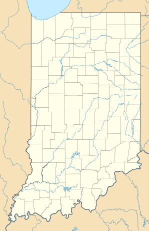
Location in Indiana
|
||
| Basic data | ||
| Foundation : | 1849 | |
| State : | United States | |
| State : | Indiana | |
| County : | Pulaski County | |
| Coordinates : | 41 ° 9 ′ N , 86 ° 29 ′ W | |
| Time zone : | Central ( UTC − 6 / −5 ) | |
| Residents : | 218 (as of 2010) | |
| Population density : | 463.8 inhabitants per km 2 | |
| Area : | 0.47 km 2 (approx. 0 mi 2 ) of which 0.47 km 2 (approx. 0 mi 2 ) is land |
|
| Height : | 221 m | |
| Postal code : | 46960 | |
| Area code : | +1 574 | |
| FIPS : | 18-50616 | |
| GNIS ID : | 439355 | |
Monterey is a place (Town) in Civil Township Tippecanoe the Pulaski County in the US state of Indiana . In 2010, 218 people lived there on an area of 0.47 km²; According to an estimate of 298 inhabitants in 2018.
geography
Monterey is located in northwest Indiana, about 70 km south of South Bend and about 115 km west of Fort Wayne . Physiogeographically, the region belongs to the Central Lowland of the Interior Plains . The region around Monterey, like much of the state, is flat and agricultural. The Tippecanoe River flows through the local area in an east-west direction.
history
| Population development | |||
|---|---|---|---|
| Census | Residents | ± in% | |
| 1870 | 210 | - | |
| 1880 | 144 | -31.4% | |
| 1890 | 226 | 56.9% | |
| 1900 | 261 | 15.5% | |
| 1910 | 260 | -0.4% | |
| 1920 | 304 | 16.9% | |
| 1930 | 283 | -6.9% | |
| 1940 | 288 | 1.8% | |
| 1950 | 250 | -13.2% | |
| 1960 | 278 | 11.2% | |
| 1970 | 268 | -3.6% | |
| 1980 | 236 | -11.9% | |
| 1990 | 230 | -2.5% | |
| 2000 | 231 | 0.4% | |
| 2010 | 218 | -5.6% | |
| 2018 estimate | 298 | 36.7% | |
The place was founded in 1849 under the name Buena Vista , but renamed Monterey when the local post office opened in 1852, as a postal district called Buena Vista already existed in Jefferson County . Both names refer to the battles of the Mexican-American War fought in 1846 and 1847, respectively .
In 1882 Monterey was connected to the railway network via the Marion - Hammond line built by the Chicago and Atlantic Railway . The connection was taken over by the Erie Railroad in 1895 and served this and the subsequent Erie Lackawanna Railroad (EL) as the main route to Chicago. After the end of rail operations of the EL in 1976, Monterey was served in rail freight by the Erie Western Railway (1977-1979), Chicago & Indiana Railroad (1979), Tippecanoe Railroad (1980-1990) and JK Line (1990-2002). With the closure of the Cargill grain silo in Monterey, rail operations ended and the line was dismantled in 2004.
Since 1918 there has been a public library in Monterey, the Monterey-Tippecanoe Township Public Library.
Web links
Individual evidence
- ^ A b c Monterey town, Indiana. United States Census Bureau , 2010, accessed March 23, 2020 .
- ^ Robert M. Taylor, Errol Wayne Stevens, Mary Ann Ponder, Paul Brockman: Indiana: A New Historical Guide . Indiana Historical Society, 1989, ISBN 978-0-87195-049-9 , pp. 566 (English): “In 1849 Eli and Peter W. Demoss laid out the town of Buena Vista, renamed Monterey. Both names derived from Mexican War battle sites. "
- ↑ Ronald L. Baker: From Needmore to Prosperity: Hoosier place names in folklore and history . Indiana University Press, 1995, ISBN 978-0-253-32866-3 , pp. 225 (English): "(Renamed) because there was already a post office called Buena Vista in Jefferson County."
- ^ H. Roger Grant: Erie Lackawanna: The Death of an American Railroad, 1938-1992 . Stanford University Press, 1996, ISBN 978-0-8047-2798-3 , pp. 6 (English).
- ^ Graydon M. Meints: Indiana Railroad Lines . Indiana University Press, 2011, ISBN 978-0-253-22359-3 , pp. 165-166 (English).
- ^ Remembering the JK Line. Hoosier Valley Railroad Museum, accessed March 23, 2020 .
- ^ History. Monterey-Tippecanoe Township Public Library, accessed March 23, 2020 .
