Municipio Carmen (Campeche)
| Carmen | ||
|---|---|---|

|
||
| Symbols | ||
|
||
| Basic data | ||
| Country | Mexico | |
| State | Campeche | |
| Seat | Ciudad del Carmen | |
| surface | 8,644.2 km² | |
| Residents | 221,094 (2010) | |
| density | 25.6 inhabitants per km² | |
| founding | 1916 | |
| Website | www.carmen.gob.mx | |
| INEGI no. | 04003 | |
| politics | ||
| Presidente municipal | Oscar Román Rosas González | |
| Ciudad del Carmen | ||
Coordinates: 18 ° 35 ′ N , 91 ° 50 ′ W
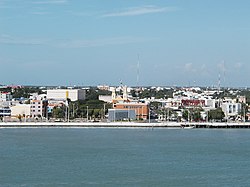
Carmen is a municipality in the Mexican state of Campeche . The municipality has 221,094 inhabitants (2010 census) and is 8644 km² in size. The administrative seat and largest town of the municipality is Ciudad del Carmen .
geography
The municipality of Carmen is located in the west of the Mexican state of Campeche at an altitude of less than 100 m around the Laguna de Términos . About 92 percent of it belongs to the southern coastal plain of the Gulf and about eight percent to the physiographic province of the Yucatán peninsula , over 99% to the hydrographic region Grijalva - Usumacinta and a good 0.6% to the Yucatán Oeste region . The geology of the municipality is determined by alluvion , palustrian and lacustrian deposits with limestone (6% of the municipality area) as the most common sedimentary rock; the predominant soil types are Gleysol (30%), Vertisol (27%) and Solonchak (11%). A good 20% of the community area is covered by water bodies, pastures, forests, mangroves and similar vegetation.
The municipality of Carmen borders the municipalities of Champotón , Escárcega , Candelaria and Palizada as well as the state of Tabasco and the Gulf of Mexico .
population
In the 2010 census, 221,094 people in 57,656 residential units were counted in the municipality. Of these, 2,955 people were registered as speakers of an indigenous language , including 967 speakers of the Mayathan and 760 speakers of the Chol . About 5.4 percent of the population were illiterate. 89,324 inhabitants were registered as economically active, of which approx. 69% were men and 3.5% were unemployed. About 8.4% of the population lived in extreme poverty.
places
The Municipio Carmen comprises 875 inhabited localidades , of which, in addition to the main town , Sabancuy, Isla Aguada, Nuevo Progreso, San Antonio Cárdenas and Atasta are classified as urban by the INEGI . In the 2010 census, 13 towns had a population of over 1000, 829 towns had fewer than 100 inhabitants. The biggest places are:
| place | Residents |
| Ciudad del Carmen | 169.466 |
| Sabancuy | 7,286 |
| Isla Aguada | 6,204 |
| Nuevo Progreso | 4,851 |
| San Antonio Cardenas | 4,206 |
| Atasta | 2,535 |
| Checubul | 1,811 |
| Chicbul | 1,692 |
| Colonia Emiliano Zapata | 1.311 |
| El Aguaca Valley | 1,270 |
| Mamantel ( Pancho Villa ) | 1,262 |
| Licenciado Gustavo Díaz Ordaz ( 18 de Marzo ) | 1,239 |
| Abelardo L. Rodríguez | 1,130 |
Web links
- Enciclopedia de los Municipios y Delegaciones de México: Municipio Carmen (Spanish)
- INEGI : Datos Geográficos: Municipio Carmen (Spanish; PDF)

