Al-Jebel al-Achdar municipality
| Al-Jabal al-Achdar municipality - الجبل الأخضر | |
|---|---|
| Capital | al-Baida |
| Residents | 217,674 (as of 2010) |
| surface | 9,400 km² |
| Population density | 23.16 inhabitants per km² |
| Coordinates | 30 ° 46 ′ N , 21 ° 44 ′ E |
| map | |
Al-Jabal al-Achdar ( Arabic الجبل الأخضر, DMG al-Ǧabal al-Aḫḍar , Italian Gebel el-Achdar ) is a municipality (until 1983 governorate ), which is located in the northeast of the Libyan Arab Republic . The capital of al-Jabal al-Achdar is the city of al-Baida .
geography
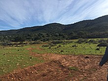
The name of the municipality is derived from the karst mountains of the same name, al-Jabal al-Achdar .
In the entire area of al-Jabal al-Achdar, 217,674 people (2010) live on a total area of 9,400 km². In the north the municipality borders on the Mediterranean Sea, in the countryside it borders on the following municipalities:
- Municipality of Darna - East
- Munizip al-Wahat - South
- Munizip al-Marj - west
history
Ruins of a historical fortification can be found in Zawiet el Argub .
Individual evidence
- ↑ World Gazetteer: Page no longer available , search in web archives: Population figures


