Namasia
|
Namasia 那 瑪夏 區 |
||
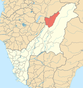
 Location of the Namasia District in Kaohsiung |
||
| State : |
|
|
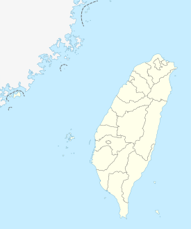
| Coordinates : | 23 ° 16 ' N , 120 ° 44' E | |
| Area : | 252.9895 km² | |
| Residents : | 3,126 (Jan 2018) | |
| Population density : | 12 inhabitants per km² | |
| Time zone : | UTC + 8 (Chungyuan time) | |
| Telephone code : | (+886) (0) 7 | |
| Postal code : | 849 | |
| ISO 3166-2 : | TW-KHH | |
| Community type : | Municipality of Kaohsiung | |
| Structure : | 3 districts (里) | |
| Mayor : | Lin Minjie (林 民 傑) | |
| Website : | ||
|
|
||
Namasia ( Chinese 那 瑪夏 區 , Pinyin Nàmǎxià Qū ), or Namaxia , is a municipality of Kaohsiung in the Republic of China (Taiwan) .
location
Namasia is located in the northeast of the urban area of Kaohsiung in the mountainous interior of the island of Taiwan . The adjacent administrative units are (clockwise) Tauyuan and Jiaxian Districts of Kaohsiung to the east and southeast, Nanhua District of Tainan to the southwest, Dapu Township ( Chiayi County ) to the west, and Alishan Township ( Chiayi County) to the north. Due to the mountainous topography, Namasia is only very sparsely populated. The upper reaches of the small river Qishan ( 旗山溪 , Qíshān Xī , also Nanzixian 楠梓仙溪 , Nánzǐxiān Xī ) flows through Namasia and receives 11 tributaries in Namasia. On May 26, 1993, the river and its tributaries became part of a 274.22 hectare nature reserve.
history
The first written mention of the area comes from descriptions in De Dagregisters van het Kasteel Zeelandia by employees of the Dutch East India Company in the years 1648 to 1655. The area was originally settled by the Taiwanese indigenous ethnic group of the Kanakanavu . After Taiwan became part of the Republic of China in 1945, the area was initially administered as the District Office Xiongfeng (雄峰 區 署, from 1945), rural community Maya (瑪雅 鄉, from 1948) and rural community Sanmin ( Chinese 三民 鄉 , Pinyin Sānmín Xiāng , ab 1958) in Kaohsiung County . The latter name was borrowed from the " Three Principles of the People " (三民主義) of the republic's founder Sun Yat-sen . On January 1, 2008, during the government of DPP President Chen Shui-bian , this name from the time of the Kuomintang sole government no longer appeared opportune and the community was given the current name 'Namasia', after the name of a river in the Bunun -Language.
On December 25, 2010, Kaohsiung County was dissolved and annexed to Kaohsiung City. The district parishes and thus Namasia received the status of urban districts (區, Qū ). In 2014 Namasia received the special status of a “ mountainous district of the indigenous people ”.
| Structure of Namibia |
Administrative division
Namasia is further subdivided into three districts (里, Li ):
- Nangisalu (南沙魯 里)
- Maya (瑪雅 里)
- Takanua (達卡努瓦里)
population
The original population consisted of members of the Kanakanavu ethnic group . Today the population is mixed. The Kanakanavu are only a minority. Furthermore, Han Chinese live here , as well as Bunun, Tsou , Atayal and Paiwan . Taiwanese indigenous peoples make up the majority of the population (around 70% Bunun). The majority of the population belongs to Christian denominations.
Economy and Transport
Namasia is very agricultural. The main products are bamboo (sprouts) (299.8 hectares of cultivation area), plums (233 hectares), ginger (75 hectares), mangoes (48.7 hectares), tea (31 hectares), taro , peaches, persimmons and pears.
Nature tourism is also of economic importance. The Typhoon Morakot taught in year 1998 serious damage, the elimination of years took to complete.
The most important traffic artery is the provincial expressway 29.
Web links
Individual evidence
- ↑ 高雄 縣 三民 鄉 境內 楠梓仙溪 野生 動物 保護 區 (Nanxixian Conservation Area in Sanmin Township, Kaohsiung County, Republic of China). Forestry Board of the Agriculture Council (農業 委員會) of the Executive Yuan, accessed September 8, 2019 (Traditional Chinese).
- ↑ a b 人文地理 現 況 ("History of human settlement"). Namasia District website, accessed March 1, 2018 (Chinese).
- ↑ 各 里 資訊 ("Overall information"). Namasia District website, accessed March 1, 2018 (Chinese).
- ↑ 農 產 季節 ("Harvest Times"). Namasia District website, accessed March 1, 2018 (Chinese).
- ↑ 景點 介紹 ("Introduction to the sights"). Namasia District website, accessed March 1, 2018 (Chinese).


