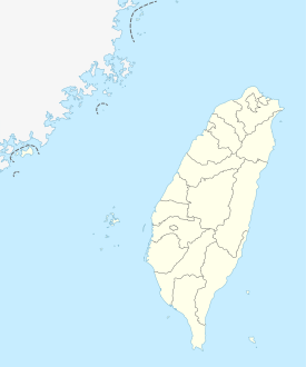
Tianliao
|
Tianliao 田寮 區 |
||
 Location of Tianliao District in Kaohsiung |
||
| State : |
|
|
| Coordinates : | 22 ° 52 ' N , 120 ° 23' E | |
| Area : | 92.6802 km² | |
| Residents : | 7,105 (Aug 2019) | |
| Population density : | 77 inhabitants per km² | |
| Time zone : | UTC + 8 (Chungyuan time) | |
| Telephone code : | (+886) (0) 7 | |
| Postal code : | 823 | |
| ISO 3166-2 : | TW-KHH | |
| Community type : | Municipality of Kaohsiung | |
| Structure : | 10 districts (里) | |
| Website : | ||
|
|
||
Tianliao ( Chinese 田寮 區 , Pinyin Tiánliáo Qū , W.-G. T'ien 2 -liao 2 Ch'ü 1 ) is a municipality in Kaohsiung in the Republic of China (Taiwan) .
description
Tianliao is located on the northern border of Kaohsiung and the neighboring city of Tainan . The district has roughly the shape of a polygon with a maximum north-south extent or west-east extent of about 11 to 12 km. The topography is characterized by hill country, and only about 10.5 km² is used for agriculture. The rest of the area consists of forest with clay soils and rocks. In several places there are so-called badlands (erosion areas with little vegetation). The neighboring administrative units are Neimen in the northeast, Qishan in the southeast, Yanchao in the south, Gangshan and Alian in the west, and Guanmiao and Longqi in the north (the latter two in Tainan, all others in Kaohsiung). The climate is subtropical with an average temperature of over 20 ° C in the months of April to October and over 10 ° C in the rest of the year. 80% of the annual precipitation falls in the summer months, which are also the typhoon season, while the winters are relatively dry.
history
From the 17th century onwards, the area of Tianliao was settled by immigrants, most of whom came from the area around Zhangzhou and Quanzhou in mainland China's Fujian Province . While Taiwan was part of the Chinese Empire, Tianliao came under the jurisdiction of Fengshan County from 1796 . At the time of the Japanese colonial rule (1895-1945) Tianliao was organized in 1920 as a "village" ( 庄 , Zhuāng ) in Takao Prefecture . After the Republic of China took over Taiwan on August 1, 1946, the former prefecture became Kaohsiung County . The old administrative boundaries were left and the village became the "rural community" ( 鄉 , Xiāng ) Tianliao. On December 25, 2010, Kaohsiung County was dissolved and completely incorporated into Kaohsiung City. The rural community became the "city district" ( 里 , Qū ) Tianliao.
population
In 1946 Tianliao had 13,104 inhabitants. By 1959, the population rose to 18,161 and since then has fallen back to the last (2019) around 7100. Over the decades, tens of thousands of people emigrated. The reasons lay in the unfavorable living conditions on site, the barren soil and the area's peripheral location. The indigenous population is very small. At the end of 2018, only 8 people (0.1%) belonged to the indigenous peoples .
| Outline Tianliaos |

|
Administrative division
Tianliao is divided into 10 districts (里, Li ):
1 Guting ( 古亭 里 )
2 Xide ( 西德里 )
3 Chongde ( 崇德 里 )
4 Sanhe ( 三 和 里 )
5 Lupu ( 鹿 埔里 )
6 Nan'an ( 南安 里 )
7 Datong ( 大同 里 )
8 Xinxing ( 新興里 )
9 Qixing ( 七星 里 )
10 Tianliao ( 田寮 里 )
economy
The main line of business is agriculture and forestry. Fruit cultivation ( longan , guavas , Chinese jujube , mangoes , bamboo shoots , bananas , grapefruits ), beekeeping , poultry and pig breeding are practiced. In 2019 there were more than 7,300 hectares of forest, about 2/3 of which was state owned and about 1/3 privately owned.
traffic
Tianliao is crossed by the national road 3 (motorway), which runs from north-northwest to south-southeast. This is crossed in the northwest of Tianlio by the provincial road 28, which runs in a west-east direction.
Attractions
Tianliao is not a decidedly tourist destination. Nationally known is the " Moon World Landscape Park " ( 月 世界 地 景 公園 , Yuè shìjiè dejǐng gōngyuán , English Moon World Landscape Park ) in the villages of Chongde and Guting, where extensive badlands without vegetation can be visited. Golf is possible on the Dagangshan Golf Course ( 大 崗 山 高爾夫球 場 , Dàgǎngshān gāo'ěrfū qiúchǎng ) . There are also several small temples and pavilions.
![]()
![]()
Web links
Individual evidence
- ↑ a b About Tianliao. Tianliao website, November 29, 2019, accessed November 30, 2019 .
- ↑ 認識 田寮 (“Get to know Tianliao”). Tianliao website, November 22, 2019, accessed November 30, 2019 (Chinese (traditional)).
- ↑ 地理 環境> 人口 分布 ("Geographical environment> Population distribution"). Tianliao website, November 22, 2019, accessed November 30, 2019 (Chinese (traditional)).
- ↑ 原住民 戶數 及 人數 Households and Persons of Indigenous People. (xls) Ministry of Interior of Taiwan, accessed November 30, 2019 (Chinese, English).
- ↑ 地理 環境> 產業 ("Geographical Environment> Industry"). Tianliao website, November 22, 2019, accessed November 30, 2019 (Chinese (traditional)).
- ^ Agricultural products. Tianliao website, November 22, 2019, accessed November 30, 2019 .
- ↑ 地理 環境> 道路 交通 系統 狀況 ("Geographical environment> Road traffic conditions"). Tianliao website, November 22, 2019, accessed November 30, 2019 (Chinese (traditional)).
- ↑ 觀光 資源 ("Tourism Resources"). Tianliao website, November 22, 2019, accessed November 30, 2019 (Chinese (traditional)).


