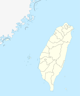
Maolin
|
Maolin 茂林 區 |
||
 Location of Maolin District in Kaohsiung |
||
| State : |
|
|
| Coordinates : | 22 ° 56 ' N , 120 ° 45' E | |
| Area : | 194.0000 km² | |
| Residents : | 1,931 (Jan 2018) | |
| Population density : | 10 inhabitants per km² | |
| Time zone : | UTC + 8 (Chungyuan time) | |
| Telephone code : | (+886) (0) 7 | |
| Postal code : | 851 | |
| ISO 3166-2 : | TW-KHH | |
| Community type : | Municipality of Kaohsiung | |
| Structure : | 3 districts (里) | |
| Mayor : | Song Nengzheng (宋 能 正) | |
| Website : | ||
|
|
||
Maolin ( Chinese 茂林 區 , Pinyin Màolín Qū ) is a municipality of Kaohsiung in the Republic of China (Taiwan) .
Location, geography and climate
Maolin is one of the larger districts of Kaohsiung in terms of area, but is only very sparsely populated with a population density of 10 people / km². With around 1930 inhabitants, it is the Kaohsiung district with the smallest population. The population consists mainly of members of the Taiwanese indigenous people of the Rukai .
Maolin is located in the south-eastern foothills of the Taiwan Central Mountains and consists predominantly of forested mountainous areas. The climate in Maolin is subtropical with hot and humid summers. The annual average temperature in the valleys is 24 ° C and the hottest and coldest months are July and January. In summer, the southwest monsoon brings intense rainfall, while winters are relatively dry. The average annual precipitation is 2500–3000 mm.
The neighboring administrative units are (counterclockwise) the Tauyuan and Liugui Districts of Kaohsiung to the north and west, the Sandimen and Wutai Townships in Pingtung County to the south, and the Yanping Township in Taitung County to the east .
| Outline Maolins |
history
The Rukai lived for a long time in relative independence in the mountainous interior even after the island of Taiwan was taken over by the Chinese Empire of the Qing Dynasty . It was not until the time of Japanese colonial rule (1895-1945) that their submission and administrative penetration of their settlement area took place. The former name of the area was Duona ( 多納 ), in Minnan romanization 屯子 . After Taiwan was taken over by the Republic of China in 1945, the area was initially organized as the ' Duona rural community' ( 多納 鄉 , Duōnà xiāng ) in Kaohsiung County . On December 1, 1957, the name was changed to 'Landgemeinde Maolin' ( 茂林 鄉 ), in honor of local politician Chen Maolin ( 陳茂林 ). Kaohsiung County was dissolved on December 25, 2010 and incorporated into Kaohsiung City, with the county councils, including Maolin, being given the status of municipalities ( 區 ). Since December 25, 2014, Maolin has also had the status of a “ mountain rural community of indigenous people ” with special rights of self-government.
Administrative division
Maolin is divided into three districts (里, Li ): Maolin (茂林 里), Wanshan (萬 山里) and Duona (多納 里).
economy
Agriculture is the economic basis. The district administration tries to promote tourism. Maolin, as well as the neighboring Liugui and parts of Sandimen (Pingtung County) are part of the Maolin National Landscape Area ( Chinese 茂林 國家 風景區 , Pinyin Màolín Guójiā Fēngjǐng Qū , English Maolin National Scenic Area ). A variety of activities such as hiking, biking, butterfly watching (best season between November and March), visiting hot thermal springs, and experiencing the indigenous cultures of Taiwan are possible here.
Attractions
In Wanshan, petroglyphs were found, which are considered ancient evidence of the Rukai culture. They have been designated a "Historic Site" by the Kaohsiung City Council.
Web links
Individual evidence
- ↑ About Maolin> Location & Geography. maolin-nsa.gov.tw/, accessed on March 3, 2018 (English).
- ↑ 行政 區域 圖 ("administrative area map"). Maolin website, accessed September 12, 2019 (Chinese (traditional)).
- ↑ 各 里 介紹 ("General Introduction"). Maolin website, accessed March 3, 2018 (Chinese).
- ↑ 交通 指南 ("Traffic Guide"). Maolin website, accessed March 3, 2018 (Chinese).
- ↑ 茂林 旅遊 (Tourism in Maolin). Maolin website, accessed March 3, 2018 (Chinese).
- ↑ Maolin National Scenic Area. taiwan.net.tw, accessed March 3, 2018 .
- ↑ Butterfly Watching Route. Maolin National Landscape Area, accessed March 3, 2018 .
- ^ Wanshan Petroglyphs Archaeological Site. (No longer available online.) Kaohsiung City Council, archived from original on April 1, 2018 ; accessed on April 1, 2018 (English). Info: The archive link was inserted automatically and has not yet been checked. Please check the original and archive link according to the instructions and then remove this notice.


