Wutai (Pingtung)
|
Wutai 霧 臺 鄉 |
||
 Location Wutais in Pingtung County |
||
| State : |
|
|
| County : | Pinging | |
| Coordinates : | 22 ° 45 ' N , 120 ° 44' E | |
| Area : | 278.7960 km² | |
| Residents : | 3,271 (Feb. 2018) | |
| Population density : | 12 inhabitants per km² | |
| Time zone : | UTC + 8 (Chungyuan time) | |
| Telephone code : | (+886) (0) 8 | |
| Postal code : | 902 | |
| ISO 3166-2 : | TW-PIF | |
| Community type : | Rural community ( 鄉 , Xiāng ) | |
| Structure : | 6 villages ( 村 , Cūn ) | |
| Website : | ||
|
|
||
Wutai ( Chinese 霧臺鄉 , Pinyin Wutai Xiang , Rukai : Vedai ) is a rural municipality in Pingtung County on Taiwan ( Republic of China ).
location
Wutai is located on the northeast tip of Pingtung County. The adjacent parishes are (clockwise from north): Maolin ( Kaohsiung District ), the three parishes of Yanping , Beinan, and Jinfeng (all in Taitung County ), and the two parishes of Majia and Sandimen in Pingtung County. The community is located in the Taiwanese Central Mountains and accordingly consists of mountainous land with mostly narrow valleys.
In 2009, Typhoon Morakot caused severe damage. In Wutai fell in three days from August 7th to 10th, 2009 1160 mmm of precipitation, which corresponded to 40 percent of the usual total annual precipitation. Like the entire island of Taiwan, Wutai is an earthquake prone area. On February 26, 2012, an earthquake with a magnitude M W 5.3 occurred with a hypocenter at a depth of 26 kilometers below Wutai.
population
In 2018 the municipality had about 3200 inhabitants and a population density of 12 inhabitants per km². This made it the most sparsely populated parish in Pingtung County. The population consists mainly of members of the Taiwanese indigenous people of the Rukai .
economy
The economy of the municipality is characterized by agriculture. The main crops are sweet potatoes , taro , cassava , corn and millet . The fruits are mango , betel nut , plum , peach and ume .
Administrative division
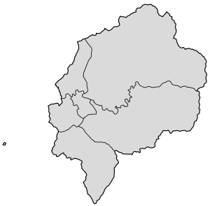
Wutai is divided into 6 villages (names in the Rukai language, in Chinese script and transcription):
- Labuwan / Labuane (大 武 村, Dawu)
- Kinulane (吉 露 村, Jilu)
- Adiri (阿 禮 村, Ali)
- Kucapungane (好茶 村, Haocha)
- Karamemedesane (佳 暮 村, Jiamu)
- Vudai (霧 台 村, Wutai)
| Outline Wutais |
Attractions
Worth seeing and interesting for tourists are, on the one hand, the relatively untouched nature with dense forests, waterfalls, (sub) tropical vegetation and flower gardens and, on the other hand, the culture and environment of the Rukai. The Rukai Museum displays art and artifacts from the Rukai. The Presbyterian Church in Wutai is also worth seeing.
With the opening of the Guchuan Bridge in October 2013, which spans the valley of the Ailiao River with a pillar height of 99 meters and connects the two communities of Wutai and Sandimen, Wutai is much easier to reach for tourists.
Kucapungane
In 1974 the residents of the settlement of Kucapungane, which is far from the traffic routes, decided to give up their old houses and to settle in the neighboring village of Sinhaocha (新) in order to have better access to the modern infrastructure. In 2009 they had to move again as a result of Typhoon Morakot after their new settlement was flooded. The settlement, which was abandoned in 1974, with its 163 houses, the majority of which were made of processed slate, was left to nature and gradually fell into disrepair. The importance of the centuries-old settlement as a cultural document of the Rukai was later recognized and the Taiwanese government declared the abandoned site a national treasure. In 2016, the New York City-based non-profit World Monuments Fund put the abandoned Rukai village of Kucapungane on its list of endangered cultural buildings. The settlement is still difficult to access and can only be reached on foot via a hike lasting several hours.
Web links
Individual evidence
- ↑ Wei-Sen Li: Lessons Learned from and Improvements Made after Typhoon Morakot. (PDF) National Science & techology Center for Disaster Reduction, accessed on April 15, 2018 .
- ^ Tilman Aretz (translator): After the storm. Taiwan Today September 1, 2010; Retrieved April 15, 2018 .
- ↑ Pan-Hsin Chiang, Ya-Ju Hsu, Wu-Lung Chang: Fault modeling of the 2012 Wutai, Taiwan earthquake and its tectonic implications . In: Tectonophysics . tape 666 , 2016, p. 66–75 , doi : 10.1016 / j.tecto.2015.10.015 (English, PDF ).
- ↑ The humanity of the Indigenous People: The mountains with wild lilies and 100-pacer snakes. Pingtung County Government, accessed April 10, 2018 .
- ^ Rukai Museum. Taiwan Maolin National Scenic Area, accessed April 15, 2018 .
- ↑ Jake Chung: Online survey determines top Pingtung destinations. Taipei Times, July 28, 2017, accessed April 15, 2018 .
- ↑ Guchuan Bridge unlocks Rukai tourism potential. Taiwan Today, June 5, 2014, accessed April 15, 2018 .
- ↑ Jake Chung: Rukai village included on list of world cultural sites. Taipei Times, October 17, 2015, accessed April 15, 2018 .
- ↑ Kucapungane. World Monuments Fund, accessed April 15, 2018 .


