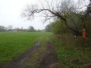
Juliusplate (nature reserve)
|
Juliusplate
|
||
|
"Juliusplate" nature reserve |
||
| location | North-east of Berne , Wesermarsch district , Lower Saxony | |
| surface | 79 ha | |
| Identifier | NSG WE 263 | |
| WDPA ID | 378103 | |
| Geographical location | 53 ° 12 ' N , 8 ° 31' E | |
|
|
||
| Sea level | from 2 m to 4 m | |
| Setup date | December 10, 2007 | |
| administration | NLWKN | |
The Juliusplate is a nature reserve on the former Weser island of the same name in the Lower Saxony municipality of Berne in the Wesermarsch district .
The nature reserve with the registration number NSG WE 263 is around 79 hectares in size. It is almost completely part of the FFH area "tributaries of the Weser with Strohauser Plate and Juliusplate". In the southeast, it is adjacent to the conservation area "Warflether sand / Juliusplate". The area has been a nature reserve since December 13, 2007. The responsible lower nature conservation authority is the Wesermarsch district.
The nature reserve, which consists of two partial areas, is located northeast of Berne on the left bank of the Weser on the former Weser island Juliusplate between the Weser arms Woltjenloch in the north and Warflether Arm in the south. It provides a semi-natural, tide -influenced flood plain in the foothills area of the Weser dike protected. In the reserve are reedbeds , remnants of alluvial forests and wetland thickets, grasslands , creeks and rivers Watten and standing water to be found.
Some of the grassland areas are used extensively for agriculture. A special feature is the occurrence of the rare chess flower on the damp meadows in the protected area.
The nature reserve is crossed roughly in the middle of the federal highway 74 as an access road to the pier of the ferry connection Berne-Farge , which connects the left side of the Weser with the Bremen district of Farge in the Blumenthal district on the opposite bank of the Weser. A campsite is located north of the main road between the Weser and the border to the protected area . The sandy beach in the east of the nature reserve at the confluence of the Warflether Arms can be used as a bathing area.
See also
Web links
- Nature reserve "Juliusplate" in the database of the Lower Saxony State Office for Water Management, Coastal and Nature Conservation (NLWKN)
Individual evidence
- ↑ Checkerboard flowers in the Juliusplate nature reserve , experiencing nature in Lower Saxony (PDF, 3.1 MB). Retrieved April 26, 2019.


